
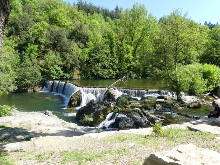
By the River Arre
4 points of interest
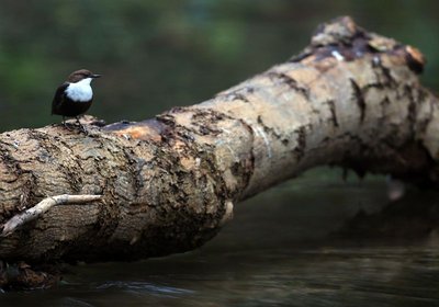
Cincle plongeur - Régis Descamps  Fauna
FaunaThe white-throated dipper
White-throated dippers are nesting in the bridge’s cavities. These birds look like they are in evening wear: white shirt and dark grey frock coat complete with an elegant tail, short and uplifted. They live in clean waterways with fairly strong currents. Perched on stones sticking out of the water, they inspect the riverbed agitatedly. Also called water ouzels, they can dive and then walk underwater while searching the riverbed for food. In one day, they can dive up to 1,600 times and stay underwater for a cumulative total of two hours.
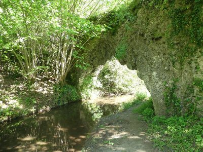
Pont de Mousse - Nathalie Thomas 
The Pont de Mousse (moss bridge)
This natural tuff bridge was described by a Mr Chante in 1933: “a small path leads to the Vézénobre brook, in which blocks of tuff covered in abundant vegetation have formed the moss bridge. The arch carries an irrigation channel, and thousands of crystal-clear drops fall without cease from the vault into the brook which, 50 metres from here, produces five waterfalls”. The whole hillside is tuff rock, which was used to build the neighbouring terrace walls. In the 14th and 15th centuries, a flour mill called Moulin de la Rode stood near the bridge.
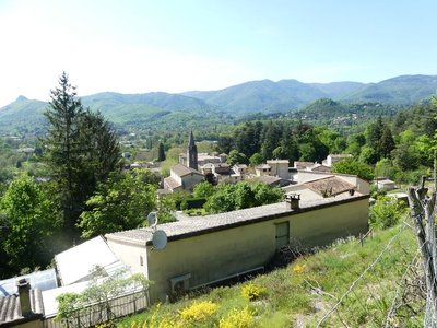
Avèze - Nathalie Thomas 
The village of Avèze
The first written mentions of Avèze are as Aveda in 1150 and as Aveza in 1262. Avèze was founded around the year 800 by Benedictine monks. For some authors, its etymology is Aveda (“I salute you, Madam”), words supposedly taught by the priests to the inhabitants who had to say them whenever they passed the image of the Virgin Mary.
Its picturesque lanes with the elegant 18th and 19th-century manor houses used to alternate with spinning mills, farms and apple meadows that covered the valley floor.
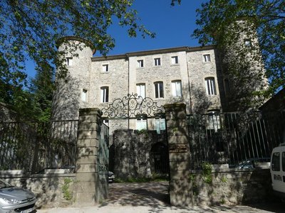
Château de Montcalm - Nathalie Thomas The Château de Montcalm
The walls of the park surrounding the mediaeval Château de Montcalm border the road. The former fortress was remodelled several times. The fortifications and ramparts were pulled down in 1609. The residence was redesigned in the 18th century and an avenue of cedars planted in the park. In the late 19th century, the roofs bristled with crenellations. It was in the 1930s that the château assumed its current appearance.
Description
Signposts will guide you all along this route. In the description below, the signposted place names and/or directions are given in bold italics between quotation marks :
Starting from “LE VIGAN", at the Mairie (town hall) car park, walk to "AVEZE" via :
- "Château d'Assas",
- “Les Calquières”,
- “Vieux Pont”.
- Get to “PONT DE MOUSSE”, then continue to :
- “Le Cayla” before returning to “LE VIGAN” via :
- “Le Haut du Pont”,
- “Vieux Pont” and “Château d'Assas”.
This walk is taken from the guidebook Les Vallées Cévenoles - En Pays Viganais, published by the Communauté de communes Pays Viganais-Cévennes as part of the collection Espaces Naturels Gardois and the label Gard Pleine Nature.
- Departure : Le Vigan, Mairie (town hall)
- Arrival : Le Vigan, Mairie (town hall)
- Towns crossed : Le Vigan and Avèze
Forecast
Altimetric profile
Recommandations
Make sure your equipment is appropriate for the day’s weather conditions. Take enough water, wear sturdy shoes and put on a hat. You must keep your dog on a leash.
Information desks
Tourism office Cévennes and Navacelles, Le Vigan
Maison de pays, place du Marché, BP 21, 30120 Le Vigan
This office is part of the National Park's associated tourist-information network, whose mission is to provide information on, and raise awareness of, the sites and events as well as the rules that must be observed in the National Park's central zone.
Open year-round
Transport
This hike is accessible by public transport.
To consult the updated schedules and plan your trip, use the route calculator below by entering the arrival stop : LE VIGAN - Community of Communes
Alès bus line 142
Nîmes bus line 140
Montpellier bus line 608
LIO Région Occitanie - https://lio.laregion.fr/
Access and parking
From Alés or Nîmes take the D999 to Le Vigan
Parking :
Source


Report a problem or an error
If you have found an error on this page or if you have noticed any problems during your hike, please report them to us here:
