
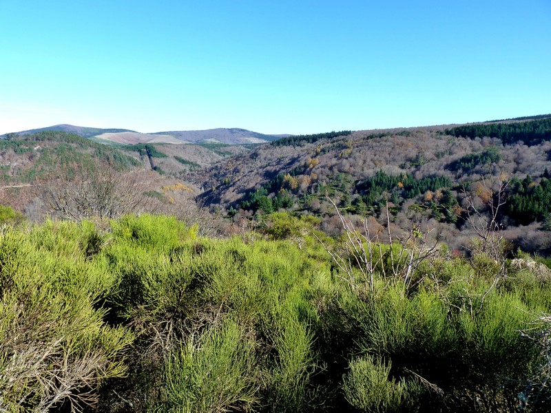
Camprieu trail
13 points of interest

Camprieu - nathalie.thomas 
Camprieu
In the 19th century, the village streets were bustling year-round with a throng of artisans, labourers and shopkeepers, who lived in these modest mountain houses that were also suitable for livestock rearing. Camprieu had: two cobblers, six clog makers, two basket makers, one carpenter, two wheelwrights, two farriers, one miller, two stonemasons, one glassworks, one sawmill, one dairy, two grocer’s shops, a haberdashery and ironmonger’s and one shop for ladies’ “fashion and dresses”. There was also a cheese cellar that produced Roquefort until 1932, a hotel and an inn.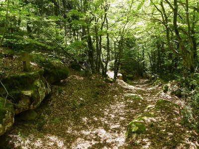
Le chemin des morts - nathalie.thomas The Path of the Dead
In the Middle Ages and until 1870, the Catholic village of Camprieu had neither church nor cemetery. “Its inhabitants therefore went to the hamlet of Saint-Sauveur de Pourcils. To transport their dead to the remote cemetery, they had to take the ‘Path of the Dead’. They carried the coffins on their backs and, at every rest stop, recited the prayer De Profundis. Funeral processions stopped using the path in summer 1872. That year, the village of Camprieu finally obtained its own cemetery. But the name has stuck: “the Path of the Dead”.
La ferme de La Boissière - nathalie.thomas La Boissière farm
La Boissière farm was abandoned by its inhabitants when Mont Aigoual was reforested. A salary from the French National Water and Forestry Commission was so much more secure than the meagre revenues from a farmer’s endless work. You pass through the farm’s porch and walk on its threshing floor – but there are no chickens or cereals on the threshing floor, and no herds ambling to the meadow. Today the forest has won.
Sapinière en futaie régulière - © Elodie Mazel 
Arboretum
To begin with, arboretums were experiments to study the behaviour of tree species introduced to the massif as part of the reforestation programme from the late 19th century on. Over time, their scientific character gave way to a more educational and ornamental outlook. On the Aigoual, the French Forestry Office maintains a network of arboretums that are representative of the forest’s diversity and of the work carried out by foresters on the massif since the early 20th century.
The waymarked circuit only covers a part of the vast arboretum.
Le hameau et ses alentours avant le reboisement - © Coll. G. Mathon 
Castle or farm estate?
In the 12th century, minor vassal lords of the Roquefeuil family ruled from a castle at Saint-Sauveur des Pourcils. They lived in autarky with their livestock, large pastures and a share of the farmers’ harvests. No remains from that period survive. The main building looks more like a farmhouse. Over the centuries, the castle has become a large farm estate with outbuildings.
© Coll. G. Mathon A church at the heart of it all
Why was such an imposing church built in a small hamlet? The profound attachment of the parishioners to their place of worship was key. The church was destroyed three times, by Protestants (1562 and 1703) and by the ravages of time (1848). But each time the parishioners who lived in neighbouring hamlets decided to rebuild it. Despite this determination, the church and cemetery were eventually transferred to Camprieu (1871). The episcopal authorities cited difficulties in accessing the place of worship and disagreements between the mayor and parish priest. The local faithful, who were opposed to the transfer, managed to keep masses for the yearly pilgrimage, baptisms, funerals and weddings in St-Sauveur.
Ecole de Villemagne dans les années 1960 - © Coll. G. Mathon A cemetery that reveals histories
The small cemetery of Saint-Sauveur des Pourcils, so peaceful today, reveals a rich and eventful history. The gravestones bear the names of Catholic, Orthodox, Protestant, Jewish and Muslim families. This religious plurality is partly due to the arrival in the 20th century of foreign workers to mine argentiferous lead and copper in the neighbouring hamlet of Villemagne. During the murky period of World War II, the wife of a resistance fighter and her six children took refuge in the surrounding area. The Muslim graves bear witness to the period following the Algerian War when a camp for harkis was set up in the region. These Algerian Muslims, who had served in the French army, were employed by the French Forestry Office for the reforestation of the Aigoual massif.
Saint Sauveur des Pourcils au début du XXe siècle - © Coll. G. Mathon Un domaine agricole reboisé
Today, the hamlet of Saint-Sauveur des Pourcils is surrounded by trees but in the 19th century the Aigoual massif was bare! Its reforestation began as a state programme managed by foresters. The French Forestry Office bought many farm estates to turn them into foresters’ houses. Saint-Sauveur des Pourcils had all the required characteristics: buildings for housing foresters; varied soils; good sun exposure; and water nearby (the river below). The foresters set up a tree nursery to grow young trees and an arboretum to test how well-adapted different species were.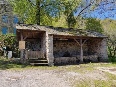
Le lavoir des Monts - Béatrice Galzin Les Monts wash house
The wash house in Les Monts still has running water but the washerwomen have disappeared for good. The site is magical. The water is clear enough for dragonflies to lay their eggs in and for birds to drink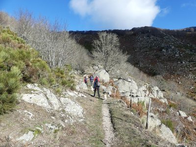
Montée au col du Suquet - nathalie.thomas 
Col du Suquet pass
You are at the highest point of the hike. On the right bank of the Dourbie, the path crosses a sheer slope that is alternatively made up of zones of solid granite and other zones where it has decomposed due to weathering into coarse granitic sand. To the south, the views encompass the entire Lingas massif, a high wooded plateau overlooking, further south, the region around Le Vigan and the Languedocian plain.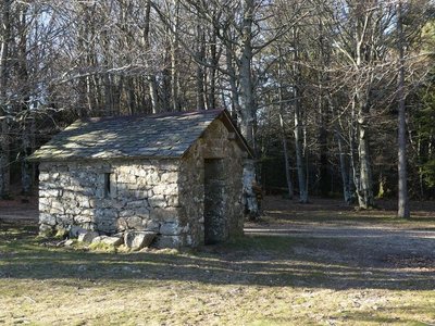
abris au col des Ubertes - Nathalie Thomas The forestry labourers’ shelter
Deep inside the forest, you will soon see a little house. From the 19th to the early 20th century, it gave shelter to the forestry labourers in charge of reforesting the mountain. The work site was too far from a proper foresters’ house to get back there every evening, especially since the working day was long. There was no question then of working only 35 or even 40 hours a week! The trees were planted one by one using a pickaxe; the daily minimum agreed on was 100 trees per man per day. A total of 68 million were planted…
La fougère aigle - Béatrice Galzin The hidden life of the forest
Trees grow upwards towards the light while mosses benefit from their shade on the ground and spread out. Like soft cushions or carpets, they hug everything that sticks out of the ground, such as old tree stumps. This soft felted surface is pleasing to see, and an undergrowth without mosses would not be worthy of the name. Legend has it that mosses show which way is north. Wrong!
Mosses indicate a degree of moisture; they protect the soil from drying out by retaining every last drop of dew. They prepare pockets of humus for the future occupants: grasses and herbaceous plants. They also love the damp of tree trunks and can grow there, on the side that is most exposed to the prevailing rains.
Sous bois du Trévezel - Béatrice Galzin The Mont Aigoual forest
“Aigoual, Forêt d’Exception”
The French Forestry Office, which manages state forests, launched a programme in 2013 called “Aigoual, Forêt d’Exception” (Aigoual: An Exceptional Forest) with the aim of highlighting the massif’s natural and cultural heritage. The Forestry Office thus tries to foreground the different aspects of its multi-facetted management: production, protection and receiving visitors. One key aspect of this approach, which complements other initiatives by local actors, is to improve visitors’ experience in the forest.
Description
Start in Camprieu, from the car park at the gymnasium. Walk to “Camprieu – La croix Basse”, then “La Croix Haute”, “La Clédette”, “La passerelle de Bramabiau”.
- At “La passerelle de Bramabiau”, take the track on the left to “Conduite Forcées”.
- At “Conduite Forcées”, head for “Les Monts” via “La Matte” and “La Combelle”.
- Walk through the village of “Les Monts” and, as you leave, take the path opposite that goes uphill towards “Col du Suquet”, via “Valat de Malbosc“ and then the road to “La Roque”.
- At “La Roque”, take the path on the left that joins a track, to “Col du Suquet” via “Le Vieux Hêtre”.
- At “Col du Suquet”, take the track on the left towards “Camprieu” via “Col des Ubertes”, “Tédounès”, “Terondel”.
- At the signpost for “Terondel”, continue on the road to “Camprieu” via “Tailladette”, “Maison du Bois”, “Tabarde”, “Le Cros”.
- Departure : Gymnasium in Camprieu
- Arrival : Gymnasium in Camprieu
- Towns crossed : Saint-Sauveur-Camprieu and Dourbies
Forecast
Altimetric profile
Recommandations
Information desks

Tourism & national parc'house
Col de la Serreyrède, 30570 Val d'Aigoual
The Maison de l'Aigoual houses the tourism office Mont Aigoual Causses Cévennes and the Maison du Parc national. This visitor centre provides information on and raises awareness of the Cévennes National Park, its sites and events as well as the rules that must be observed in the National Park's central zone.
On site: changing exhibitions, video projections, Festival Nature events and shop Open year-round

Tourism office Mont Aigoual Causses Cévennes, Valleraugue
7 quartier des Horts, 30570 Valleraugue
This office is part of the National Park's associated tourist-information network, whose mission is to provide information on, and raise awareness of, the sites and events as well as the rules that must be observed in the National Park's central zone. : Open year-round
Transport
(in term time).
Access and parking
Parking :
Source


Report a problem or an error
If you have found an error on this page or if you have noticed any problems during your hike, please report them to us here: