
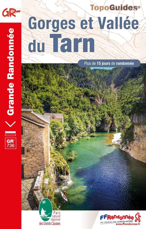
GR®736 Tarn gorge and valley
This hike between Mont Lozère and the Tarn gorge takes you through diverse landscapes with a wealth of natural heritage and villages with varied and typical architecture based on granite, limestone and schist.
The route is also multi-purpose. Find out how to do part of the circuit by canoe, mountain-bike or e-bike or else with a donkey. Enjoy different ways of discovering the river Tarn using non-motorised means of locomotion !
50 points of interest

Lavoir de Villefort - OT Mont Lozère 
Lavoir
This 19th-century granite washing place has two basins. Laundry was beaten in the large basin using a washing bat, then rinsed in the clear water of the smaller basin which was fed by the river. You can still see the traces of soot from the stoves used to boil water. This lively site, where the grievances and joys of the washerwomen resounded, was in use until the 1950s.


River network
The river Palhères flows through Villefort on its way down from Mont Lozère. It goes through one of the two mismatched Gothic arches of Saint Jean bridge. This humpback bridge dates from the 14th century. Two rivers flow through the centre of the village, under Place du Bosquet. Having become unsanitary after being used as drains and latrines, they were vaulted over for reasons of hygiene in 1934. This created both the square and Rue des Jardins.
Religious buildings and pilgrimages
Rue de Rome leads to Saint-Jean Chapel, also called gleisetto (little church). In the Middle Ages, sick pilgrims or pilgrims looking for a roof for the night were welcomed in this former Romanesque chapel-turned-residence. A leper colony was attached to it. Further north, Saint-Loup-et-Saint-Roch Chapel overlooks the Lake. It was built to look exactly like a Romanesque edifice of the 12th or 13th century, on the precise site where a hermit, who had followed the example set by St-Loup, had his shelter. It has been restored several times. St-Loup is the region's patron saint; St-Roch has been associated with him since the 1720 plague. Two pilgrimages persist to this day: on 29 July for St-Loup and on 16 August for St-Roch.

The fairs at Villefort
Since 1511, Villefort market has been held on Thursday mornings. In the early 19th century, there were up to 14 fairs a year. Children had to attend mass at Saint-Loup-et-Saint-Roch Chapel to be allowed to go to the fairs. Large crowds were attracted to the fairs by their good reputation. The fair held on 14 September was one of the most impressive, with countless cattle blocking the village's squares and lanes. Today, Villefort is a lively place with bric-a-brac shops and artisan fairs.

Villefort, rue de la Bourgade, maison de forgeron, enseigne sculptée - © Guy Grégoire 
Rue de la Bourgade
At the southern end of Rue de la Bourgade is the birthplace of Odilon Barrot (1791-1873), an eminent barrister at the Toulouse parliament and the court of appeal, parliamentarian, president of the council of ministers, etc. A plaque was put up on the wall in 1991. In this street, you can also see two lintels dated 1617 and 1620 respectively, as well as a third that has been sculpted to indicate a blacksmith's workshop (on a house near Avenue de la Gare).
The origins of Villefort
In the Middle Ages, Villefort was known as Villa Montisfortis, a name that might stem from a former Roman agricultural estate. At the time, a castle overlooked the village, of which nothing remains today. This castrum was strategically located on the heights of Le Collet (at the southern exit of Villefort) to protect the Regordane Way – and to collect tolls.
Merchants and craftsmen
Local crafts first emerged in the Middle Ages. In the late 18th century, lead mining began in the area, affording farmers another source of income. A foundry was built upstream of the village. A century later, the attraction of industry and the city led to a rural exodus and the decline of trade and crafts.
Troubled times
Villefort was embroiled in the religious wars of the 16th and 17th centuries. In 1629, Henri de Rohan besieged the village. Rue de la Bourgade was torched by the Huguenots. In the 17th century, town walls were built around Villefort, which were demolished between 1808 and 1813. During the French Revolution, heraldic shields recalling the Ancien Regime were chiselled off walls, testament to the locals' hatred of their lords. A cross on Place du Portalet is a reminder of the 1794 execution of a defiant priest from Saint-Frézal-d'Albuges. The First World War caused many local casualties. During the Second World War, Villefort was occupied by the Germans. A resistance movement nevertheless emerged in the area, consisting of many different groups.
The Regordane Way
The Regordane Way linking Alès (Gard) and Luc (Lozère) is a section of the important route that connected Lower Languedoc and the Auvergne in the Middle Ages. It facilitated trade between the Mediterranean basin and parts of the Kingdom of France. The mule-drivers that used it – known locally as Régordans or Rigourdiers – transported oil, wine and salt. It was also a religious path, taking pilgrims called Romieux to Saint Gilles It was progressively abandoned in the 14th century, when the port at Marseille and the fairs in Lyon grew in importance. Ruts left by cartwheels can still be seen north of Prévenchères (between Le Thort and La Molette) and near Saint-André-Capcèze.
Stone architecture
The architecture of Villefort's old buildings is typical for one-street villages:
• the houses with the two vaulted porches were once inns, tradesmen's or artisans' shops: one of the porches was used to store merchandise, the other to display it;
• the sculpted lintels above the entrances to some houses on Rue de l'Eglise and Rue de la Bourgade bear witness to the activities of former occupants;
• several facades have handsome mullioned windows from the Renaissance.Rue de l’Église
The town hall is a former private mansion of the 15th century, with a spiral staircase and ground-floor rooms with vaulted ceilings. The lintel behind the gate comes from a fortified house in the village of Bayard, which is now under the waters of the Lake. On the facade of the 16th century house opposite is a finely crafted mullion window.
• The oldest house in the village is a listed monument and dates from the 14th century. It has Gothic windows and a pulley system once used to bring forage into the loft.
• An archway giving onto an internal courtyard shows you mediaeval walls made from large regular blocks.
• Two lintels bear Christ's monogramme: IHS, Iesus Hominum Salvator (Jesus saviour of mankind). One instance is followed by the inscription Ave Maria.The sweet chestnut
In 1900, sweet chestnuts were the main farm produce. The nuts of this so-called “bread tree” fed many families as well as their farm animals. Chestnut-growing is a year-round activity, but is especially busy at harvest time. Harvesters would meet in the evening for a brousillade (chestnuts roasted on a wood fire). When parts of the rural population left, many chestnut orchards were abandoned while others were cut down for their tannin to be extracted. Chestnut bleeding canker and chestnut blight, diseases caused by mushrooms, also killed off a great number of trees. Today, chestnut farming in the Cévennes is being revived with a focus on quality.
The tourism boom
Villefort dam, located a kilometre north of the village, was filled on 14 July 1964, creating an economic alternative to agriculture. Tourist activities developed: fishing, swimming and water sports. Local tourism is also founded on the canton's abundant natural heritage, with a great number of hiking trails, canyoning in the Chassezac gorge, skiing at the Mont Lozère ski stations, etc.

Place de l'Ormeau
Villefort's former market square, Place de l'Ormeau hosted Clédou market on Thursday mornings until the 1980s. The square teemed with smells and colours. Livestock, meat, vegetables, grains and chestnuts were sold here, especially in the 19th century. The lime tree on the square was planted on 11 November 1920 as a “victory tree” so that future generations might remember their ancestors' fight for freedom during the First World War. The Maison Chambon, with its double-archway entrance, has an inscribed lintel: Metre Iehan Martin 1595, flanked by a diamond shape and a heart.
The Paris to Marseille railway line
From 1865 onwards, the P.L.M. (Paris-Lyon-Marseilles) Company constructed the railway line that the Cévenol train still uses to link Paris and Marseilles via Clermont-Ferrand, Alès and Nîmes. The line helped to open up the area and was thus a real asset for the towns located along its path in the Lozère. New occupations were created: P.L.M. employee (during construction) or dispatcher of local products (e.g. chestnuts from the Borne valley). But the disappearance of mule trains struck a blow at the local economy, in particular craftsmen and innkeepers.
How the village is arranged
Located at an altitude of 605 m, Villefort developed as a one-street village alongside the Regordane Way (now known as Rue de l'Eglise and Rue de la Bourgade). In the 19th century, a main road was built through Villefort and became its main traffic artery. Today it is called Avenue des Cévennes.

Arbre mort - © KARCZEWSKI Gaël  Flora
FloraMeet a tinder fungus
The fat mushroom stuck to the trunk of an old beech is a tinder fungus, a tree parasite. From above, it looks like a cep cap. Below, fine tubes are full of spores, the little cells that allow the fungus to reproduce. Tinder fungus is totally inedible. So what might it be used for? Once dried, it catches fire at the first spark. Prehistoric humans used it to light their fires.
Sous-sol forestier - © PNC 
The secret life of the subsoil
Did you know that, as you walk through the forest, you are trampling a little-known world? Under your feet a multitude of tiny creatures are tirelessly active: by decomposing organic matter, such as dead leaves, they enable tree roots to absorb nutrients. Without them, there would be no forest. Below the roots, this tree gives you a glimpse of the subsoil. Let us see what it hides.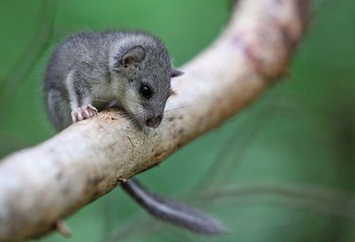
Loir gris - © R. Descamps A real village
During their lifespan, these trees grow crooked, swell, become wrinkled. A ripped-off branch leaves a scar open to bird beaks. Towards the end of its life, the old tree is full of cavities – comfortable nests for small animals. Can you hear a soft whoo hoo hoo in the forest? That is a boreal owl. The black woodpecker carves its nest out of dead wood using its powerful beak. The European edible dormouse, a rather pretty rodent, hides its food stores in holes in old beeches.
Exploitation de bois - © A. Bouissou/TERRA Humans and the forest
In some places, you can see that trees have been felled. Why? The paint marks differentiate trees to be felled from those that will be preserved according to economic and ecological criteria. In the forest at Mas de la Barque, we have to ensure that the forest ecosystem works well. It is a resource to be preserved for the future. Let us watch the forest technician at work.
Rocher de la Barque - © Biotope The mysterious boat
Have you noticed the strange rock shaped like a boat (barque)? Is that what gave the hamlet its name? Alternatively, in the local patois, a berque is a gap in the mountain. So: Mas de la Barque or Mas de la Berque?
Mas de la Barque is part of the municipality of Vialas and borders the forest of Gourdouze. The estate of the Priory of Gourdouze, to which the forest once belonged, was declared government property during the French Revolution in 1789, before being sold to pay the state’s debts.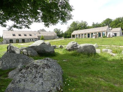
Mas de La Barque - nathalie.thomas Le Mas de La Barque
Le Mas de La Barque was only a forester’s house at the end of the 20th century. From the 1960s onwards, it was frequented by children’s ski clubs and then by families from the Gard on the weekend. During the week, the association “Union pour l'Animation de la Grange” organised field trips, heritage classes and theme days open to all. A costly infrastructure was gradually built (buildings, ski lifts, snow canons), then partly demolished again. Today, as part of an overall programme of reclassifying the site, it has been developed for tourism (cross-country skiing, snowshoeing, dog-sledding, etc.) and is run by a semi-public company. The resort offers outdoor activities in summer as well as in winter.
Drosera rotundifolia - © Yannick Manche The peat bog: a world apart
This natural environment is a strange world where only very particular plants survive. Sundew (drosera) is the star of the peat bog. The soil is so poor here that the plant catches insects to feed on; it is carnivorous. The water is very acidic and contains very little oxygen here. When plants die, they do not decompose as well as in the forest. Instead they accumulate to form a thick layer of peat.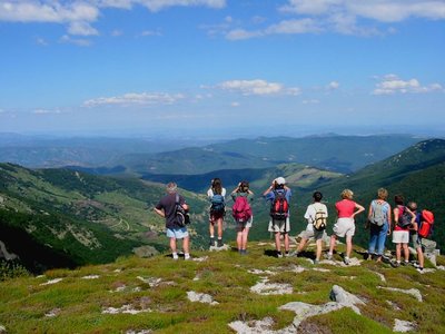
Groupe au Pic Cassini - otcevennesmontlozere Mas de la Barque
The small family ski station of Mas de la Barque was inaugurated in 1968 to meet the expectations of people living locally. But in 1981, there was precipitation but not much snow; in 1982 the winter was mild; 1983 was a very hot year; and 1984 and 1985 were very cold (record: -23.5°C). These climate hazards gradually shifted the station's focus onto cross-country skiing; downhill skiing was phased out from 1994.

Arbres morts - © Mathieu Baconnet The death of a tree
A dying or dead tree makes us a little sad. And yet it regenerates the forest. Once the tree is dead, it still provides refuge for fauna over many years. Its rotting wood feeds legions of small animals, which turn an old forest into a living treasure. The larvae of the bronze carabid devour slugs and snails while the larvae of the longhorn beetle burrow into dead wood.
Hêtre soudé (anastomose) - © E. Balaye FloraTree kisses
Among trees, there is strength in unity. Trees like to merge with others via the roots – it makes them stronger. But here, there are beeches that have grown together at the branch level or even at the trunk. Strange bonds! Try to spot them but do not disturb them.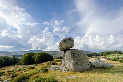
Chaos de granite - © A. BOUISSOU / TERRA Ministère de l'Environnement 
Granite architecture
In the surrounding landscape, here and there, you can see piled-up granite boulders and balls, some of them precariously balanced. These are called block fields (or felsenmeer), geological formations created by a long process of fracturing and erosion of the granite by wind, frost and precipitation. These block fields often supplied the raw materials for house-building, eliminating the need to open up underground quarries. The farmers of the Mont Lozère used granite with great technical skill, as evoked by Jean-Pierre Chabrol in his short story, “Le Crève Cévenne”.
Careful! Do not climb the boulders as their balance is precarious.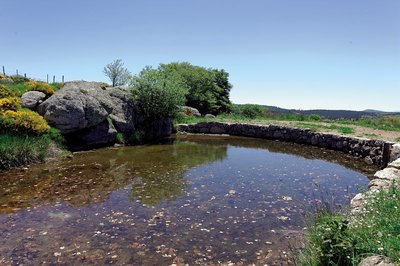
Gourgue de Mas Camargues - © Yannick Manche The gourgue and béal
To supply the mills with a sufficient and stable supply of water, a gourgue (reservoir) was laid out using a stone-and-soil levee. A slab with a hole drilled into it let the water flow out. A log with a wooden pole for a handle was used as a cork, ready to be removed whenever milling or threshing were planned. Both upstream and downstream of this reservoir, you can follow the béal, the channel which carries the water from the Tarn all the way to the mills. This system was preferable to using the Tarn’s waters directly, which would have been too dangerous because of the violent floods.
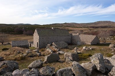
Les bâtiments du mas vus depuis le potager - @ Guy Grégoire 
The vegetable plot
The vegetable garden, which has lain fallow since the early 20th century, is not easy to spot. It usually consisted of a small plot closed off by stone walls topped by brambles, as protection against animals. A second garden was below the road leading to the Mas. These vegetable gardens are testament to an economy that prioritised self-sufficiency to the greatest possible extent. The main crops were fresh vegetables (carrots, lettuce, etc.) to provide a change from the usual fare of cabbage and potatoes.
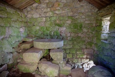
L’intérieur du moulin, la meule fixe est restée sur son axe - © Brigitte Mathieu The mill
This was a water-powered mill for grinding grain, mainly rye. Like the vast majority of mills on the Mont Lozère, it had a horizontal wheel that was easy to put in operation even with a low head of water. It was first mentioned in the 17th century, and last served during the Second World War. Note the “sleeping” millstone on which the “turning” millstone (no longer extant) ground the rye.
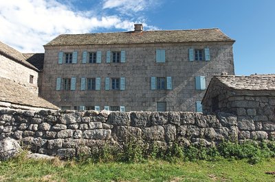
Mas Camargues - © Olivier Prohin Imposing buildings!
The main building is surprisingly grand in both its dimensions and its façade of carefully carved granite blocks under a curved cornice. Historical records mention the prosperous estate of Mas Camargues as early as the 15th century. However, its current configuration dates from the late 19th century, as the date carved into a lintel shows. If you wander through the neighbouring hamlets, you will understand just how unusual this settlement is on the Mont Lozère. Its owners proudly marked the landscape as no-one had dared to do before them…
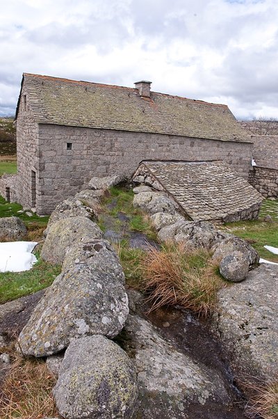
Le béal qui permet à la machine hydraulique de fonctionner - @ Guy Grégoire The modern hydraulic machine
This building resembles the mill but had an entirely different function, which is testament to the advanced state of technology in Mas Camargues in the late 19th century. The water supply fell onto and turned a vertical paddle wheel, thus creating more power than the mill. The building only housed the “engine” – the energy produced was actually used outside. Imagine a long belt (a wide strap of leather or woven material) that transmitted the energy to a threshing machine set up on the paved threshing floor outside, which separated grains from chaff.
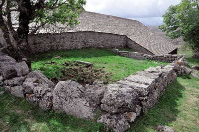
Mas Camargues, Mont Lozère - © Yann Toutain The family cemetery
In a small plot of land enclosed by a low dry-stone wall is a plain gravestone for a little girl who died in 1905. This simple granite slab reminds us of local Protestant tradition. As a result of the 1685 Revocation of the Edict of Nantes (which re-criminalised Protestantism in France), the village cemetery was reserved for Catholics only, and the practice of private Protestant burials became generalised. Some Protestants still choose to be buried in their gardens or fields to this day.
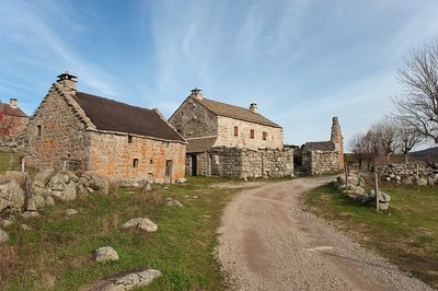
Hameau de Bellecoste entre Mas Camargues et Mas de la Barque - © Guy Grégoire From L'Hôpital to Mas de la Barque
To enable ox-carts and livestock herds to cross the canal, several small bridges were built out of granite slabs. Before the current track was opened up, the path from L’Hôpital to Bellecoste passed through here, upstream of Mas Camargue.
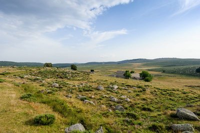
Paturâges sur les hauteurs de Mas Camargues - @ Arnaud Bouissou TERRA Ministère de l'Environnement Evolving landscapes
The Mas Camargues landscape is not an unchangeable set, but evolves with land use. In 1813, you would still have seen arable land, fewer pastures and more meadows and gardens, all witnesses to diversified activities. Around 1913, increasing specialisation in livestock rearing, which brought in the largest part of farm incomes, meant that large pastures came to predominate. Tomorrow’s landscape depends on the agricultural choices made. Maintaining livestock breeding is decisive for keeping spaces open; a lack of grazing would lead to an extension first of heath and then of forests.
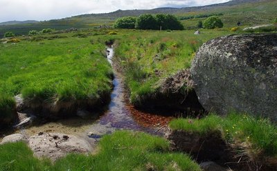
A deux reprises, le béal rencontre un ruisseau. - @ Brigitte Mathieu A water crossing-point
Here, the béal leading to the mills has to cross a tributary of the Tarn. How to stop the béal water from running off down the steeper gradient with the brook water? A simple soil levee damming the brook has created a sort of buffer pond, from which the waters flow in the two directions in acceptable proportions.
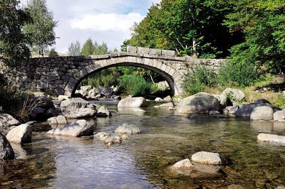
Pont de Mas Camargues, Mont Lozère - © Yann Toutain Camargues Bridge
The pure lines of its arch and the narrow deck are two important elements in giving the least possible hold to the floodwaters of the Tarn. This type of construction has led to the bridge being called “the Roman bridge” in local tradition. However, it was not built before 1850. For the bridge we admire today to have withstood the passage of time and defied the floodwaters of the Tarn since the Roman era would be nothing short of a miracle.
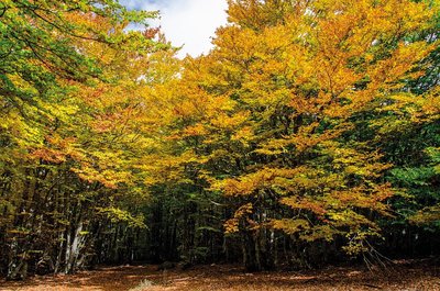
Mas Camargue, Mont Lozère - © Olivier Prohin Camargues Wood
These woods, mainly beech, do not seem to have changed for centuries. That is hardly surprising once you know that they were only intended to meet the requirements in firewood, tool handles, etc. of the inhabitants of Mas Camargues. They were never commercially exploited in the modern sense. The undergrowth looks quite sparse, but people still harvest blueberries and lichens here.
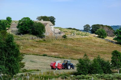
Mas Camagues - © A. BOUISSOU / TERRA Ministère de l'Environnement 
Agro-pastoralism
What is agro-pastoralism? It is a form of agriculture dominated by extensive livestock rearing: herds roam large spaces to feed themselves. Here you can see the distinct zones of the two types of breeding practised on the southern slopes of Mont Lozère: upstream, transhumant sheep on high pastures that are open all the way to the ridges; downstream, predominantly sedentary cattle farming in enclosed parcels of land.
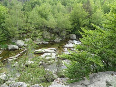
Gasbiel - nathalie.thomas Gasbiel (old ford)
This crossing was much used to go from L'Hôpital to the parish of Frutgères via the Commandery of the Order of Malta. The latter owned almost all the land; a large part was rented to tenant farmers who paid their rent in money and in kind.
Frutgères - nathalie.thomas Frutgères
This village used to be the parish seat and developed long before Le-Pont-de-Montvert, a mere hamlet, turned into a small village of about 60 souls by 1631. In the 12th century, the important Commandery of the Knights of St-John of Jerusalem settled in the parish of Frutgères. This religious and military order later took the name of the Order of the Knights of Malta. The parish church was burned down by the Camisards (Protestant rebels), who were responsible for the assassination of the Frutgères parish priest, Reversat, in 1702, one day after the murder of the Abbot du Chaila in Le-Pont-de-Montvert. The church had been built after the unification of the parishes of Frutgères and Grizac. In the early 19th century, the municipality was densely populated (25 inhabitants/sq km). The large estates needed numerous labourers to harvest their hay, rye and buckwheat.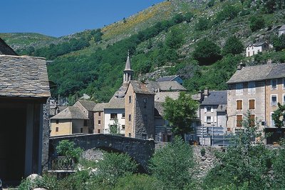
Le Pont-de-Montvert - © Guy Grégoire Pont-de-Montvert
Marker 12
Le Pont-de-Montvert is at the confluence of the Tarn and two of its tributaries: the Rieumalet and the Martinet. The draille (drovers’ road) has today almost disappeared, but it was once used by flocks from the south of France to reach the summer pastures on the Mont Lozère. The first neighbourhoods were established along this axis. In 1630 the village was almost as extensive as in the early 19th century. Three stone bridges were built over the rivers, but the great floods of 1827 and 1900 seriously damaged or destroyed them. The grand Tarn Bridge is the only stone bridge still standing. New neighbourhoods developed on the village’s periphery, preserving the historic centre.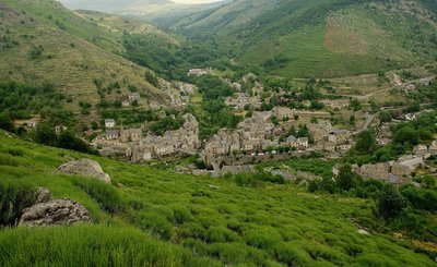
Chemin des camisards - © Brigitte Mathieu The Camisards' path
Marker 11
This path used to be an important communication route linking Le Pont-de-Montvert with Barre-des-Cévennes. On 24 July 1702, it was used by a gathering of Huguenots coming from the Col des Trois Fayards, who intended to liberate their fellow Protestants being held by Abbot du Chayla in Le Pont-de-Montvert. These men thus used the path on which you stand. The tragic events that followed (including the Abbot’s violent death) triggered the Camisard War. The landscape surrounding the village is the result of intense agricultural activity. All neighbouring slopes were cultivated, especially with rye, on man-made terraces called bancels.Natural evolution of beech and oak groves
Marker 1
This steep terrain consists of a mass of fallen granite rocks (scree), which makes it unusable by domestic animals. The beeches and chestnuts growing here have thus evolved naturally, the only intervention being felling for timber or firewood. Other species are also associated with tree cover (hazelnuts, blueberries, ferns, etc.), as well as rocks covered in mosses, which attest to the relatively damp conditions.A rolling stone...
Marker 10
On the plateau, the path has not always made a very distinct mark on the ground, evidence of little erosion. By contrast, the entire descent towards Le Pont-de-Montvert shows signs of more intense erosion, especially near the top where a large block has rolled into the middle of the path. It is the repeated passage of humans and animals that, combined with natural factors, eventually destabilised the rock. After the rock moved, the path was re-routed.Sheepfold with lauze-covered roof
Marker 9
Unlike the previous sheepfold, this one was built out of heavy, compact and solid materials. A granite vault instead of a timber roof suggests the rarity of wood. The roof was made watertight by schist lauzes (tilestones) on a bed of clay or coarse granite sand. This place is called La Jasse de Chanteloup (jasse/jas: resting place for animals; canteloube in popular etymology = place where the wolves howl, or, according to scholarly sources, luppe = stone, height, rounded mountain).
Panorama
Marker 8
Views of the southern slope of Mont LozèreGranite boulders
Marker 4
Granite, which is used for dressed stone as you saw in the hamlet, is a vulnerable rock on the geological timescale. The erosive power of water is furthered by the cracks that divide the rock. These occur because of the stresses to which granite – which rose as magma at the end of the Paleozoic – has been exposed since cooling. The speed of this erosion depends on the climate. This is why whole, undamaged granite blocks break off. They form particularly picturesque block fields (felsenmeer) once the coarse sands have disappeared.A sheepfold in ruins
Marker 7
You need to leave the path on the left and walk for about 200 metres to see this former shelter for farm animals (ovines and bovines). The materials for its construction were found locally: granite for the walls, Scots pine or oak for the timber part of the roof, rye thatch for the roof. The variety of rye grown locally had fine long straw. It was cut by scythe at the end of July and put into swathes, then stored in stacks and threshed on threshing-floors. Finally it was made into small sheaves, which were soaked before use to make the last seeds germinate and make the straw less breakable during thatching.
Prairie vers l'Hermet - © Guy Grégoire Heath alternating with hay meadows
Marker 6
Callune has established itself on the knolls, meaning the convex areas which have poor and dry soils, whereas the meadows occupy the concave areas with their deeper and damper soils. All of these territories offer food sources for specific fauna. You may see hares, but also birds of prey (buzzards, hen and Montagu’s harriers, short-toed snake eagles, common kestrels) and red-legged partridges.
Description
Only the section of the GR® long-distance hiking path that crosses the Cévennes National Park (from Villefort to Le Rozier) is presented here.
The official guidebook for the GR®736 by the Fédération Française de randonnée pédestre (FFRandonnée, French hiking federation) has been published in spring 2023. You can find it on sale in the Maisons du tourism et du Parc (joint tourist office and National Park information centres), the online shop at www.cevennes-parcnational.fr, in bookshops and sports shops and at https://boutique.ffrandonnee.fr
- Departure : Villefort
- Arrival : Le Rozier
- Towns crossed : Villefort, Pourcharesses, Saint-André-Capcèze, Ponteils-et-Brésis, Concoules, Pont de Montvert - Sud Mont Lozère, Vialas, Cassagnas, Cans et Cévennes, Florac Trois Rivières, Bédouès-Cocurès, Gorges du Tarn Causses, La Malène, Massegros Causses Gorges, Saint-Pierre-des-Tripiers, and Le Rozier
Forecast
Altimetric profile
Recommandations
NB: For a variety of reasons, there may be differences between the actual waymarks and the route shown in the guidebook.
Please follow the waymarks.
Make sure your equipment is appropriate for a multi-day hike as well as for the day’s weather conditions. Remember that the weather changes quickly in the mountains. Take enough water, wear sturdy shoes and put on a hat. Please close any gates and barriers behind you.
Bivouacking in the Cévennes National Park is regulated. Get informed at La Maison du tourisme et du Parc (joint tourist office and National Park information centre) in Florac-Trois-Rivières (tel. 04 66 45 01 14).
Information desks
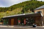
Tourism'house and national Parc at Florac
Place de l'ancienne gare, N106, 48400 Florac-trois-rivières
This office is part of the National Park's associated tourist-information network, whose mission is to provide information on, and raise awareness of, the sites and events as well as the rules that must be observed in the National Park's central zone.
On site: exhibitions, video projections, events and shop Open year-round

Office de tourisme Des Cévennes au mont Lozère
le Quai, 48220 Le Pont de Montvert sud mont-Lozère
Ouvert toute l'année (se renseigner pour les jours et horaires d'ouverture en période hivernale)

Tourism office Mont-Lozère, Villefort
43, Place du Bosquet, 48800 Villefort
This office is part of the National Park's associated tourist-information network, whose mission is to provide information on, and raise awareness of, the sites and events as well as the rules that must be observed in the National Park's central zone.
Open year-round
Transport
Summer only bus lines
- line 254 La Garde Guérin - Villefort - Bagnols les bains - Mende
- line 253 Mende - Bagnols les bains - Mont Lozère
- line 261 Mont Lozère - Pont de Montvert - Florac
- line 258 Florac - Le Rozier
Access and parking
Villefort on the D906 from Génolhac or on the D901 via Le Bleymard.
Parking :
Source


Report a problem or an error
If you have found an error on this page or if you have noticed any problems during your hike, please report them to us here: