
Le Devois cross
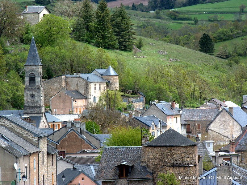
Lanuéjols
Le Devois cross
Medium
5h
13,3km
+351m
-351m
Embed this item to access it offline
This trail starts at Lanuéjols, the first village on the Causse Noir plateau. It takes you through pretty scenery on the edge of the Cévennes area to the west of the Aigoual massif, and some beautiful sections in the forest. You may see a watchful stag grazing or hear a great spotted woodpecker drumming on a tree trunk to let you know that you are entering his territory ?
3 points of interest

L'arbre et la vie - Gaël Karczewski 
Forest management
The Mont Aigoual forest.
The wood harvested here comes from a forest that was reforested from the late 19th century onwards, after a period of overgrazing. This forest begins, grows and dies like all living beings. The job of foresters is to manage and support its development while respecting the laws of nature. They harvest trees before they die to make room for young trees. These tree trunks supply an entire economic sector, from the lumberjack to the skidder operator, the saw operator and the carpenter or cabinetmaker. Wood also accompanies you throughout your lives, from your cradle, furniture, woodwork and the wooden frame of your house to your coffin.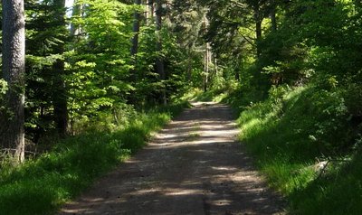
La piste en forêt - Michel Monnot 
The Commanders
You are on a ridge path on the so-called “Commanders’ crests”. It is the last trace of the fact that this area belonged, from 1312 onwards, to the Knights Hospitaller and then to the Knights of Malta, who were based at the nearby hamlet of Servillières, at their “Commandery of Meyrueis and Servillières”. You are here on the border between the Gard and Lozère, marked by a standing stone. This ridge path is called the “wolf pen drovers’ road”, a variant thousands of years old of the main drovers’ road of La Lusette between L'Espérou and Meyrueis. Transhumant livestock would overnight here, in a closed-off space safe from wolves.
La Pierre Plantée - Béatrice Galzin Pierre plantée (Pierre plantée)
Since ancient times, stones have stood along the Camin Ferrat: directional markers indicating a crossroads. Above all, they marked the boundaries of two parishes. Since the creation of Departments in 1790, they have outlined the border between Gard and Lozère.
Description
Start from the church square. Take the road “Le Village”, then Rue du Barry. At the end of this road, turn left to reach and walk alongside the "Garène brook". Continue in the gully to reach the D 986, coming from Meyrueis.
- Turn right onto the D 986, cross "the Pont de Claparouse" bridge and continue for 600m.
- After the first bend, turn left and take the track.
- At the storage basin, take the path uphill on the right. You join up with a track, turn left onto it and then immediately turn right onto the GR®6 long-distance trail, which you follow to" the standing stone".
- At "the standing stone" (“La pierre plantée”), go right towards “Lanuéjols” on the GR®62.
- NB. At the third crossing, fork right, leave the GR®62 and continue on the path that runs straight ahead of you.
- After several zigzags, join up with the D 986, cross it and take the path opposite. Shortly afterwards, cross a second road. At “Croix de l’Estrade”, head towards “Lanuéjols” to return to the car park.
- Departure : Church - Lanuéjols
- Arrival : Church - Lanuéjols
- Towns crossed : Lanuéjols
Forecast
Altimetric profile
Recommandations
Before committing yourself to a circuit, ensure that it is suitable for your activity level and ability. Make sure your equipment is appropriate for the day’s weather conditions. Remember that the weather changes quickly in the mountains. Take enough water. Please close all gates and barriers behind you. No off-roading.
Information desks

Tourism & national parc'house
Col de la Serreyrède, 30570 Val d'Aigoual
The Maison de l'Aigoual houses the tourism office Mont Aigoual Causses Cévennes and the Maison du Parc national. This visitor centre provides information on and raises awareness of the Cévennes National Park, its sites and events as well as the rules that must be observed in the National Park's central zone.
On site: changing exhibitions, video projections, Festival Nature events and shop Open year-round
Accessibility :
Accessible aux personnes à mobilité réduite sur les trois niveaux du bâtiment (ascenseur)
Transport
liO is the regional public transport service of the Occitanie/ Pyrénées – Méditerranée region. It facilitates everyone’s movements by prioritising public transport. For more information https://www.lio-occitanie.fr/
(not during school holidays)
(not during school holidays)
Access and parking
From Meyrueis, towards Lanuéjols on the D 986. At Bout-de-Côte, take the D 47 to reach Lanuéjols. Park in the village.
Parking :
Church square
Source

CC Causses Aigoual Cévennes Terres Solidaireshttp://www.caussesaigoualcevennes.fr/

Parc national des Cévenneshttp://www.cevennes-parcnational.fr/
Report a problem or an error
If you have found an error on this page or if you have noticed any problems during your hike, please report them to us here: