
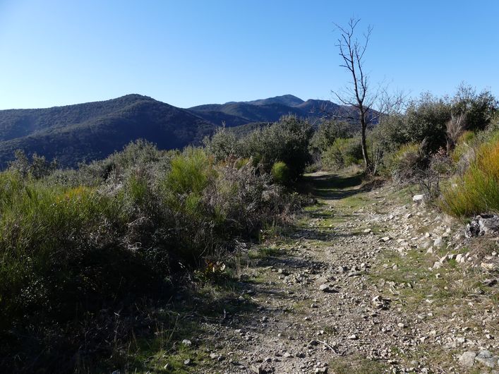
The stagecoach
Here, place names, castle, manor house, schist buildings all tell of the men and women who valiantly defended their freedom of worship.
12 points of interest
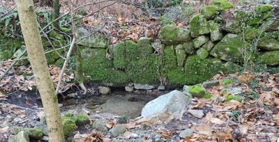
Tancat sur le ruisseau de Vallongue - Béatrice Galzin 
Hydraulic heritage
In the valley of Valescure, an integration project for the unemployed and socially disadvantaged restored over 450 hydraulic engineering structures, supervised by various institutional and scientific partners. This project helps you understand the importance of hydraulic dams in the Cévennes: tancats (small thresholds or dams built across the waterway to recover any sediment carried by rainwater runoff), païssières (thresholds, little dams), béals (irrigation channels), trancats (rainwater drains carved into the rock or constructed uphill of buildings to channel rainwater and protect the buildings).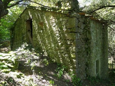
La Fayssolle - Nathalie Thomas 
The ruins of La Fayssolle
The departmental archives preserve the historical traces of Mas de Faysolle in a mariage act from 20 November 1554. Notary records mention the wedding of Jeanne Mercoiret with Antoine Pascal.
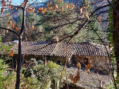
Château de Valescure - Béatrice Galzin Château de Valescure
The Château de Valescure, a private property owned by the French Forestry Office (ONF) since 1922, must have been built in the 15th century by Bertrand de Valescure, whose descendants were ennobled and distinguished themselves during the French Wars of Religion. They held the seigneury of Valescure until 1618, when by alliance it became the Tourtoulon family’s, which held it until the French Revolution. Long empty, in 1941 the château came back to life when it became an advance post of the Chantiers de jeunesse (a paramilitary youth institution of the Vichy regime). Later in the Second World War, Resistance fighters found refuge here. In 1985, the ONF began renting it out.

A stream under surveillance
The governmental research organisation CNRS has installed a hydrometric station here that measures the stream's water levels and flow rate. You can easily see the graduated vertical scale. This is complemented by a pressure probe connected to a data recording centre. This monitoring equipment is part of a series of stations in the Vallée Borgne. The data they record have shown the important role played by tancats (cf. Precious reserves) in regulating water flow. They also confirm how effective the various measures are that have been taken to rehabilitate these structures and maintain riverbank vegetation.
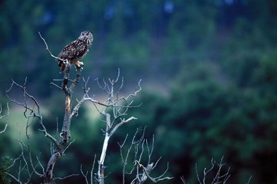
La chouette chevêche - Descamps R  Flora
FloraA preserved valley
The Vallée Obscure, a natural zone of ecological, faunal and floral interest, has a significant heritage of rare species, such as the nightjar, little owl, bee-eater, raven and honey buzzard... As for flora, almost ten varieties of orchids have been identified. In spring, snapdragon is common on the rocky slopes. In the valley, there are also Atlas cedars and tall thujas, planted by the ONF in the 1950s.
Precious reserves
To store water, especially during dry periods, locals have dug and built a great number of gorgas. These reservoirs supplied gardens, fields and mills. They were fed by springs or streams, whose water was diverted by a paissièira and then transported by a besal (béal).
Vital arteries
Besals or béals are channels that have been built to carry and distribute water where it is needed: plots of cultivated land, gardens, mills, etc. They were usually created and maintained collectively. The distribution of water to the various users was controlled by small sluice gates (esclafidors). These were opened and closed at precise times of day, which were decided according to customary law – and could be subject to disputes and legal proceedings.
Past - present
Locals have built a great number of structures along valats (streams in steep-sided Cevenol valleys) to control them. The structures bear witness to their hard work and to local culture, and represent a precious hydraulic heritage. To help preserve it, from 2003 to 2006, the “Ressource en eau” programme restored and rehabilitated over 400 tancats, dry-stone barriers that slow down river flow, retain the sediment it carries and form small crop terraces. Moreover, in dry periods, the water stored behind each tancat (where it can only move slowly through the sediment), is returned to the river gradually and thus regulates its flow rate.
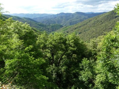
Les cachettes huguenotes - Nathalie Thomas The King’s dragoons and the dragonnade
Three-quarters of local Huguenots (Protestants) renounced their faith due to the “missionaries in boots”, meaning the dragoons. The dragonnade was the name given to Huguenots being forced to house these soldiers of the King, who then pillaged and mistreated them into renouncing their faith. The dragoons met with a unique resistance in the Camisard War (1702 to 1705), during which 3,000 Protestants in white shirts defied 30,000 red dragoons. The dragoons were on horseback, booted and armed with sabres a metre-and-a-half long, which was not very practical on small paths, during this guerilla war.
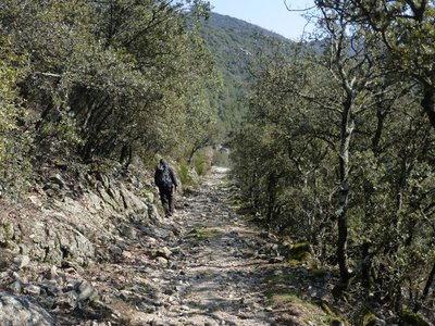
Descente au col de Mercou - © Nathalie Thomas Draille
The rocky path becomes wider and has stone reinforcements on the downhill side, which shows that it was once used by large herds. This draille led from Saint-Jean-du-Gard to the summer pastures on Mont Aigoual. At the Col de Mercou pass (570 m), there are panoramic views northwards over the Corniche des Cevennes. The pass was once a site for trade and commerce, with its own market. Its name is derived from Mercury, the god of travellers and commerce. There are also references to Melkart, a Phoenician deity: Semitic traders left traces of their passage here in the architecture of the old proto-historic bridges. Melkart or Melqart was the tutelary god of the city of Tyre - whose name means “strong king” in Phoenician – and was the god of riches, industry and navigation. He was worshipped in the tenth century BC.

Cable de transport de materiaux - Béatrice Galzin Cobbled paths and retaining walls
Under your feet, you will see traces of all this old built road heritage on the paths. Cobblestones make roads more comfortable and suitable for vehicles.
The retaining walls are regular and, in places, built on very steep areas or carved into the rock. The traces left by humanity are impressive.
After the Château de Bussas, you will see piled-up tyres by the side of the path. There is also a thick cable. The taut-cable system made it possible to transport materials and wood all the way to the road. When the load arrived, it had sometimes picked up too much speed because of its weight. The pile of tyres was there to stop it.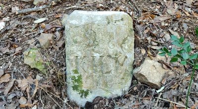
Borne kilométrique sur l'ancienne route départementale 20 - Béatrice Galzin 
Soucy bridge and the D20 road
The magnificent stone bridge that straddles the Gardon river was built in July 1872.
On 14 June 1872, François Poujol requested permission to build a submersible bridge over the Gardon de St- André, between the D 20 and the new RN 107, in Les Soucis in the municipality of St-Martin de Corconac.
The road that we take today between Soucy bridge and L’Arénas was the only road on the valley floor. It was disused in 1873 when the new RN 107 (now the RN 907) was built on the slope opposite. Try to find the distance marker, which is on the edge of the path.
Description
Signposts will guide you all along this route, as well as yellow painted waymarks. In the description below, the signposted place names and/or directions are given in bold italics between quotation marks:
Starting from the car park "Peyrolles - Serre de Clayrac", turn right onto the Départemental road and, 200m later,
- "La Planque", go downhill on the left on the small road towards
- "Pont de L'Arénas",
- "Vallée Obscure" and
- "Château de vallée obscure". At “Château de vallée obscure” take the path on the right towards
- "La Jasse", then
- "Rouvière", and
- "Col du Briontet". At “col du Briontet”, go towards "Col du Mercou" on a wooded path on your right, which goes uphill between two forestry tracks.
- At “Col du Mercou”, take the path on your right towards
- "Soucy".Turn right towards “Pont de l’Arénas” (2), then left towards “La Planque” (1) to return to the main road and the starting car park.
- Departure : La Planque bend in the road – Peyrolles
- Arrival : La Planque bend in the road – Peyrolles
- Towns crossed : Peyrolles, Soudorgues, and L'Estréchure
Forecast
Altimetric profile
Recommandations
Caution! Heavy rainfall will make crossing the ford at Pont de Vallongue impossible.
Before committing yourself to a circuit, ensure that it is suitable for your activity level and ability. Remember that the weather changes quickly in the mountains. Take enough water.
Information desks

Tourism & national parc'house
Col de la Serreyrède, 30570 Val d'Aigoual
The Maison de l'Aigoual houses the tourism office Mont Aigoual Causses Cévennes and the Maison du Parc national. This visitor centre provides information on and raises awareness of the Cévennes National Park, its sites and events as well as the rules that must be observed in the National Park's central zone.
On site: changing exhibitions, video projections, Festival Nature events and shop Open year-round

Tourism office Mont Aigoual Causses Cévennes, Saint-André-de-Valborgne
les quais, 30940 Saint-André-de-Valborgne
This office is part of the National Park's associated tourist-information network, whose mission is to provide information on, and raise awareness of, the sites and events as well as the rules that must be observed in the National Park's central zone.
Transport
liO is the regional public transport service of the Occitanie/ Pyrénées – Méditerranée region. It facilitates everyone’s movements by prioritising public transport. For more information, go to https://www.lio-occitanie.fr/
(not during school holidays)
Access and parking
From St-Jean du Gard, towards St-André de Valborgne on the D 907, car park "La Planque" after 800m, after the bus shelter on your left.
Parking :
Source


Report a problem or an error
If you have found an error on this page or if you have noticed any problems during your hike, please report them to us here: