
Once upon a mine
5 points of interest
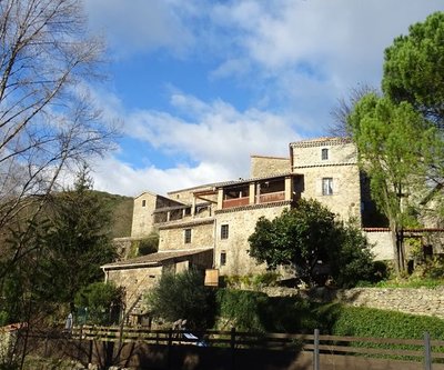
Le Vieux-Buis - © JF.Raulet 
Le Vieux-Buis
This mediaeval hamlet has been in the records since the 11th century, when farming prospered on its slopes. Perched on the hillside, Le Vieux-Buis existed quietly through the centuries with no disruption until the Plague that raged unstoppably in 1348. It was not until the mid-15th century that farming was given a new lease of life in this devastated region, where everything needed to be rebuilt. Up until the 19th century, the arid hills were dedicated to farming: small livestock farms, vineyards, olive trees, etc., whose vestiges you will come across all along the path.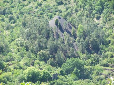
Terril de la Berle - © O.Pagès 
Slag heaps
These heaps are made up of the waste from coal mining. In mining days, the slopes were black and several dozen metres high. Today adapted vegetation covers them, allowing them to blend into the landscape. The slag heap concerned has recently been flattened and used to backfill the track. It is no longer covered by vegetation.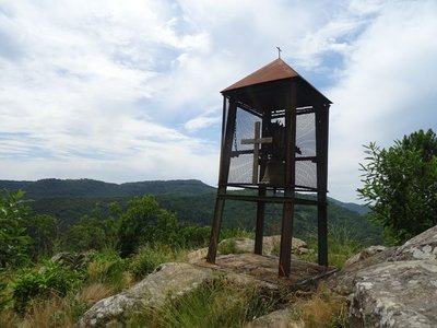
La cloche de Saint Laurent - © JF.Raulet Saint Lawrence’s chapel
Every year on 10 August, pilgrims come to thank St Lawrence, once reputed to cure oral diseases. Detailed archaeological study would be necessary to elucidate the mystery of this chapel. A priory belonging to the Abbey of Saint-Andéol-de-Robiac, located in the village, is believed to have stood on the chapel site. The Romanesque chapel, of which only a few traces remain, was probably built between the 11th and 13th centuries. The various types of stone-setting show that, since then, it has been reworked many times, although we do not know when exactly. St-Lawrence’s chapel was stripped of its bell, which is now on the rocky spur that overlooks it.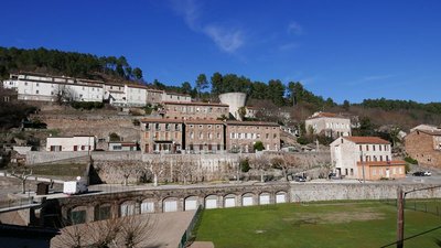
Rochessadoule - © O.Pagès Rochessadoule
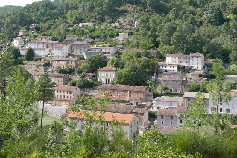
From the top of this mountain, you overlook the new town of Rochessadoule, which as of 1886 had 3,000 inhabitants come from all over Europe to work in its coal mine. Giant smokestacks stood between its stone and brick buildings. On the side of the road below, there would have been a lamp workshop, a queue of miners awaiting their turn, a changing room, and a cable car that carried and dumped the mine waste onto the slag heap. Slowly, the buildings were turned into art galleries, artisan workshops and holiday homes. Today, what remains of the epic mining days are small santons (nativity figures) called Saint Barbara’s santons (the patron saint of miners), which are produced and sold each year in November at the great exhibition and sale in Rochessadoule.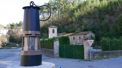
Rochessadoule - © O.Pagès The mining railway
This walk is mostly on a section of the former railway line from Rochessadoule to Bessèges, which was above all a trunk line from Alès to Bessèges. It transported coal from the mines at Robiac, Grangier and Brissac to the factories in Bessèges. This freight line was much used until the 1960s. By 2012, the Robiac-Bessèges railway could no longer compete with the road and was discontinued.
Description
From "ROBIAC" follow "ROCHESSADOULE" via "Robiac - Route de Chanteperdrix", "Conrocs" then"Patte d’Oie du Ronc Rouge", "Arbousset", "La Font" and "Rochessadoule – Mairie". Return to "ROBIAC" via "La Passerelle du Rieusset", "Rochessadoule - le Pialet", "Le Ramier" et "Frayssinet", "Rochessadoule – Église", "Le Puits de Brissac", "Le Brossard", "La Tintonne", "L’Ancienne Voie Ferrée" and "Robiac - Route de Chanteperdrix".
This hike is taken from the guidebook Cévennes Haute Vallée de la Cèze, published by the Communauté de communes Cèze Cévennes as part of the collection Espaces Naturels Gardois and the label Gard Pleine Nature.
- Departure : Robiac, Le Buis
- Arrival : Robiac, Le Buis
- Towns crossed : Robiac-Rochessadoule and Bessèges
Forecast
Altimetric profile
Recommandations
Information desks

Tourism office CezeCévennes, Bessèges
14 rue de la République, 30160 Bessèges
This office is part of the National Park's associated tourist-information network, whose mission is to provide information on, and raise awareness of, the sites and events as well as the rules that must be observed in the National Park's central zone.
Open year-round
Tourism office Cèze-Cévennes Saint-Ambroix
Place de l'ancien Temple, 30500 Saint-Ambroix
This office is part of the National Park's associated tourist-information network, whose mission is to provide information on, and raise awareness of, the sites and events as well as the rules that must be observed in the National Park's central zone.
Open year-round
Transport
Access and parking
Parking :
Source

Report a problem or an error
If you have found an error on this page or if you have noticed any problems during your hike, please report them to us here: