
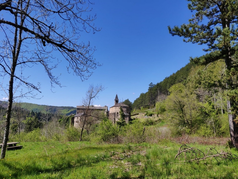
MTB 14 - The 3 rivers challenge – graded black
23 points of interest

Sous bois du Trévezel - Béatrice Galzin 
The Mont Aigoual forest
“Aigoual, Forêt d’Exception”
The French Forestry Office, which manages state forests, launched a programme in 2013 called “Aigoual, Forêt d’Exception” (Aigoual: An Exceptional Forest) with the aim of highlighting the massif’s natural and cultural heritage. The Forestry Office thus tries to foreground the different aspects of its multi-facetted management: production, protection and receiving visitors. One key aspect of this approach, which complements other initiatives by local actors, is to improve visitors’ experience in the forest.
La fougère aigle - Béatrice Galzin The hidden life of the forest
Trees grow upwards towards the light while mosses benefit from their shade on the ground and spread out. Like soft cushions or carpets, they hug everything that sticks out of the ground, such as old tree stumps. This soft felted surface is pleasing to see, and an undergrowth without mosses would not be worthy of the name. Legend has it that mosses show which way is north. Wrong!
Mosses indicate a degree of moisture; they protect the soil from drying out by retaining every last drop of dew. They prepare pockets of humus for the future occupants: grasses and herbaceous plants. They also love the damp of tree trunks and can grow there, on the side that is most exposed to the prevailing rains.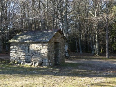
abris au col des Ubertes - Nathalie Thomas 
The forestry labourers’ shelter
Deep inside the forest, you will soon see a little house. From the 19th to the early 20th century, it gave shelter to the forestry labourers in charge of reforesting the mountain. The work site was too far from a proper foresters’ house to get back there every evening, especially since the working day was long. There was no question then of working only 35 or even 40 hours a week! The trees were planted one by one using a pickaxe; the daily minimum agreed on was 100 trees per man per day. A total of 68 million were planted…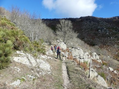
Montée au col du Suquet - nathalie.thomas 
Col du Suquet pass
You are at the highest point of the hike. On the right bank of the Dourbie, the path crosses a sheer slope that is alternatively made up of zones of solid granite and other zones where it has decomposed due to weathering into coarse granitic sand. To the south, the views encompass the entire Lingas massif, a high wooded plateau overlooking, further south, the region around Le Vigan and the Languedocian plain.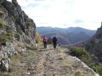
Vue sur le Lingas - nathalie.thomas The Dourbies gorge
The path comes out on the Dourbie gorge. Opposite you, the western part of the high granite plateau of the Lingas joins up on its right with the limestone plateau called Causse de Larzac. On your right, you can see the granite dome of Saint-Guiral. Closer to you, in the vales that converge on the Dourbie, are the former crop terraces, pastureland, the village built on the riverbank at the valley’s widest point and finally the chestnut orchard. You are seeing the upper limit of its range, which corresponds to it maximum altitude in this zone (800 m).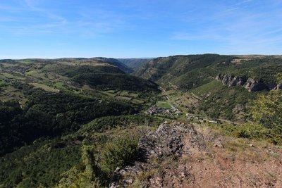
© Valère Marsaudon 
Open-sky geology
The granite and schist (slate) that constitute the bedrock of the Cévennes and Causses were created in the Paleozoic. The bedrock was then flattened by erosion and covered by the sea, leading to limestone deposits. On the reliefs, erosion has eliminated the sedimentary top layer while in zones of subsidence, such as the Causses, the limestone deposits remained in place. Since then, waterways have cut ever deeper into the limestone, and continue to do so today.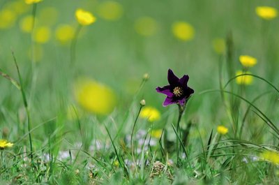
Anémone pulsatille - © Olivier Prohin Typical grasslands on limestone soil
This small area of grassland is one of the rare open spaces on the Causse de Canayère. It is of interest for the preservation of certain flower species, especially the pasqueflower and several varieties of orchid. To counteract the natural progression towards more closed environments, this site is maintained by regular mowing.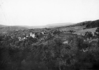
© Fonds Flahault The hamlet of Espruniers
This hamlet, which consisted of a sizeable grouping of houses, was inhabited until about 1930. You have stopped on what was probably the threshing floor for grains.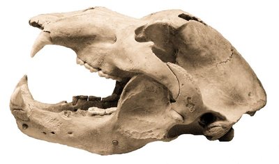
Crâne d'ours - © M. Delor 
Joulie Cave
In March 1952, Jolly, a forestry official, showed his friend Frayssignes this cave. Deposited in it they discovered the remains of 300 humans from the Neolithic, who had been carefully laid out side by side. The cave was rapidly declared a historical monument. In the depths of the cave, a great number of bear bones was also found. This cave bear, the ancestor of our brown bear (Ursus spelaeus), had a skull 50 cm long! In the winter, groups of these bears would have huddled together in clay wallows at the rear of the caves. Ursus artos succeeded the cave bear and was succeeded in turn by the brown bear, which was hunted to extinction in the 15th century. (B. Mathieu)
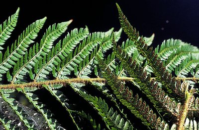
Polystic - © Yves Maccagno The schist/limestone contact zone
Here, the layers of the schist outcrops are almost vertical in places. This contact between Causses and Cévennes, between the primary bedrock and the limestone layers, is due to a geological fault created by the various movements and constraints that have affected the Earth’s crust. In this zone, the schist bedrock has been pushed upwards by several hundred metres along the fault line compared to the limestone plateau, although the latter is less old.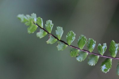
Capillaire - © Valère Marsaudon  Flora
FloraCalcifugous vegetation
This section of the path in the schist zone showcases calcifugous (“limestone-avoiding”) vegetation, which only grows on acid soils (schist or granite): especially chestnut trees, ferns, heather and broom.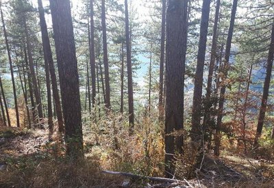
pins noirs - © Sud Cévennes A recent forest
The stands that were planted during the large reforestation programmes of the late 19th century onwards consist of black pines, a rustic species that is well-adapted to dry limestone soils. Underground, the Causses plateaux are characterised by networks of tunnels and cavities that have been created by water movement over millions of years. Subterranean rivers are blocked by the impermeable layers of the valley floor and flow into the Trévezel instead.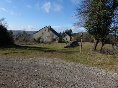
Canayère - nathalie.thomas Canayère
A former farm turned forester's house in 1880. In the early days of the Mont Aiguoal reforestation, forestry officers lived here year-round during their missions. Forestry workers working on the replanting were allowed to use the outbuildings. Later, only one official resided here. Since 1967, no official has permanently lived here. (B. Mathieu)
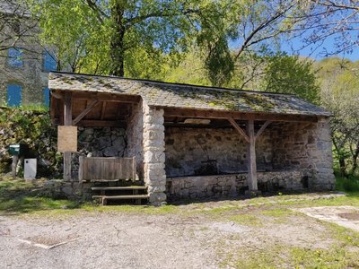
Le lavoir des Monts - Béatrice Galzin Les Monts wash house
The wash house in Les Monts still has running water but the washerwomen have disappeared for good. The site is magical. The water is clear enough for dragonflies to lay their eggs in and for birds to drink
La ferme de La Boissière - nathalie.thomas La Boissière farm
La Boissière farm was abandoned by its inhabitants when Mont Aigoual was reforested. A salary from the French National Water and Forestry Commission was so much more secure than the meagre revenues from a farmer’s endless work. You pass through the farm’s porch and walk on its threshing floor – but there are no chickens or cereals on the threshing floor, and no herds ambling to the meadow. Today the forest has won.
Ecole de Villemagne dans les années 1960 - © Coll. G. Mathon A cemetery that reveals histories
The small cemetery of Saint-Sauveur des Pourcils, so peaceful today, reveals a rich and eventful history. The gravestones bear the names of Catholic, Orthodox, Protestant, Jewish and Muslim families. This religious plurality is partly due to the arrival in the 20th century of foreign workers to mine argentiferous lead and copper in the neighbouring hamlet of Villemagne. During the murky period of World War II, the wife of a resistance fighter and her six children took refuge in the surrounding area. The Muslim graves bear witness to the period following the Algerian War when a camp for harkis was set up in the region. These Algerian Muslims, who had served in the French army, were employed by the French Forestry Office for the reforestation of the Aigoual massif.
Le hameau et ses alentours avant le reboisement - © Coll. G. Mathon 
Castle or farm estate?
In the 12th century, minor vassal lords of the Roquefeuil family ruled from a castle at Saint-Sauveur des Pourcils. They lived in autarky with their livestock, large pastures and a share of the farmers’ harvests. No remains from that period survive. The main building looks more like a farmhouse. Over the centuries, the castle has become a large farm estate with outbuildings.
Saint Sauveur des Pourcils au début du XXe siècle - © Coll. G. Mathon Un domaine agricole reboisé
Today, the hamlet of Saint-Sauveur des Pourcils is surrounded by trees but in the 19th century the Aigoual massif was bare! Its reforestation began as a state programme managed by foresters. The French Forestry Office bought many farm estates to turn them into foresters’ houses. Saint-Sauveur des Pourcils had all the required characteristics: buildings for housing foresters; varied soils; good sun exposure; and water nearby (the river below). The foresters set up a tree nursery to grow young trees and an arboretum to test how well-adapted different species were.
Sapinière en futaie régulière - © Elodie Mazel Arboretum
To begin with, arboretums were experiments to study the behaviour of tree species introduced to the massif as part of the reforestation programme from the late 19th century on. Over time, their scientific character gave way to a more educational and ornamental outlook. On the Aigoual, the French Forestry Office maintains a network of arboretums that are representative of the forest’s diversity and of the work carried out by foresters on the massif since the early 20th century.
The waymarked circuit only covers a part of the vast arboretum.
© Coll. G. Mathon A church at the heart of it all
Why was such an imposing church built in a small hamlet? The profound attachment of the parishioners to their place of worship was key. The church was destroyed three times, by Protestants (1562 and 1703) and by the ravages of time (1848). But each time the parishioners who lived in neighbouring hamlets decided to rebuild it. Despite this determination, the church and cemetery were eventually transferred to Camprieu (1871). The episcopal authorities cited difficulties in accessing the place of worship and disagreements between the mayor and parish priest. The local faithful, who were opposed to the transfer, managed to keep masses for the yearly pilgrimage, baptisms, funerals and weddings in St-Sauveur.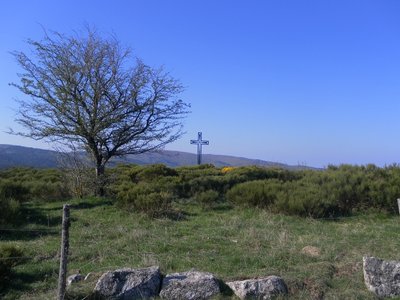
Col de la croix de fer - nelly Carel Col de la Croix de Fer pass
At the col de la Croix de Fer pass, which is a strategic crossroads of several tracks, there used to be an inn for travellers. The magnificent ruin with its two impressive vaults was also a sizeable farm, owned by the Baron de Roquedols. It was located at the limit of the municipalities of Meyrueis and St-Sauveur-Camprieu on the route of the Camin Ferrat and the King’s Road. In the days of religious persecution, the preacher François Vivens* organised secret Protestant gatherings in the small valley just below the buildings. (*Vivens was killed in 1692, 10 years before the Camisard War)
Perte du Bonheur - nathalie.thomas 
The Bonheur river
The Bramabiau site is an example of a karst spring. Here, slightly east of Camprieu, the Bonheur River has dug into the Causse (limestone plateau) and disappears in a natural tunnel. It re-emerges into the open at the bottom of the Aven de Balset, but it twists to the south to disappear again below ground. The river meanders through more than 10 km of tunnels. Then, 700 horizontal meters from its sinkhole, it reappears as a spring! The rock walls of the narrow canyon magnify the sound of its waters and add to its rumbling some acoustic vibrations that are close to a gigantic roaring. This is no longer the tranquil Bonheur, it is the tumultuous Bramabiau.
Camprieu - nathalie.thomas Camprieu
In the 19th century, the village streets were bustling year-round with a throng of artisans, labourers and shopkeepers, who lived in these modest mountain houses that were also suitable for livestock rearing. Camprieu had: two cobblers, six clog makers, two basket makers, one carpenter, two wheelwrights, two farriers, one miller, two stonemasons, one glassworks, one sawmill, one dairy, two grocer’s shops, a haberdashery and ironmonger’s and one shop for ladies’ “fashion and dresses”. There was also a cheese cellar that produced Roquefort until 1932, a hotel and an inn.
Description
Signposts will guide you all along this route. In the description below, the signposted place names and/or directions are given in bold italics between quotation marks:
Starting from “Camprieu”, head towards "col des Ubertes" via
- "Le Cros",
- "Tabarde",
- "Maison du bois",
- "Tailladette",
- "Terondel".
- At "col des Ubertes" follow "Col du Suquet".
- At “col du Suquet” follow the GR® trail towards
- “Le Vieux Hêtre”, then turn left towards
- "La plaine de Vialat",
- “Mont Mal”, "Serre de Cade".
- From “Serre de Cade”, there is a technical descent to the road. Turn left onto the road for 1 km till you reach
- "Sous le col des Rhodes".
Turn right and follow “Canayère” via - "Le pas du Coulet" and
- "Les Pins noirs", then continue to “Comeiras”
- At "Comeiras" start the long climb to
- “La Roque”.
Take the road on the left towards - "Valat de Malbosc", then turn left to
- “Les Monts”. Then head towards "Pont de l’Âne" via
- "La Combette",
- "La Matte" and
- "Conduite forcée".
- At “Pont de l’Âne”, go to “St Sauveur des Pourcils” via
- "Le Muguet",
- "La Fonderie",
- "Valat de la Fonderie". Then head for
- “Carrefour des Pourcils”.
Turn right to return to "Camprieu" via - "Travadaire",
- "Rouveyrolle",
- "Abîme de Bramabiau",
- "Perte de Bramabiau",
- "La mairie",
- "La Croix basse".
This circuit is taken from the guidebook Massif de l’Aigoual, published by the communauté de communes Causses Aigoual Cévennes as part of the collection Espaces naturels gardois and the label Gard Pleine Nature.
- Departure : Camprieu
- Arrival : Camprieu
- Towns crossed : Saint-Sauveur-Camprieu, Dourbies, Trèves, and Lanuéjols
Forecast
Altimetric profile
Recommandations
Before committing yourself to a circuit, ensure that it is suitable for your activity level and ability. You must wear a helmet. Protective equipment is recommended. Respect other road users and stay in control of your speed and trajectory. Make sure your equipment is appropriate for the day’s weather conditions. Remember that the weather changes quickly in the mountains. Take enough water. Please close all gates and barriers behind you. No off-roading.
Information desks

Tourism & national parc'house
Col de la Serreyrède, 30570 Val d'Aigoual
The Maison de l'Aigoual houses the tourism office Mont Aigoual Causses Cévennes and the Maison du Parc national. This visitor centre provides information on and raises awareness of the Cévennes National Park, its sites and events as well as the rules that must be observed in the National Park's central zone.
On site: changing exhibitions, video projections, Festival Nature events and shop Open year-round
Transport
liO is the regional public transport service of the Occitanie/ Pyrénées – Méditerranée region. It facilitates everyone’s movements by prioritising public transport. For more information, call 08 10 33 42 73 or go to www.laregion.fr
Access and parking
From Valleraugue, take the D 986 towards L’Espérou. At the roundabout, turn right to the col de la Serreyrède pass. At the pass, turn left onto the D 986 – car park in the village.
Parking :
Source


Report a problem or an error
If you have found an error on this page or if you have noticed any problems during your hike, please report them to us here: