
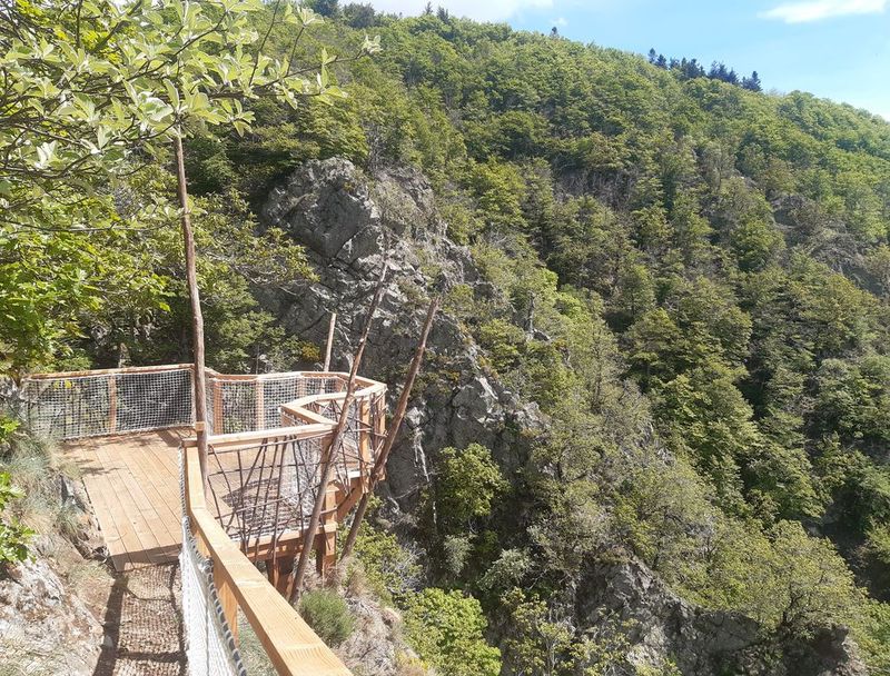
The Hérault waterfalls - long

From the spring of the river Hérault (Prat Peyrot), this path winds through the forest on the steep southern slopes of Mont Aigoual. Dotted with varied texts on fauna, flora and forest management, referred to in the leaflet, it makes its way to a spectacular viewpoint over the Hérault waterfalls.
8 points of interest
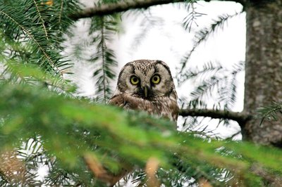
La chouette de tengmalm - Gaël.Karczewski  Fauna
FaunaBoreal owl
Abandoned woodpecker chambers are a boon for small mammals and other birds, such as the boreal owl, which has come from Nordic countries to settle here at altitudes of 800 m. Very discreet, it confines itself to the depths of our forested mountain ranges. It can be identified in March by its sonorous and gentle call. To maintain the species, the Cévennes National Park and the French forestry office protect trees with nesting chambers and old-growth forests from being logged.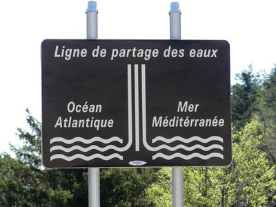
Ligne de partage des eaux - nathalie.thomas 
The watershed
The current relief creates a frontier between the Atlantic and the Mediterranean: depending on the slope, water runs towards either the Ocean or the Sea. This is due to the uplift of the Cevenol sill, brought about by geological activity along the Cévennes fault, which borders draw the northern limit of the Languedoc region. This natural sill marks the geographical border between the northwest slope – verdant, not too steep – and the southeast slope, which falls away abruptly in the Languedoc and continues to be subject to powerful erosion.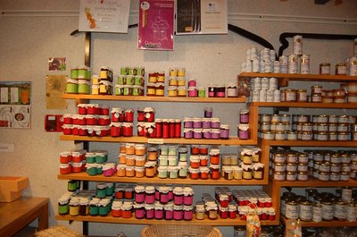
Boutique des producteurs - © Nathalie Thomas The association "Terres d'Aigoual"
The Cévennes National Park rents out part of the building to the association, enabling local farmers to sell their products directly to the public. The association brings together farmers who wish to promote what they produce and share their know-how. They also enjoy sharing their vision of farming- high quality produce and products,
- human-sized farms,
- mutual aid.
Come and discover their products!
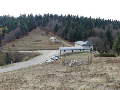
La Serreyrède - nathalie.thomas 
Climate frontier
The pass is also a climate frontier. The Atlantic side is predominantly exposed to the west wind and receives rainfall that is fairly regularly spread over the year. The Mediterranean side, however, is drier and hotter and constitutes a massive barrier to the occasional southeast wind (the marin), thus forcing its humid air to rise suddenly. This makes the clouds’ water content condense, which can give rise to so-called Cevenol episodes: heavy rainfall (600 mm in 24 hrs) causing catastrophic floods. The Aigoual, Mount Aigualis the rainy (A. Bernard), is well-named! After Savoie, it is the rainiest place in France.
Maison forestière de la Serreyrède - © Jacques de Joly La Serreyrède
Before 1861, the house at the Col de la Serreyrède was inhabited by two families of farmers. They owned some livestock and had a vegetable garden, whose terraces you can still see above the La Caumette track. From 1861 on, the farm was inhabited by a forest ranger. It was only bought by the state body Eaux et Forêts in 1883, to be turned into a forester's house. It became one of Georges Fabre's headquarters during the reforestation of the Aigoual massif. The Cévennes National Park, tourism office and Terres d'Aigoual growers have now joined forces to revive La Serreyrède with the help of the Communauté de Communes Causses Aigoual Cévennes – Terres solidaires.

© R. Descamps Two waterfalls... Find the Hérault!
Faced with these two threads of rivers, geographers hesitated between flow rate and length, and finally designated the waterway below you the Hérault while the waterfall opposite you was named the Dauphine. Two remarkable plants can be seen here: orpine (Hylotelephium telephium) with its succulent leaves, a food source for the larvae of a butterfly that is in strong decline all over the Massif central: the Apollo (which may be seen from mid-July to mid-August); and Prost saxifrage, which forms regular cushions that are easy to recognise. They enable it better to store what little water is available. It is a plant endemic to the Cévennes.
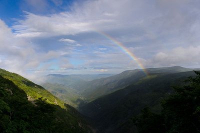
Vue plongeante sur la vallée de l'Hérault - Arnaud.Bouissou River capture
Violent precipitation and the steep gradient of Mediterranean torrents cause regressive (i.e. upstream) erosion of the valleys through which they flow. This erosion can invert the sense of flow and thus “capture” for the Mediterranean a waterway that had, until then, flowed into the Atlantic. One example is the Hérault with its waterfalls, the capture being located at the falls. The Hérault and the Dauphine brook used to flow via L'Espérou into the Dourbie... River pebbles found around the village by geologists attest to the existence of a waterway in the past.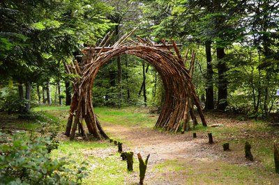
L'Orée (Yoann Crépin) - © Filature du Mazel 
On the Verge (Yoann Crépin)
A doorway to a circuit of art within the natural environment.
To fuse and interact with the environment and play with the seasons, time, light and weightlessness. To let humanity express itself through nature and nature express itself through humanity – a necessary interaction, a symbiotic interaction that inspires us to discover another world.
Forecast
Altimetric profile
Recommandations
Narrow and craggy path – firm shoes are essential.
Do not leave the path as this environment is unstable and very delicate. Horse-riding or mountain-biking are not allowed on or adapted to discovery trails.
Information desks

Tourism & national parc'house
Col de la Serreyrède, 30570 Val d'Aigoual
The Maison de l'Aigoual houses the tourism office Mont Aigoual Causses Cévennes and the Maison du Parc national. This visitor centre provides information on and raises awareness of the Cévennes National Park, its sites and events as well as the rules that must be observed in the National Park's central zone.
On site: changing exhibitions, video projections, Festival Nature events and shop Open year-round
Transport
LiO is the regional public transport service of the Occitanie/ Pyrénées – Méditerranée region. It facilitates everyone’s movements by prioritising public transport. For more information, go to www.lio.laregion.fr
Access and parking
Starting at Part Peyrot: D48 from Le Vigan via the Col de la Serreyrède pass or else D18 from Lozère via the Col du Perjuret pass
Parking :
Source

Report a problem or an error
If you have found an error on this page or if you have noticed any problems during your hike, please report them to us here:
