

Le tour du Suquet - escapades à vélo
At an average altitude of 1,000 m, you will feel as though you are flying over the exceptional landscape. Peaceful downhill section to the village of Dourbies. As you cross Le Suquet mountain with its green forest, you can observe the limestone cliffs of Le Trévezel. On the regular climb to the Col de La Serreyrède pass, admire the luxurious beech forest that surrounds you. Return to Prat Peyrot.
21 points of interest

Village de l'Espérou - Béatrice Galzin 
The village of L’Espérou
The village of L’Espérou lies on the border of Dourbies and Valleraugue local councils. A draille (track for livestock to migrate to summer pastures with their shepherds) crosses the village. As in many villages in the Gard, the two places of worship – one Catholic, the other Protestant – are opposite each other. The village is located in a varied environment that is suitable for outdoor activities and sports.
Dourbies - nathalie.thomas  Fauna
FaunaThe Dourbie
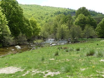
In the upper reaches of the river, a diverse and fascinating wildlife has developed despite the strong current. The clear running waters condition the presence and future of the brown trout. It cohabits with minnows, otters… You may see a white-throated dipper on a rock, or else a grey heron or wagtail on the bank. But it is in the clear waters and under rocks that a whole little aquatic world exists: molluscs, crustaceans, insect larvae, etc. They pile up quite harmoniously, dozens per square metre. Some stick to the rocks; others drift, lurk or float. It all depends on the equipment nature has provided them with: bristles, suckers, hooks, sheaths weighted with gravel...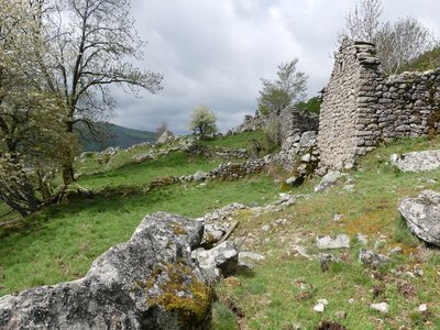
Malpertus - nathalie.thomas 
Malpertus
The ruined hamlet of Malpertus is a splendid and moving site, with its feel of a paradise lost which one would like to restore to its former glory. The views onto the Dourbie valley are stunning. The short grass makes it easy to see far, and spot friends or enemies early. Weapons were hidden here in World War Two, stored in a rock shelter at the Roc du Salidou, just behind the buildings. The hamlet’s last inhabitant left this site, inaccessible except on muleback, in the 1960s. Today it is home to diverse small fauna: birds, insects, lizards, common frogs, etc.
Aulne glutineux - nathalie.thomas  Flora
FloraThe common alder
A wise tree lives in the sunshine with its feet in the waters of the Dourbie: the common alder. You can identify it even in winter by looking for its strobili on the ground or on its branches - female inflorescences shaped like small pinecones. The alder’s tangled roots are solidly anchored in low riverbanks, thus ensuring their protection. By symbiosis between alders and a bacteria called frankia living in their root, nitrogen is fixed in the ground at about 60 to 200 kg per hectare per year! This is a bonanza for poor soils, which are quickly enriched.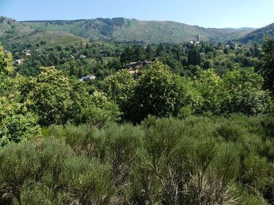
Vue sur Dourbies - nathalie.thomas Dourbies
The village of Dourbies was built on a ridge to maximise the flatter soils for cultivation. Farming having declined in the valley, fields that were once cultivated have now been urbanised, and broom heath is invading more and more land.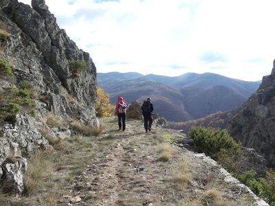
Vue sur le Lingas - nathalie.thomas 
The Dourbies gorge
The path comes out on the Dourbie gorge. Opposite you, the western part of the high granite plateau of the Lingas joins up on its right with the limestone plateau called Causse de Larzac. On your right, you can see the granite dome of Saint-Guiral. Closer to you, in the vales that converge on the Dourbie, are the former crop terraces, pastureland, the village built on the riverbank at the valley’s widest point and finally the chestnut orchard. You are seeing the upper limit of its range, which corresponds to it maximum altitude in this zone (800 m).
La fougère aigle - Béatrice Galzin 
The hidden life of the forest
Trees grow upwards towards the light while mosses benefit from their shade on the ground and spread out. Like soft cushions or carpets, they hug everything that sticks out of the ground, such as old tree stumps. This soft felted surface is pleasing to see, and an undergrowth without mosses would not be worthy of the name. Legend has it that mosses show which way is north. Wrong!
Mosses indicate a degree of moisture; they protect the soil from drying out by retaining every last drop of dew. They prepare pockets of humus for the future occupants: grasses and herbaceous plants. They also love the damp of tree trunks and can grow there, on the side that is most exposed to the prevailing rains.
Sous bois du Trévezel - Béatrice Galzin The Mont Aigoual forest
“Aigoual, Forêt d’Exception”
The French Forestry Office, which manages state forests, launched a programme in 2013 called “Aigoual, Forêt d’Exception” (Aigoual: An Exceptional Forest) with the aim of highlighting the massif’s natural and cultural heritage. The Forestry Office thus tries to foreground the different aspects of its multi-facetted management: production, protection and receiving visitors. One key aspect of this approach, which complements other initiatives by local actors, is to improve visitors’ experience in the forest.
Roitelet huppé - Bruno.Descaves FaunaThe goldcrest
As you walk through the woods, you may hear the shy zee zee of the goldcrest, which depends on conifers. But do you know where its name comes from?
Its Latin name is Regulus regulus, the little king. In Celtic tradition, the smallest bird is the druid of the avian world. In first-century local Celtic languages, the same word was used for ‘druid’ and ‘goldcrest’.
Another reason for this royal title is that the goldcrest, when in love, raises the black-rimmed golden feathers on his head, like a little crown.
L'Abbaye de Notre-Dame-du-Bonheur - nathalie.thomas Notre-Dame-du Bonheur
This Romanesque monastery was built in the 11th and 12th centuries by the rich Lord of Roquefeuil and Mandagout, with the noble intention of turning it into a “hospital for the poor”. He allowed the monks to reap the fruits and revenue of the land. In return, the villagers paid him sheep, pigs, poultry, wine and cheese. He also charged the transhumant herds on his vast estate pasture fees. The path that passed through this peatbog linked Languedoc to the Gévaudan. A snowstorm bell weighing 200 kg would ring in fog or blizzards to help merchants, peddlers, itinerant workers, farmers etc. find their way to safety. The monastery had six canons, the last of whom was forced to leave during the French Revolution. An association dedicated to preserving the Abbey of Notre-Dame du Bonheur is working to restore it.
Pic noir mâle - © Jean-Pierre Malafosse Peat bog and acclimatisation garden
Marker 4
This peat bog was a site for experiments and research by Charles Flahault. Flahault, who studied the geographical distribution of species, was interested in what was then known as acclimatisation (adaptiaton to local environmental conditions). He attempted to introduce 200 plants from 40 non-indigenous species to Le Trévezel peat bog, echoing the way tree species were introduced into arboretums. The peat bog's history and the way it works are described in detail on the panel (in French only).
Drosera rotundifolia - © Bruno Descaves Le Trévezel molière (peat bog)
Marker 3
A peat bog is a thick layer of plant cover that has decayed little or not at all because of accumulated water, acid soils and the cold climate. This wetland has hardly changed for centuries. Once called molières, soulages, sagnes or fanga, these environments were long denigrated and “cleaned up”. Today, they are known to be well worth preserving. Peat bogs are home to a great variety of more or less specific species, such as the sundew, a little carnivorous plant.
Irregular forest
This tree population consists of trees of very different diameters, ages and heights. Species are mixed: mainly pine, but also beech, rowan and whitebeam. This is an irregular mature forest, a forestry dynamic that is interesting for several reasons: it creates permanent forest cover; resistance to soil erosion; better resilience against storms or parasite attacks; regular production, etc. In the small clearing to the left of the path, the sunlight now penetrating to the forest floor has made natural regeneration of beech and fir possible, ensuring the renewal of the forest.

Productive forest
Marker 2
Another method of creating a durable forest cover is to plant or sow. This work is carried out either on bare soil or among existing tree stands. The Aigoual reforestation programme was a gigantic effort, requiring 900,000 days of work, the planting of 60 million conifers and 7 million deciduous trees, and sowing of 38 tonnes of seeds. Spruces and pines, which can be planted in full sunlight and grow quite quickly, were widely used. Under the forest canopy, preference was given to firs.From beech copse to mature plantation
Marker 1
Around 1850, before reforestation began, the inhabitants of the Cevennes were using local wood resources on a massive scale for heating and in industry, especially spinning-mills. Gradually, only a few beech copses remained, which were cut every 25 to 40 years. Grazing by tens of thousands of sheep further reduced the herbaceous plant cover. Much weakened, the plant cover was then also subjected to heavy precipitation, the so-called Cevenol episodes. It is against this backdrop that the lengthy work of the foresters began. To reduce risks and establish a lasting forest cover, the first technique was to make use of what was already present by converting the disused copses into mature plantations.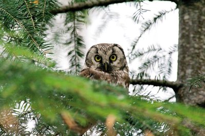
La chouette de tengmalm - Gaël.Karczewski FaunaBoreal owl
Abandoned woodpecker chambers are a boon for small mammals and other birds, such as the boreal owl, which has come from Nordic countries to settle here at altitudes of 800 m. Very discreet, it confines itself to the depths of our forested mountain ranges. It can be identified in March by its sonorous and gentle call. To maintain the species, the Cévennes National Park and the French forestry office protect trees with nesting chambers and old-growth forests from being logged.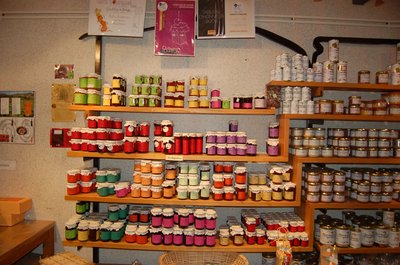
Boutique des producteurs - © Nathalie Thomas The association "Terres d'Aigoual"
The Cévennes National Park rents out part of the building to the association, enabling local farmers to sell their products directly to the public. The association brings together farmers who wish to promote what they produce and share their know-how. They also enjoy sharing their vision of farming- high quality produce and products,
- human-sized farms,
- mutual aid.
Come and discover their products!

Maison forestière de la Serreyrède - © Jacques de Joly La Serreyrède
Before 1861, the house at the Col de la Serreyrède was inhabited by two families of farmers. They owned some livestock and had a vegetable garden, whose terraces you can still see above the La Caumette track. From 1861 on, the farm was inhabited by a forest ranger. It was only bought by the state body Eaux et Forêts in 1883, to be turned into a forester's house. It became one of Georges Fabre's headquarters during the reforestation of the Aigoual massif. The Cévennes National Park, tourism office and Terres d'Aigoual growers have now joined forces to revive La Serreyrède with the help of the Communauté de Communes Causses Aigoual Cévennes – Terres solidaires.
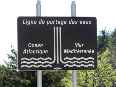
Ligne de partage des eaux - nathalie.thomas 
The watershed
The current relief creates a frontier between the Atlantic and the Mediterranean: depending on the slope, water runs towards either the Ocean or the Sea. This is due to the uplift of the Cevenol sill, brought about by geological activity along the Cévennes fault, which borders draw the northern limit of the Languedoc region. This natural sill marks the geographical border between the northwest slope – verdant, not too steep – and the southeast slope, which falls away abruptly in the Languedoc and continues to be subject to powerful erosion.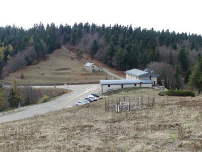
La Serreyrède - nathalie.thomas 
Climate frontier
The pass is also a climate frontier. The Atlantic side is predominantly exposed to the west wind and receives rainfall that is fairly regularly spread over the year. The Mediterranean side, however, is drier and hotter and constitutes a massive barrier to the occasional southeast wind (the marin), thus forcing its humid air to rise suddenly. This makes the clouds’ water content condense, which can give rise to so-called Cevenol episodes: heavy rainfall (600 mm in 24 hrs) causing catastrophic floods. The Aigoual, Mount Aigualis the rainy (A. Bernard), is well-named! After Savoie, it is the rainiest place in France.Georges Fabre
A graduate of the Ecole polytechnique, and top of his year at the Nancy forestry school, the forester Georges Fabre devoted 30 years of his energy to reforesting the mountains of the Lozère and Gard. His goal was to stabilise mountain soils, but also to provide work for a local population that would otherwise have been condemned, in its entirety, to leave the countryside. In 1894, he initiated the construction of the Mont Aigoual weather observatory. In association with the Club Cévenol and Club Alpin Français, he also laid the foundations of the local “heritage tourism” (creating the Grand Hotel de l'Aigoual, building a shelter and viewpoint indicator at the summit, etc.) that continues to this day.
Description
From L'Epérou, go to Dourbies on the D151.
- After the village of Dourbies, continue on the D151 towards Trèves/Nant, until you reach the Col de Rhode pass.
- Turn right onto the D170, towards Camprieu.
- At Tabarde, go right on the D986, return to the Col de La Serreyrède pass, then L'Espérou.
- Departure : L'Espérou
- Arrival : Prat Peyrot
- Towns crossed : Dourbies, Trèves, Lanuéjols, Saint-Sauveur-Camprieu, and Val-d'Aigoual
Forecast
Altimetric profile
Recommandations
Before committing yourself to a circuit, ensure that it is suitable for your activity level and ability. Respect traffic laws and other road users; stay in control of your speed and trajectory. Make sure to be seen and travel in single file when in a group. Remember that the weather changes quickly in the mountains. Take enough water. Safe trip !
Information desks

Tourism & national parc'house
Col de la Serreyrède, 30570 Val d'Aigoual
The Maison de l'Aigoual houses the tourism office Mont Aigoual Causses Cévennes and the Maison du Parc national. This visitor centre provides information on and raises awareness of the Cévennes National Park, its sites and events as well as the rules that must be observed in the National Park's central zone.
On site: changing exhibitions, video projections, Festival Nature events and shop Open year-round
Access and parking
From Valleraugue, take the D986 to L’Espérou and to the Col de La Serreyrède pass. At the pass, head to Prat Peyrot on the D269.
Parking :
Source

Report a problem or an error
If you have found an error on this page or if you have noticed any problems during your hike, please report them to us here:
