
Between Gard and Lozère
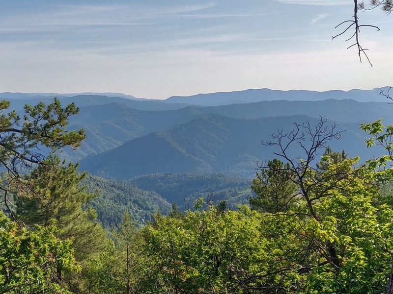
How satisfying, on arriving at Le Pompidou, to have a view over the entire Vallée Française and even further !
On this legendary road, Le Pompidou and St-Roman de Tousque have been rest stops for travellers since the days of long journeys in horse-drawn carriages.
23 points of interest

le château de Nogaret - Sabine Keller 
The Château de Nogaret
Built in the 11th century, the Château de Nogaret stood on the only road linking Saint-André de Valborgne with Le Pompidou. It is believed to have been constructed to serve as a stronghold and to defend the Vallée Borgne. It was set alight in 1628 during the war between the Duke of Rohan and Louis XIII, and again in 1704 by the Camisards, before being rebuilt in the 18th century. This private property still belongs to the Manoel de Nogaret family.
“This small château is one of the finest examples of the fortified manor houses built towards the end of the Middle Ages by minor local lords wanting to free themselves, at least symbolically, from domination by their feudal overlords.” (Isabelle Darnas - Les châteaux médiévaux en Cévennes).
© Béatrice Galzin 
Traces of giants?
“Giant’s cauldrons” have formed in the rock at the base of the waterfall. These regular, rounded cavities are only created in rapidly flowing waters. They are caused by the repeated friction of stones caught in a depression and moved by swirling currents.
© Béatrice Galzin 
The tanners’ district
La Calquière district gets its name from that of the ditches in which the tanners soaked their animal skins with limestone, which is called cauç or calç in Occitan. All along the Gardon there were tanneries because its acidic water was good for rinsing the skins, which was indispensable for obtaining high quality products.
© Béatrice Galzin The age of silk
From the 19th century onwards, the silk industry developed in the Cévennes: tanneries gave way to spinning mills. The mills used water not only to treat the silkworm cocoons (which were boiled to prepare the silk) but also for the steam-driven spinning machines. In the second half of the 19th century, diseases strongly reduced silk production, which was also subject to competition from foreign silks and then from artificial silk. The silk industry went under in 1965.
© Béatrice Galzin 
One spring, five fountains
This fountain is one of Saint-André’s five public fountains, all of which are supplied by the same spring (its water is thus the same as in the Fontaine du Griffon). Before houses were connected to mains water, there were many more fountains on this side of the quay.
Le village de St André de Valborgne - Béatrice Galzin The village of St André de Valborgne
As you stroll along the quay above the river, you can still see the handsome bourgeois houses dating from the silk boom. If you look around, former spinning mills and industrial buildings dedicated to silk farming can still be seen in the landscape. A little lower down, opposite the 16th century château, you can listen to
Bernadette Lafont on the Camisard saga in and after 1702. As you reach the square again, quench your thirst at the fountain and have a look inside the Romanesque church (12th century).
© Béatrice Galzin The gardonnades
The village benefits from the water that the Gardon brings – but it also has to put up with the river’s sporadic bad moods. Abundant rain can rapidly raise river levels. It is often in autumn that the torrent overflows its banks. The worst floods can have dramatic consequences in both material and human terms. Many can still remember the floods of September 1958 and 2002, which caused much damage.
Fontaine du Griffon - © Béatrice Galzin Water!
The Griffon fountain is known for its pure water, which will quench any walker’s thirst. In the old days, the whole neighbourhood used it not only for drinking but also for cooking, washing, washing clothes, watering plants, etc. The fountain was not only a supply point but also an important meeting-point in village life.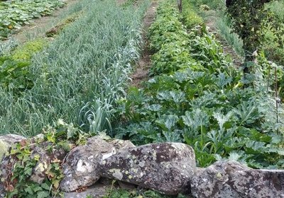
© Béatrice Galzin Well-supplied
Cévenol gardens are supplied by béals (little canals), which bring water from rivers or springs to cultivated land. The latter is usually laid out in bancels (terraces). By retaining the soil, the low walls make it possible to have level plots and deeper soils. Water can seep into the ground slowly and remain there for longer.
Calade - © Béatrice Galzin Two in one
This cobbled path going uphill is a calade. It is not only a path but also a brook, allowing rainwater to be evacuated. Caution: slippery when wet!
Bergeronnette des ruisseaux - © Régis Descamps  Fauna
FaunaFish and other animals...
On the river banks, a pretty white, grey and black bird paces up and down looking for insects, bopping its long tail up and down: the white wagtail. The more colourful grey wagtail is often seen alongside it. The white-throated dipper resembles a blackbird with a big white stain on its breast. It often disappears underwater to hunt insect larvae. Trout, which like the same prey, also live in the Gardon, where they keep anglers happy.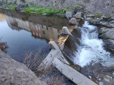
© Béatrice Galzin Electrified…
The village’s inhabitants had access to electricity as early as 1919. The inconspicuous little hut on the opposite bank sheltered a little turbine supplied with water by a béal (irrigation channel). It was built by a villager, Mr Teston, and produced enough electricity for one lightbulb per household.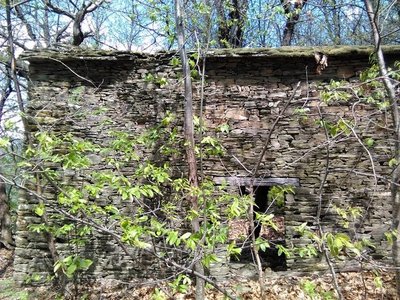
Les ruines d'Aygue Bernesse - Nathalie Thomas Cévenol housing
Houses normally occupied the centre of the cultivated area. Built from schist, they were tall and narrow to save the level ground for crops. When houses needed expanding, people either added another storey to existing buildings or built a new wing parallel to the contour lines. Hamlets were always constructed near water sources and often at mid-slope because the valley floors are susceptible to brutal flooding as well as difficult to access. Good exposure to sunlight was not a decisive factor in choosing sites.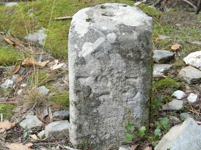
Borne kilométrique sur la route Royale - Nathalie Thomas Heritage: the King’s road
The uphill section from Capou is on the former King’s road, which climbs up the Valat des Pierres valley all the way to St-Roman de Tousque. The road originally linked St-Roman to St-Hippolyte du Fort via Lasalle, the Col du Mercou pass, St-Martin de Corconac and Saumane. This former road is a delight for a slow walk among ferns, pines and sweet chestnut trees. The sound of water is everywhere, in the form of springs or little waterfalls, and the original supporting walls, aqueducts and milestones are magnificent.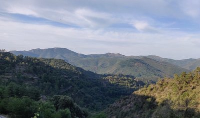
Vue de St Roman vers la Vallée Francaise - Béatrice Galzin The village of St-Roman de Tousque
"Tousque" is believed to mean "a tuft of trees, thicket, bush". This charming village overlooks the Vallée Borgne to the south and Mont Lozère to the north. It lies on what was once a strategic crossroads of two King’s roads: from Montpellier to Mende, and the connection between the Vallée Française and the Vallée Borgne. Like Le Pompidou, St-Roman was a stopover village for horses and travellers.
As you contemplate the magnificent surrounding scenery or stroll through the lanes, you can imagine the much busier life in the old days… Today St-Roman is a peaceful village where life is good.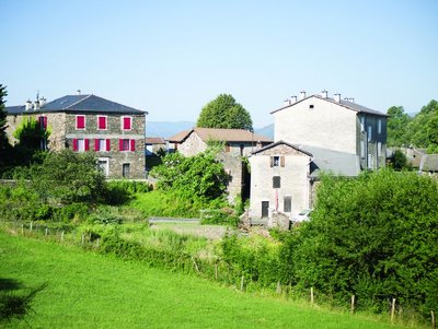
Saint-Roman de Tousque - OT des Cévennes au Mont Lozère Saint-Roman de Tousque
The village of St-Roman de Tousque, which is part of the municipality of Moissac Vallée Française, owes its development to its location on the Corniche des Cévennes road, which facilitated the expansion of trade. In the 17th and 18th century, the village had a large number of artisans and shopkeepers. During the Camisard War, a company of the King’s troops was stationed here. The Camisard Lafleur came to sing psalms in front of the Catholic church, accompanied by six men. Believing themselves to be under attack, the soldiers barricaded themselves in, leaving the Camisards free to torch the church. The 19th century saw several Protestant commemorations.
It was in St-Roman de Tousque that the hymn of the Cevenol protestants, La Cévenole, was sung for the first time, during the bicentenary of the Revocation of the Edict of Nantes, in 1885.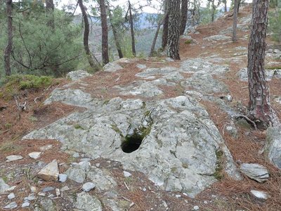
Les potences - nathalie.thomas Serre des Potences (Gallows’ Ridge)
Almost at the summit of the ridge, where the schist bedrock is relatively flat, are three holes 35 cm in diameter and 45 cm deep. They form an isosceles triangles with sides 2.4 m long. The holes were for chestnut poles linked by horizontal beams, from which the condemned would be hung.
The gallows belonged to the Lord of Moissac, who meted out justice in these parts. In the Middle Ages, each château had its gallows. They were located close to the château (here, about 2 km away) and visible to the valley’s peasants and to travellers on the ridge track. You have to imagine the ridges without trees, as they would have been in those days.
La châtaigneraie pâturée - OT des Cévennes au Mont Lozère FaunaThe sweet chestnut orchard
This chestnut orchard consists of ungrafted shoots (bouscas). A herd of goats from the hamlet of Fobies grazes here regularly, keeping the undergrowth down. This well-maintained orchard has more species diversity than a chestnut orchard that is not grazed. In the latter, you will find thorny and low woody plants – brambles, ferns, broom, heather – while a grazed chestnut orchard has a wide range of small plants: grasses, herbaceous plants, legumes, orchids, etc. This diversity shelters and feeds many insects, birds, snakes and mammals.
Le col - Béatrice Galzin Lique Ser
Lique Ser path goes up to the famous Corniche des Cévennes, a ridge between the two departments of Gard and Lozère. This road, which is busy these days in summer because of its superb views, has not always been a holiday address.
In the days of Louis XIII and XIV, this was the route of the dragonnades and the repression of Protestantism by the King’s army after the Revocation of the Edict (the billeting of deliberately ill-disciplined soldiers in Protestant households) of Nantes. This ridge gave the soldiers, known as the King’s dragoons, strategic viewpoints. The road was abandoned from the 19th century onwards. In 1930, after lengthy renovations, it was opened to traffic again, becoming a major tourist route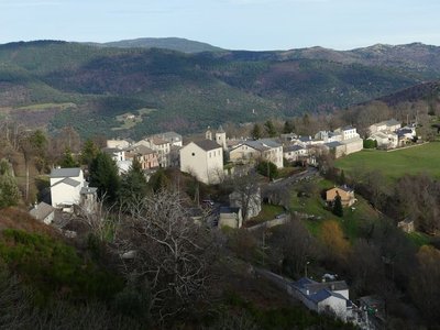
Le Pompidou - nathalie.thomas Le Pompidou
Le Pompidou, like Saint-Roman de Tousque, owes its development to its location on the Corniche des Cévennes road. From the 17th century onwards, this former mule track carried substantial trade, with mule cart drivers bringing up salt, wine and dried fish from southern France to the Gévaudan, taking grains and cloth down from the uplands, and exporting the silk and chestnuts of the Cévennes. You can still see two buildings, the former inn (Le Cheval Blanc) and the Chapeau Rouge staging post, where travellers changed carriage horses.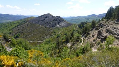
Col de Tartabissac - nathalie.thomas Small buildings
The small buildings you see dotted here and there are jasses (from jas: place where livestock sleeps), sheepfolds of times gone by. There used to be at least 20 between Tartabissac and Bézuc. From the first warm days to 6 December, livestock would spend the night here, and their owners would come up during the day to watch them. An old saying goes, “No livestock in the chestnut groves before the sixth of December”. 6 December was the date of the fair in Florac when the local chestnuts were sold. Today Bézuc hosts 200 sheep for 8 months of the year.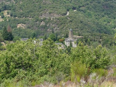
Le château du Folhaquier - Nathalie Thomas The mediaeval castles
Very close to the village of St-André de Valborgne, on the edge of a cliff, stand the remains of the castrum of La Fare, a defensive castle believed to date from the 12th century. Only a wall face of the tower survives. The ruins above bear witness to the site’s importance. The archives mention a well, cistern and drawbridge – but on site nothing remains. On the next spur is the majestic and dominating castle of Le Folhaquier. Transformations throughout the centuries by various owners have shaped the hamlet as we see it today. The era of silk farming strongly influenced the landscape by welcoming the “tree of gold”, the mulberry tree.
Les ruines du château de la Fare - capri’ces des Cévennes Château de la Fare
Following on from many battles against the Château du Folhaquier, today all that is left of the large mediaeval castle of the Lord de la Fare is this expanse of wall. Built at the summit of a schist hill, the castle is surrounded by sheer drops on all sides. The former village was fortified and located just below the expanse of wall. Sources indicate that the castle had a drawbridge and a chapel.
Description
From St-André de Valborgne, towards Le Pompidou on the D10 and D61.
-
Descend to the valley floor towards Saumane, turn left and climb to St-Roman de Tousque via the D39.
-
In St-Roman de Tousque, take the D9 ( Corniche des Cévennes road) to Le Pompidou.
-
At Le Pompidou, descend via the D10 to St-André de Valborgne.
- Departure : St-André de Valborgne
- Arrival : St-André de Valborgne
- Towns crossed : Saint-André-de-Valborgne, Saumane, Moissac-Vallée-Française, Sainte-Croix-Vallée-Française, Gabriac, and Le Pompidou
Forecast
Altimetric profile
Recommandations
Before committing yourself to a circuit, ensure that it is suitable for your activity level and ability. Respect traffic laws and other road users; stay in control of your speed and trajectory. Make sure to be seen and travel in single file when in a group. Remember that the weather changes quickly in the mountains. Take enough water. Safe trip !
Information desks

Tourism & national parc'house
Col de la Serreyrède, 30570 Val d'Aigoual
The Maison de l'Aigoual houses the tourism office Mont Aigoual Causses Cévennes and the Maison du Parc national. This visitor centre provides information on and raises awareness of the Cévennes National Park, its sites and events as well as the rules that must be observed in the National Park's central zone.
On site: changing exhibitions, video projections, Festival Nature events and shop Open year-round

Tourism office Mont Aigoual Causses Cévennes, Saint-André-de-Valborgne
les quais, 30940 Saint-André-de-Valborgne
This office is part of the National Park's associated tourist-information network, whose mission is to provide information on, and raise awareness of, the sites and events as well as the rules that must be observed in the National Park's central zone.
Access and parking
From St-Jean du Gard, take the D907 to St-André de Valborgne, via L’Estréchure and Saumane.
From Florac, take the D907 towards St-Jean du Gard, through the villages of Vébron, Les Vanels and Rousses, to reach St-André de Valborgne.
Parking :
Source

Report a problem or an error
If you have found an error on this page or if you have noticed any problems during your hike, please report them to us here: