
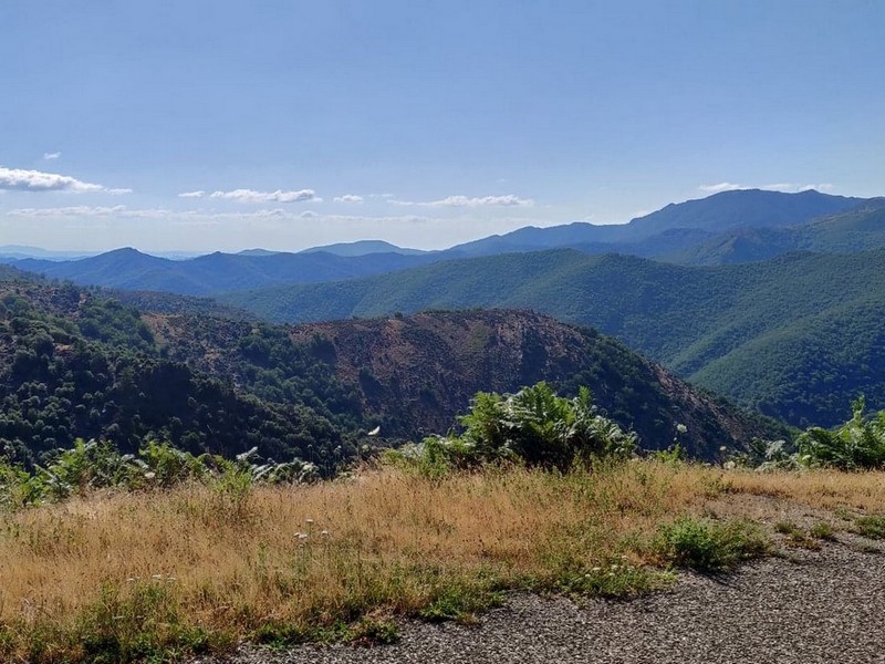
The sources of the Borgne
The mountain relief appears in shades of blue. Often Mont Ventoux can be seen in the distance, sometimes even the Alps.
8 points of interest
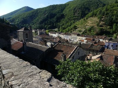
Valleraugue - nathalie.thomas 
Valleraugue
Valleraugue is believed to derive from "vallis eraugia", the Hérault valley. With its 7,834 hectares, the town extends from the Hérault valley to the summit of Mont Aigoual. Valleraugue is located on an important transportation route between the garrigues and the uplands, and once had up to 4,192 inhabitants (1851). Just over a century ago, in 1907, Abbot Fesquet wrote in his monograph on the village: "The population has been reduced to 2,500 souls. There was a time when it was difficult to find lodgings, says a 1773 town council deliberation. Nowadays, accommodation is plentiful...". In the 2007 census, the population was 1,081.
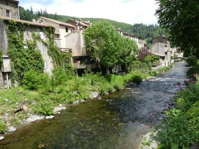
Valleraugue - nathalie.thomas 1703
In Valleraugue, exporting chestnuts in times of famine or trouble was forbidden by law. In 1703, however, during the Camisard War, an official decree ordered the inhabitants to transport their chestnuts and cereals to other villages. This was to deprive the insurgents, who were supported by the locals, of provisions. The goods were guarded, and the inhabitants only kept two weeks’ worth in reserve.
Montée au dessus de Valleraugue - © Michel Monnot  Flora
FloraMediterranean level
To begin with, the path is in the holm-oak altitudinal zone. Holm oaks tend to grow on the Mediterranean side of the watershed, where they are plentiful up to an altitude of about 500 m. Here, they have been eradicated to create crop terraces. On the either side of the path, which runs between high walls and has steps that give access to gardens, you can still see these terraces, now invaded by or planted with conifers. Like the holm oak, the tree heath and strawberry trees that are also present are typically Mediterranean species. Plants in this zone are xerophile, meaning that they thrive in dry environments. They are well-adapted because their small and glazed leaves limit water evaporation.
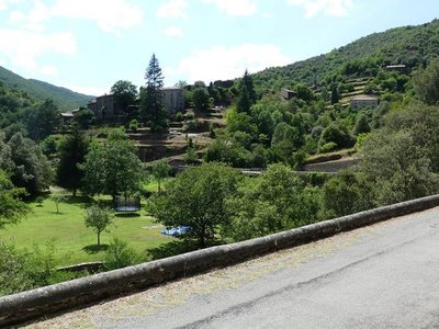
Le hameau de Monteils - Nathalie Thomas The keep of Monteils castle
The castle to which this tower belonged was once part of the La Fare barony. It occupied a platform of about 400 m2; the ditch which used to protect its northwestern side has been filled in. The first three stories of this remarkable rectangular keep, which covers an area of 70 m2 on the ground, remain. They are built out of handsome schist dimension stones and have resisted due to the sturdiness of the thick walls, which are solid stone throughout. An enclosed courtyard once surrounded the keep. The stones from the castle and its surrounding wall were reused to build the hamlet’s houses.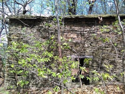
Les ruines d'Aygue Bernesse - Nathalie Thomas 
Cévenol housing
Houses normally occupied the centre of the cultivated area. Built from schist, they were tall and narrow to save the level ground for crops. When houses needed expanding, people either added another storey to existing buildings or built a new wing parallel to the contour lines. Hamlets were always constructed near water sources and often at mid-slope because the valley floors are susceptible to brutal flooding as well as difficult to access. Good exposure to sunlight was not a decisive factor in choosing sites.
Bergeronnette des ruisseaux - © Régis Descamps  Fauna
FaunaFish and other animals...
On the river banks, a pretty white, grey and black bird paces up and down looking for insects, bopping its long tail up and down: the white wagtail. The more colourful grey wagtail is often seen alongside it. The white-throated dipper resembles a blackbird with a big white stain on its breast. It often disappears underwater to hunt insect larvae. Trout, which like the same prey, also live in the Gardon, where they keep anglers happy.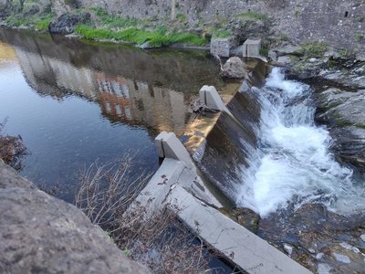
© Béatrice Galzin Electrified…
The village’s inhabitants had access to electricity as early as 1919. The inconspicuous little hut on the opposite bank sheltered a little turbine supplied with water by a béal (irrigation channel). It was built by a villager, Mr Teston, and produced enough electricity for one lightbulb per household.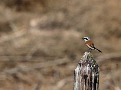
Pie-grièche écorcheur - Descamps Régis FaunaLook up!
In the forest, Dartford warblers (black, burgundy belly) accompany your efforts by chirping from the top of broom bushes. You might also come across their cousin, the much more colourful Eastern subalpine warbler (orange belly), or else a Northern wheatear.
The ridges are home to two rare bird species, protected in both France and the European Union: the red-backed shrike and the Eurasian eagle-owl. Other interesting protected species, such as the Eleonora’s falcon and the common rock thrush, may also be observed here.
Description
From Valleraugue, head towards Les Plantiers on the D10 to the Col du Pas pass.
- At Col du Pas, take the D193 towards Les Plantiers via Faveyrolles, Monteils. Continue on the D20 to the bridge at Bourgnolle.
- At the bridge, climb to St-André de Valborgne on the D907.
- Before you reach St-André de Valborgne, take the D10 towards Valleraugue via Les Abrits and the Col de l’Espinas pass.
- Continue on the D10 to Valleraugue.
- Departure : Valleraugue
- Arrival : Valleraugue
- Towns crossed : Val-d'Aigoual, Les Plantiers, Saumane, and Saint-André-de-Valborgne
Forecast
Altimetric profile
Recommandations
Before committing yourself to a circuit, ensure that it is suitable for your activity level and ability. Respect traffic laws and other road users; stay in control of your speed and trajectory. Make sure to be seen and travel in single file when in a group. Remember that the weather changes quickly in the mountains. Take enough water. Safe trip !
Information desks

Tourism & national parc'house
Col de la Serreyrède, 30570 Val d'Aigoual
The Maison de l'Aigoual houses the tourism office Mont Aigoual Causses Cévennes and the Maison du Parc national. This visitor centre provides information on and raises awareness of the Cévennes National Park, its sites and events as well as the rules that must be observed in the National Park's central zone.
On site: changing exhibitions, video projections, Festival Nature events and shop Open year-round
Tourism office Mont Aigoual Causses Cévennes, Saint-André-de-Valborgne
les quais, 30940 Saint-André-de-Valborgne
This office is part of the National Park's associated tourist-information network, whose mission is to provide information on, and raise awareness of, the sites and events as well as the rules that must be observed in the National Park's central zone.
Tourism office Mont Aigoual Causses Cévennes, Valleraugue
7 quartier des Horts, 30570 Valleraugue
This office is part of the National Park's associated tourist-information network, whose mission is to provide information on, and raise awareness of, the sites and events as well as the rules that must be observed in the National Park's central zone. : Open year-round
Access and parking
From Le Vigan, drive towards Montpellier on the D999; at Le Pont d’Hérault, head to Valleraugue on the D986.
Parking :
Report a problem or an error
If you have found an error on this page or if you have noticed any problems during your hike, please report them to us here: