
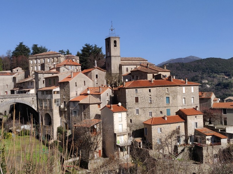
Valleraugue - Road bike circuit #7
The first kilometres to Le Mazel are a pleasant warm-up, followed by a beautiful road to Saint-André-de-Majencoules and Mandagout. Then things spice up, with the passes of Col des Vieilles pass and the famous Col de La Luzette (altitude 1,351 m), where even five-times Tour de France winner Bernard Hinault had to dismount !
Another small effort to L'Espérou before the downhill section to Valleraugue.
21 points of interest

Montée au dessus de Valleraugue - © Michel Monnot  Flora
FloraMediterranean level
To begin with, the path is in the holm-oak altitudinal zone. Holm oaks tend to grow on the Mediterranean side of the watershed, where they are plentiful up to an altitude of about 500 m. Here, they have been eradicated to create crop terraces. On the either side of the path, which runs between high walls and has steps that give access to gardens, you can still see these terraces, now invaded by or planted with conifers. Like the holm oak, the tree heath and strawberry trees that are also present are typically Mediterranean species. Plants in this zone are xerophile, meaning that they thrive in dry environments. They are well-adapted because their small and glazed leaves limit water evaporation.
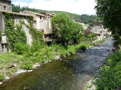
Valleraugue - nathalie.thomas 
1703
In Valleraugue, exporting chestnuts in times of famine or trouble was forbidden by law. In 1703, however, during the Camisard War, an official decree ordered the inhabitants to transport their chestnuts and cereals to other villages. This was to deprive the insurgents, who were supported by the locals, of provisions. The goods were guarded, and the inhabitants only kept two weeks’ worth in reserve.
Figayrole - Nathalie Thomas Figayrole
In 1692 a clandestine gathering of Protestants – who were meeting to practice their religion, banned in 1685 by Louis XIV – was surprised here. Dozens or even hundreds of people might attend such gatherings. When they were caught in the act, the community was severely punished. Families that were directly involved ran the risk of being sent to the galleys, having their property confiscated and having their children taken away from them.
Naissance de la fougère aigle - PNC FloraBracken
Since the abandonment of the chestnut orchard, the bracken, which was once cut and used as litter and fodder for animals, has spread. Some locals still remember that bracken fronds were given to pigs to eat with water and flour.

La belle filature du Mazel - Michel Monnot The spinning-mill
From the car park, you can see the imposing buildings of the former spinning-mill by the river. Flowing water was indispensable for spinning-mills to work: its energy was used to turn the spools (guindres), around which the silk thread was wound, and for the throwing, which consisted of twisting and spinning the silk.
We do not know who built the first building but a forge was set up in 1806, and in 1943 the building was home to both a throwing mill and a spinning-mill. The second building was added in 1856, and in 1900 they both had electric lighting installed. In 1936, the whole complex was managed by the Société des Filatures de Soie des Hautes Cévennes [Upper Cévennes silk spinnning-mills company]". In 1984, Bresson-Rande still had a hosiery workshop here. In 1995, all activity on the site ceased.
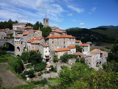
Le village - Michel Monnot St-André de Majencoules
With agricultural decline, the village’s population has dropped sharply: 561 inhabitants in 2000 compared to 1,506 in 1913. In those days, the village had about 40 artisans and shopkeepers, including two blacksmiths, six shoemakers, four tailors, three hairdressers and eight grocers.
You will notice that the village is built on a rocky spur above the river, a strategic position which makes it possible to survey the valley but also to use water for crops. Near the village are terraces planted with mild onions.

La filature - Michel Monnot Water and the spinning-mill
How strange to have a spinning-mill at the top of the village!
Usually, this kind of building is erected alongside a waterway. But here, a powerful spring is tapped using a béal (irrigation channel), which takes the water to the mill. The precious water is stored in gourgues (basins or pools) above the building, making it possible to regulate the quantity of water used to drive the spinning-mill.
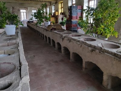
Intérieur de la filature - Beatrice Galzin The spinning-mill
The spinning-mill was built out of shaped blocks of granite in 1825, under the supervision of the architect Victor Chapot of Le Vigan and its owner M. Durand.
On the ground floor were the (GENSOUL type) furnace, the ovens [for asphyxiating the silkworms using hot air], the vast wood stores and the stables and yards for the horses.
On the first floor was the spinners’ workshop with its 54 circular terra cotta bassins (still visible) and rows of swifts (reels) that have since disappeared.
The top floor was home to the nursery, the storage area for the silk cocoons.
The silkworm disease pébrine (1856), the opening of the Suez Canal (1869), artificial silk (1884) and the owner’s death put an end to this beautiful adventure.
Le hameau de Camias - Béatrice Galzin Camias and its agriculture
In the 20th century, the hamlet of Camias still had 80 inhabitants. They grew grapes for wine. Some olive trees can also still be seen on the sunny sheltered slopes and some magnificent chestnut orchards on the shaded slopes (ubac). It is not difficult to imagine sheep and goats keeping these spaces open.
This is where Albertine Sarrazin lived, the author of the two novels Astragal and La Traversière, while her husband raised hell in Montpellier or elsewhere.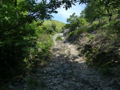
Chemin muletier - N Thomas Camin Ferrat
The name camin ferrat, literally “iron road”, is obscure in origin. For some, it was a transit route for iron bars; for others, a route used by itinerant blacksmiths. The most likely explanation seems to be that it was used by shod beasts of burden. A local woman claims that the path was damaged by oxcarts laden with wood.

Le Faucon Pélerin - Descamps Régis  Fauna
FaunaThe peregrine falcon
Given that it nests nearby, you might be lucky enough to observe a peregrine falcon. This is the most powerful and, above all, the fastest of the falcons in the Cévennes National Park. Grey in colour, the adult has a wingspan of about one metre for females, more than that for males. Its wings are angular, wide and pointed, and a black mask covers its cheeks.

Mouflon brebis - © Chantal Daquo FaunaWhat is a mouflon?
Marker 1
The mouflon is a ruminant mammal related to the domestic sheep. Its staple diet is herbaceous plants, which it finds in open spaces such as heaths. It also feeds on about a hundred other plants (ferns, mosses, mushrooms, etc.).The horns of the male (ram) are spiral-shaped and grow continuously, which makes it possible to estimate its age. The female (ewe) rarely has horns. The mouflon's life expectancy is around 14 years. Being an excellent climber, it can easily escape to steep areas in case of danger. These rocky zones also help limit the growth of its hooves through wear.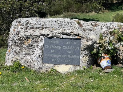
André Chamson (1900-1983)
In his works, André Chamson constructed an imaginary Cévennes park. His writings bear witness to his love for the area and his attachment to his Huguenot ancestors. A nationally renowned writer, he was elected to the Académie française in 1956. His final works see time and death become more powerful than work or human faith.

Passage de la transhumance au col de l'Asclié - © Olivier Prohin The origins of the mouflon
Marker 6
L'Abeuradou is located on a draille, a drovers' road for shepherds and their flocks to move between the plains of Languedoc and summer pastures on the southern Massif Central. The name L'Abeuradou indicates that it is a spot where the flocks drink and rest before continuing their long hike. Today's domestic sheep is descended from the mouflon. Since being introduced to the slopes of Mont Aigoual, the mouflon has thus been rubbing shoulders with its cousin, which grazes here in summer. Their cohabitation does not seem to be a problem for the livestock farmers.
Mouflons - © Régis Descamps Managing the species
Marker 5
The Cévennes National Park is unusual for a national park in that hunting is allowed in its central zone. In the absence of large predators, hunting is considered compatible with maintaining a good natural balance. Local mouflons are subject to a compulsory hunting plan, which estimates the numbers to be culled every year. There is regular monitoring to check population levels. Knowing that a mouflon group grows by about 25% a year, it is possible to calculate the number of animals that can be culled without compromising the future of the herd.
Mouflons - © Gaël Karczewski FaunaThe saga of the mouflon
Marker 2
Twenty-three mouflons were introduced to this mountain range in 1954. They roamed the ridge rimmed by heath that you can see in front and to the right of you. Since introduction, the population has slowly grown on the Cevenol slopes. In 1999, the Gard Departmental Hunters' Federation in tandem with the Office National des Forêts, the Cévennes National Park, farmers and hunters took over the management and monitoring of the species. Since then, the population has grown steadily in the Aigoual area, and has recently started to settle other districts as well.
Formation mouflon, Aigoual, juin 2015 - © Michel Monnot 
The 4 seasons of the mouflon
Marker 3
A vantage point for mouflon spotting, which is equipped with an information panel on how to detect mouflons and how to get your bearings in this vast landscape.
Quelques indices pour les repérer (au printemps et en été) - © Régis Descamps FaunaPic de Barette
Marker 4
The Pic de Barette is a perfect viewpoint for spotting a great variety of animals, especially the golden eagle. Mouflons like to warm up in the sun and graze quietly on the slope opposite you, near the rocks that stick out of the forest. You will need patience and silence to spot mouflons. In spring and summer, their beige colour stands out against the rather green surroundings. In autumn and winter, it is easiest to make out the females' white 'face masks' and the males' saddles (white mark on the back).
Groupes de femelles - © Gaël Karczewski Head counts
There are two methods for counting mouflons. “Relative abundance indices” estimate variations in the population. In May, observers position themselves in fixed spots at day's end and record the number of animals they see in 20 minutes. Head counts “by combined observation from a hide and from stalking” are used at the end of winter. Observers move through thickets where mouflons shelter. The groups of animals they disturb escape towards fixed observers, who count them. The mouflon population is currently estimated at around 200. Local actors and inhabitants are very involved in the monitoring and counting operations.


The watershed
The watershed goes through the village of L’Espérou. This natural limit is also the border between the two municipalities of Val d’Aigoual and Dourbies. The rain that falls on and runs off the Valleraugue side continues to the Mediterranean. The water that flows towards Dourbies does not follow the same route and ends up in the Atlantic…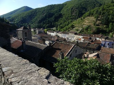
Valleraugue - nathalie.thomas Valleraugue
Valleraugue is believed to derive from "vallis eraugia", the Hérault valley. With its 7,834 hectares, the town extends from the Hérault valley to the summit of Mont Aigoual. Valleraugue is located on an important transportation route between the garrigues and the uplands, and once had up to 4,192 inhabitants (1851). Just over a century ago, in 1907, Abbot Fesquet wrote in his monograph on the village: "The population has been reduced to 2,500 souls. There was a time when it was difficult to find lodgings, says a 1773 town council deliberation. Nowadays, accommodation is plentiful...". In the 2007 census, the population was 1,081.
Description
From Valleraugue, bike towards Le Vigan on the D986.
- At Le Mazel, take the D170 to Saint-André-de-Majencoules.
- After St-André-de-Majencoules, at Les Quatre Chemins, take the D354.
- Then take the D329 to Mandagout.
- At Mandagout, continue on the D329 to L’Espérou via Cap-de-Côte and the Col de La Luzette.
- Continue to L’Espérou on the D548 and go downhill to Valleraugue on the D986.
- Departure : Valleraugue
- Arrival : Valleraugue
- Towns crossed : Val-d'Aigoual, Notre-Dame-de-la-Rouvière, Saint-André-de-Majencoules, Mandagout, Arphy, and Dourbies
Forecast
Altimetric profile
Recommandations
Before committing yourself to a circuit, ensure that it is suitable for your activity level and ability. Respect traffic laws and other road users; stay in control of your speed and trajectory. Make sure to be seen and travel in single file when in a group. Remember that the weather changes quickly in the mountains. Take enough water. Safe trip !
Information desks

Tourism & national parc'house
Col de la Serreyrède, 30570 Val d'Aigoual
The Maison de l'Aigoual houses the tourism office Mont Aigoual Causses Cévennes and the Maison du Parc national. This visitor centre provides information on and raises awareness of the Cévennes National Park, its sites and events as well as the rules that must be observed in the National Park's central zone.
On site: changing exhibitions, video projections, Festival Nature events and shop Open year-round

Tourism office Mont Aigoual Causses Cévennes, Valleraugue
7 quartier des Horts, 30570 Valleraugue
This office is part of the National Park's associated tourist-information network, whose mission is to provide information on, and raise awareness of, the sites and events as well as the rules that must be observed in the National Park's central zone. : Open year-round
Access and parking
From Camprieu or Le Pont d’Hérault, take the D986 to Valleraugue.
Parking :
Source

Report a problem or an error
If you have found an error on this page or if you have noticed any problems during your hike, please report them to us here: