
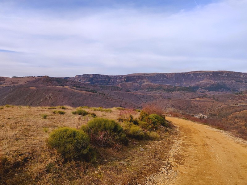
From valley to valley – between Gardon and Tarnon (day 2)
23 points of interest

Le village de St André de Valborgne - Béatrice Galzin 
The village of St André de Valborgne
As you stroll along the quay above the river, you can still see the handsome bourgeois houses dating from the silk boom. If you look around, former spinning mills and industrial buildings dedicated to silk farming can still be seen in the landscape. A little lower down, opposite the 16th century château, you can listen to
Bernadette Lafont on the Camisard saga in and after 1702. As you reach the square again, quench your thirst at the fountain and have a look inside the Romanesque church (12th century).
© Béatrice Galzin 
One spring, five fountains
This fountain is one of Saint-André’s five public fountains, all of which are supplied by the same spring (its water is thus the same as in the Fontaine du Griffon). Before houses were connected to mains water, there were many more fountains on this side of the quay.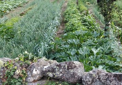
© Béatrice Galzin Well-supplied
Cévenol gardens are supplied by béals (little canals), which bring water from rivers or springs to cultivated land. The latter is usually laid out in bancels (terraces). By retaining the soil, the low walls make it possible to have level plots and deeper soils. Water can seep into the ground slowly and remain there for longer.
© Béatrice Galzin The gardonnades
The village benefits from the water that the Gardon brings – but it also has to put up with the river’s sporadic bad moods. Abundant rain can rapidly raise river levels. It is often in autumn that the torrent overflows its banks. The worst floods can have dramatic consequences in both material and human terms. Many can still remember the floods of September 1958 and 2002, which caused much damage.
Calade - © Béatrice Galzin Two in one
This cobbled path going uphill is a calade. It is not only a path but also a brook, allowing rainwater to be evacuated. Caution: slippery when wet!
Fontaine du Griffon - © Béatrice Galzin Water!
The Griffon fountain is known for its pure water, which will quench any walker’s thirst. In the old days, the whole neighbourhood used it not only for drinking but also for cooking, washing, washing clothes, watering plants, etc. The fountain was not only a supply point but also an important meeting-point in village life.
Bergeronnette des ruisseaux - © Régis Descamps  Fauna
FaunaFish and other animals...
On the river banks, a pretty white, grey and black bird paces up and down looking for insects, bopping its long tail up and down: the white wagtail. The more colourful grey wagtail is often seen alongside it. The white-throated dipper resembles a blackbird with a big white stain on its breast. It often disappears underwater to hunt insect larvae. Trout, which like the same prey, also live in the Gardon, where they keep anglers happy.
© Béatrice Galzin 
The age of silk
From the 19th century onwards, the silk industry developed in the Cévennes: tanneries gave way to spinning mills. The mills used water not only to treat the silkworm cocoons (which were boiled to prepare the silk) but also for the steam-driven spinning machines. In the second half of the 19th century, diseases strongly reduced silk production, which was also subject to competition from foreign silks and then from artificial silk. The silk industry went under in 1965.
© Béatrice Galzin The tanners’ district
La Calquière district gets its name from that of the ditches in which the tanners soaked their animal skins with limestone, which is called cauç or calç in Occitan. All along the Gardon there were tanneries because its acidic water was good for rinsing the skins, which was indispensable for obtaining high quality products.
© Béatrice Galzin 
Traces of giants?
“Giant’s cauldrons” have formed in the rock at the base of the waterfall. These regular, rounded cavities are only created in rapidly flowing waters. They are caused by the repeated friction of stones caught in a depression and moved by swirling currents.
le château de Nogaret - Sabine Keller The Château de Nogaret
Built in the 11th century, the Château de Nogaret stood on the only road linking Saint-André de Valborgne with Le Pompidou. It is believed to have been constructed to serve as a stronghold and to defend the Vallée Borgne. It was set alight in 1628 during the war between the Duke of Rohan and Louis XIII, and again in 1704 by the Camisards, before being rebuilt in the 18th century. This private property still belongs to the Manoel de Nogaret family.
“This small château is one of the finest examples of the fortified manor houses built towards the end of the Middle Ages by minor local lords wanting to free themselves, at least symbolically, from domination by their feudal overlords.” (Isabelle Darnas - Les châteaux médiévaux en Cévennes).
Tronc de châtaignier - Béatrice Galzin 
The sweet chestnut : a food tree
You are in a grafted chestnut orchard, which means that the trees were maintained and their nuts harvested by locals to be eaten in the family. The enormous trees around you are about 300 years old.
The chestnuts were dried in a clède, a small building on two levels that was located either close to the dwellings or right inside the forest. The clède would have been in use for an entire month in autumn to ensure that the whole, wood-dried chestnuts could be preserved for a year.
The chestnut tree was so vital in local subsistence farming that it was also called l'arbre à pain (the bread tree); it was also used to make beams, barrels, baskets, trunk-beehives and more, feed livestock and provide their bedding.
Le col - Béatrice Galzin Lique Ser
Lique Ser path goes up to the famous Corniche des Cévennes, a ridge between the two departments of Gard and Lozère. This road, which is busy these days in summer because of its superb views, has not always been a holiday address.
In the days of Louis XIII and XIV, this was the route of the dragonnades and the repression of Protestantism by the King’s army after the Revocation of the Edict (the billeting of deliberately ill-disciplined soldiers in Protestant households) of Nantes. This ridge gave the soldiers, known as the King’s dragoons, strategic viewpoints. The road was abandoned from the 19th century onwards. In 1930, after lengthy renovations, it was opened to traffic again, becoming a major tourist route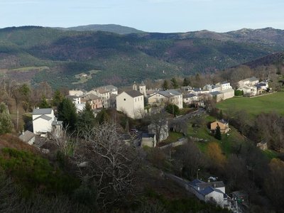
Le Pompidou - nathalie.thomas Le Pompidou
Le Pompidou, like Saint-Roman de Tousque, owes its development to its location on the Corniche des Cévennes road. From the 17th century onwards, this former mule track carried substantial trade, with mule cart drivers bringing up salt, wine and dried fish from southern France to the Gévaudan, taking grains and cloth down from the uplands, and exporting the silk and chestnuts of the Cévennes. You can still see two buildings, the former inn (Le Cheval Blanc) and the Chapeau Rouge staging post, where travellers changed carriage horses.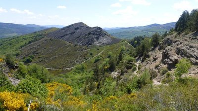
Col de Tartabissac - nathalie.thomas Small buildings
The small buildings you see dotted here and there are jasses (from jas: place where livestock sleeps), sheepfolds of times gone by. There used to be at least 20 between Tartabissac and Bézuc. From the first warm days to 6 December, livestock would spend the night here, and their owners would come up during the day to watch them. An old saying goes, “No livestock in the chestnut groves before the sixth of December”. 6 December was the date of the fair in Florac when the local chestnuts were sold. Today Bézuc hosts 200 sheep for 8 months of the year.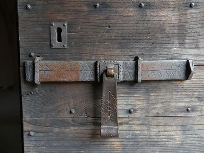
St-Flour du Pompidou - nathalie.thomas Saint-Flour du Pompidou
The architecture of this handsome Romanesque church makes good use of the two local bedrocks (limestone walls, schist tilestones on the roof). Saint-Flour is believed to have been created by the Benedictine monks who sought refuge in the Cévennes from the 11th to 12th centuries. During the Camisard War, the vicar took refuge in Le Pompidou, which had a garrison of which St-Flour was an outpost. During the night of 26 and 27 January 1703, the Camisard leader Castanet and his lieutenant Jean Valmalle, known as The Rose, attacked Le Pompidou. The church and priory at Saint-Flour were set alight. During the French Revolution, the priory was sold to an inhabitant of Le Pompidou as the property of the French state. The church became a grange, and the presbytery was closed. In 1986, Saint-Flour was added to the supplementary list of historical monuments; in summer it is a concert venue.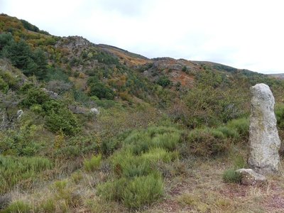
Vue sur La Can depuis le col de Tartabisac - nathalie.thomas Contact
At the Col de Tartabisac pass, there is a clear limit between the two bedrocks: on the left, the limestone plateau; on the right, a schist slope. The two rocks are in contact at a geological fault. A layer of very wet sandstone sits at the level of the meadows, at the foot of the limestone. This is where the water that has infiltrated via the thick layers of the Can plateau re-emerges.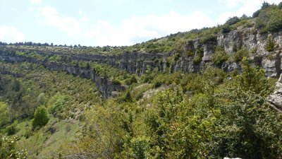
Descente sous Les Crottes - nathalie.thomas Schist, limestone or granite
From the track, you can make out the hamlets on the side of the valley at the foot of the Can: Roumassel, Le Crouzet, Le Crémat, Le Masbonnet. The land stretching from the valley floor to the plateau belongs to these hamlets, including chestnut groves, pasture and parcels for growing grains. After Bézuc, the bedrock is partly schist, where broom and heather grow, partly limestone, which is linked to the presence of the carline thistle. In a meadow beyond the beech forest, you can see blocks of granite, which stem from a vein linking Mont Aigoual to Mont Lozère. The ruiniform rocks on the plateau were shaped by water, which infiltrates fractures in the rock and dissolves the dolomite that they are made of.
Frêne commun - Nathalie Thomas  Flora
FloraAsh trees
Ash trees, like the ones that border the path, like cool and damp environments. They were planted alongside paths by locals because ash branches, cut towards the end of summer, provided additional fodder for livestock.

Relief de la Can de l’Hospitalet - Florac - Sud Lozère The evolution of the landscape
140 million years ago, the sea was shrinking, and the Can de l’Hospitalet and Causse Méjean were not yet separated by the Tarnon valley. The landscape was completely different then. In a hot and humid climate, limestone “turrets” overlooked rivers whose routes were different from today's. Successive uplifts, shifts on either side of geological faults and the slow work of erosion have created the relief you see today. You have panoramic views over the valley of the Baumale, a tributary of the Tarnon, and, opposite you, the Causse Méjean. It is difficult to make out the limit between the limestone zone and the schist zone in this heavily wooded landscape.

Ephippigère des Vignes - Nathalie Thomas FaunaBush crickets
Dry grassland is home to a multitude of insects, including bush crickets. At night, they produce a squealing sound by rubbing the stubs of their wings together. The sound has given them the name of “gouzi”. But despite their musical wings, they cannot fly, and hide in vegetation (such as boxwood or juniper bushes) to escape predators.

Le long du Tarnon - Nathalie Thomas The Tarnon river
The Tarnon is 38.9 km long and has its spring on the Mont Aigoual massif (Mont Aigoual: 1,565 m) in the municipality of Bassurels. It flows into the Tarn upstream of Florac, having already joined with the Mimente river. It separates the Causse Méjean plateau from the Cévennes.
Upstream of Rousses, the Trépalous flows into the Tarnon. It is this small river that has carved out the Tapoul gorge, famous for canyoning.
The Tarnon may experience violent and sudden floods during Cévenol episodes (major rain storms). Its flow rate may vary from 0.1 m3 per second (in the dry period) to 400 m3/s (November 1982).

Chemin vers Le Gua - N Thomas Small walls and terraces
"The path, lined in places by a wall, used to lead from Rousses to Massevaques. Some locals still remember having used it to get back up to Massevaques after a wake in Rousse. At the start of the path, you can see on your left the small walls of two bancels (crop terraces), where rye was grown. Then you enter the beech forest. This slope is exposed to the north and west winds, which suits beech, but it is only in the more protected vales that you will find a few sweet chestnuts interspersed with conifers. This forest is still exploited by the inhabitants of the district, who cut their firewood here.” (P. Grime)
Description
Starting from St-André de Valborgne, walk towards “Le Pompidou” on the GRP® long-distance path Tour de la Haute-Vallée Borgne (yellow and red waymarks).
- At the reservoir at Le Serre, take the path that goes uphill.
- Once on the track, go downhill opposite through the forest of conifers, then turn left onto the path. Pass the houses “Folie” and “Le Pompidou”.
- At Le Pompidou, go uphill through the village on the left (D9 road) to the fountain, turn right and walk to “Tartabissac”.
- Then “Bézuc” and “L’Hospitalet”, always following the red and yellow waymarks.
- At “L’Hospitalet”, cross the D9 and take the dirt path opposite (GR®7-67), waymarked red and white.
- At point 1058 on the map, take the path on your right that takes you back to the village of Rousses.
- Departure : St-André de Valborgne
- Arrival : Rousses
- Towns crossed : Saint-André-de-Valborgne, Le Pompidou, Vebron, Rousses, and Bassurels
Forecast
Altimetric profile
Recommandations
Avoid the section from the Col de Tartabisac pass to Bézuc after heavy rain : rivers and brooks will be flooded.
Make sure your equipment is appropriate for the day’s weather conditions. Remember that the weather changes quickly in the mountains. Take enough water, wear sturdy shoes and put on a hat. Please close any gates and barriers behind you.
Information desks

Information center Le Pompidou
La poste, 48400 Le Pompidou
This centre is part of the National Park's associated tourist-information network, whose mission is to provide information on, and raise awareness of, the sites and events as well as the rules that must be observed in the National Park's central zone. :
Open year-round

Tourism & national parc'house
Col de la Serreyrède, 30570 Val d'Aigoual
The Maison de l'Aigoual houses the tourism office Mont Aigoual Causses Cévennes and the Maison du Parc national. This visitor centre provides information on and raises awareness of the Cévennes National Park, its sites and events as well as the rules that must be observed in the National Park's central zone.
On site: changing exhibitions, video projections, Festival Nature events and shop Open year-round
Tourism'house and national Parc at Florac
Place de l'ancienne gare, N106, 48400 Florac-trois-rivières
This office is part of the National Park's associated tourist-information network, whose mission is to provide information on, and raise awareness of, the sites and events as well as the rules that must be observed in the National Park's central zone.
On site: exhibitions, video projections, events and shop Open year-round

Office de tourisme Des Cévennes au mont Lozère
le Quai, 48220 Le Pont de Montvert sud mont-Lozère
Ouvert toute l'année (se renseigner pour les jours et horaires d'ouverture en période hivernale)

Tourism office Mont Aigoual Causses Cévennes, Saint-André-de-Valborgne
les quais, 30940 Saint-André-de-Valborgne
This office is part of the National Park's associated tourist-information network, whose mission is to provide information on, and raise awareness of, the sites and events as well as the rules that must be observed in the National Park's central zone.
Access and parking
D907 St-André de Valborgne.
Parking :
Source

Report a problem or an error
If you have found an error on this page or if you have noticed any problems during your hike, please report them to us here: