
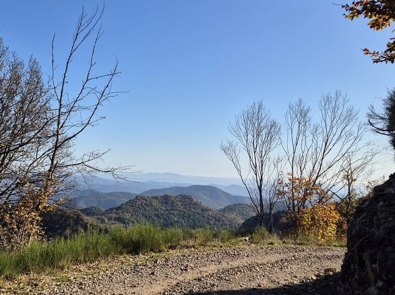
On Fageas ridge – 4 days
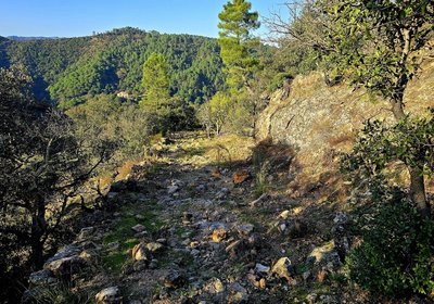
These ridge paths were once vital traffic arteries between the valleys. Some houses in ruins still stand along the tracks. They used to be taverns, cafes or just refuges for travellers passing through or else shepherds migrating up to summer pastures with their sheep. These were meeting-points where news was exchanged and connections between the mountains’ inhabitants forged.
4 steps
31 points of interest
© Béatrice Galzin Well-supplied
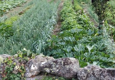
Cévenol gardens are supplied by béals (little canals), which bring water from rivers or springs to cultivated land. The latter is usually laid out in bancels (terraces). By retaining the soil, the low walls make it possible to have level plots and deeper soils. Water can seep into the ground slowly and remain there for longer.
© Béatrice Galzin 
The gardonnades
The village benefits from the water that the Gardon brings – but it also has to put up with the river’s sporadic bad moods. Abundant rain can rapidly raise river levels. It is often in autumn that the torrent overflows its banks. The worst floods can have dramatic consequences in both material and human terms. Many can still remember the floods of September 1958 and 2002, which caused much damage.
Le village de St André de Valborgne - Béatrice Galzin 
The village of St André de Valborgne
As you stroll along the quay above the river, you can still see the handsome bourgeois houses dating from the silk boom. If you look around, former spinning mills and industrial buildings dedicated to silk farming can still be seen in the landscape. A little lower down, opposite the 16th century château, you can listen to
Bernadette Lafont on the Camisard saga in and after 1702. As you reach the square again, quench your thirst at the fountain and have a look inside the Romanesque church (12th century).
© Béatrice Galzin One spring, five fountains
This fountain is one of Saint-André’s five public fountains, all of which are supplied by the same spring (its water is thus the same as in the Fontaine du Griffon). Before houses were connected to mains water, there were many more fountains on this side of the quay.
© Béatrice Galzin 
The age of silk
From the 19th century onwards, the silk industry developed in the Cévennes: tanneries gave way to spinning mills. The mills used water not only to treat the silkworm cocoons (which were boiled to prepare the silk) but also for the steam-driven spinning machines. In the second half of the 19th century, diseases strongly reduced silk production, which was also subject to competition from foreign silks and then from artificial silk. The silk industry went under in 1965.
© Béatrice Galzin The tanners’ district
La Calquière district gets its name from that of the ditches in which the tanners soaked their animal skins with limestone, which is called cauç or calç in Occitan. All along the Gardon there were tanneries because its acidic water was good for rinsing the skins, which was indispensable for obtaining high quality products.
© Béatrice Galzin 
Traces of giants?
“Giant’s cauldrons” have formed in the rock at the base of the waterfall. These regular, rounded cavities are only created in rapidly flowing waters. They are caused by the repeated friction of stones caught in a depression and moved by swirling currents.
Fontaine du Griffon - © Béatrice Galzin Water!
The Griffon fountain is known for its pure water, which will quench any walker’s thirst. In the old days, the whole neighbourhood used it not only for drinking but also for cooking, washing, washing clothes, watering plants, etc. The fountain was not only a supply point but also an important meeting-point in village life.
Bergeronnette des ruisseaux - © Régis Descamps  Fauna
FaunaFish and other animals...
On the river banks, a pretty white, grey and black bird paces up and down looking for insects, bopping its long tail up and down: the white wagtail. The more colourful grey wagtail is often seen alongside it. The white-throated dipper resembles a blackbird with a big white stain on its breast. It often disappears underwater to hunt insect larvae. Trout, which like the same prey, also live in the Gardon, where they keep anglers happy.
Calade - © Béatrice Galzin Two in one
This cobbled path going uphill is a calade. It is not only a path but also a brook, allowing rainwater to be evacuated. Caution: slippery when wet!
Aire de Côte - Stephan.Corporan Aire de Côte
Aire-de-Côte farm was purchased by the French State in 1862, during the period of reforestation. Before the farm became a stopover gîte, it was for a long time the residence of the local forester and his family. In the first half of the 20th century, Aire-de-Côte was very different. To the north, behind the house, was the draille (drovers’ road), lined by upright stones and 40 to 50 metres wide. Thousands of transhumant animals passed every year on their way to or from summer pastures. The transhumant animals stopped there at lunchtime, then continued on towards Mont Aigoual.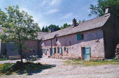
Guy.Grégoire A Resistance refuge
In early 1943, the first Resistance group of the Cévennes was formed. The refuge of the Aire-de-côte group was one of the wooden shacks used for forestry works, whose roof was camouflaged using branches. On 10 July 1943, a message warned the post office in Rousses that a German attack was imminent. The Resistance was informed – but a storm delayed the group’s departure. The Germans arrived… The forester was arrested as an accomplice, accused of being in radio contact with London. Indeed, the Aire-de-côte Resistance listened to a crystal radio set built by the two Jews who were hiding there.
Les prairies de Bonperrier - Michel Monnot Bonperier
The etymology of this name is believed to be “good fields”. Indeed, there are fields surrounding the hamlet that are still maintained today. It is said that the hamlet’s inhabitants grew cereals. After harvest, they would take the wheat and rye down to the mill in the village. The oats, however, stayed in the hamlet as livestock fodder. Fauna
FaunaThe short-toed snake eag
From spring to autumn, if you are lucky, you might see a large bird of prey whose underside is almost white and whose head is large and dark: the short-toed snake eagle. These bare ridges, which are hot and sunny during the day, are excellent hunting grounds for this lover of snakes, who knows how to flush them out. It is often windy here, which the snake eagle uses to hunt, not by circling in updrafts like other raptors but by flying on the spot, legs dangling, wings immobile. The snake eagle is migratory and stays here only to nest, from March to October – it winters in Africa
l'Auberge-relais de Bonperrier - Michel Monnot Bonperrier and its inn
Legend has it that up on the Bonperrier ridge, just before the Great War, there was an inn run by two families. The crossroads was a lively place of exchange. The former King’s Road running north-south is also the limit between two municipalities.
Ridge roads were faster, and the coaching inns located alongside them offered travellers warm and dry overnight stays as well as fresh horses so that they could pursue their journey. Postmen came with the post but also with stories from the neighbouring valleys. In June, transhumant shepherds and their flocks still stay over at Bonperrier before going on to their summer pastures the next morning. Their stopover always turns into a convivial evening even if the inn no longer exists.
Le genêts à balai - Béatrice Galzin  Flora
FloraCommon broom
Common broom dominates on the sides of the path. Not appreciated by shepherds or their sheep, this tough legume was harshly condemned by the Cévenol writer Jean-Pierre Chabrol. For him, agricultural abandonment closed the landscape of the Cévennes by making way for broom, which signals the end of a civilisation.
Chêne blanc ou pubescent - Yves Maccagno 
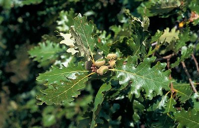
The downy or pubescent oak
Before the pass, you can see a downy oak wood below the path, with some good-sized specimens. This tree is native to low and intermediate altitudes; from the 9th century onwards, sweet chestnuts were planted in its stead. And yet it provides high-quality wood, resists fire and drought due to its deep roots, and shelters a large number of insect and herbaceous plant species (700 different plant and animal species, including 490 of beetles that live in wood).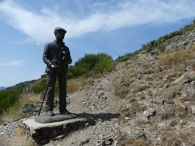
Le pastre - Nathalie Thomas The draille (drovers’ road) and the sheep bridge
The draille (drovers’ road) and the sheep bridge architecture The sheep bridge at the Col de l’Asclier is on an important draille (a traditional path for livestock migrating to the upland summer pastures of Mont Aigoual and Mont Lozère), which was also a King’s road during the Camisard revolt in the 18th century, a peddlers’ road and is now a long-distance hiking path. The Col de l’Asclier pass (from Occitan asclar, to split), where the road seems to go through a gap, is well-named: it lies on a fault line in the rock. But the most astonishing is the bridge, a bridge without road. It was built to help sheep flocks negotiate this difficult spot!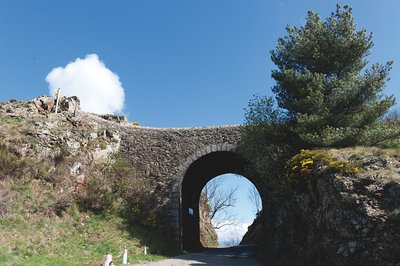
Pont moutonnier - © Olivier Prohin 
Sheep bridge
This bridge was expressly built in the 19th century for shepherds heading from the plains of Languedoc to greener regions in the summer. Following the mountain ridges with their flocks, they ascended to the summer pastures. This draille [drovers' road], the Draille de la Margeride, is one of the most famous in the Cévennes alongside those leading to the Aubrac and the Gévaudan.
- Flora
The forestry track
On the first two kilometres, up to the Rocher de l'Aigle, you are on the forestry track opened in 1938. Where there are forestry tracks, there are state-owned forests, meaning forests managed by the French state and the Office National des Forêts so as to develop the area. The presence of so many beech trees and pines is a marker of the previous reforestation policy on the Aigoual massif and in the Cevenol foothills. A plaque has been erected at the Col du Fageas pass, further along this trail, in memory of Max Nègre (1880 – 1960), one of the project managers of this collective undertaking. From 1935 to 1939, he thinned out the forests planted since the end of the 19th century and opened up forestry tracks.
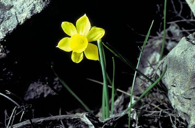
Narcisse à feuilles de jonc - © Yves Maccagno FloraRush-leaf narcissus
Come in spring – up to the end of April – to see the rush-leaf narcissi opposite the Rocher de l'Aigle. They grow in abundance on the limited surface area of the sheltered and south-facing stony slope. Often there is only one fragrant flower per plant. Do not pick them! Take a photo instead!
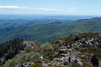
Vue panoramique - © Olivier Prohin 
Panoramic views
Enjoy a superb 360° view! On the northern horizon, you can see the summit of Mont Aigoual and, on the valley floor, the hamlets of Les Millerines and L'Abric in the foreground and a part of the districts of L'Estréchure and Saumane in the middle distance. Further north, the village of St-Roman-de-Tousque is perched on the long corniche of the Cévennes. To the east, you can make out the city of Alès, Mont Bouquet and, in the distance, the “giant of Provence”, Mont Ventoux (1,912 m).
On the southern horizon are two limestone hills: the Jumelles de Monoblet. Behind them, Coutach hill overlooks Sauve and Quissiac. The Pic Saint-Loup rises above it all with its 658 m. You can also see a stretch of coastline, with the salt marshes of Aigues-Mortes and La Grande-Motte just visible. Further west, the Roc Blanc rises next to the Pic d'Anjeau. And finally, just opposite you, Mont Fageas, the summit of the Liron range, on which you have been walking west-to-east for an hour already.
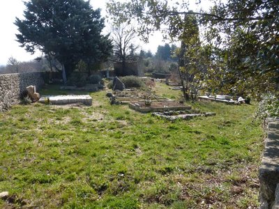
Cimetière communal - © Nathalie Thomas Cemetery history
The walk leads you past the village cemetery, which was in fact the Protestant cemetery. Soudorgues also has a Catholic cemetery, another particularity brought about by the turbulent history of the Reformation. Catholic cemeteries did not accept “non-Christians” or “heretic Christians”. There were countless exhumations of Protestant bodies in the 16th century. To put an end to this injustice, the Edict of Nantes ordered that “convenient” cemeteries be built for those who followed the so-called reformed religion. When the Edict was revoked, the order was also dropped. Huguenots had to renounce their religion to be buried in 'family” cemeteries in the countryside. Today, only the owners of these on-site cemeteries still have the right to be buried in them.
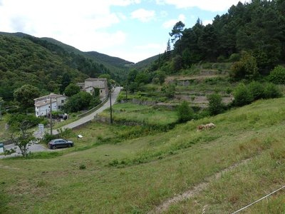
Les Horts et les bancels ou faïsses - Nathalie Thomas Les Horts hamlet
The hamlet got its name from the Latin hortus, meaning garden. The presence of many springs and waterways contributed to the expansion of dry-stone terraces for growing crops (bancels or faïsses). Les Horts had a watermill.

Aiguilles du pin parasol - Béatrice Galzin FloraThe stone or umbrella pine
In the distance in the Lasalle valley there is dense, dark green vegetation. The stone or umbrella pine has a very characteristic opened-out shape, which resembles an umbrella from a distance. This conifer is at home especially in the Mediterranean basin. It prefers dry, deep and cool soils. Its bark is reddish and cracked. Its fruit, the pine nut, is often used in pastry cooking.

Lime kiln
The process of burning limestone to make lime has been used since the Bronze Age. The lime was mixed with sand to make mortar for building houses. Concrete was not known until the early 19th century. Lime is also a powerful antiseptic and was used to disinfect buildings, especially sheepfolds. The kiln operator had to maintain the kiln temperature at 800 to 1,000°C. Plaster was made from gypsum deposits using the same principle.
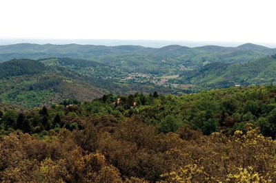
Vue des crêtes de Mauripe - © Olivier Prohin 360° views from Mauripe
From here, on a clear day, you can see the Alps (west) and the Mediterranean (south). Looking northwest, you can make out Mont Aigoual, the Col de l'Asclier pass, the Col de Fageas with its television mast and, if you follow the ridges eastwards with your eyes, the Rocher de l'Aigle, Piécamp and La Mortière. The lowest ridge is the famous Corniche des Cevennes. Behind it, further east, are the mountain ranges of La Vieille Morte and Le Mortissou, and, in the far distance, the ridges of Mont Lozère. Far to the south, you can make out the city of Alès and, even further away, Mont Ventoux. In front are the town of Lassalle and then La Fage mountain above Saint-Hippolyte-du-Fort. On the horizon, the Mediterranean shimmers furtively.
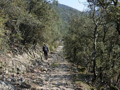
Descente au col de Mercou - © Nathalie Thomas Draille
The rocky path becomes wider and has stone reinforcements on the downhill side, which shows that it was once used by large herds. This draille led from Saint-Jean-du-Gard to the summer pastures on Mont Aigoual. At the Col de Mercou pass (570 m), there are panoramic views northwards over the Corniche des Cevennes. The pass was once a site for trade and commerce, with its own market. Its name is derived from Mercury, the god of travellers and commerce. There are also references to Melkart, a Phoenician deity: Semitic traders left traces of their passage here in the architecture of the old proto-historic bridges. Melkart or Melqart was the tutelary god of the city of Tyre - whose name means “strong king” in Phoenician – and was the god of riches, industry and navigation. He was worshipped in the tenth century BC.
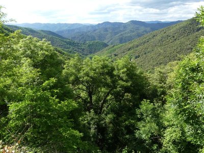
Les cachettes huguenotes - Nathalie Thomas The King’s dragoons and the dragonnade
Three-quarters of local Huguenots (Protestants) renounced their faith due to the “missionaries in boots”, meaning the dragoons. The dragonnade was the name given to Huguenots being forced to house these soldiers of the King, who then pillaged and mistreated them into renouncing their faith. The dragoons met with a unique resistance in the Camisard War (1702 to 1705), during which 3,000 Protestants in white shirts defied 30,000 red dragoons. The dragoons were on horseback, booted and armed with sabres a metre-and-a-half long, which was not very practical on small paths, during this guerilla war.

Cable de transport de materiaux - Béatrice Galzin Cobbled paths and retaining walls
Under your feet, you will see traces of all this old built road heritage on the paths. Cobblestones make roads more comfortable and suitable for vehicles.
The retaining walls are regular and, in places, built on very steep areas or carved into the rock. The traces left by humanity are impressive.
After the Château de Bussas, you will see piled-up tyres by the side of the path. There is also a thick cable. The taut-cable system made it possible to transport materials and wood all the way to the road. When the load arrived, it had sometimes picked up too much speed because of its weight. The pile of tyres was there to stop it.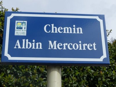
Albin Mercoiret - Nathalie Thomas Albin Mercoiret
Today, he would be over 100 years old. All the inhabitants of St Jean remember this self-taught man, a fervent Protestant, town counsellor, founder of the tourist office, and a butcher by profession. Always smiling in his blue overalls, as solid as the vine stock that he regularly went up the hill to look after, pushing his wheelbarrow and followed by his few sheep. When he wanted to take the train, he sent his children ahead to let the stationmaster know that he would be arriving. Then he walked through the small town greeting his acquaintances while in the distance the locomotive’s whistle sounded impatiently – but the train never left without him.
Description
- Day 1 : Saint-André de Valborgne - Aire de Côte (yellow waymarks, then red-and-white GR®7) : 13.8 km.
- Day 2 : Aire de Côte - Mas Corbière on the GR® 6-67 (red-and-white waymarks) : 13.9 km.
- Day 3 : Mas Corbière - Soudorgues, on the GR®67, GR®61 and GR®63 (red-and-white waymarks) : 17.8 km.
- Day 4 : Soudorgues - St-Jean du Gard via Mont Mercou (yellow waymarks, then red-and-white GR®61 : 13.3 km.
- Departure : Saint André de Valborgne
- Arrival : St Jean du Gard
- Towns crossed : Saint-André-de-Valborgne, Bassurels, Val-d'Aigoual, Les Plantiers, Notre-Dame-de-la-Rouvière, L'Estréchure, Soudorgues, Peyrolles, and Saint-Jean-du-Gard
Forecast
Altimetric profile
Recommandations
Make sure your equipment is appropriate for the day’s weather conditions. Remember that the weather changes quickly in the mountains. Take enough water, wear sturdy shoes and put on a hat. Please close any gates and barriers behind you.
Where to sleep :
Aire de Côte : oficial bivouac area (composting toilets, water); no food available on-site. 09 70 03 56 62, contact@airedecote.fr https://airedecote.fr/
Mas Corbières : 06 22 72 14 78 contact@mascorbieres.com www.mascorbieres.com/
Stopover in Soudorgues :
Gite Longitude : 04 66 85 07 89 gitelongitude30@gmail.com www.gite-longitude.com
Le Petit Pavillon des Cévennes accueil@lesfaissesencevennes.fr www.lesfaissesencevennes.fr
Information desks

Tourism & national parc'house
Col de la Serreyrède, 30570 Val d'Aigoual
The Maison de l'Aigoual houses the tourism office Mont Aigoual Causses Cévennes and the Maison du Parc national. This visitor centre provides information on and raises awareness of the Cévennes National Park, its sites and events as well as the rules that must be observed in the National Park's central zone.
On site: changing exhibitions, video projections, Festival Nature events and shop Open year-round

Tourism office Cévennes Tourisme, Saint-Jean-du-Gard
Maison rouge, 30270 Saint-Jean-du-Gard
This office is part of the National Park's associated tourist-information network, whose mission is to provide information on, and raise awareness of, the sites and events as well as the rules that must be observed in the National Park's central zone.
Open year-round

Tourism office Mont Aigoual Causses Cévennes, Lassale
Centre Viala, rue de la Place, 30460 Lasalle
This office is part of the National Park's associated tourist-information network, whose mission is to provide information on, and raise awareness of, the sites and events as well as the rules that must be observed in the National Park's central zone. : Open year-round

Tourism office Mont Aigoual Causses Cévennes, Saint-André-de-Valborgne
les quais, 30940 Saint-André-de-Valborgne
This office is part of the National Park's associated tourist-information network, whose mission is to provide information on, and raise awareness of, the sites and events as well as the rules that must be observed in the National Park's central zone.

Tourism office Mont Aigoual Causses Cévennes, Valleraugue
7 quartier des Horts, 30570 Valleraugue
This office is part of the National Park's associated tourist-information network, whose mission is to provide information on, and raise awareness of, the sites and events as well as the rules that must be observed in the National Park's central zone. : Open year-round
Transport
This hike is accessible by public transport.
At Saint Jean du Gard - La Poste (post office), you can park your car and take the bus to Saint André de Valborgne.
For up-to-date bus times and to plan your journey, use the itinerary calculator below for your destination bus stop : SAINT-ANDRE-DE-VALBORGNE-Fontaine
Access and parking
From St-Jean-du-Gard towards St-André de Valborgne on the D907 via the villages of L’Estréchure and Saumane.
Parking :
Source


Report a problem or an error
If you have found an error on this page or if you have noticed any problems during your hike, please report them to us here: