
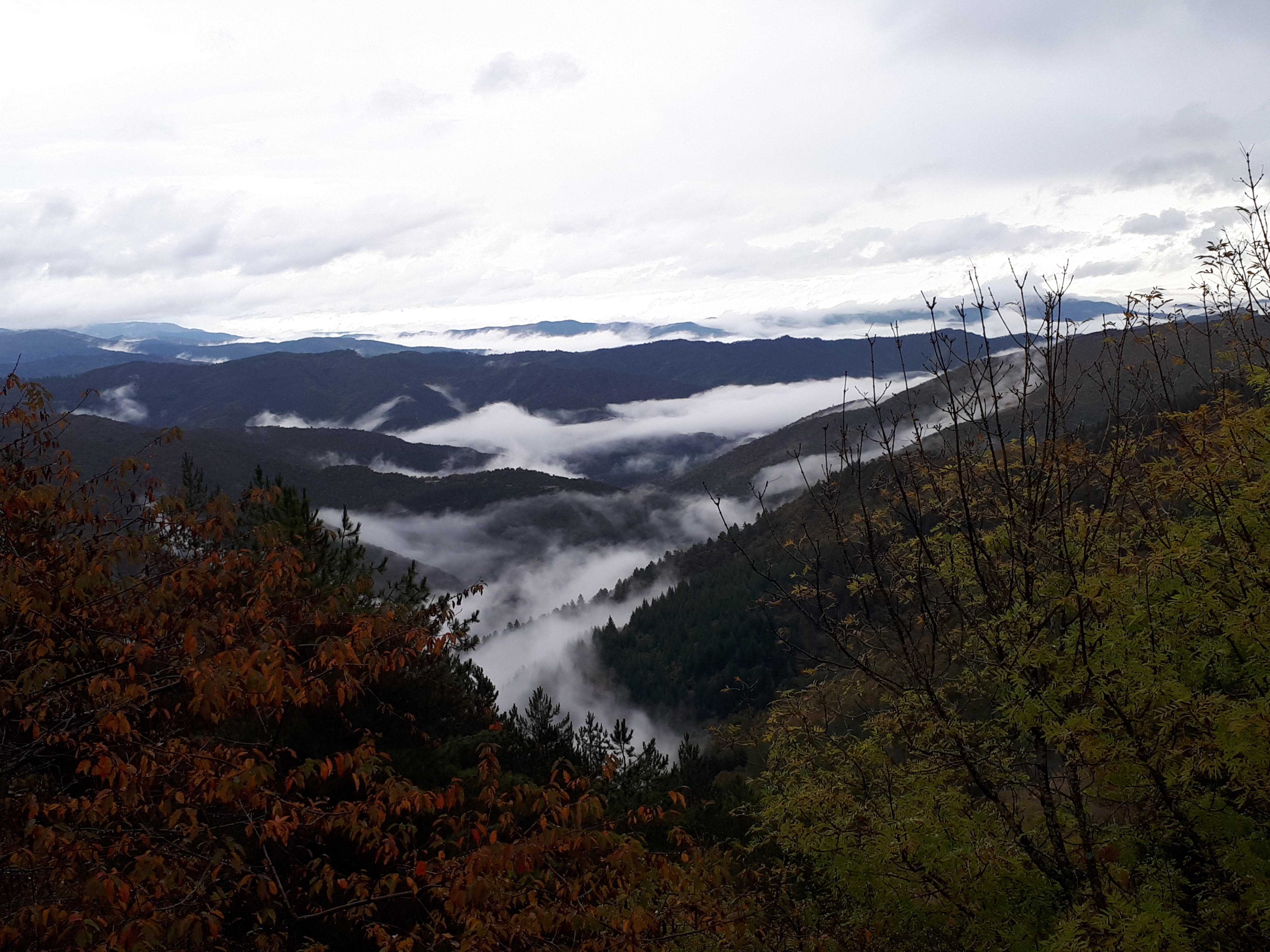
On Fageas ridge (day 1)
Aire de Côte, an old forester’s house, is now a stopover gite. It straddles two municipalities and two departments: Saint-André-de-Valborgne (Gard) and Bassurels (Lozère). Ideally located for hiking, it provides access in several directions: to the Aigoual massif, north, south, the ridges and the valleys leading to the villages.
12 points of interest

© Béatrice Galzin 
One spring, five fountains
This fountain is one of Saint-André’s five public fountains, all of which are supplied by the same spring (its water is thus the same as in the Fontaine du Griffon). Before houses were connected to mains water, there were many more fountains on this side of the quay.
© Béatrice Galzin 
The tanners’ district
La Calquière district gets its name from that of the ditches in which the tanners soaked their animal skins with limestone, which is called cauç or calç in Occitan. All along the Gardon there were tanneries because its acidic water was good for rinsing the skins, which was indispensable for obtaining high quality products.
© Béatrice Galzin The age of silk
From the 19th century onwards, the silk industry developed in the Cévennes: tanneries gave way to spinning mills. The mills used water not only to treat the silkworm cocoons (which were boiled to prepare the silk) but also for the steam-driven spinning machines. In the second half of the 19th century, diseases strongly reduced silk production, which was also subject to competition from foreign silks and then from artificial silk. The silk industry went under in 1965.
Le village de St André de Valborgne - Béatrice Galzin 
The village of St André de Valborgne
As you stroll along the quay above the river, you can still see the handsome bourgeois houses dating from the silk boom. If you look around, former spinning mills and industrial buildings dedicated to silk farming can still be seen in the landscape. A little lower down, opposite the 16th century château, you can listen to
Bernadette Lafont on the Camisard saga in and after 1702. As you reach the square again, quench your thirst at the fountain and have a look inside the Romanesque church (12th century).
© Béatrice Galzin The gardonnades
The village benefits from the water that the Gardon brings – but it also has to put up with the river’s sporadic bad moods. Abundant rain can rapidly raise river levels. It is often in autumn that the torrent overflows its banks. The worst floods can have dramatic consequences in both material and human terms. Many can still remember the floods of September 1958 and 2002, which caused much damage.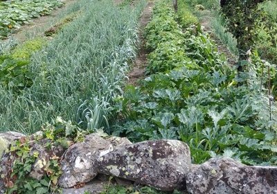
© Béatrice Galzin Well-supplied
Cévenol gardens are supplied by béals (little canals), which bring water from rivers or springs to cultivated land. The latter is usually laid out in bancels (terraces). By retaining the soil, the low walls make it possible to have level plots and deeper soils. Water can seep into the ground slowly and remain there for longer.
Fontaine du Griffon - © Béatrice Galzin Water!
The Griffon fountain is known for its pure water, which will quench any walker’s thirst. In the old days, the whole neighbourhood used it not only for drinking but also for cooking, washing, washing clothes, watering plants, etc. The fountain was not only a supply point but also an important meeting-point in village life.
Bergeronnette des ruisseaux - © Régis Descamps  Fauna
FaunaFish and other animals...
On the river banks, a pretty white, grey and black bird paces up and down looking for insects, bopping its long tail up and down: the white wagtail. The more colourful grey wagtail is often seen alongside it. The white-throated dipper resembles a blackbird with a big white stain on its breast. It often disappears underwater to hunt insect larvae. Trout, which like the same prey, also live in the Gardon, where they keep anglers happy.
Calade - © Béatrice Galzin Two in one
This cobbled path going uphill is a calade. It is not only a path but also a brook, allowing rainwater to be evacuated. Caution: slippery when wet!
© Béatrice Galzin 
Traces of giants?
“Giant’s cauldrons” have formed in the rock at the base of the waterfall. These regular, rounded cavities are only created in rapidly flowing waters. They are caused by the repeated friction of stones caught in a depression and moved by swirling currents.
Aire de Côte - Stephan.Corporan Aire de Côte
Aire-de-Côte farm was purchased by the French State in 1862, during the period of reforestation. Before the farm became a stopover gîte, it was for a long time the residence of the local forester and his family. In the first half of the 20th century, Aire-de-Côte was very different. To the north, behind the house, was the draille (drovers’ road), lined by upright stones and 40 to 50 metres wide. Thousands of transhumant animals passed every year on their way to or from summer pastures. The transhumant animals stopped there at lunchtime, then continued on towards Mont Aigoual.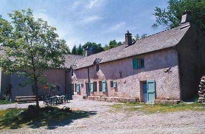
Guy.Grégoire A Resistance refuge
In early 1943, the first Resistance group of the Cévennes was formed. The refuge of the Aire-de-côte group was one of the wooden shacks used for forestry works, whose roof was camouflaged using branches. On 10 July 1943, a message warned the post office in Rousses that a German attack was imminent. The Resistance was informed – but a storm delayed the group’s departure. The Germans arrived… The forester was arrested as an accomplice, accused of being in radio contact with London. Indeed, the Aire-de-côte Resistance listened to a crystal radio set built by the two Jews who were hiding there.
Description
Start at “St André de Valborgne”, by the church (yellow waymarks).
Walk towards “Aire de Côte” via “La virevolte”.
- On reaching the top of the climb, at "la combe Radal" crossroads, take the track on the left on the GR®7 (red-and-white waymarks), towards “Aire de Côte”.
- Take the draille (drovers’ road) and continue to “Aire de Côte” (yellow waymarks).
- Departure : Saint-André de Valborgne
- Arrival : Aire de côte
- Towns crossed : Saint-André-de-Valborgne and Bassurels
Forecast
Altimetric profile
Recommandations
NB : Long climb without shade. Do not attempt this climb on summer afternoons.
Make sure your equipment is appropriate for the day’s weather conditions. Remember that the weather changes quickly in the mountains. Take enough water, wear sturdy shoes and put on a hat. Please close any gates and barriers behind you.
Information desks

Tourism & national parc'house
Col de la Serreyrède, 30570 Val d'Aigoual
The Maison de l'Aigoual houses the tourism office Mont Aigoual Causses Cévennes and the Maison du Parc national. This visitor centre provides information on and raises awareness of the Cévennes National Park, its sites and events as well as the rules that must be observed in the National Park's central zone.
On site: changing exhibitions, video projections, Festival Nature events and shop Open year-round

Tourism office Mont Aigoual Causses Cévennes, Lassale
Centre Viala, rue de la Place, 30460 Lasalle
This office is part of the National Park's associated tourist-information network, whose mission is to provide information on, and raise awareness of, the sites and events as well as the rules that must be observed in the National Park's central zone. : Open year-round

Tourism office Mont Aigoual Causses Cévennes, Saint-André-de-Valborgne
les quais, 30940 Saint-André-de-Valborgne
This office is part of the National Park's associated tourist-information network, whose mission is to provide information on, and raise awareness of, the sites and events as well as the rules that must be observed in the National Park's central zone.

Tourism office Mont Aigoual Causses Cévennes, Valleraugue
7 quartier des Horts, 30570 Valleraugue
This office is part of the National Park's associated tourist-information network, whose mission is to provide information on, and raise awareness of, the sites and events as well as the rules that must be observed in the National Park's central zone. : Open year-round
Access and parking
Parking :
Report a problem or an error
If you have found an error on this page or if you have noticed any problems during your hike, please report them to us here: