
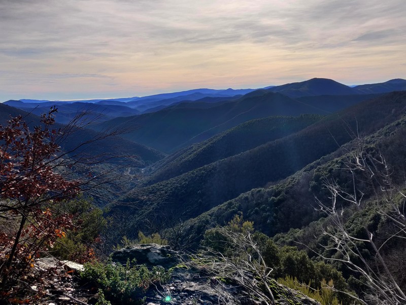
2. On Fageas ridge (day 2)
You briefly leave the catchment basin of the Vallée Borgne to look down over the Hérault valley, with the village of Valleraugue below. Higher up, the Aigoual dominates the surrounding mountains. Today you will be walking on the draille, a path that is thousands of years old and which livestock have been using for centuries.
9 points of interest

Aire de Côte - Stephan.Corporan 
Aire de Côte
Aire-de-Côte farm was purchased by the French State in 1862, during the period of reforestation. Before the farm became a stopover gîte, it was for a long time the residence of the local forester and his family. In the first half of the 20th century, Aire-de-Côte was very different. To the north, behind the house, was the draille (drovers’ road), lined by upright stones and 40 to 50 metres wide. Thousands of transhumant animals passed every year on their way to or from summer pastures. The transhumant animals stopped there at lunchtime, then continued on towards Mont Aigoual.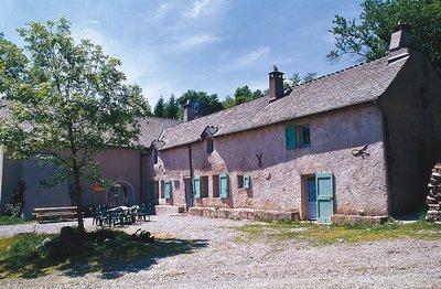
Guy.Grégoire A Resistance refuge
In early 1943, the first Resistance group of the Cévennes was formed. The refuge of the Aire-de-côte group was one of the wooden shacks used for forestry works, whose roof was camouflaged using branches. On 10 July 1943, a message warned the post office in Rousses that a German attack was imminent. The Resistance was informed – but a storm delayed the group’s departure. The Germans arrived… The forester was arrested as an accomplice, accused of being in radio contact with London. Indeed, the Aire-de-côte Resistance listened to a crystal radio set built by the two Jews who were hiding there.
Les prairies de Bonperrier - Michel Monnot Bonperier
The etymology of this name is believed to be “good fields”. Indeed, there are fields surrounding the hamlet that are still maintained today. It is said that the hamlet’s inhabitants grew cereals. After harvest, they would take the wheat and rye down to the mill in the village. The oats, however, stayed in the hamlet as livestock fodder.
 Fauna
FaunaThe short-toed snake eag
From spring to autumn, if you are lucky, you might see a large bird of prey whose underside is almost white and whose head is large and dark: the short-toed snake eagle. These bare ridges, which are hot and sunny during the day, are excellent hunting grounds for this lover of snakes, who knows how to flush them out. It is often windy here, which the snake eagle uses to hunt, not by circling in updrafts like other raptors but by flying on the spot, legs dangling, wings immobile. The snake eagle is migratory and stays here only to nest, from March to October – it winters in Africa
l'Auberge-relais de Bonperrier - Michel Monnot Bonperrier and its inn
Legend has it that up on the Bonperrier ridge, just before the Great War, there was an inn run by two families. The crossroads was a lively place of exchange. The former King’s Road running north-south is also the limit between two municipalities.
Ridge roads were faster, and the coaching inns located alongside them offered travellers warm and dry overnight stays as well as fresh horses so that they could pursue their journey. Postmen came with the post but also with stories from the neighbouring valleys. In June, transhumant shepherds and their flocks still stay over at Bonperrier before going on to their summer pastures the next morning. Their stopover always turns into a convivial evening even if the inn no longer exists.
Le genêts à balai - Béatrice Galzin  Flora
FloraCommon broom
Common broom dominates on the sides of the path. Not appreciated by shepherds or their sheep, this tough legume was harshly condemned by the Cévenol writer Jean-Pierre Chabrol. For him, agricultural abandonment closed the landscape of the Cévennes by making way for broom, which signals the end of a civilisation.
Pont moutonnier - © Olivier Prohin 
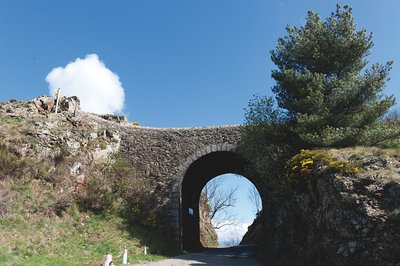
Sheep bridge
This bridge was expressly built in the 19th century for shepherds heading from the plains of Languedoc to greener regions in the summer. Following the mountain ridges with their flocks, they ascended to the summer pastures. This draille [drovers' road], the Draille de la Margeride, is one of the most famous in the Cévennes alongside those leading to the Aubrac and the Gévaudan.
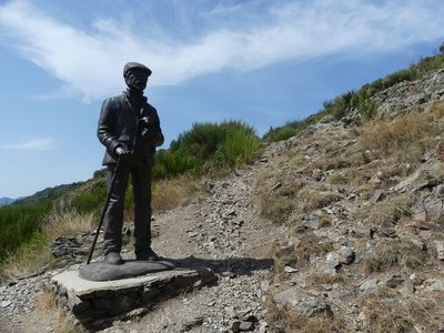
Le pastre - Nathalie Thomas The draille (drovers’ road) and the sheep bridge
The draille (drovers’ road) and the sheep bridge architecture The sheep bridge at the Col de l’Asclier is on an important draille (a traditional path for livestock migrating to the upland summer pastures of Mont Aigoual and Mont Lozère), which was also a King’s road during the Camisard revolt in the 18th century, a peddlers’ road and is now a long-distance hiking path. The Col de l’Asclier pass (from Occitan asclar, to split), where the road seems to go through a gap, is well-named: it lies on a fault line in the rock. But the most astonishing is the bridge, a bridge without road. It was built to help sheep flocks negotiate this difficult spot!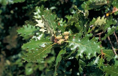
Chêne blanc ou pubescent - Yves Maccagno 
The downy or pubescent oak
Before the pass, you can see a downy oak wood below the path, with some good-sized specimens. This tree is native to low and intermediate altitudes; from the 9th century onwards, sweet chestnuts were planted in its stead. And yet it provides high-quality wood, resists fire and drought due to its deep roots, and shelters a large number of insect and herbaceous plant species (700 different plant and animal species, including 490 of beetles that live in wood).
Description
From ”Aire de Côte” take the GR® 6-67 long-distance hiking path to “Col du Pas” via “Le Fageas”.
1) At “Col du Pas”, continue on the GR®6-67 to “Col des Traverses”, “Bonperrier”, “Col de l’Homme Mort”, “Col de l’Asclier”.
2) At “Col de l’Asclier”, go downhill on the road for 10 metres, then take on the right a path going downhill to “Mas Corbière” (yellow waymarks).
- Departure : Aire de Côte
- Arrival : Mas Corbière (municipality of Notre Dame de la Rouvière)
- Towns crossed : Bassurels, Saint-André-de-Valborgne, Val-d'Aigoual, Les Plantiers, and Notre-Dame-de-la-Rouvière
Forecast
Altimetric profile
Recommandations
Make sure your equipment is appropriate for the day’s weather conditions. Remember that the weather changes quickly in the mountains. Take enough water, wear sturdy shoes and put on a hat. Please close any gates and barriers behind you.
Information desks

Tourism & national parc'house
Col de la Serreyrède, 30570 Val d'Aigoual
The Maison de l'Aigoual houses the tourism office Mont Aigoual Causses Cévennes and the Maison du Parc national. This visitor centre provides information on and raises awareness of the Cévennes National Park, its sites and events as well as the rules that must be observed in the National Park's central zone.
On site: changing exhibitions, video projections, Festival Nature events and shop Open year-round
Tourism office Mont Aigoual Causses Cévennes, Lassale
Centre Viala, rue de la Place, 30460 Lasalle
This office is part of the National Park's associated tourist-information network, whose mission is to provide information on, and raise awareness of, the sites and events as well as the rules that must be observed in the National Park's central zone. : Open year-round
Tourism office Mont Aigoual Causses Cévennes, Saint-André-de-Valborgne
les quais, 30940 Saint-André-de-Valborgne
This office is part of the National Park's associated tourist-information network, whose mission is to provide information on, and raise awareness of, the sites and events as well as the rules that must be observed in the National Park's central zone.
Tourism office Mont Aigoual Causses Cévennes, Valleraugue
7 quartier des Horts, 30570 Valleraugue
This office is part of the National Park's associated tourist-information network, whose mission is to provide information on, and raise awareness of, the sites and events as well as the rules that must be observed in the National Park's central zone. : Open year-round
Report a problem or an error
If you have found an error on this page or if you have noticed any problems during your hike, please report them to us here: