
11 points of interest
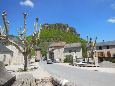
La place du village - Béatrice Galzin 
Trèves
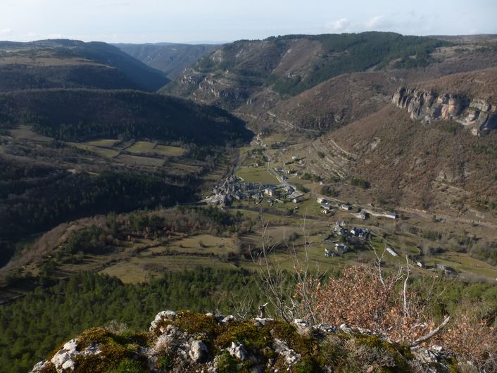
From Tabrî, meaning “village close to the water” in the Chasséen culture (Baume Lairoux, La Verrière, etc.), which lay on the trade route between the Gabali tribe, the coast and the Arecomici tribe. It was given a wooden bridge by the Romans, occupied first by Arian Visigoths and then by Nicene Christian Franks, and destroyed by Muslims around 730. It was revived in the Carolingian period with its Romanesque bridge, and was loyal to the Kings of France, who granted it a consuls’ charter in the 14th century and the bell on top of the church, which had remained Catholic. In the 17th century, Trèves had hemp fields, whose hempen cloth was used in the draperies in Lodève. Its blue sheep’s cheese, its galena mine and its terraces of almond trees and lentils belong to the past. Only the Pétassou (local pagan character and festival) remains (M.MOULINIER, historian).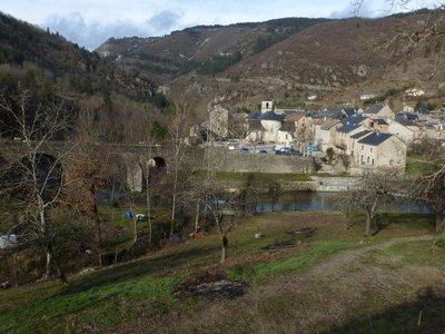
Trèves - nathalie.thomas Treves
In Antiquity, the village square was a cemetery. The name Trèves is believed to derive from the Gaulish trebo – meaning 'village' according to some sources or the Celtic water goddess according to others – or perhaps from trivium, crossroads... The track going over the Roman bridge at Le Trévezel, restored in the 18th century, was in fact an important road in Antiquity. There is another hypothesis if you consult Boissier de Sauvages' 1820 dictionary, in whose opinion Treva or Trebo are Occitan words referring to phantoms or spirits. You might well be tempted by this version once you know the history of the Pas de Joulié cave described below! (B. Mathieu)
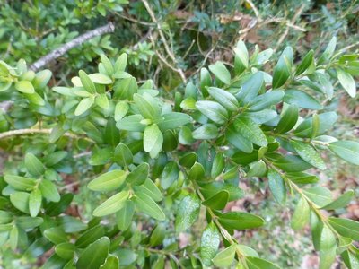
Buis - © Nathalie Thomas 
Box (Buxus)
Boxwood and humans: a long relationship! When livestock farming increased, the primeval oak forest opened up and box – which is too hard for sheep's teeth – took hold everywhere. Humans discovered one of its major qualities: broken up and scattered over the ground as a litter, it protects vegetable seedlings from drought and frost. Its leaves can make up for a lack of straw for fertilising arable land. In 1818, a decree issued by the prefect of the Gard department worried about the excessive clearing of box groves and the messy manner in which they were being uprooted, without adequate tools. Until about 1910, you might see mules laden with enormous bundles of box; then chemistry took over. (B. Mathieu)
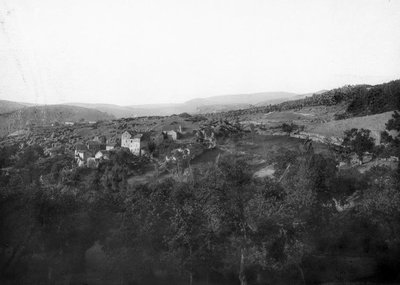
© Fonds Flahault The hamlet of Espruniers
This hamlet, which consisted of a sizeable grouping of houses, was inhabited until about 1930. You have stopped on what was probably the threshing floor for grains.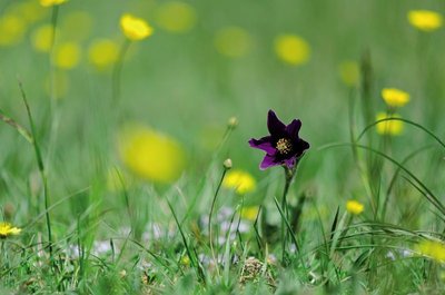
Anémone pulsatille - © Olivier Prohin 
Typical grasslands on limestone soil
This small area of grassland is one of the rare open spaces on the Causse de Canayère. It is of interest for the preservation of certain flower species, especially the pasqueflower and several varieties of orchid. To counteract the natural progression towards more closed environments, this site is maintained by regular mowing.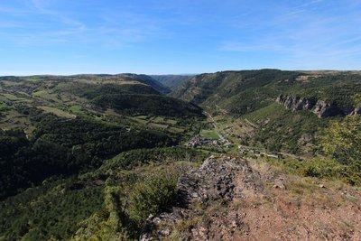
© Valère Marsaudon 
Open-sky geology
The granite and schist (slate) that constitute the bedrock of the Cévennes and Causses were created in the Paleozoic. The bedrock was then flattened by erosion and covered by the sea, leading to limestone deposits. On the reliefs, erosion has eliminated the sedimentary top layer while in zones of subsidence, such as the Causses, the limestone deposits remained in place. Since then, waterways have cut ever deeper into the limestone, and continue to do so today.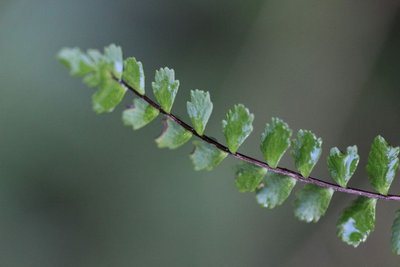
Capillaire - © Valère Marsaudon  Flora
FloraCalcifugous vegetation
This section of the path in the schist zone showcases calcifugous (“limestone-avoiding”) vegetation, which only grows on acid soils (schist or granite): especially chestnut trees, ferns, heather and broom.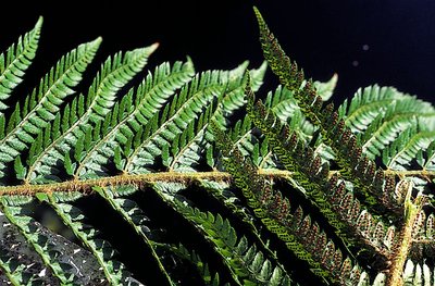
Polystic - © Yves Maccagno The schist/limestone contact zone
Here, the layers of the schist outcrops are almost vertical in places. This contact between Causses and Cévennes, between the primary bedrock and the limestone layers, is due to a geological fault created by the various movements and constraints that have affected the Earth’s crust. In this zone, the schist bedrock has been pushed upwards by several hundred metres along the fault line compared to the limestone plateau, although the latter is less old.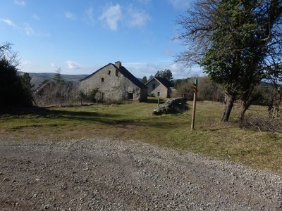
Canayère - nathalie.thomas Canayère
A former farm turned forester's house in 1880. In the early days of the Mont Aiguoal reforestation, forestry officers lived here year-round during their missions. Forestry workers working on the replanting were allowed to use the outbuildings. Later, only one official resided here. Since 1967, no official has permanently lived here. (B. Mathieu)
pins noirs - © Sud Cévennes A recent forest
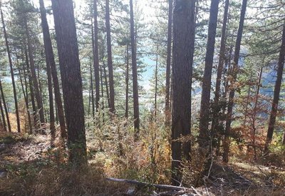
The stands that were planted during the large reforestation programmes of the late 19th century onwards consist of black pines, a rustic species that is well-adapted to dry limestone soils. Underground, the Causses plateaux are characterised by networks of tunnels and cavities that have been created by water movement over millions of years. Subterranean rivers are blocked by the impermeable layers of the valley floor and flow into the Trévezel instead.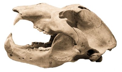
Crâne d'ours - © M. Delor 
Joulie Cave
In March 1952, Jolly, a forestry official, showed his friend Frayssignes this cave. Deposited in it they discovered the remains of 300 humans from the Neolithic, who had been carefully laid out side by side. The cave was rapidly declared a historical monument. In the depths of the cave, a great number of bear bones was also found. This cave bear, the ancestor of our brown bear (Ursus spelaeus), had a skull 50 cm long! In the winter, groups of these bears would have huddled together in clay wallows at the rear of the caves. Ursus artos succeeded the cave bear and was succeeded in turn by the brown bear, which was hunted to extinction in the 15th century. (B. Mathieu)
Forecast
Altimetric profile
Information desks

Tourism & national parc'house
Col de la Serreyrède, 30570 Val d'Aigoual
The Maison de l'Aigoual houses the tourism office Mont Aigoual Causses Cévennes and the Maison du Parc national. This visitor centre provides information on and raises awareness of the Cévennes National Park, its sites and events as well as the rules that must be observed in the National Park's central zone.
On site: changing exhibitions, video projections, Festival Nature events and shop Open year-round
Source

Report a problem or an error
If you have found an error on this page or if you have noticed any problems during your hike, please report them to us here: