
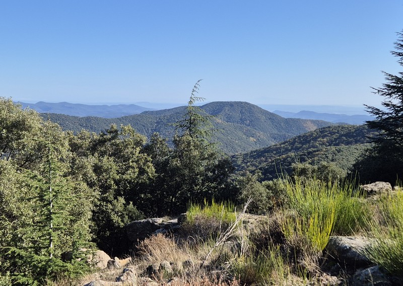
3. On Fageas ridge (day 3)
The climb to the Col de l’Asclier pass is steep. Walk under the bridge, built to ensure that the sheep are comfortable on their walk up to the summer pastures. You are on an ancient track, solidly constructed, which bears witness to the know-how of days past. This rocky path with its superb views could well be an old King’s road, even if time has changed it somewhat.
11 points of interest
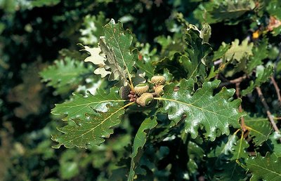
Chêne blanc ou pubescent - Yves Maccagno 
The downy or pubescent oak
Before the pass, you can see a downy oak wood below the path, with some good-sized specimens. This tree is native to low and intermediate altitudes; from the 9th century onwards, sweet chestnuts were planted in its stead. And yet it provides high-quality wood, resists fire and drought due to its deep roots, and shelters a large number of insect and herbaceous plant species (700 different plant and animal species, including 490 of beetles that live in wood).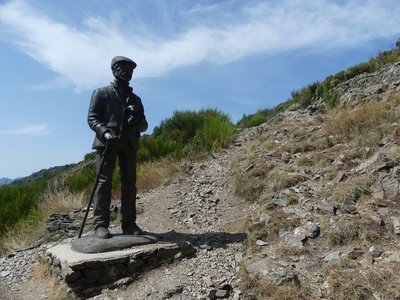
Le pastre - Nathalie Thomas The draille (drovers’ road) and the sheep bridge
The draille (drovers’ road) and the sheep bridge architecture The sheep bridge at the Col de l’Asclier is on an important draille (a traditional path for livestock migrating to the upland summer pastures of Mont Aigoual and Mont Lozère), which was also a King’s road during the Camisard revolt in the 18th century, a peddlers’ road and is now a long-distance hiking path. The Col de l’Asclier pass (from Occitan asclar, to split), where the road seems to go through a gap, is well-named: it lies on a fault line in the rock. But the most astonishing is the bridge, a bridge without road. It was built to help sheep flocks negotiate this difficult spot!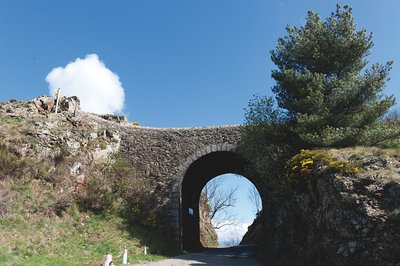
Pont moutonnier - © Olivier Prohin 
Sheep bridge
This bridge was expressly built in the 19th century for shepherds heading from the plains of Languedoc to greener regions in the summer. Following the mountain ridges with their flocks, they ascended to the summer pastures. This draille [drovers' road], the Draille de la Margeride, is one of the most famous in the Cévennes alongside those leading to the Aubrac and the Gévaudan.

 Flora
FloraThe forestry track
On the first two kilometres, up to the Rocher de l'Aigle, you are on the forestry track opened in 1938. Where there are forestry tracks, there are state-owned forests, meaning forests managed by the French state and the Office National des Forêts so as to develop the area. The presence of so many beech trees and pines is a marker of the previous reforestation policy on the Aigoual massif and in the Cevenol foothills. A plaque has been erected at the Col du Fageas pass, further along this trail, in memory of Max Nègre (1880 – 1960), one of the project managers of this collective undertaking. From 1935 to 1939, he thinned out the forests planted since the end of the 19th century and opened up forestry tracks.
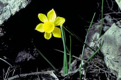
Narcisse à feuilles de jonc - © Yves Maccagno FloraRush-leaf narcissus
Come in spring – up to the end of April – to see the rush-leaf narcissi opposite the Rocher de l'Aigle. They grow in abundance on the limited surface area of the sheltered and south-facing stony slope. Often there is only one fragrant flower per plant. Do not pick them! Take a photo instead!
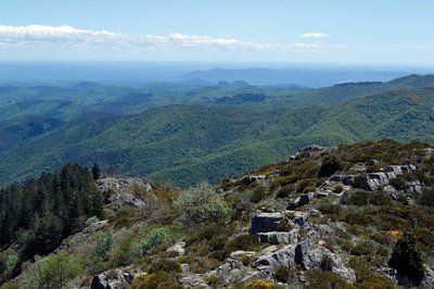
Vue panoramique - © Olivier Prohin 
Panoramic views
Enjoy a superb 360° view! On the northern horizon, you can see the summit of Mont Aigoual and, on the valley floor, the hamlets of Les Millerines and L'Abric in the foreground and a part of the districts of L'Estréchure and Saumane in the middle distance. Further north, the village of St-Roman-de-Tousque is perched on the long corniche of the Cévennes. To the east, you can make out the city of Alès, Mont Bouquet and, in the distance, the “giant of Provence”, Mont Ventoux (1,912 m).
On the southern horizon are two limestone hills: the Jumelles de Monoblet. Behind them, Coutach hill overlooks Sauve and Quissiac. The Pic Saint-Loup rises above it all with its 658 m. You can also see a stretch of coastline, with the salt marshes of Aigues-Mortes and La Grande-Motte just visible. Further west, the Roc Blanc rises next to the Pic d'Anjeau. And finally, just opposite you, Mont Fageas, the summit of the Liron range, on which you have been walking west-to-east for an hour already.
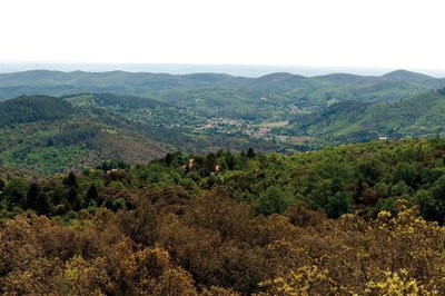
Vue des crêtes de Mauripe - © Olivier Prohin 360° views from Mauripe
From here, on a clear day, you can see the Alps (west) and the Mediterranean (south). Looking northwest, you can make out Mont Aigoual, the Col de l'Asclier pass, the Col de Fageas with its television mast and, if you follow the ridges eastwards with your eyes, the Rocher de l'Aigle, Piécamp and La Mortière. The lowest ridge is the famous Corniche des Cevennes. Behind it, further east, are the mountain ranges of La Vieille Morte and Le Mortissou, and, in the far distance, the ridges of Mont Lozère. Far to the south, you can make out the city of Alès and, even further away, Mont Ventoux. In front are the town of Lassalle and then La Fage mountain above Saint-Hippolyte-du-Fort. On the horizon, the Mediterranean shimmers furtively.

Lime kiln
The process of burning limestone to make lime has been used since the Bronze Age. The lime was mixed with sand to make mortar for building houses. Concrete was not known until the early 19th century. Lime is also a powerful antiseptic and was used to disinfect buildings, especially sheepfolds. The kiln operator had to maintain the kiln temperature at 800 to 1,000°C. Plaster was made from gypsum deposits using the same principle.
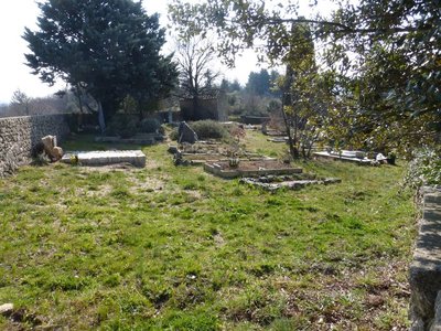
Cimetière communal - © Nathalie Thomas 
Cemetery history
The walk leads you past the village cemetery, which was in fact the Protestant cemetery. Soudorgues also has a Catholic cemetery, another particularity brought about by the turbulent history of the Reformation. Catholic cemeteries did not accept “non-Christians” or “heretic Christians”. There were countless exhumations of Protestant bodies in the 16th century. To put an end to this injustice, the Edict of Nantes ordered that “convenient” cemeteries be built for those who followed the so-called reformed religion. When the Edict was revoked, the order was also dropped. Huguenots had to renounce their religion to be buried in 'family” cemeteries in the countryside. Today, only the owners of these on-site cemeteries still have the right to be buried in them.

Aiguilles du pin parasol - Béatrice Galzin FloraThe stone or umbrella pine
In the distance in the Lasalle valley there is dense, dark green vegetation. The stone or umbrella pine has a very characteristic opened-out shape, which resembles an umbrella from a distance. This conifer is at home especially in the Mediterranean basin. It prefers dry, deep and cool soils. Its bark is reddish and cracked. Its fruit, the pine nut, is often used in pastry cooking.
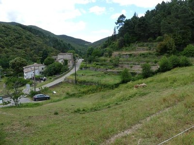
Les Horts et les bancels ou faïsses - Nathalie Thomas Les Horts hamlet
The hamlet got its name from the Latin hortus, meaning garden. The presence of many springs and waterways contributed to the expansion of dry-stone terraces for growing crops (bancels or faïsses). Les Horts had a watermill.
Description
Starting at "Mas Corbière" go back up to the sheep bridge on the track that you took last night, towards “Pont Moutonnier”. Walk under the bridge.
- Then walk towards “Col du Mercou” via “la Cale” (GR®61 long-distance hiking path).
- Turn left towards "Col de Piécamp" and "col de la Mortière".
- From "Col de la Mortière" head to "Col de la cabane vieille".
- At “Col de la cabane vieille” go downhill on the GR®63 long-distance path to reach “Pierre Plantée”.
- Continue to “Quatre Chemins” and go left to reach “Soudorgues" village.
- Departure : Mas Corbière
- Arrival : Soudorgues
- Towns crossed : Val-d'Aigoual, Notre-Dame-de-la-Rouvière, Les Plantiers, L'Estréchure, and Soudorgues
Forecast
Altimetric profile
Recommandations
Make sure your equipment is appropriate for the day’s weather conditions. Remember that the weather changes quickly in the mountains. Take enough water, wear sturdy shoes and put on a hat. Please close any gates and barriers behind you.
Report a problem or an error
If you have found an error on this page or if you have noticed any problems during your hike, please report them to us here: