
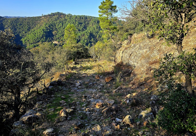
4. On Fageas ridge (day 4)
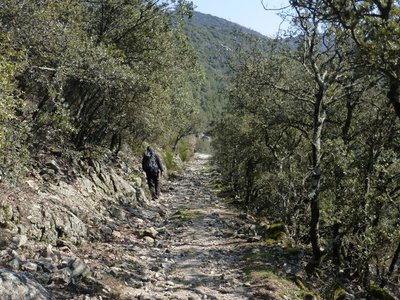
From Briontet onwards you lose altitude, and Mediterranean vegetation gradually takes over, with holm oaks. Imagine the time it took to build this paved road that leads you into the heart of the village of Saint-Jean du Gard ! Who placed the first stone ?
9 points of interest
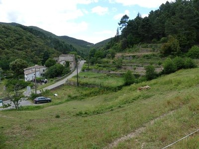
Les Horts et les bancels ou faïsses - Nathalie Thomas 
Les Horts hamlet
The hamlet got its name from the Latin hortus, meaning garden. The presence of many springs and waterways contributed to the expansion of dry-stone terraces for growing crops (bancels or faïsses). Les Horts had a watermill.

Aiguilles du pin parasol - Béatrice Galzin  Flora
FloraThe stone or umbrella pine
In the distance in the Lasalle valley there is dense, dark green vegetation. The stone or umbrella pine has a very characteristic opened-out shape, which resembles an umbrella from a distance. This conifer is at home especially in the Mediterranean basin. It prefers dry, deep and cool soils. Its bark is reddish and cracked. Its fruit, the pine nut, is often used in pastry cooking.
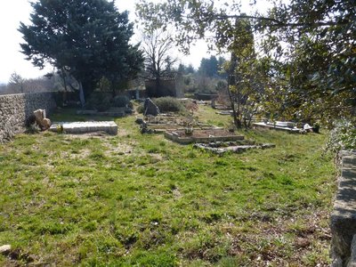
Cimetière communal - © Nathalie Thomas Cemetery history
The walk leads you past the village cemetery, which was in fact the Protestant cemetery. Soudorgues also has a Catholic cemetery, another particularity brought about by the turbulent history of the Reformation. Catholic cemeteries did not accept “non-Christians” or “heretic Christians”. There were countless exhumations of Protestant bodies in the 16th century. To put an end to this injustice, the Edict of Nantes ordered that “convenient” cemeteries be built for those who followed the so-called reformed religion. When the Edict was revoked, the order was also dropped. Huguenots had to renounce their religion to be buried in 'family” cemeteries in the countryside. Today, only the owners of these on-site cemeteries still have the right to be buried in them.


Lime kiln
The process of burning limestone to make lime has been used since the Bronze Age. The lime was mixed with sand to make mortar for building houses. Concrete was not known until the early 19th century. Lime is also a powerful antiseptic and was used to disinfect buildings, especially sheepfolds. The kiln operator had to maintain the kiln temperature at 800 to 1,000°C. Plaster was made from gypsum deposits using the same principle.
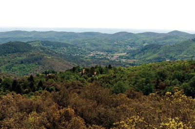
Vue des crêtes de Mauripe - © Olivier Prohin 
360° views from Mauripe
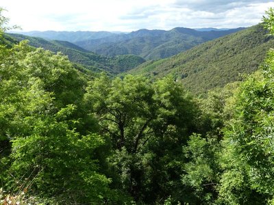
From here, on a clear day, you can see the Alps (west) and the Mediterranean (south). Looking northwest, you can make out Mont Aigoual, the Col de l'Asclier pass, the Col de Fageas with its television mast and, if you follow the ridges eastwards with your eyes, the Rocher de l'Aigle, Piécamp and La Mortière. The lowest ridge is the famous Corniche des Cevennes. Behind it, further east, are the mountain ranges of La Vieille Morte and Le Mortissou, and, in the far distance, the ridges of Mont Lozère. Far to the south, you can make out the city of Alès and, even further away, Mont Ventoux. In front are the town of Lassalle and then La Fage mountain above Saint-Hippolyte-du-Fort. On the horizon, the Mediterranean shimmers furtively.
Descente au col de Mercou - © Nathalie Thomas Draille
The rocky path becomes wider and has stone reinforcements on the downhill side, which shows that it was once used by large herds. This draille led from Saint-Jean-du-Gard to the summer pastures on Mont Aigoual. At the Col de Mercou pass (570 m), there are panoramic views northwards over the Corniche des Cevennes. The pass was once a site for trade and commerce, with its own market. Its name is derived from Mercury, the god of travellers and commerce. There are also references to Melkart, a Phoenician deity: Semitic traders left traces of their passage here in the architecture of the old proto-historic bridges. Melkart or Melqart was the tutelary god of the city of Tyre - whose name means “strong king” in Phoenician – and was the god of riches, industry and navigation. He was worshipped in the tenth century BC.
Les cachettes huguenotes - Nathalie Thomas The King’s dragoons and the dragonnade
Three-quarters of local Huguenots (Protestants) renounced their faith due to the “missionaries in boots”, meaning the dragoons. The dragonnade was the name given to Huguenots being forced to house these soldiers of the King, who then pillaged and mistreated them into renouncing their faith. The dragoons met with a unique resistance in the Camisard War (1702 to 1705), during which 3,000 Protestants in white shirts defied 30,000 red dragoons. The dragoons were on horseback, booted and armed with sabres a metre-and-a-half long, which was not very practical on small paths, during this guerilla war.

Cable de transport de materiaux - Béatrice Galzin Cobbled paths and retaining walls
Under your feet, you will see traces of all this old built road heritage on the paths. Cobblestones make roads more comfortable and suitable for vehicles.
The retaining walls are regular and, in places, built on very steep areas or carved into the rock. The traces left by humanity are impressive.
After the Château de Bussas, you will see piled-up tyres by the side of the path. There is also a thick cable. The taut-cable system made it possible to transport materials and wood all the way to the road. When the load arrived, it had sometimes picked up too much speed because of its weight. The pile of tyres was there to stop it.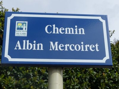
Albin Mercoiret - Nathalie Thomas Albin Mercoiret
Today, he would be over 100 years old. All the inhabitants of St Jean remember this self-taught man, a fervent Protestant, town counsellor, founder of the tourist office, and a butcher by profession. Always smiling in his blue overalls, as solid as the vine stock that he regularly went up the hill to look after, pushing his wheelbarrow and followed by his few sheep. When he wanted to take the train, he sent his children ahead to let the stationmaster know that he would be arriving. Then he walked through the small town greeting his acquaintances while in the distance the locomotive’s whistle sounded impatiently – but the train never left without him.
Description
Starting at “Soudorgues”, walk to “mairie de Sourdorgues” and then to “Les quatre chemins”.
- Continue to “sous Mauripe”, “Serre des Hubacs” and “Col du Mercou”.
- At “Col du Mercou”, walk to “Col de Briontet” (GR®61).
- Continue to “St-Jean du Gard” on the GR®61 via “La Rouvière”, “Jasse d’Alméras”, “La Malaygue”, “La Graussille”.
- Departure : Soudorgues
- Arrival : Saint-Jean du Gard
- Towns crossed : Soudorgues, Peyrolles, and Saint-Jean-du-Gard
Forecast
Altimetric profile
Recommandations
Make sure your equipment is appropriate for the day’s weather conditions. Remember that the weather changes quickly in the mountains. Take enough water, wear sturdy shoes and put on a hat. Please close any gates and barriers behind you.
Report a problem or an error
If you have found an error on this page or if you have noticed any problems during your hike, please report them to us here: