
Chalet de l’Aigle
12 points of interest

Hêtre soudé (anastomose) - © E. Balaye  Flora
FloraTree kisses
Among trees, there is strength in unity. Trees like to merge with others via the roots – it makes them stronger. But here, there are beeches that have grown together at the branch level or even at the trunk. Strange bonds! Try to spot them but do not disturb them.
Boisement sous le Pic Cassini - otcevennesmontlozere FloraFir/beech forest
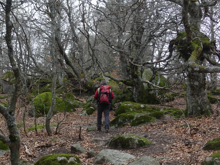
This forest is both protective and productive. Silver firs are grown for timber; beeches (known locally as fayard) for firewood. But above all these trees serve to keep soils in place, break the wind, and stop the snow. The extreme weather conditions in this mountain environment (fog, violent storms, heavy snowfall, droughts) make forest growth unpredictable. The old beeches have been felled; only tall young trees have been kept to regenerate the beech forest. The creeping pines, planted over 80 years ago, are a frugal mountain species that makes do with poor soils.

Carte Cassini du mont Lozère - © Archives départementales de la Lozère 
Cassini
The first geometrical map of the Kingdom of France was realised, at a scale of 1:864,000, on the initiative of Louis XV. It is known as the Cassini Map. The Cassini family produced four generations of scholars. The first Cassini, an astronomer, began to apply a geodesic system that consisted of measuring the position of a point on Earth using bearings, namely the polar axis and the Equator. His descendants established a precise map of France (180 sheets) by triangulating a large number of bearings, such as Pic Cassini. It was used as a model for France's Ordnance Survey maps and today has practical applications in many fields (toponymy, phytosociology, etc.).

Arbre mort - © KARCZEWSKI Gaël FloraMeet a tinder fungus
The fat mushroom stuck to the trunk of an old beech is a tinder fungus, a tree parasite. From above, it looks like a cep cap. Below, fine tubes are full of spores, the little cells that allow the fungus to reproduce. Tinder fungus is totally inedible. So what might it be used for? Once dried, it catches fire at the first spark. Prehistoric humans used it to light their fires.
Sous-sol forestier - © PNC 
The secret life of the subsoil
Did you know that, as you walk through the forest, you are trampling a little-known world? Under your feet a multitude of tiny creatures are tirelessly active: by decomposing organic matter, such as dead leaves, they enable tree roots to absorb nutrients. Without them, there would be no forest. Below the roots, this tree gives you a glimpse of the subsoil. Let us see what it hides.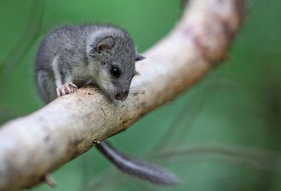
Loir gris - © R. Descamps A real village
During their lifespan, these trees grow crooked, swell, become wrinkled. A ripped-off branch leaves a scar open to bird beaks. Towards the end of its life, the old tree is full of cavities – comfortable nests for small animals. Can you hear a soft whoo hoo hoo in the forest? That is a boreal owl. The black woodpecker carves its nest out of dead wood using its powerful beak. The European edible dormouse, a rather pretty rodent, hides its food stores in holes in old beeches.
Exploitation de bois - © A. Bouissou/TERRA Humans and the forest
In some places, you can see that trees have been felled. Why? The paint marks differentiate trees to be felled from those that will be preserved according to economic and ecological criteria. In the forest at Mas de la Barque, we have to ensure that the forest ecosystem works well. It is a resource to be preserved for the future. Let us watch the forest technician at work.
Rocher de la Barque - © Biotope 
The mysterious boat
Have you noticed the strange rock shaped like a boat (barque)? Is that what gave the hamlet its name? Alternatively, in the local patois, a berque is a gap in the mountain. So: Mas de la Barque or Mas de la Berque?
Mas de la Barque is part of the municipality of Vialas and borders the forest of Gourdouze. The estate of the Priory of Gourdouze, to which the forest once belonged, was declared government property during the French Revolution in 1789, before being sold to pay the state’s debts.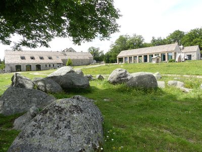
Mas de La Barque - nathalie.thomas Le Mas de La Barque
Le Mas de La Barque was only a forester’s house at the end of the 20th century. From the 1960s onwards, it was frequented by children’s ski clubs and then by families from the Gard on the weekend. During the week, the association “Union pour l'Animation de la Grange” organised field trips, heritage classes and theme days open to all. A costly infrastructure was gradually built (buildings, ski lifts, snow canons), then partly demolished again. Today, as part of an overall programme of reclassifying the site, it has been developed for tourism (cross-country skiing, snowshoeing, dog-sledding, etc.) and is run by a semi-public company. The resort offers outdoor activities in summer as well as in winter.
Drosera rotundifolia - © Yannick Manche 
The peat bog: a world apart
This natural environment is a strange world where only very particular plants survive. Sundew (drosera) is the star of the peat bog. The soil is so poor here that the plant catches insects to feed on; it is carnivorous. The water is very acidic and contains very little oxygen here. When plants die, they do not decompose as well as in the forest. Instead they accumulate to form a thick layer of peat.
Arbres morts - © Mathieu Baconnet The death of a tree
A dying or dead tree makes us a little sad. And yet it regenerates the forest. Once the tree is dead, it still provides refuge for fauna over many years. Its rotting wood feeds legions of small animals, which turn an old forest into a living treasure. The larvae of the bronze carabid devour slugs and snails while the larvae of the longhorn beetle burrow into dead wood.
Groupe au Pic Cassini - otcevennesmontlozere 
Mas de la Barque
The small family ski station of Mas de la Barque was inaugurated in 1968 to meet the expectations of people living locally. But in 1981, there was precipitation but not much snow; in 1982 the winter was mild; 1983 was a very hot year; and 1984 and 1985 were very cold (record: -23.5°C). These climate hazards gradually shifted the station's focus onto cross-country skiing; downhill skiing was phased out from 1994.
Description
Signposts will guide you all along this route. In the description below, the signposted place names and/or directions are given in bold italics between quotation marks:
From “Mas de La Barque”, walk to “Le Pic de Cassini” via :
- “Bois de Bellecoste”,
- “Sous la tête de Bœuf”
- “Col de l’Aigle”. Return to Pic Cassini.
- Then go left towards “Chalet de l’Aigle”.
- At “Chalet de l’Aigle”, return to “Mas de la Barque” via :
- “Sous le chalet de l’Aigle”,
- “Lous Felzillas”,
- “La roche fendue”,
- “Sous la roche fendue” 2x,
- “Gardione” 2x,
- “Rochers de la Barque” and “Les écuries de Mas de la Barque”.
This hike is taken from the guidebook Mont Lozère - Pays des sources, Sommet des Cévennes published by the Pôle de pleine nature du Mont Lozère.
- Departure : Mas de La Barque
- Arrival : Mas de La Barque
- Towns crossed : Pont de Montvert - Sud Mont Lozère, Pourcharesses, Concoules, and Vialas
Forecast
Altimetric profile
Recommandations
In the summer, you may encounter flocks of sheep and patous (livestock guard dogs). Seek advice on how to behave near these dogs from tourist offices and National Park information centres.
Make sure your equipment is appropriate for the day’s weather conditions. Remember that the weather changes quickly in the mountains. Take enough water, wear sturdy shoes and put on a hat. Please close gates and barriers behind you.
Information desks
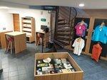
Tourism'house and national parc, Génolhac
Place du Colombier, 30450 Génolhac
This office is part of the National Park's associated tourist-information network, whose mission is to provide information on, and raise awareness of, the sites and events as well as the rules that must be observed in the National Park's central zone.
Open from april to october
Tourism office Des Cévennes au mont-Lozère, Vialas
1 place de l'ancienne gendarmerie, 48220 Vialas
This office is part of the National Park's associated tourist-information network, whose mission is to provide information on, and raise awareness of, the sites and events as well as the rules that must be observed in the National Park's central zone. Open July and August
Tourism office Mont-Lozère, Villefort
43, Place du Bosquet, 48800 Villefort
This office is part of the National Park's associated tourist-information network, whose mission is to provide information on, and raise awareness of, the sites and events as well as the rules that must be observed in the National Park's central zone.
Open year-round
Le Mas de la Barque outdoor centre
48800 Villefort
This centre is part of the National Park's associated tourist-information network, whose mission is to provide information on, and raise awareness of, the sites and events as well as the rules that must be observed in the National Park's central zone.
Access and parking
From Villefort, on the D66 (25 min).
From Génolhac, on the D362 then the D66 (30 min).
Parking :
Source


Report a problem or an error
If you have found an error on this page or if you have noticed any problems during your hike, please report them to us here: