
GR® 68, the Mont Lozère circuit
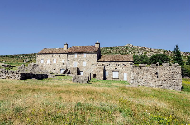
Whether with family or friends or on your own, discover the scenery of Mont Lozère. Amidst contrasting landscapes, this path reveals many elements of agropastoralism: drovers’ roads, terraced cropland, farms, open areas, itinerant shepherds, sheep… You will be hiking on old mule tracks, now disused in favour of more comfortable routes, passing belltowers, which bear witness to a time when the rude winters cut off villages from all outside contact. This is a solitary country of heath and granite, but also an authentic one, where a welcome always awaits you.
42 points of interest


The fairs at Villefort
Since 1511, Villefort market has been held on Thursday mornings. In the early 19th century, there were up to 14 fairs a year. Children had to attend mass at Saint-Loup-et-Saint-Roch Chapel to be allowed to go to the fairs. Large crowds were attracted to the fairs by their good reputation. The fair held on 14 September was one of the most impressive, with countless cattle blocking the village's squares and lanes. Today, Villefort is a lively place with bric-a-brac shops and artisan fairs.

Religious buildings and pilgrimages
Rue de Rome leads to Saint-Jean Chapel, also called gleisetto (little church). In the Middle Ages, sick pilgrims or pilgrims looking for a roof for the night were welcomed in this former Romanesque chapel-turned-residence. A leper colony was attached to it. Further north, Saint-Loup-et-Saint-Roch Chapel overlooks the Lake. It was built to look exactly like a Romanesque edifice of the 12th or 13th century, on the precise site where a hermit, who had followed the example set by St-Loup, had his shelter. It has been restored several times. St-Loup is the region's patron saint; St-Roch has been associated with him since the 1720 plague. Two pilgrimages persist to this day: on 29 July for St-Loup and on 16 August for St-Roch.

River network
The river Palhères flows through Villefort on its way down from Mont Lozère. It goes through one of the two mismatched Gothic arches of Saint Jean bridge. This humpback bridge dates from the 14th century. Two rivers flow through the centre of the village, under Place du Bosquet. Having become unsanitary after being used as drains and latrines, they were vaulted over for reasons of hygiene in 1934. This created both the square and Rue des Jardins.

Lavoir de Villefort - OT Mont Lozère Lavoir
This 19th-century granite washing place has two basins. Laundry was beaten in the large basin using a washing bat, then rinsed in the clear water of the smaller basin which was fed by the river. You can still see the traces of soot from the stoves used to boil water. This lively site, where the grievances and joys of the washerwomen resounded, was in use until the 1950s.
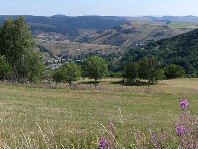
Cubières depuis le Causse - nathalie.thomas Cubières
This village, which was founded long ago, owes its name (cubereis) to the copper that the Gallo-Romans mined here. In the Middle Ages, under the protection of the local lord, villagers had to mill flour and then bake their bread in the shared bread oven, which was the property of the Seigneur du Tournel. Whenever they did so, he received a tax called the ban. This feudal right was abolished during the French Revolution, and the oven simply became the village oven.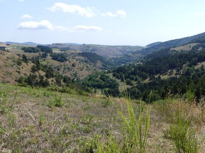
Le Rieutord - © Nathalie Thomas 
The Rieutord
This brook is the Rieutord, which flows into the Altier, a tributary of the Chassezac. Amateur geologists will notice that you are here on the boundary between a limestone pocket on the right, schist (slate) on the right and granite at the summit. The three bedrocks determine the landscape and its vegetation. The limestone is a maritime memento from the Jurassic. The schist was formed in the heat of considerable depths and pushed to the surface by earthquakes during the Quaternary Period. The granite is former magma that made its way through the schist from deeper still to become the surface of Mont Lozère.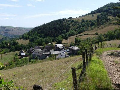
Neyrac - nathalie.thomas Mule trains
You are at a crossroads; one of the tracks is the former road from Mende to Villefort, which veers off the Route des Arvènes (the Régordane) at La Maloutière (as you leave Villefort). How many mule trains – convoys of at least six laden mules – passed here over the centuries, their bells ringing! The mule drivers passing in their caravans brought life to the village and gave Cubières a look of prosperity. The village road was very commercial, aligning inns and shops.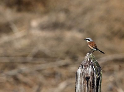
Pie-grièche écorcheur - Régis Descamps  Fauna
FaunaPasserine birds
Open spaces with a few trees and bushes favour passerine birds. Passerines are the largest and most varied order of birds, containing over half of all bird species. The red-backed shrike in particular likes this environment, which abounds in the large insects that constitute its main food source. The shrike is strictly migratory and hibernates in eastern Africa.
La croix des missions - Nathalie Thomas The “mission” cross
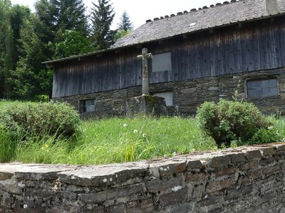
In the municipality of Le Bleymard, there is a large number of crosses and other small religious heritage elements, which bear witness to inhabitants’ fervour in the old days. You will see them as you enter villages, on main squares and at crossroads, to protect the walker and ploughman. Offerings sometimes took the form of crosses, which were then called “mission” crosses.

locher de tourmente des Sagnes - © Guy Grégoire Blizzard belltowers
Caught in a violent storm, peddlers, farmers or the local abbot might hesitate over which track to take in the fog. Perhaps they missed a turning. Then they would hear the tolling of the invisible but reassuring bell, signalling the right way. The Serviès belltower is unique in having a shelter, which kept the bell ringer dry and comforted the passer-by. These small belltowers were also used to ring the Angelus bell in the morning and evening. It was also said that, as well as saving lost travellers, their sound waves kept hail away. The bishop of Mende prohibited this practice which, he declared, had more to do with superstition than observation. (B. Mathieu)

Pierre des trois paroisses - © Eddie Balaye 
Three-Parish Stone
Marker 1
The most majestic menhir in this sector is known as the Three-Parish Stone because of its location at the point where the municipalities of Les Bondons, Ispagnac and Saint-Etienne-du-Valdonnez meet. There are many hypotheses as to the origins of the menhirs, ranging from the very rational to the very esoteric, but the stones retain a large share of mystery. Often weighing several tonnes, they were extracted, shaped and moved – in some cases over distances of several kilometres – before being erected. For what purpose? Archaeology allows us to find clues to the daily life of prehistoric humans; their world view and spirituality, however, remain largely unknown.
Puechs des Bondons sous la neige - © Jean-Pierre Malafosse Puech d'Allègre and Puech de Mariette
Marker 2
These natural eccentricities with their generous proportions have reminded some of female forms. Were they at the origin of a fertility cult connected also with the menhirs and their phallic silhouettes? According to one legend, it was Gargantua who created the puechs by scraping dirt off his clogs. Geologically, the Cham des Bondons is part of the Causse de Sauveterre, to which it is connected by the Col de Montmirat pass. The limestone cham sits atop the granite bedrock of the Mont Lozère and offers remarkable landscapes, notably the Eschino d'Aze with its donkey's-back appearance, and the puechs, buttes of fossil-rich black marl.
Dolmen des Combes - © Eddie Balaye Dolmen at Les Combes
Marker 3
Of the megalithic monuments, dolmens (megalithic portal tombs) tend to be better-known than menhirs. They were linked to funeral practices from 3500 BC (end of the Neolithic) to 200 BC. The dead were deposited in these collective tombs alongside personal objects. Funeral practices offer precious clues for understanding the beliefs and organisation of ancient societies. These monuments are often located in spots that dominate the surroundings, and would certainly have reminded the living of the dead.
L'horizon des causses - © Olivier Prohin 
Panoramic viewpoint
Marker 4

Menhirs de Chabusse - © Eddie Balaye Chabusse
Marker 5
The Chabusse berm, which cuts abruptly across the slope, has three handsome menhirs and a fourth modest and incomplete one, and also bears other traces of successive settlement. Dr Charles Morel, who published the first menhir inventory of the Cham des Bondons, reported that a large axe made out of polished granite was found here. This, in addition to other objects found more recently (shaped flints, arrowheads, scrapers, etc.), shows that the area was inhabited at the time of the menhirs. On the same site, excavations of two tumuli uncovered human remains from multiple burials and/or bone burials, along with objects dating from the Bronze Age to the beginning of the Roman occupation.
Gorges depuis la combe des Cades - © Guy Grégoire Constructing landscapes
Marker 8
Did the menhir-builders move in the same landscape that we see today? Current archaeological knowledge does not allow us to reproduce with great accuracy what the landscape of Mont Lozère’s slopes would have looked like in the late Neolithic. Yet the birth of agriculture and livestock rearing in the Neolithic without doubt opened a new chapter in the relationship between humans and nature. For the first time in their history, populations designed the landscape by dotting it with monuments, but more importantly by developing agricultural and pastoral activities. Today – 5,000 years later – human interventions are carried out based on Natura 2000 measures, which focus notably on keeping open spaces intact and maintaining agro-pastoral activities.
Les Puechs des Bondons vus du Rocher des Laubies - © Jean-Pierre Malafosse Mines and menhirs
Marker 6
The region is scattered with geological faults, which are responsible for the presence of ores. Locally there is predominantly barite, but also zinc and silver-bearing lead. Scientific analyses carried out in local peat bogs demonstrate that lead was being mined 2,500 years ago and again a thousand years later. Recently a uranium deposit was mined in the municipality of Les Bondons. The fact that menhirs stand just above the seam has led some people to associate megalithism with the hypothesis of magnetism, though there is no scientific proof for this. Recent research has shown that the choice of location for menhirs is mainly linked to the way territory was organised at the end of the Neolithic.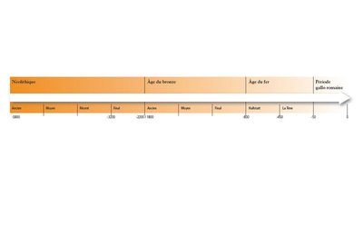
Chronologie de la Préhistoire - © Olivier Prohin Les Combettes
Marker 7
The village of Les Combettes is built in a natural depression, as its name indicates (combette = little valley). The exhibition on display in the communal oven building emphasises how late Mont Lozère was first settled. By the Upper Neolithic (around 3500 BC), the region of the Grands Causses was widely settled, following a population increase. The first agro-pastoral communities formed, creating farms and villages and clearing land to grow cereals and breed livestock, whilst still hunting and gathering. These groups are behind local megalithism. The age of metals put an end to the practice of erecting menhirs, but dolmens were in use for a while longer.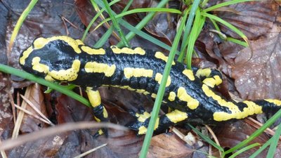
Salamandre terrestre - © Nathalie Thomas FaunaFire salamander (Salamandra salamandra)
This nocturnal animal has large black eyes. On its back, its smooth black skin has a pattern of yellow (sometimes orange or red) points or lines. The pattern is different for each individual and makes it possible to identify them. The thick shiny skin has many glands, which secrete a fine layer of mucus containing a neurotoxin that acts when it comes into contact with mucous membranes. These secretions primarily serve to suppress the growth of bacterial and fungal infections on the animal's moist skin (bactericidal and fungicidal properties).
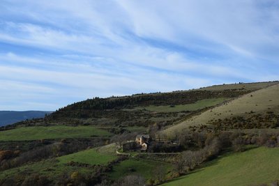
Le manoir d'Issenges - © CC Florac Sud Lozère 
The Manoir d'Issenges
This fortified house, built from 1624 onwards, is an example of a type of rural seigneurial estate inherited from the Middle Ages. The complex consists of three buildings: the main building with its almost square ground plan, and two long and low wings of farm buildings, which together enclose a courtyard open to the gardens to the east. The entrance is via an archway located at the southern corner of the main building. This building must have had four corner turrets, a projecting tower in the centre that contained the spiral staircase, and an entrance topped by a pediment. This fortified look was reinforced by musket slits and a parapet, or at least a brattice over the entrance gates. The turrets have been demolished and the central tower reduced in height. The mullioned windows have been preserved. A stone shows the date of 1624.
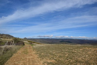
Draille de la Margeride - © CC Florac Sud Lozère 
The draille de la Margeride
The ascent to Issenges is on the draille de la Margeride. A draille is a path used by herds of goats during the transhumance: moving up to the mountain pastures in June and coming back down again in September.

Troupeau de brebis - © com com Florac Sud Lozère Transhumant history
“I moved my sheep to summer pastures all the way in the Margeride. I'm from up there myself. When I was a kid, there were many of us in the family, and whenever we saw a transhumant [seasonally migrating] shepherd pass by, my dad would say: one day you'll have to go off with a shepherd... I left and became a transhumant shepherd. My first stopover was Bonperrier. Then we'd eat at L'Hospitalet, and go down to Florac for the night. I moved pastures with 4,000 sheep.”

Château d'Arigès - © com com Florac Sud Lozère Château d’Arigès
This can be seen on your left, in a gap in the forest. It was only a share-cropping farm, whose buildings were in ruins, when the Lord of Issenges bought it in 1658. He lived in it from 1688. This Château, which is no doubt more comfortable than the « maison carrée » (“square house”), was built in a river bend of the Tarn and is surrounded by fertile soils well-suited for crop-growing.
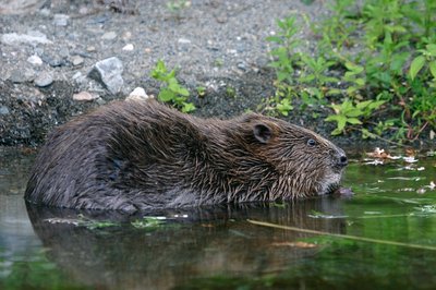
Castor au réfectoire - © Bruno Descaves FaunaThe European beaver (Castor fiber)
The calm deep stretches of the Tarn are good areas to settle for the European beaver, which lives in a lodge dug into the river bank. An essentially vegetarian animal, it bases its diet on cellulose. It eats young shoots, bark, aquatic plants, and foliage that is abundant in the riparian forest. It is thus useful in regulating the woody vegetation of river banks, facilitating the development of riverside fauna and flora. Through its activities, it prevents the potentially dangerous accumulation of dead wood during floods. It does not build dams.

Vigne à Molines - © jean Pierre Malafosse The vines of Florac
Some vines still grow at the edges of paths or cling to trees and scrub; a few people still make their own wine. But today it is an anecdotal activity. Florac was once encircled by grapevines growing on terraces, and every farmer made several hundred litres of wine. But in around 1945, rural flight and the arduousness of the work led to these vine arbours being abandoned. In 2003, two wine-growers moved to Ispagnac, and viticulture was reborn.

Vue sur le Lempezou et Florac - © CC Florac Sud Lozère Summit of Mont Lempézou
Mont Lempézou is the mountain overlooking Florac and the Tarnon valley. From the Col (pass) of the same name, you can take a path to the summit. Panoramic views over the three valleys (Tarn, Tarnon, Mimente) will give you a better idea of the local hydrography.

La Draille du Languedoc - otcevennesmontlozere The Languedoc draille
This draille (path for seasonal livestock migration) is known as the Languedoc draille and has seen tens of thousands of sheep pass by that have come up the many drailles from the Midi, combining into ever larger flocks before reaching the summer pastures on the Mont Lozère plateau. The plant cover, grazed and trampled by so many sheep, had no time to grow back. A few flocks and a few shepherds still keep the tradition alive. Other flocks are brought to the summer pastures by lorry.

Boisement du Bougès sud - © Guy Grégoire  Flora
FloraThe Bougès state forest
This covers an area of about 3,300 hectares. Reforestation was carried out between 1880 and 1925, at the beginning of the agricultural decline, to fight the erosion caused by over-grazing. Today, the Office National des Forêts manages this forest, primarily with the goal of protecting the different forest species and ecosystems, but also with a view to making it productive. The forest is made up of a number of tree species, including spruce, silver fir, larch and Corsican pine. A varied fauna inhabits the forest (deer, wild boar, birds of prey). A few capercaillies, re-introduced by the Cévennes National Park, live in these wide open spaces. (Julie Hugon)

Gourdouze - nathalie.thomas Gourdouze
In the 14th century, this village was a priory of Castagnols parish. In 1906 all its thatched roofs burned down. Parts of the village were bought by a private individual in the 1960s who greatly modified them. It subsequently became the property of the Cévennes National Park, which sold 250 hectares back to a Mont Lozère livestock cooperative: their herds maintain the space. The cooperative manages 1,200 hectares at Mas Camargues and Gourdouze. These uplands receive sheep and cattle herds from 15 May to 15 November.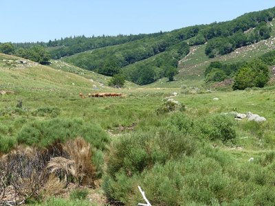
Troupeau au dessus de Gourdouze - nathalie.thomas 
Slash-and-burn
This technique consists of clearing weeds and shrubs using fire: the fire is utilised to get rid of broom, especially in places that a motorised shredder cannot access. Slash-and burn is carried out every 4 to 5 years in a zone chosen by the farmer. Over larger areas, it is supervised by the fire brigade. In the 19th century, 100,000 sheep migrated to summer pastures here (transhumance) and joined the plateau herds, leaving no room for broom. As soon as the meadows are no longer grazed, they are colonised by broom, then shrubs, then forest. These open spaces are due to human activity (clearing) to allow herds to graze on grass. Grazing prevents the spontaneous growth of shrubs and any generalised invasion of forest.How the village is arranged
Located at an altitude of 605 m, Villefort developed as a one-street village alongside the Regordane Way (now known as Rue de l'Eglise and Rue de la Bourgade). In the 19th century, a main road was built through Villefort and became its main traffic artery. Today it is called Avenue des Cévennes.
The Paris to Marseille railway line
From 1865 onwards, the P.L.M. (Paris-Lyon-Marseilles) Company constructed the railway line that the Cévenol train still uses to link Paris and Marseilles via Clermont-Ferrand, Alès and Nîmes. The line helped to open up the area and was thus a real asset for the towns located along its path in the Lozère. New occupations were created: P.L.M. employee (during construction) or dispatcher of local products (e.g. chestnuts from the Borne valley). But the disappearance of mule trains struck a blow at the local economy, in particular craftsmen and innkeepers.
Place de l'Ormeau
Villefort's former market square, Place de l'Ormeau hosted Clédou market on Thursday mornings until the 1980s. The square teemed with smells and colours. Livestock, meat, vegetables, grains and chestnuts were sold here, especially in the 19th century. The lime tree on the square was planted on 11 November 1920 as a “victory tree” so that future generations might remember their ancestors' fight for freedom during the First World War. The Maison Chambon, with its double-archway entrance, has an inscribed lintel: Metre Iehan Martin 1595, flanked by a diamond shape and a heart.
The sweet chestnut
In 1900, sweet chestnuts were the main farm produce. The nuts of this so-called “bread tree” fed many families as well as their farm animals. Chestnut-growing is a year-round activity, but is especially busy at harvest time. Harvesters would meet in the evening for a brousillade (chestnuts roasted on a wood fire). When parts of the rural population left, many chestnut orchards were abandoned while others were cut down for their tannin to be extracted. Chestnut bleeding canker and chestnut blight, diseases caused by mushrooms, also killed off a great number of trees. Today, chestnut farming in the Cévennes is being revived with a focus on quality.
The tourism boom
Villefort dam, located a kilometre north of the village, was filled on 14 July 1964, creating an economic alternative to agriculture. Tourist activities developed: fishing, swimming and water sports. Local tourism is also founded on the canton's abundant natural heritage, with a great number of hiking trails, canyoning in the Chassezac gorge, skiing at the Mont Lozère ski stations, etc.
Rue de l’Église
The town hall is a former private mansion of the 15th century, with a spiral staircase and ground-floor rooms with vaulted ceilings. The lintel behind the gate comes from a fortified house in the village of Bayard, which is now under the waters of the Lake. On the facade of the 16th century house opposite is a finely crafted mullion window.
• The oldest house in the village is a listed monument and dates from the 14th century. It has Gothic windows and a pulley system once used to bring forage into the loft.
• An archway giving onto an internal courtyard shows you mediaeval walls made from large regular blocks.
• Two lintels bear Christ's monogramme: IHS, Iesus Hominum Salvator (Jesus saviour of mankind). One instance is followed by the inscription Ave Maria.Stone architecture
The architecture of Villefort's old buildings is typical for one-street villages:
• the houses with the two vaulted porches were once inns, tradesmen's or artisans' shops: one of the porches was used to store merchandise, the other to display it;
• the sculpted lintels above the entrances to some houses on Rue de l'Eglise and Rue de la Bourgade bear witness to the activities of former occupants;
• several facades have handsome mullioned windows from the Renaissance.Troubled times
Villefort was embroiled in the religious wars of the 16th and 17th centuries. In 1629, Henri de Rohan besieged the village. Rue de la Bourgade was torched by the Huguenots. In the 17th century, town walls were built around Villefort, which were demolished between 1808 and 1813. During the French Revolution, heraldic shields recalling the Ancien Regime were chiselled off walls, testament to the locals' hatred of their lords. A cross on Place du Portalet is a reminder of the 1794 execution of a defiant priest from Saint-Frézal-d'Albuges. The First World War caused many local casualties. During the Second World War, Villefort was occupied by the Germans. A resistance movement nevertheless emerged in the area, consisting of many different groups.
The Regordane Way
The Regordane Way linking Alès (Gard) and Luc (Lozère) is a section of the important route that connected Lower Languedoc and the Auvergne in the Middle Ages. It facilitated trade between the Mediterranean basin and parts of the Kingdom of France. The mule-drivers that used it – known locally as Régordans or Rigourdiers – transported oil, wine and salt. It was also a religious path, taking pilgrims called Romieux to Saint Gilles It was progressively abandoned in the 14th century, when the port at Marseille and the fairs in Lyon grew in importance. Ruts left by cartwheels can still be seen north of Prévenchères (between Le Thort and La Molette) and near Saint-André-Capcèze.
Merchants and craftsmen
Local crafts first emerged in the Middle Ages. In the late 18th century, lead mining began in the area, affording farmers another source of income. A foundry was built upstream of the village. A century later, the attraction of industry and the city led to a rural exodus and the decline of trade and crafts.
The origins of Villefort
In the Middle Ages, Villefort was known as Villa Montisfortis, a name that might stem from a former Roman agricultural estate. At the time, a castle overlooked the village, of which nothing remains today. This castrum was strategically located on the heights of Le Collet (at the southern exit of Villefort) to protect the Regordane Way – and to collect tolls.

Villefort, rue de la Bourgade, maison de forgeron, enseigne sculptée - © Guy Grégoire Rue de la Bourgade
At the southern end of Rue de la Bourgade is the birthplace of Odilon Barrot (1791-1873), an eminent barrister at the Toulouse parliament and the court of appeal, parliamentarian, president of the council of ministers, etc. A plaque was put up on the wall in 1991. In this street, you can also see two lintels dated 1617 and 1620 respectively, as well as a third that has been sculpted to indicate a blacksmith's workshop (on a house near Avenue de la Gare).
Description
All information on the whole route can be found on the site monGR.fr of the French hikers’ federation, the Fédération française de la randonnée pédestre. Map ref. IGN 2739 OT.
- Departure : Villefort
- Arrival : Villefort
- Towns crossed : Villefort, Pourcharesses, Altier, Cubières, Cubiérettes, Mont Lozère et Goulet, Saint-Étienne-du-Valdonnez, Les Bondons, Bédouès-Cocurès, Florac Trois Rivières, Pont de Montvert - Sud Mont Lozère, Cans et Cévennes, Cassagnas, Saint-André-de-Lancize, Saint-Privat-de-Vallongue, Vialas, Génolhac, Concoules, Ponteils-et-Brésis, and Saint-André-Capcèze
Forecast
Altimetric profile
Recommandations
NB: For various reasons, the waymarked path may differ from that shown in the topographic guidebook: please follow the waymarks on the trail. Make sure your equipment is appropriate for several days of hiking as well as the day’s weather conditions. Remember that the weather changes quickly in the mountains. Take enough water, wear sturdy shoes and put on a hat. Please close all gates and barriers behind you. As you approach any flock of sheep, be aware that they have guard dogs (patous): get information from a tourist office or National Park information centre on how to behave around these dogs. Bivouacking alongside GR trails in the National Park’s central zone is regulated and, on some stretches, prohibited.
Information desks

Office de tourisme Des Cévennes au mont Lozère
le Quai, 48220 Le Pont de Montvert sud mont-Lozère
Ouvert toute l'année (se renseigner pour les jours et horaires d'ouverture en période hivernale)

Tourism office Mont-Lozère, Villefort
43, Place du Bosquet, 48800 Villefort
This office is part of the National Park's associated tourist-information network, whose mission is to provide information on, and raise awareness of, the sites and events as well as the rules that must be observed in the National Park's central zone.
Open year-round
Transport
Bus
- Line 251 Florac - Mende
- Line 253 Mende - Mont Lozère
- Line 261 Mont Lozère - Pont de Montvert - Florac
https://lio.laregion.fr/
- Train line: Clermont-Ferrand - Nîmes (Villefort - Génolhac)
Access and parking
Villefort on the D 906 from Génolhac or the D 901 from Le Bleymard.
Parking :
Source


Report a problem or an error
If you have found an error on this page or if you have noticed any problems during your hike, please report them to us here: