
La haute vallée Borgne - Escapades à vélo
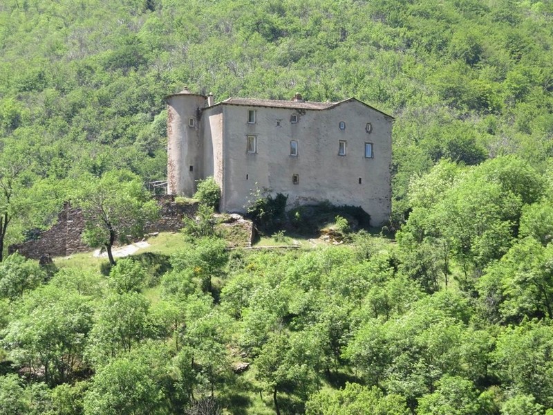
This ride through the upper Borgne valley showcases its mediaeval châteaux and their mysteries. You can admire the Château du Folhaquier and the Château de La Fare on the ridges, the Château de l’Hom blending into the chestnut and beech trees, and the Château du Poujol reaching for the sky…
14 points of interest
© Béatrice Galzin Well-supplied
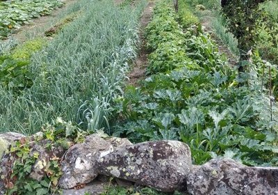
Cévenol gardens are supplied by béals (little canals), which bring water from rivers or springs to cultivated land. The latter is usually laid out in bancels (terraces). By retaining the soil, the low walls make it possible to have level plots and deeper soils. Water can seep into the ground slowly and remain there for longer.
Le village de St André de Valborgne - Béatrice Galzin 
The village of St André de Valborgne
As you stroll along the quay above the river, you can still see the handsome bourgeois houses dating from the silk boom. If you look around, former spinning mills and industrial buildings dedicated to silk farming can still be seen in the landscape. A little lower down, opposite the 16th century château, you can listen to
Bernadette Lafont on the Camisard saga in and after 1702. As you reach the square again, quench your thirst at the fountain and have a look inside the Romanesque church (12th century).
Calade - © Béatrice Galzin Two in one
This cobbled path going uphill is a calade. It is not only a path but also a brook, allowing rainwater to be evacuated. Caution: slippery when wet!
© Béatrice Galzin 
One spring, five fountains
This fountain is one of Saint-André’s five public fountains, all of which are supplied by the same spring (its water is thus the same as in the Fontaine du Griffon). Before houses were connected to mains water, there were many more fountains on this side of the quay.
© Béatrice Galzin The gardonnades
The village benefits from the water that the Gardon brings – but it also has to put up with the river’s sporadic bad moods. Abundant rain can rapidly raise river levels. It is often in autumn that the torrent overflows its banks. The worst floods can have dramatic consequences in both material and human terms. Many can still remember the floods of September 1958 and 2002, which caused much damage.
Fontaine du Griffon - © Béatrice Galzin Water!
The Griffon fountain is known for its pure water, which will quench any walker’s thirst. In the old days, the whole neighbourhood used it not only for drinking but also for cooking, washing, washing clothes, watering plants, etc. The fountain was not only a supply point but also an important meeting-point in village life.
© Béatrice Galzin 
The age of silk
From the 19th century onwards, the silk industry developed in the Cévennes: tanneries gave way to spinning mills. The mills used water not only to treat the silkworm cocoons (which were boiled to prepare the silk) but also for the steam-driven spinning machines. In the second half of the 19th century, diseases strongly reduced silk production, which was also subject to competition from foreign silks and then from artificial silk. The silk industry went under in 1965.
© Béatrice Galzin 
Traces of giants?
“Giant’s cauldrons” have formed in the rock at the base of the waterfall. These regular, rounded cavities are only created in rapidly flowing waters. They are caused by the repeated friction of stones caught in a depression and moved by swirling currents.
Les ruines du château de la Fare - capri’ces des Cévennes Château de la Fare
Following on from many battles against the Château du Folhaquier, today all that is left of the large mediaeval castle of the Lord de la Fare is this expanse of wall. Built at the summit of a schist hill, the castle is surrounded by sheer drops on all sides. The former village was fortified and located just below the expanse of wall. Sources indicate that the castle had a drawbridge and a chapel.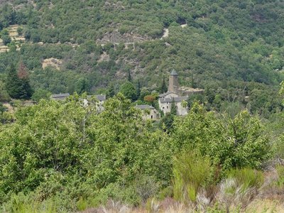
Le château du Folhaquier - Nathalie Thomas The mediaeval castles
Very close to the village of St-André de Valborgne, on the edge of a cliff, stand the remains of the castrum of La Fare, a defensive castle believed to date from the 12th century. Only a wall face of the tower survives. The ruins above bear witness to the site’s importance. The archives mention a well, cistern and drawbridge – but on site nothing remains. On the next spur is the majestic and dominating castle of Le Folhaquier. Transformations throughout the centuries by various owners have shaped the hamlet as we see it today. The era of silk farming strongly influenced the landscape by welcoming the “tree of gold”, the mulberry tree.
Hameau du château du Folhaquier - Béatrice Galzin Château du Folhaquier
The Château du Folhaquier is outlined on this small ridge, which was a strategic site in the Middle Ages, overlooking the Gardon de Saint-Jean river and the Château de La Fare opposite.
It is separated from the hamlet by a ditch cut into the schist bedrock, and a square tower can still be seen that was built in the 16th century on 12th century ramparts, as well as the vestiges of a round tower at the other end. The foundations of the castle chapel are easy to distinguish, and the Romanesque church of Notre-Dame du Folhaquier, which remains in an excellent state, has withstood the elements for almost a millennium.
Le château de l'Hom - Béatrice Galzin The castles of the upper Vallée Borgne
The Château du Poujol is the last castle of the Vallée Borgne. It is located under the rocky ridge of the Can de l’Hospitalet to the north and the Col Salidès to the south. It was built in the 13th century on a rocky spur to watch over the valley. Locals laid out many terraces around the site, which gives you an idea of agricultural life in the Cévennes.
The Château de l’Hom sits in lush greenery. It is first mentioned in 1401. Many lords have left their trace in the architecture, but not only there. In 1826, an assassination took place on this spot, in connection to a goat’s ear cut off in punishment for eating the lady’s flowers…
le château de Nogaret - Sabine Keller The Château de Nogaret
Built in the 11th century, the Château de Nogaret stood on the only road linking Saint-André de Valborgne with Le Pompidou. It is believed to have been constructed to serve as a stronghold and to defend the Vallée Borgne. It was set alight in 1628 during the war between the Duke of Rohan and Louis XIII, and again in 1704 by the Camisards, before being rebuilt in the 18th century. This private property still belongs to the Manoel de Nogaret family.
“This small château is one of the finest examples of the fortified manor houses built towards the end of the Middle Ages by minor local lords wanting to free themselves, at least symbolically, from domination by their feudal overlords.” (Isabelle Darnas - Les châteaux médiévaux en Cévennes).
© Béatrice Galzin The tanners’ district
La Calquière district gets its name from that of the ditches in which the tanners soaked their animal skins with limestone, which is called cauç or calç in Occitan. All along the Gardon there were tanneries because its acidic water was good for rinsing the skins, which was indispensable for obtaining high quality products.
Description
From St-André de Valborgne, take the D907 towards Florac,
- Go downhill to Bassurels on the D10A, via Les Salides.
- Turn right to Le Pont Mares / St-André on the D10a.
- Return to the village of St-André de Valborgne on the D10.
- Departure : St-André de Valborgne
- Arrival : St-André de Valborgne
- Towns crossed : Saint-André-de-Valborgne and Bassurels
Forecast
Altimetric profile
Recommandations
Before committing yourself to a circuit, ensure that it is suitable for your activity level and ability. Respect traffic laws and other road users; stay in control of your speed and trajectory. Make sure to be seen and travel in single file when in a group. Remember that the weather changes quickly in the mountains. Take enough water. Safe trip !
Information desks

Tourism & national parc'house
Col de la Serreyrède, 30570 Val d'Aigoual
The Maison de l'Aigoual houses the tourism office Mont Aigoual Causses Cévennes and the Maison du Parc national. This visitor centre provides information on and raises awareness of the Cévennes National Park, its sites and events as well as the rules that must be observed in the National Park's central zone.
On site: changing exhibitions, video projections, Festival Nature events and shop Open year-round

Tourism office Mont Aigoual Causses Cévennes, Saint-André-de-Valborgne
les quais, 30940 Saint-André-de-Valborgne
This office is part of the National Park's associated tourist-information network, whose mission is to provide information on, and raise awareness of, the sites and events as well as the rules that must be observed in the National Park's central zone.
Access and parking
From St-Jean du Gard, take the D907 to St-André de Valborgne, via L’Estréchure and Saumane.
From Florac, take the D907 towards St-Jean du Gard via Vébron, Les Vanels and Rousses to reach St-André de Valborgne.
Parking :
Source

Report a problem or an error
If you have found an error on this page or if you have noticed any problems during your hike, please report them to us here: