
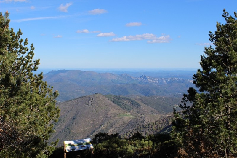
MTB 10 - La Luzette – graded red
10 points of interest

Village de l'Espérou - Béatrice Galzin 
The village of L’Espérou
The village of L’Espérou lies on the border of Dourbies and Valleraugue local councils. A draille (track for livestock to migrate to summer pastures with their shepherds) crosses the village. As in many villages in the Gard, the two places of worship – one Catholic, the other Protestant – are opposite each other. The village is located in a varied environment that is suitable for outdoor activities and sports.

feuille de hêtre - © Emilien Herault  Flora
FloraFrom flower to fruit ...
The beech is a monoecious tree, meaning that female and male flowers are distinct but occur on the same tree. They flower in April and May; insects carry the male reproductive cells (the pollen) to the female cells.
After pollination, the flower produces seeds enclosed in soft-spined husks: beechnuts. Every three to five years, in autumn, an adult beech disperses thousands of seeds.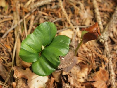
© Philippe Raichaud FloraFrom the seed to the tree
Because most seeds are rich in oils, they are devoured by famished animals in the winter: squirrels, field mice, wild boar, jays, chaffinches… Any seeds still on the ground the following spring can start germinating.
© Mathieu Baconnet 
Timber from stumps
Beech trees regenerate very easily; their regrowth is a number of shoots grouped together on the same stump. In the old days, this method (coppicing) was much used to obtain firewood. On the northern slope of Aulas mountain, foresters turned the former coppices into timber plantations on stumps: the new trees with their straight boles were a steady supply of wood for packaging (crates). Since the closure of these companies, the beeches have only been commercialised as firewood.
© Gaël Karczewski 
The profession of forester
The forester is a silviculturist, meaning that s/he cultivates the forest to ensure that it is vigorous and healthy. The forester intervenes at all stages in the trees’ life cycle to encourage or oppose natural evolution, depending on the objectives. Sometimes that means momentarily protecting a species dominated by rival plants, for instance by clearing beech seedlings threatened by brambles or young firs. When a plantation reaches maturity – at about 70 years – the forester supervises fructification to make sure there are abundant flowers receiving sufficient light…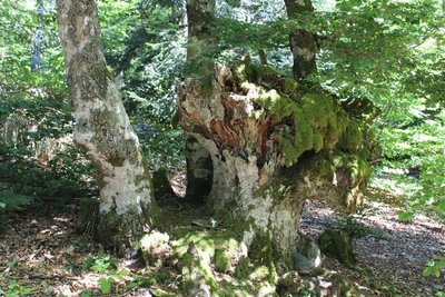
© Valère Marsaudon FloraA genetic conservatory
This parcel, no. 308, is an official Conservatory of Genetic Resources. Its trees are vigorous and thus well adapted to the soil, climate and altitude conditions. These qualities of adaptation to the environment are inscribed in their seed, which is why some of their beechnuts are liable to be collected, dehydrated and preserved so as to be used to regenerate the beech forests of the Aigoual massif, if necessary.
Chouette de Tengmalm - © Régis Descamps  Fauna
FaunaA little treasure!
The evolution of plantations, and of handsome beeches with straight boles, is favourable to certain animal species. They include a discreet little owl, 25 cm tall and weighing less than 200g, which resettled the Aigoual massif in 1990: the boreal or Tengmalm’s owl. Nesting trees are marked with yellow paint, and an official period of peace and quiet applies to areas of reproduction from 1 January to 31 July, during which all forestry is forbidden.
lobaria - © Bruno Descaves An ancient forest
Some species, such as the Lobaria pulmonaria lichen, which grows very slowly, are good indicators of a forest’s age. Likewise, some species of herbaceous flora, for instance woodrush, are noticeably more abundant in old forests than in recent forests.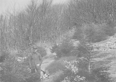
© M Nègre (1923) The south-facing slope
Over the centuries, the south-facing slope of Aulas mountain was cleared for pasture, leaving the bedrock bare in places. In the late 19th century, foresters replanted the slope with spruce. These pioneer trees slowly re-established a forest floor and, in their shade, beechnuts germinated. Foresters are now guiding this stand towards a mixed plantation of beech and fir.

The watershed
The watershed goes through the village of L’Espérou. This natural limit is also the border between the two municipalities of Val d’Aigoual and Dourbies. The rain that falls on and runs off the Valleraugue side continues to the Mediterranean. The water that flows towards Dourbies does not follow the same route and ends up in the Atlantic…
Description
Signposts will guide you all along this route. In the description below, the signposted place names and/or directions are given in bold italics between quotation marks:
From “Halle de l’Espérou”, take the road on the left.
- At “La Halle”, take the track on the right and continue to
- “Les Douzes” (this section is shared with MTB 1 and 4) then to
- “Le Font des Douzes” (shared with MTB 4).
- At “Pueylong”, take the track on the right to
- “Tabusse”, then follow on the left “Col de Montals” via
- “Bois de Montals”.
- At "Col de Montals", cross the road and take the track on your left towards “Col de La Lusette” via
- “La Hêtraie”.
- At "Col de la Lusette", take the single-track trail opposite to
- “Bois de Villeméjane”, then to
- “Bois du Mas Méjean”,
- “Route Dhombres”.
Cross the road to take on your right the single track towards - “Le Château”, then return to “La Halle de L'Espérou” via
- “Carrefour”.
This circuit is taken from the guidebook Massif de l’Aigoual, published by the communauté de communes Causses Aigoual Cévennes as part of the collection Espaces naturels gardois and the label Gard Pleine Nature.
- Departure : L’Espérou
- Arrival : L’Espérou
- Towns crossed : Dourbies, Bréau-Mars, Arphy, and Val-d'Aigoual
Forecast
Altimetric profile
Recommandations
Before committing yourself to a circuit, ensure that it is suitable for your activity level and ability. You must wear a helmet. Protective equipment is recommended. Respect other road users and stay in control of your speed and trajectory. Make sure your equipment is appropriate for the day’s weather conditions. Remember that the weather changes quickly in the mountains. Take enough water. Please close all gates and barriers behind you. No off-roading.
Information desks

Tourism & national parc'house
Col de la Serreyrède, 30570 Val d'Aigoual
The Maison de l'Aigoual houses the tourism office Mont Aigoual Causses Cévennes and the Maison du Parc national. This visitor centre provides information on and raises awareness of the Cévennes National Park, its sites and events as well as the rules that must be observed in the National Park's central zone.
On site: changing exhibitions, video projections, Festival Nature events and shop Open year-round

Tourism office Mont Aigoual Causses Cévennes, Valleraugue
7 quartier des Horts, 30570 Valleraugue
This office is part of the National Park's associated tourist-information network, whose mission is to provide information on, and raise awareness of, the sites and events as well as the rules that must be observed in the National Park's central zone. : Open year-round
Transport
liO is the regional public transport service of the Occitanie/ Pyrénées – Méditerranée region. It facilitates everyone’s movements by prioritising public transport. For more information, call 08 10 33 42 73 or go to www.laregion.fr
Access and parking
From Meyrueis, take the D986 towards St-Sauveur-Camprieu, then towards col de la Serreyrède pass and L'Espérou.
Parking :
Source


Report a problem or an error
If you have found an error on this page or if you have noticed any problems during your hike, please report them to us here: