
The Bonheur valley
Saint-Sauveur-Camprieu
The Bonheur valley
Medium
3h
9,3km
+197m
-198m
Embed this item to access it offline
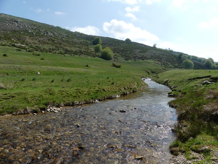
The long valley of the Bonheur separates sloping pastureland from a forest. You will pass La Baraque Neuve and La Baraque Vieille, two houses whose history is intertwined with sheep transhumance (migration to and from summer pastures).
7 points of interest

Sous bois du Trévezel - Béatrice Galzin 
The Mont Aigoual forest
“Aigoual, Forêt d’Exception”
The French Forestry Office, which manages state forests, launched a programme in 2013 called “Aigoual, Forêt d’Exception” (Aigoual: An Exceptional Forest) with the aim of highlighting the massif’s natural and cultural heritage. The Forestry Office thus tries to foreground the different aspects of its multi-facetted management: production, protection and receiving visitors. One key aspect of this approach, which complements other initiatives by local actors, is to improve visitors’ experience in the forest.
Roitelet huppé - Bruno.Descaves  Fauna
FaunaThe goldcrest
As you walk through the woods, you may hear the shy zee zee of the goldcrest, which depends on conifers. But do you know where its name comes from?
Its Latin name is Regulus regulus, the little king. In Celtic tradition, the smallest bird is the druid of the avian world. In first-century local Celtic languages, the same word was used for ‘druid’ and ‘goldcrest’.
Another reason for this royal title is that the goldcrest, when in love, raises the black-rimmed golden feathers on his head, like a little crown.
L'Abbaye de Notre-Dame-du-Bonheur - nathalie.thomas 
Notre-Dame-du Bonheur
This Romanesque monastery was built in the 11th and 12th centuries by the rich Lord of Roquefeuil and Mandagout, with the noble intention of turning it into a “hospital for the poor”. He allowed the monks to reap the fruits and revenue of the land. In return, the villagers paid him sheep, pigs, poultry, wine and cheese. He also charged the transhumant herds on his vast estate pasture fees. The path that passed through this peatbog linked Languedoc to the Gévaudan. A snowstorm bell weighing 200 kg would ring in fog or blizzards to help merchants, peddlers, itinerant workers, farmers etc. find their way to safety. The monastery had six canons, the last of whom was forced to leave during the French Revolution. An association dedicated to preserving the Abbey of Notre-Dame du Bonheur is working to restore it.
Zone humide - Béatrice Galzin 
Wetlands
Above the path, the soft sound of trickling water… These are wetlands, a fragile zone that must be protected. The peatbog is made up of rushes, sedge and many types of moss, such as sphagnum. Numerous insects live here, such as the large marsh grasshopper and dragonflies, as well as the common frog. If you make little noise, you may see deer here, or other animals that have come to cool down.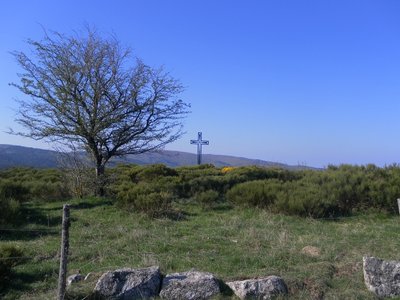
Col de la croix de fer - nelly Carel Col de la Croix de Fer pass
At the col de la Croix de Fer pass, which is a strategic crossroads of several tracks, there used to be an inn for travellers. The magnificent ruin with its two impressive vaults was also a sizeable farm, owned by the Baron de Roquedols. It was located at the limit of the municipalities of Meyrueis and St-Sauveur-Camprieu on the route of the Camin Ferrat and the King’s Road. In the days of religious persecution, the preacher François Vivens* organised secret Protestant gatherings in the small valley just below the buildings. (*Vivens was killed in 1692, 10 years before the Camisard War)
Perte du Bonheur - nathalie.thomas The Bonheur river
The Bramabiau site is an example of a karst spring. Here, slightly east of Camprieu, the Bonheur River has dug into the Causse (limestone plateau) and disappears in a natural tunnel. It re-emerges into the open at the bottom of the Aven de Balset, but it twists to the south to disappear again below ground. The river meanders through more than 10 km of tunnels. Then, 700 horizontal meters from its sinkhole, it reappears as a spring! The rock walls of the narrow canyon magnify the sound of its waters and add to its rumbling some acoustic vibrations that are close to a gigantic roaring. This is no longer the tranquil Bonheur, it is the tumultuous Bramabiau.
Camprieu - nathalie.thomas Camprieu
In the 19th century, the village streets were bustling year-round with a throng of artisans, labourers and shopkeepers, who lived in these modest mountain houses that were also suitable for livestock rearing. Camprieu had: two cobblers, six clog makers, two basket makers, one carpenter, two wheelwrights, two farriers, one miller, two stonemasons, one glassworks, one sawmill, one dairy, two grocer’s shops, a haberdashery and ironmonger’s and one shop for ladies’ “fashion and dresses”. There was also a cheese cellar that produced Roquefort until 1932, a hotel and an inn.
Description
Signposts will guide you all along this route. In the description below, the signposted place names and/or directions are given in bold italics between quotation marks:
Start at the football pitch, "Camprieu - parking", head towards "Col de La Serreyrède" via "Le Cros", "Tabarde", "Bois de Camprieu", "Plan du Châtaignier" till you reach "Sous St Flour", then follow "Bonahuc", "La Baraque Vieille", "La Baraque Neuve", "Le Devois", "Pont du Bonheur", "L'Aubespi". Return to "Camprieu" via"Perte du Bonheur" and "Camprieu - Mairie".
This walk is taken from the guidebook Massif de l’Aigoual, published by the Communauté de communes Causses Aigoual Cévennes as part of the collection Espaces naturels gardois and the label Gard Pleine Nature.
Start at the football pitch, "Camprieu - parking", head towards "Col de La Serreyrède" via "Le Cros", "Tabarde", "Bois de Camprieu", "Plan du Châtaignier" till you reach "Sous St Flour", then follow "Bonahuc", "La Baraque Vieille", "La Baraque Neuve", "Le Devois", "Pont du Bonheur", "L'Aubespi". Return to "Camprieu" via"Perte du Bonheur" and "Camprieu - Mairie".
This walk is taken from the guidebook Massif de l’Aigoual, published by the Communauté de communes Causses Aigoual Cévennes as part of the collection Espaces naturels gardois and the label Gard Pleine Nature.
- Departure : Camprieu, football pitch
- Arrival : Camprieu, football pitch
- Towns crossed : Saint-Sauveur-Camprieu and Val-d'Aigoual
Forecast
Altimetric profile
Recommandations
Durant l'été, présence de troupeaux de moutons et de patous. Adaptez votre équipement aux conditions météo du jour. N'oubliez pas que le temps change vite en montagne. Pensez à emporter de l'eau en quantité suffisante, de bonnes chaussures et un chapeau. Bien refermer les clôtures et les portillons.
Is in the midst of the park
The national park is an unrestricted natural area but subjected to regulations which must be known by all visitors.
Information desks

Tourism & national parc'house
Col de la Serreyrède, 30570 Val d'Aigoual
The Maison de l'Aigoual houses the tourism office Mont Aigoual Causses Cévennes and the Maison du Parc national. This visitor centre provides information on and raises awareness of the Cévennes National Park, its sites and events as well as the rules that must be observed in the National Park's central zone.
On site: changing exhibitions, video projections, Festival Nature events and shop Open year-round
Accessibility :
Accessible aux personnes à mobilité réduite sur les trois niveaux du bâtiment (ascenseur)
Transport
liO est le Service Public Occitanie Transports de la Région Occitanie/Pyrénées-Méditerranée. Il permet à chacun de se déplacer facilement en privilégiant les transports en commun. lio.laregion.fr
Access and parking
From Meyrueis or L'Espérou on the D986.
Parking :
Terrain de foot
Source

CC Causses Aigoual Cévennes Terres Solidaireshttp://www.caussesaigoualcevennes.fr/

Parc national des Cévenneshttp://www.cevennes-parcnational.fr/
Report a problem or an error
If you have found an error on this page or if you have noticed any problems during your hike, please report them to us here: