The standing stone of Trépaloup
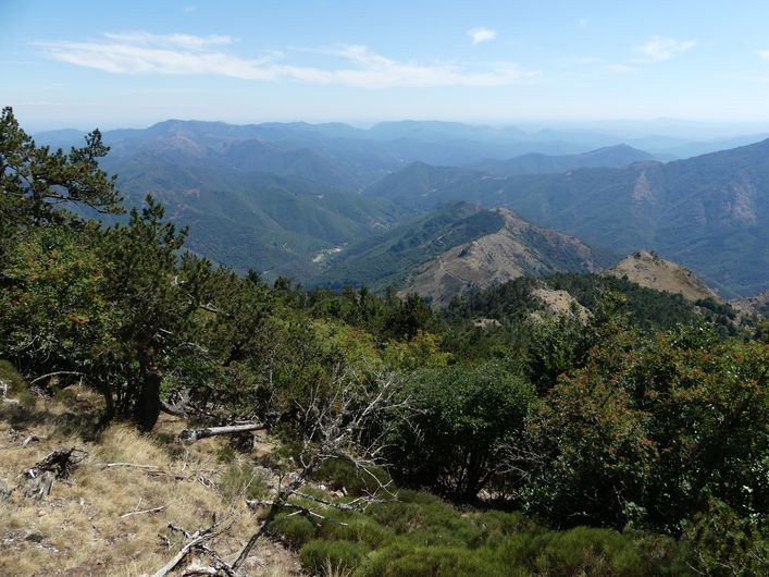
This walk offers panoramic views from the summit, at 1,567 m the highest point of the Gard department. They stretch from the Alps to the Pyrenees, from the Puy de Sancy to the Mediterranean. You overlook the Hérault valley and its legendary 4,000 Steps trail.
18 points of interest
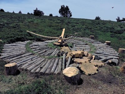
Tempus fugit (Fiona Paterson, Donald Buglass) - © Natacha Maltaverne 
Tempus Fugit (Fiona Paterson, Donald Buglass)
Time flies, conscience cries, death threatens, heaven invites, hell scolds, and man sleeps. Here, the effects of time and natural elements transform the wood used in the artwork; everything is an endless renewal at the same rate as the passing hours. How much time have we got left before everything is lost and it is too late to repair the damage? Nature will continue on its trajectory and efface the traces of Humanity on Earth.
Observatoire de l'Aigoual - nathalie.thomas The meteorological observatory
Inaugurated in 1824, the meteorological observatory was built on the initiative of Georges Fabre, one of the pioneers of the reforestation of Mont Aigoual. His work with the botanist Charles Flahault enabled the creation of the arboretum of L’Hort de Dieu. The first meteorological data were gathered by agents from the French National Water and Forestry Commission. Since 1943, the observatory has been managed by the National Meteorological Office. It is France’s last mountain weather station that is inhabited year-round.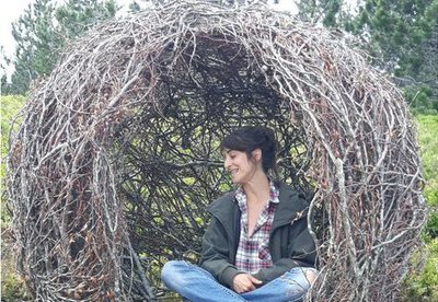
Cellule (Marie Gueydon de Dives) - © Filature du Mazel 
Cell (Marie Gueydon de Dives)
This artwork, natural in architecture but artificial in execution, represents a passage between the interior and exterior worlds. Posing or opposing while questioning the notions of limit, porousness and opening.
This work encourages you to come inside but feel outside. To be the contemplative eye, the receiving ear, the conscience that objectifies reality.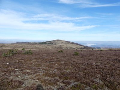
Le Portalet - nathalie.thomas  Flora
FloraShort-grass prairies and heath on the summit of Mont Aigoual
Here, only species with a short reproductive cycle can settle due to the frequently glacial climate. The heath has been invaded by heather and mountain pine. This zone is barely wooded due to the violent winds and is comparable to subalpine vegetation, consisting of short-grass prairies and heather and blueberry moor. It is sometimes called pseudo-alpine.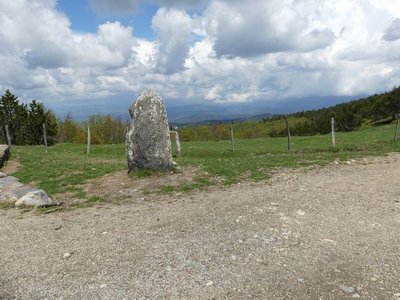
Vue depuis Font de Trépaloup - nathalie.thomas FloraThe evolution of plant life
At the pass stands a schist menhir (standing stone). To the north, in Trépaloup ravine, hewn flint implements bear witness to a human presence in the region since prehistoric times. Palynological analyses (studies of pollen fossilised in peatbogs) have allowed scientists to piece together the plant life on Mont Aigoual from 8,000 to 5,000 BC. Pine predominated, accompanied by birch and hazelnut. Then pine populations gradually diminished. The damp climate warmed up, favouring the spread of oak and hazelnut. Finally, the increased damp and cloud cover at altitude allowed fir and beech to develop. From the end of the first century BC, the substantial percentage of grasses shows that forest had receded in favour of pasture and prairies. This was the start of the great deforestation.
Forêt de l'Aigoual - © Gaël Karczewski A site for botanical experiments
Marker 1
L’Hort de Dieu is located at an altitude of 1,300 m and shaped by an extreme climate. This site with its exceptional assets is a favoured study and experimentation zone for botanists. The tree collection is just over 100 years old, and some of the specimens are declining because of old age or else because they are not well-adapted to this mountain range. Today, there are 75 species left of the 140 that have been tested over the past century. To safeguard the interest of this heritage site, the Office National des Forêts and the Cévennes National Park are currently reflecting on renewing the collection.

Apollon - © Régis Descamps 
Restoring the forest
Marker 3
Several forestry dynamics can be seen here:
on the left, natural evolution: the rocky ridges have herbaceous and shrubby vegetation and are gradually being colonised by oak and whitebeam. This overgrowth tends to be detrimental to certain species, such as the Apollo butterfly.
opposite, natural regrowth of the beech forest from over-exploited 19th-century coppices.
on the high slopes, on the right, assisted forest development: conifers have been introduced among the naturally growing deciduous trees.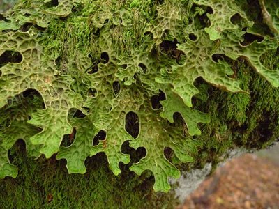
Lobaria pulmonaria - © Mario Klesczewski Did you say “chourradou”?
Marker 4
This remarkable beech is over 200 years old and called chourradou in Occitan, after the sheep that would chourrer (ruminate) and rest under its shady canopy. This kind of tree (large cavity, detached bark and dead wood) is home above all to saproxylic or dead-wood-eating insects and fungi. On another of these old beeches, below the path, you can see a large lichen called lobaria pulmonaria, which needs a lot of water and is highly sensible to atmospheric pollution. It grows very slowly and thus testifies to the ripe old age of this part of the forest.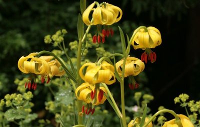
Lis des Pyrénées - © J.-P. Grandmont Alpine garden
Marker 5
This panel shows the legacy of Charles Flahault's experimental work.
Chalet laboratoire en 2023 - © B. Algoët The Chalet, Charles Flahault's laboratory
Marker 6
“And who knows whether some generous benefactor will not decide one day that our students should have a hospitable roof at L'Hort de Dieu itself? I can see the little house as if it were already built, receiving much sunlight on the Mediterranean side, with its study room on the ground floor and its large fireplace around which scientific problems are discussed late into the night..” (Charles Flahault, 1904)
The Chalet, which was built the following year, made it possible to establish a botanical garden, a high-altitude vegetable plot and a plant nursery nearby. Despite the forest reconquering the surroundings, some of the plants introduced at the time have survived until today: Pyrenean lily, great masterwort, and others.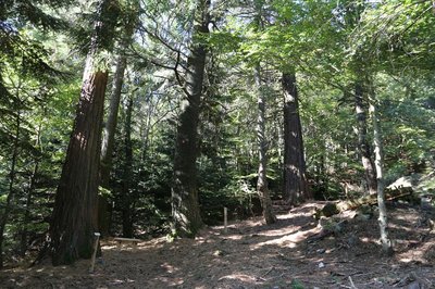
Collection de l'Hort de Dieu - © B. Algoët Acclimatising a plant species
Marker 7
Fabre and Flahault pursued two objectives: studying the way certain forest species adapt to the Cevenol climate and studying plants in their relationship with environmental conditions. Some plant species are better adapted than others to the Cevenol climate. Thus, Mediterranean and Douglas firs do very well, as do almost all the species native to Europe, Asia Minor and the western United States. Species from East Asia and the eastern United States, however, whither away. Through his work, Flahault laid the foundations of phytosociology, the study of how plants arrange themselves into communities as a function of the environmental conditions.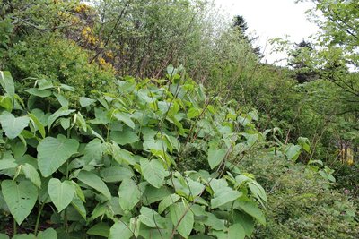
Renouée - © Valère Marsaudon FloraAn invasive species: knotweed (fallopia japonica)
Marker 8
Sakhalin knotweed, just like Japanese knotweed, is an invasive species. That means it is not in its environment of origin and grows at the expense of other species, alongside roads and on the banks of many rivers. A “test zone” project aiming to limit the species is being studied at L'Hort de Dieu, thus continuing the experimental mission of the arboretum. To stop knotweed from proliferating, ripping-up, rhizome destruction and covering- up with tarpaulins are all being tried.
Stèle homage aux botanistes et forestiers - © B. Algoët Botanists' history
Marker 9
The particular nature of this site earned it the name of “God's garden” (Hortus Dei). Since the 16th century, Mont Aigoual has provided botanists with rare species for herbariums and botanical surveys. Some species were also gathered for their medicinal qualities, called “vertus des simples”, a term to be found on a handwritten map of the Cévennes dating from the early 18th century. In 1936, a stele was inaugurated that is dedicated to the memory of the many botanists who contributed to the advancement of the sciences on the L'Hort de Dieu site.
Forêt de l'Aigoual - © Gaël Karczewski A site for botanical experiments
Marker 1
L’Hort de Dieu is located at an altitude of 1,300 m and shaped by an extreme climate. This site with its exceptional assets is a favoured study and experimentation zone for botanists. The tree collection is just over 100 years old, and some of the specimens are declining because of old age or else because they are not well-adapted to this mountain range. Today, there are 75 species left of the 140 that have been tested over the past century. To safeguard the interest of this heritage site, the Office National des Forêts and the Cévennes National Park are currently reflecting on renewing the collection.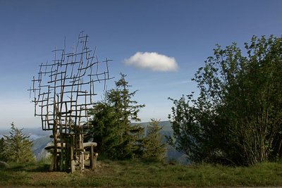
Assise (Marie-Hélène Richard) - © Filature du Mazel Seated (Marie-Hélène Richard)
Far from town, paths open the door to new rhythms. Another vision of life and time lets us breathe in the ever-present contemplation, stones, trees and skies. A physical experience of coming face-to-face with nature. A bench made of wood and branches, whose back becomes thinner as it rises towards the sky, as if to turn back into a tree.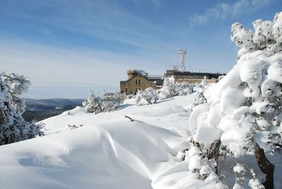
L'Aigoual sous la neige - © Météosite du Mont Aigoual Mont Aigoual weather station
Inaugurated in 1894, this infrastructure is France’s last mountain weather station to be inhabited. Its history is closely linked to the reforestation of Mont Aigoual. It has become a high-performance weather station with an array of modern test instruments, measuring devices for extreme conditions, and a museum/exhibition on meteorology. The 800 sq m exhibition will tell you more about climatology on Mont Aigoual and about meteorology in general.
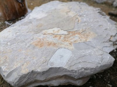
Archéosmart (Marc Limousin) - © Filature du Mazel 
Archeosmart (Marc Limousin)
Smartphone imprints appear on the rocks: fossils of the present that will become mysterious in the future. This carved stone, like the cup-shaped marks and other rock art of the region, discloses history revealed in matter and resonates with Malraux’s phrase: “The future is a present given to us by the past”.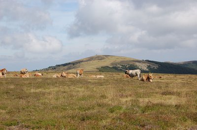
Troupeau au sommet de l'Aigoual - © Nathalie Thomas FloraSummit of Mont Aigoual
At an altitude of 1,565 m, the climate is harsh: weather conditions are the same as they would be at 2,000 m elsewhere, with only four “frost-free” months a year. Winds of above 60 kph blow on 265 days a year, and the average annual temperature is 4.8°C. Trees do not have enough time to complete their life cycle. Local plant formations are those of the montane zone: subalpine short-grass prairies.
Description
Signposts will guide you all along this route. In the description below, the signposted place names and/or directions are given in bold italics between quotation marks:
Starting from "Mont Aigoual – Parking", make for
- "Menhir de Trépaloup", then"
- Source du Tarnon",
- "Combe Rude". Walk around the summit to return to "Menhir de Trépaloup". Climb towards
- "Mont Aigoual" (0.6 km). Walk past the front of the meteorological museum to reach the car park.
This walk is taken from the guidebook Massif de l’Aigoual, published by the communauté de communes Causses Aigoual Cévennes as part of the collection Espaces naturels gardois and the label Gard Pleine Nature.
- Departure : Summit of Mont Aigoual
- Arrival : Summit of Mont Aigoual
- Towns crossed : Val-d'Aigoual and Bassurels
Forecast
Altimetric profile
Recommandations
No mountain-biking. Make sure your equipment is appropriate for the day’s weather conditions. Remember that the weather changes quickly in the mountains. Take enough water, wear sturdy shoes and put on a hat. Please close all gates and barriers behind you.
Information desks

Tourism & national parc'house
Col de la Serreyrède, 30570 Val d'Aigoual
The Maison de l'Aigoual houses the tourism office Mont Aigoual Causses Cévennes and the Maison du Parc national. This visitor centre provides information on and raises awareness of the Cévennes National Park, its sites and events as well as the rules that must be observed in the National Park's central zone.
On site: changing exhibitions, video projections, Festival Nature events and shop Open year-round
Transport
liO is the regional public transport service of the Occitanie/ Pyrénées – Méditerranée region. It facilitates everyone’s movements by prioritising public transport. For more information, call 08 10 33 42 73 or go to www.laregion.fr
Access and parking
From L'Espérou on the D986, D269, D18 and RD 118. From the Col de Perjuret on the D18 and D 118.
Parking :
Source


Report a problem or an error
If you have found an error on this page or if you have noticed any problems during your hike, please report them to us here: