
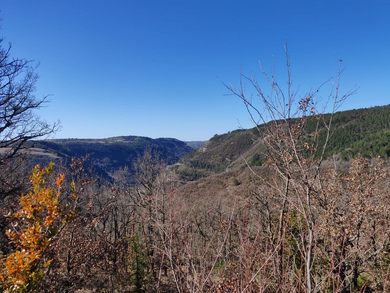
Le Pas de l'Ane
A long time ago, that donkey took a wrong step (“pas de l’âne” means “donkey step”) and fell off the cliff with its unlucky owner…
8 points of interest
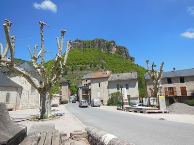
La place du village - Béatrice Galzin 
Trèves
From Tabrî, meaning “village close to the water” in the Chasséen culture (Baume Lairoux, La Verrière, etc.), which lay on the trade route between the Gabali tribe, the coast and the Arecomici tribe. It was given a wooden bridge by the Romans, occupied first by Arian Visigoths and then by Nicene Christian Franks, and destroyed by Muslims around 730. It was revived in the Carolingian period with its Romanesque bridge, and was loyal to the Kings of France, who granted it a consuls’ charter in the 14th century and the bell on top of the church, which had remained Catholic. In the 17th century, Trèves had hemp fields, whose hempen cloth was used in the draperies in Lodève. Its blue sheep’s cheese, its galena mine and its terraces of almond trees and lentils belong to the past. Only the Pétassou (local pagan character and festival) remains (M.MOULINIER, historian).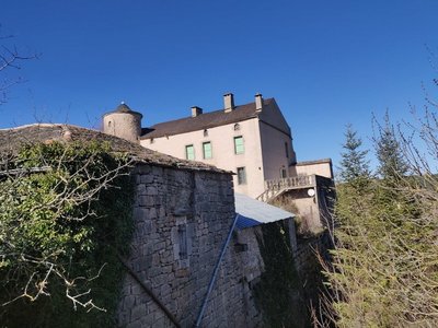
Le château - Béatrice Galzin Espinassous and its castle
This is the Espinassous plateau with its 15th century castle. It only has one tower; the second tower allegedly imitated that donkey and fell into the ravine on whose edge it stood.
The castle courtyard with its former farm outbuildings is magnificent; you can see them through the bars of the gate. These buildings are typical of Causse architecture: heavy limestone roofs, facades flanked by buttresses, narrow openings in the pointed barrel vaults.
The hamlet is in an agricultural plain near the cliff’s edge.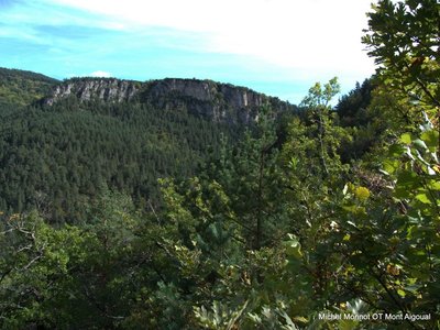
La barre rocheuse - Michel Monnot 
Le Trévezel
You are on the western border of the Aigoual massif, whose vast wooded slopes you can see. Southwest of you is a geological contact zone between the Causse Noir limestone plateau and the granite massif of Le Suquet. Between the two lies the deep groove created by the white waters of Le Trévezel. A small causse at the foot of Le Suquet is home to the hamlet of Comeiras, which is mentioned in Jean Carrière’s novel, La Caverne des pestiférés.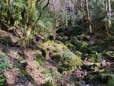
Le ravin sans nom - Béatrice Galzin 
Tropical forest and the Causse flora
The Causse vegetation is very different from that on the valley floor of the “ravine with no name”.
On the Causse with its dry limestone soil grow pale flowers, such as the blue/mauve liverwort or the white wood anemone. A yellow spot is a California buttercup, without forgetting the thyme which perfumes the path!
Boxwood lines both sides of the path. Downy oaks and Scots pine give some shelter in summer. The “ravine with no name” is a total change of scene. All of a sudden, you find yourself in a dense tropical forest; boxwood and lianas share the ravine. The sun never pierces the plant cover to warm the stream – never! It is chilly down here.
Moss grows everywhere. Luckily the waymarking is perfect.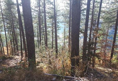
pins noirs - © Sud Cévennes A recent forest
The stands that were planted during the large reforestation programmes of the late 19th century onwards consist of black pines, a rustic species that is well-adapted to dry limestone soils. Underground, the Causses plateaux are characterised by networks of tunnels and cavities that have been created by water movement over millions of years. Subterranean rivers are blocked by the impermeable layers of the valley floor and flow into the Trévezel instead.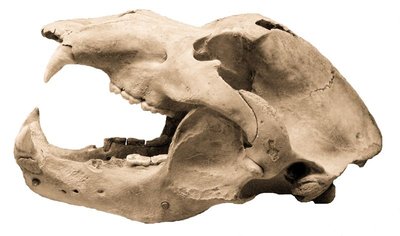
Crâne d'ours - © M. Delor 
Joulie Cave
In March 1952, Jolly, a forestry official, showed his friend Frayssignes this cave. Deposited in it they discovered the remains of 300 humans from the Neolithic, who had been carefully laid out side by side. The cave was rapidly declared a historical monument. In the depths of the cave, a great number of bear bones was also found. This cave bear, the ancestor of our brown bear (Ursus spelaeus), had a skull 50 cm long! In the winter, groups of these bears would have huddled together in clay wallows at the rear of the caves. Ursus artos succeeded the cave bear and was succeeded in turn by the brown bear, which was hunted to extinction in the 15th century. (B. Mathieu)
Buis - © Nathalie Thomas 
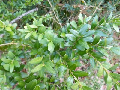
Box (Buxus)
Boxwood and humans: a long relationship! When livestock farming increased, the primeval oak forest opened up and box – which is too hard for sheep's teeth – took hold everywhere. Humans discovered one of its major qualities: broken up and scattered over the ground as a litter, it protects vegetable seedlings from drought and frost. Its leaves can make up for a lack of straw for fertilising arable land. In 1818, a decree issued by the prefect of the Gard department worried about the excessive clearing of box groves and the messy manner in which they were being uprooted, without adequate tools. Until about 1910, you might see mules laden with enormous bundles of box; then chemistry took over. (B. Mathieu)
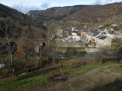
Trèves - nathalie.thomas Treves
In Antiquity, the village square was a cemetery. The name Trèves is believed to derive from the Gaulish trebo – meaning 'village' according to some sources or the Celtic water goddess according to others – or perhaps from trivium, crossroads... The track going over the Roman bridge at Le Trévezel, restored in the 18th century, was in fact an important road in Antiquity. There is another hypothesis if you consult Boissier de Sauvages' 1820 dictionary, in whose opinion Treva or Trebo are Occitan words referring to phantoms or spirits. You might well be tempted by this version once you know the history of the Pas de Joulié cave described below! (B. Mathieu)
Description
Start in Trèves, on the car park in front of the mairie. Take the path uphill to the cross.
- There are several hairpin bends to reach the signpost “Roc du regard”: go to the viewpoint.
- At “Roc du regard”, turn left; make sure to close the barrier.
- Continue on the path. At the lane “Le puech”, go right towards "Mare d'Espinassous" and the hamlet.
- Walk through the hamlet of L'Espinassous and continue straight ahead.
- At the signpost "Mare d'Espinassous" turn right and go downhill to “Randavel”, then to the D157.
- Turn right onto the road for about 800 m.
- Turn left and cross the bridge over the Trévezel river. Continue on the road towards Comeiras.
- In the 4th hairpin bend, leave the road and go straight – close the barrier.
- Continue on the path to a level area.
- Difficult downhill section among the rocks: slippery path.
- At "La Sourdette" go back up towards “Hameau du Villaret” and from there downhill to “Trèves” via "La vierge". Cross the village uphill to the mairie.
- Departure : Trèves – mairie (town hall)
- Arrival : Trèves – mairie (town hall)
- Towns crossed : Trèves, Lanuéjols, and Dourbies
Forecast
Altimetric profile
Recommandations
Information desks

Tourism & national parc'house
Col de la Serreyrède, 30570 Val d'Aigoual
The Maison de l'Aigoual houses the tourism office Mont Aigoual Causses Cévennes and the Maison du Parc national. This visitor centre provides information on and raises awareness of the Cévennes National Park, its sites and events as well as the rules that must be observed in the National Park's central zone.
On site: changing exhibitions, video projections, Festival Nature events and shop Open year-round
Transport
(in term time)
Access and parking
Parking :
Source


Report a problem or an error
If you have found an error on this page or if you have noticed any problems during your hike, please report them to us here: