
The Hérault waterfalls - short

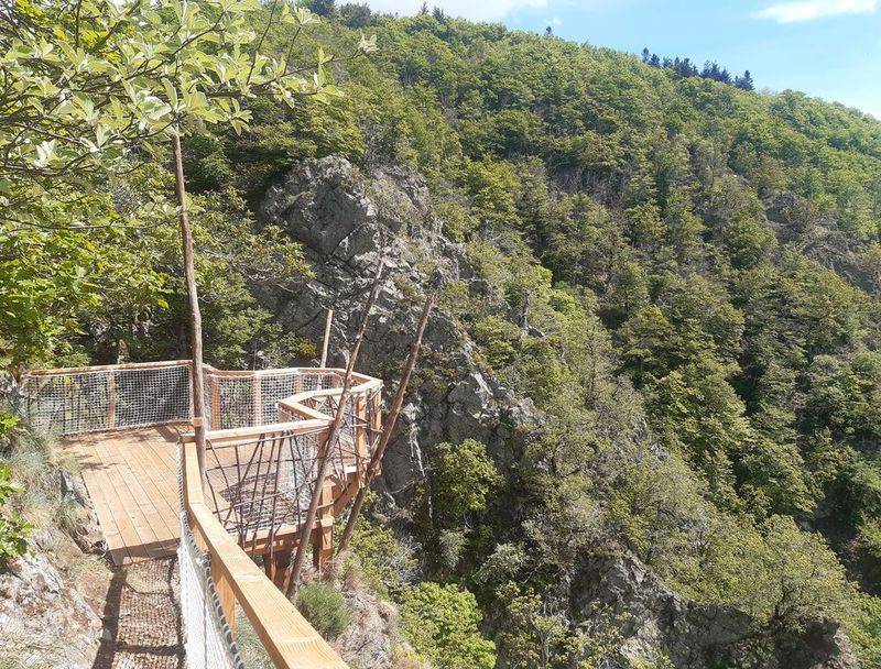
From the dividing line between the Atlantic and the Mediterranean (Serreyrède pass), this path winds through the forest on the steep southern slopes of Mont Aigoual. Dotted with varied texts on fauna, flora and forest management, referred to in the leaflet, it makes its way to a spectacular viewpoint over the Hérault waterfalls.
11 points of interest

Maison forestière de la Serreyrède - © Jacques de Joly La Serreyrède
Before 1861, the house at the Col de la Serreyrède was inhabited by two families of farmers. They owned some livestock and had a vegetable garden, whose terraces you can still see above the La Caumette track. From 1861 on, the farm was inhabited by a forest ranger. It was only bought by the state body Eaux et Forêts in 1883, to be turned into a forester's house. It became one of Georges Fabre's headquarters during the reforestation of the Aigoual massif. The Cévennes National Park, tourism office and Terres d'Aigoual growers have now joined forces to revive La Serreyrède with the help of the Communauté de Communes Causses Aigoual Cévennes – Terres solidaires.
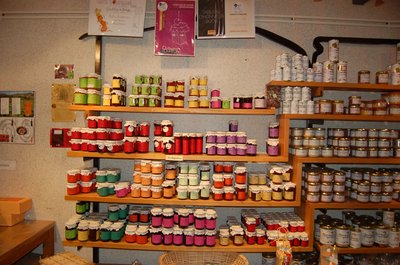
Boutique des producteurs - © Nathalie Thomas The association "Terres d'Aigoual"
The Cévennes National Park rents out part of the building to the association, enabling local farmers to sell their products directly to the public. The association brings together farmers who wish to promote what they produce and share their know-how. They also enjoy sharing their vision of farming- high quality produce and products,
- human-sized farms,
- mutual aid.
Come and discover their products!


From beech copse to mature plantation
Marker 1
Around 1850, before reforestation began, the inhabitants of the Cevennes were using local wood resources on a massive scale for heating and in industry, especially spinning-mills. Gradually, only a few beech copses remained, which were cut every 25 to 40 years. Grazing by tens of thousands of sheep further reduced the herbaceous plant cover. Much weakened, the plant cover was then also subjected to heavy precipitation, the so-called Cevenol episodes. It is against this backdrop that the lengthy work of the foresters began. To reduce risks and establish a lasting forest cover, the first technique was to make use of what was already present by converting the disused copses into mature plantations.
Drosera rotundifolia - © Bruno Descaves 
Le Trévezel molière (peat bog)
Marker 3
A peat bog is a thick layer of plant cover that has decayed little or not at all because of accumulated water, acid soils and the cold climate. This wetland has hardly changed for centuries. Once called molières, soulages, sagnes or fanga, these environments were long denigrated and “cleaned up”. Today, they are known to be well worth preserving. Peat bogs are home to a great variety of more or less specific species, such as the sundew, a little carnivorous plant.Irregular forest
This tree population consists of trees of very different diameters, ages and heights. Species are mixed: mainly pine, but also beech, rowan and whitebeam. This is an irregular mature forest, a forestry dynamic that is interesting for several reasons: it creates permanent forest cover; resistance to soil erosion; better resilience against storms or parasite attacks; regular production, etc. In the small clearing to the left of the path, the sunlight now penetrating to the forest floor has made natural regeneration of beech and fir possible, ensuring the renewal of the forest.

Productive forest
Marker 2
Another method of creating a durable forest cover is to plant or sow. This work is carried out either on bare soil or among existing tree stands. The Aigoual reforestation programme was a gigantic effort, requiring 900,000 days of work, the planting of 60 million conifers and 7 million deciduous trees, and sowing of 38 tonnes of seeds. Spruces and pines, which can be planted in full sunlight and grow quite quickly, were widely used. Under the forest canopy, preference was given to firs.Georges Fabre
A graduate of the Ecole polytechnique, and top of his year at the Nancy forestry school, the forester Georges Fabre devoted 30 years of his energy to reforesting the mountains of the Lozère and Gard. His goal was to stabilise mountain soils, but also to provide work for a local population that would otherwise have been condemned, in its entirety, to leave the countryside. In 1894, he initiated the construction of the Mont Aigoual weather observatory. In association with the Club Cévenol and Club Alpin Français, he also laid the foundations of the local “heritage tourism” (creating the Grand Hotel de l'Aigoual, building a shelter and viewpoint indicator at the summit, etc.) that continues to this day.
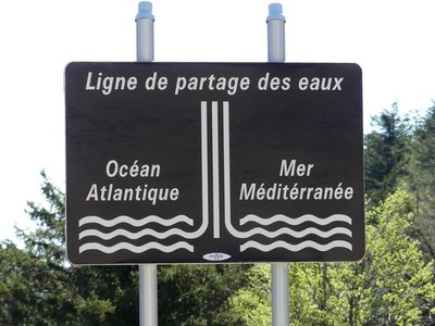
Ligne de partage des eaux - nathalie.thomas 
The watershed
The current relief creates a frontier between the Atlantic and the Mediterranean: depending on the slope, water runs towards either the Ocean or the Sea. This is due to the uplift of the Cevenol sill, brought about by geological activity along the Cévennes fault, which borders draw the northern limit of the Languedoc region. This natural sill marks the geographical border between the northwest slope – verdant, not too steep – and the southeast slope, which falls away abruptly in the Languedoc and continues to be subject to powerful erosion.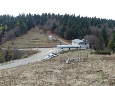
La Serreyrède - nathalie.thomas 
Climate frontier
The pass is also a climate frontier. The Atlantic side is predominantly exposed to the west wind and receives rainfall that is fairly regularly spread over the year. The Mediterranean side, however, is drier and hotter and constitutes a massive barrier to the occasional southeast wind (the marin), thus forcing its humid air to rise suddenly. This makes the clouds’ water content condense, which can give rise to so-called Cevenol episodes: heavy rainfall (600 mm in 24 hrs) causing catastrophic floods. The Aigoual, Mount Aigualis the rainy (A. Bernard), is well-named! After Savoie, it is the rainiest place in France.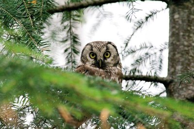
La chouette de tengmalm - Gaël.Karczewski  Fauna
FaunaBoreal owl
Abandoned woodpecker chambers are a boon for small mammals and other birds, such as the boreal owl, which has come from Nordic countries to settle here at altitudes of 800 m. Very discreet, it confines itself to the depths of our forested mountain ranges. It can be identified in March by its sonorous and gentle call. To maintain the species, the Cévennes National Park and the French forestry office protect trees with nesting chambers and old-growth forests from being logged.
© R. Descamps Two waterfalls... Find the Hérault!
Faced with these two threads of rivers, geographers hesitated between flow rate and length, and finally designated the waterway below you the Hérault while the waterfall opposite you was named the Dauphine. Two remarkable plants can be seen here: orpine (Hylotelephium telephium) with its succulent leaves, a food source for the larvae of a butterfly that is in strong decline all over the Massif central: the Apollo (which may be seen from mid-July to mid-August); and Prost saxifrage, which forms regular cushions that are easy to recognise. They enable it better to store what little water is available. It is a plant endemic to the Cévennes.
Description
Une variante, plus longue, est possible depuis la station de Prat Peyrot.
- Departure : Maison de l'Aigoual
- Arrival : Maison de l'Aigoual
- Towns crossed : Val-d'Aigoual
Forecast
Altimetric profile
Recommandations
Narrow and craggy path – firm shoes are essential.
Do not leave the path as this environment is unstable and very delicate. Horse-riding or mountain-biking are not allowed on or adapted to discovery trails.
Information desks

Tourism & national parc'house
Col de la Serreyrède, 30570 Val d'Aigoual
The Maison de l'Aigoual houses the tourism office Mont Aigoual Causses Cévennes and the Maison du Parc national. This visitor centre provides information on and raises awareness of the Cévennes National Park, its sites and events as well as the rules that must be observed in the National Park's central zone.
On site: changing exhibitions, video projections, Festival Nature events and shop Open year-round
Transport
LiO is the regional public transport service of the Occitanie/ Pyrénées – Méditerranée region. It facilitates everyone’s movements by prioritising public transport. For more information, go to www.lio.laregion.fr
Access and parking
Col de la Serreyrède, on the D 986 Camprieu - Valleraugue or on the D 48 from Le Vigan.
Parking :
Source


Report a problem or an error
If you have found an error on this page or if you have noticed any problems during your hike, please report them to us here:
