
Les cascades d'Orgon - Escapades à vélo
10 points of interest


The watershed
The watershed goes through the village of L’Espérou. This natural limit is also the border between the two municipalities of Val d’Aigoual and Dourbies. The rain that falls on and runs off the Valleraugue side continues to the Mediterranean. The water that flows towards Dourbies does not follow the same route and ends up in the Atlantic…
© Gaël Karczewski 
The profession of forester
The forester is a silviculturist, meaning that s/he cultivates the forest to ensure that it is vigorous and healthy. The forester intervenes at all stages in the trees’ life cycle to encourage or oppose natural evolution, depending on the objectives. Sometimes that means momentarily protecting a species dominated by rival plants, for instance by clearing beech seedlings threatened by brambles or young firs. When a plantation reaches maturity – at about 70 years – the forester supervises fructification to make sure there are abundant flowers receiving sufficient light…
© Mathieu Baconnet 
Timber from stumps
Beech trees regenerate very easily; their regrowth is a number of shoots grouped together on the same stump. In the old days, this method (coppicing) was much used to obtain firewood. On the northern slope of Aulas mountain, foresters turned the former coppices into timber plantations on stumps: the new trees with their straight boles were a steady supply of wood for packaging (crates). Since the closure of these companies, the beeches have only been commercialised as firewood.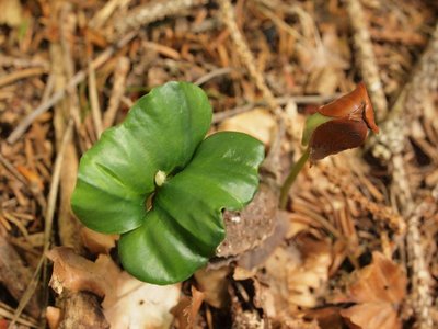
© Philippe Raichaud  Flora
FloraFrom the seed to the tree
Because most seeds are rich in oils, they are devoured by famished animals in the winter: squirrels, field mice, wild boar, jays, chaffinches… Any seeds still on the ground the following spring can start germinating.
feuille de hêtre - © Emilien Herault FloraFrom flower to fruit ...
The beech is a monoecious tree, meaning that female and male flowers are distinct but occur on the same tree. They flower in April and May; insects carry the male reproductive cells (the pollen) to the female cells.
After pollination, the flower produces seeds enclosed in soft-spined husks: beechnuts. Every three to five years, in autumn, an adult beech disperses thousands of seeds.
lobaria - © Bruno Descaves An ancient forest
Some species, such as the Lobaria pulmonaria lichen, which grows very slowly, are good indicators of a forest’s age. Likewise, some species of herbaceous flora, for instance woodrush, are noticeably more abundant in old forests than in recent forests.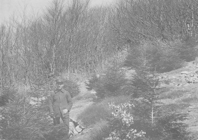
© M Nègre (1923) The south-facing slope
Over the centuries, the south-facing slope of Aulas mountain was cleared for pasture, leaving the bedrock bare in places. In the late 19th century, foresters replanted the slope with spruce. These pioneer trees slowly re-established a forest floor and, in their shade, beechnuts germinated. Foresters are now guiding this stand towards a mixed plantation of beech and fir.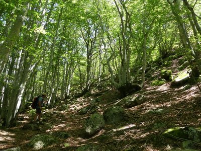
La hêtraie - N Thomas FloraAltitudinal vegetation zones
The path ranges from 700 to 1,250m in altitude and clearly shows the changes in vegetation as you climb. Vegetation zones have been defined based on altitude; they are given the name of the predominant plant species.
The first, the holm oak zone, stops at around 500m. It occurs mainly on schist or limestone. From 500 to 900m is the zone of deciduous oaks and sweet chestnut. From 1000m to 1500m is the beech zone; here you are in the Aigoual state forest. The final vegetation zone, above 1500m, is treeless and only concerns a small circle around the Aigoual summit.

Le col du Minier - N Thomas 
Foresters’ houses
When you arrive at the forest road, you turn left onto it. On the right used to be Le Minier forester’s house. Many foresters’ houses were scattered throughout the mountains where the forest rangers lived with their families. But living in such isolation was difficult, and school age children had to board. Gradually, these isolated houses were abandoned; the rangers now live in the villages.

Village de l'Espérou - Béatrice Galzin The village of L’Espérou
The village of L’Espérou lies on the border of Dourbies and Valleraugue local councils. A draille (track for livestock to migrate to summer pastures with their shepherds) crosses the village. As in many villages in the Gard, the two places of worship – one Catholic, the other Protestant – are opposite each other. The village is located in a varied environment that is suitable for outdoor activities and sports.
Description
From L’Espérou, head for the Col de Montals pass, first on the D548a, then on the D548.
Continue on the D548 to the Col de la Broue pass (optional side trip on foot to see the Orgon waterfalls, 5 minutes away).
- At the Col de la Broue, return to L’Espérou on the D48n via the Col du Minier, then on the D986a.
- Departure : L’Espérou
- Arrival : L’Espérou
- Towns crossed : Dourbies, Val-d'Aigoual, Arphy, and Bréau-Mars
Forecast
Altimetric profile
Recommandations
Before committing yourself to a circuit, ensure that it is suitable for your activity level and ability. Respect traffic laws and other road users; stay in control of your speed and trajectory. Make sure to be seen and travel in single file when in a group. Remember that the weather changes quickly in the mountains. Take enough water. Safe trip !
Access and parking
From Valleraugue, take the D986 to L’Espérou – park in the village.
Parking :
Source

Report a problem or an error
If you have found an error on this page or if you have noticed any problems during your hike, please report them to us here: