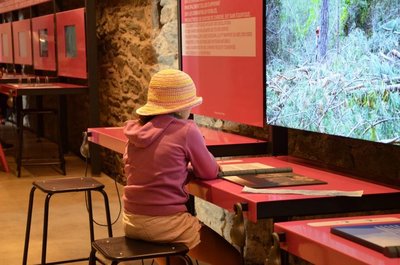
The panoramic Cévennes via Mont Aigoual
The route crosses the massif on ridge paths, alternating between forest tracks and technically demanding singletracks. The highpoints are the panoramic views over the surrounding massifs and the technical sections. A route reserved for experienced runners, used to technical terrain and long distances.
50 points of interest
PROHIN Olivier 
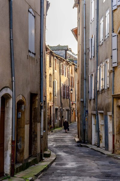
Grand-Rue
Rue Armand Jullié used to be Florac’s trading street and would have been lined with workshops with typical shop fronts. Mule drivers once used this road to carry their goods from the Auvergne down to the Midi, before they were replaced by cart drivers and finally wagoners. More than twenty wagoners would stop off in Florac at the turn of the 20th century. They would rest here and, before resuming their journey, would take on additional horses to help climb the steep hills that awaited them on the road ahead.
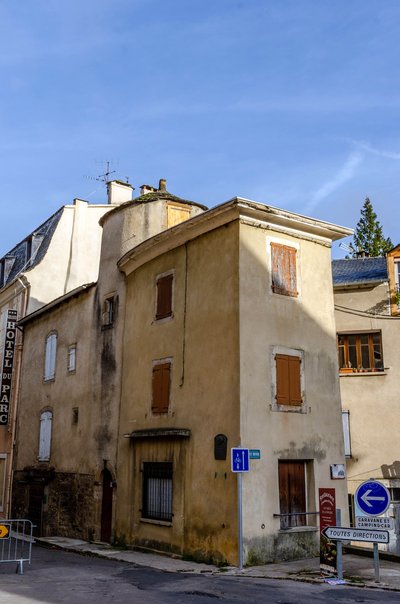
PROHIN Olivier The Planet neighbourhood
In the 16th and17th centuries, a large number of religious conflicts between Catholics and Protestants affected the Cévennes, bringing with them much destruction. After the Peace of Alais was signed by Richelieu and the Duke of Rohan in June 1629, Protestants retained the right to practise their religion, but their fortifications were razed. This included Florac's town walls. The house bearing this information panel is one of the town's oldest: its tower used to watch over Thérond Gate. It also stands at the crossroads of the former road linking Nîmes with Saint-Flour and the former road from Florac to Séverac via the Causse plateau.
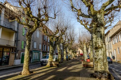
PROHIN Olivier The Esplanade
The covered passage of the sub-prefecture is one of several in Florac, running beneath the houses. You have just gone through the former town wall and now find yourself inside the medieval town. Besides the beautiful ancient plane trees (the oldest are 200 years old), you can see, at one end, the statue of Léon Boyer, who built the Garabit viaduct with Gustave Eiffel and died in 1883 in Panama, where he was working on the construction of the Canal; and at the other end, the temple (Protestant church) and the War Memorial.
BOUISSOU Arnaud 
Panorama and history
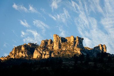
Cave dwellers used to live in the rocks of Rochefort (at an altitude of 1,054 m) as far back as the Bronze Age. That is also where the first feudal castle was built. In the Gallo-Roman era, Florac was probably only a rural estate. The medieval village developed on the small hill overlooking the Vibron, next to the church in the Fourniol district. The population passed the 1,000 mark in the 18th century, and stood at 2,236 in 1852. Since the early 20th century, it has remained relatively stable at around 2,000 inhabitants.
PROHIN Olivier 
The former convent
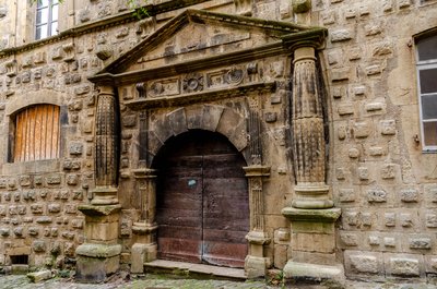
Originally built to house a hospital, this building became a Capuchin convent in the 17th century. Subsequently transformed back in to a hospital, it has since also been the seat of the sub-prefecture and a religious institution. It is known as the “house of the Congregation” and is today used as a private school. We have to picture it in the late 17th century, when this district was densely populated, teemed with life and saw much economic activity: textile craftsmen, leather craftsmen, mule drivers, carters and innkeepers, who made their living from the merchants and goods passing through.
PROHIN Olivier Saint-Martin's Church
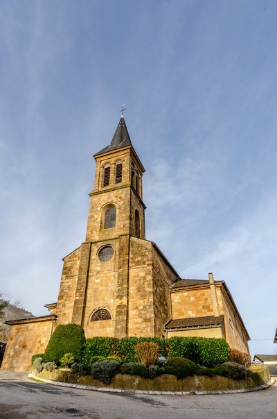
The original church, the Chaise-Dieu Priory church, stood on the site of the current church, surrounded by a cemetery. Between the 13th and 15th century, Florac was known for the power struggle between its priory and its lord, who lived on the other side of the Bibrou (Vibron) river. The church was destroyed in 1561 and a temple (Protestant church) built on its vestiges. Florac was devastated many times by religious wars: the temple, the clock and the church tower were all destroyed at the beginning of the 17th century (1629). The current Catholic church, built in the neoclassical style, dates from 1833, just like the temple on the Esplanade.
La source du Pêcher - PROHIN Olivier 
The river Vibron
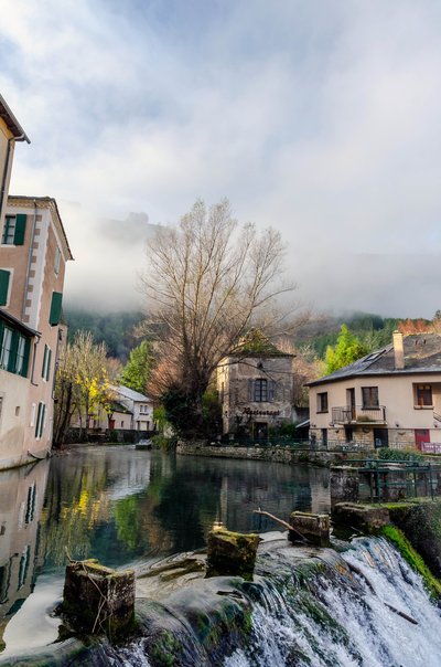
This river has been used as the drinking-water supply for the town’s many fountains, to irrigate its gardens, power up to eight water mills and provide water for a fish farm. In the old days, it was also used for public wash-houses, tanneries and as a drain for waste water.
PROHIN Olivier 
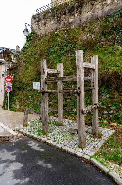
The ferradou and fairground
The ferradou was once the place where oxen were shod. It is located next to the public weigh house on the former fairground, where Florac’s thirteen annual fairs used to be held. These fairs were an occasion for trade between the regions. People would come from the Causses, Cévennes, Mont Lozère and even further afield to sell their sheep, goats, cows, oxen and pigs. Wine, chestnuts, wheat, fruit, clogs and woollen cloth would also have been sold. These fairs were also great festivities, which some people celebrated by drinking beyond reason before staggering back to their villages!
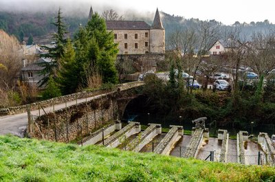
PROHIN Olivier The former fish farm
Situated upstream of the former Draille Bridge, the fish farm carries on a local tradition of fish farming that was no doubt ancient. Behind the fish farm you will find one of Florac’s former mills (the mill of the spring). The mills served several purposes: grinding wheat, pressing walnuts for oil, fulling wool, etc.
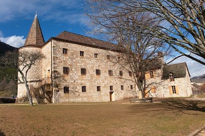
Siège du Parc national des Cévennes, Château de Florac - © Guy Grégoire The castle and fairground
Florac castle was rebuilt in 1652, after the religious wars, and now stands on the spot of the former feudal castle, mentioned in records dating back to the early 13th century. During the French Revolution, the castle was turned into a salt loft for storing salt. Sold to the French State in 1810, it was used as a prison. It still retains some features of that period. Since 1976, the castle has been the seat of the Cévennes National Park.
PROHIN Olivier 
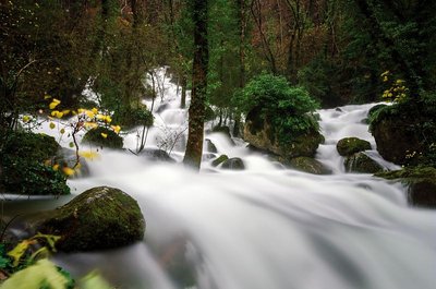
The Pesquié spring
The spring of the Pêcher surges in several places from a big mass of fallen rocks. It has not been possible so far to explore any of these points further. The spring provides a lot of water, but in irregular quantities:
• low flow rate: between 80 L/s and 200 L/s
• average flow rate: between 1,250 L/s and 7,000 L/s
The average temperature is 10 to 10.2°C.
La Can de Ferrières - © Guy Grégoire The Can de Ferrières
This limestone plateau continues to be grazed by flocks of sheep. Note the piles of stones, called clapas. They are not there by chance! They are the result of locals clearing their fields and pastureland of stones. These piles shelter many species.

Place des Ayres (Threshing Square)
Marker 20
So called because it used to be where most of Barre’s farmers came to thresh their grains using flails. This technique, known since Gallo-Roman times, was for a long time the most widely used.
Scree
Marker 19
Limestone is made up of thin layers topped by thicker ones. Water penetrates into the rock’s interstices and, when it freezes, fractures it. The base layers are more fissured and therefore eliminated more quickly. That is how the overhangs you can see at three different heights were created. These rocky environments have an important ecological role because they are a refuge for certain species of plants (French-leaf sorrel) and animals (little owl). A little further down, some seeps support wetland vegetation: horsetails, hemp-agrimony. This is also a meeting-point for many butterflies (great banded grayling, marbled white), which are the only creatures that can reach the nectar deep inside hemp-agrimonies and plume thistles.The watershed
Marker 18
At the centre of the landscape, the river Malzac meanders through the relatively gentle relief and then flows into the Mimente in the Atlantic catchment area. Meanwhile the Grisoulle, on your left, is a tributary of the Gardon, which flows into the nearby Mediterranean, cutting abrupt slopes into the relief as it goes. The Grisoulle’s gradient is six times steeper than the Malzac’s. It is quite possible that in a few thousand years, the Grisoulle will capture the Malzac and profoundly alter the landscape. The little pass that separates them is the watershed, which also goes through the Castelas and Can Noire.Place de la loue (Hiring Square)
Marker 1
This little square, located at the north-eastern entrance to the village, was where the “loue” (hiring) used to be held during the great spring and autumn fairs: shepherds, domestics and chestnut gatherers would sit on the parapet and hope for an employer to take them on. The village hosted 12 to 15 fairs every year. The spring and autumn ones could attract up to ten thousand people from neighbouring departments, but also from the Var, Vaucluse and Bouches-du-Rhône. This village-rue (one-road village) was protected at each end by a fortified gate. One of them, called the Florac Gate, stood near the Place de la Loue. It was destroyed in the early 19th century.
Castor au réfectoire - © Bruno Descaves The Malzac valley
The erosion caused by the Malzac, weaker than that caused by the Griboulle, has left more land usable for crops and fields. This allows farmers to keep a few cow herds. The region’s climate, relief and soils force its inhabitants to base the local economy on agricultural and forestry activities of low productivity. At the same time, climatic and environmental variety generates a large range of plant and animal species, the source of abundant bio-diversity. The Cévennes National Park has worked hard to conserve this wealth by re-introducing some species that had disappeared: roe deer, stags, the Western capercaillie, beavers, and the griffon vulture.

Fontaine du Thérond - © Guy Grégoire Théron Fountain
Marker 2
Barre was built on the contact zone between sandstone and mica schist. Several springs and seeps emerge from this impermeable zone, which feed into the village’s fountains and garden wells. The oldest, the Théron Fountain, has been restored several times. The typical Barre house is generally taller than it is wide, probably to avoid encroaching on cultivatable land. On the ground floor would have been a shop, workshop, storage space, or the stable; on the first floor, the kitchen; and above that one or two bedrooms. At the very top, a hay loft would have been used to store hay and straw. Flora
FloraRock plants
Marker 17
These rocks offer a plant habitat comparable to stone walls, but plants have been established here for longer. Most shelter along fissures or shelves, where they can find a few minerals and organic matter, leaving the smooth rock faces to lichens. The dolomite rock has created particular soil conditions here, which are favourable to certain plants such as Kernera saxatilis. Erosion has created small cavities that shelter certain birds, such as the black redstart (phoenicurus ochruros) in summer and the alpine accentor (prunella collaris) in winter.The temple (Protestant church)
Marker 7
Begun in 1823 and finished in 1826, this temple was Barre’s third. Its architecture is similar to that of all the temples built at this time. The first temple had been constructed in 1608 near the Catholic church, shortly after the arrival of Protestantism in the region. Only one of its stones still exists and can today be seen in the facade of a house on the main street, inscribed: “He who is of God hears the word of God – 1608”. In 1675 Protestants built a second temple below the village. It was destroyed on Royal orders in 1685 following the Revocation of the Edict of Nantes (which re-criminalised Protestantism), forcing Protestants to hold their religious gatherings in the mountains.Bedrocks and construction
Marker 3
Different types of rock were used to build the village, as in the courtyard on your left, in particular limestone (5) and quartzite (2) for houses. Additionally, sandstone (4) and granite (1) were used for retaining walls, and mica schist for roofs (3). These rocks came from the immediate surroundings of Barre, where they make up the landscape’s structure. This can be seen in the foreground, looking south-west. On each side of the narrow street are the terraced gardens. This system, typical of mountain regions, makes it possible to retain soil by reducing gradients. Oral tradition has it that local lords granted their feudal tenants these gardens free of charge.- Flora
Wall plants
Marker 3
Vegetation on walls has to overcome the lack of both soil and water. To persist under these conditions, there are three possible strategies:
- spending the hardest season as seeds, as annuals do, e.g. thyme-leaved sandwort (arenaria serpyllifolia);
- laying in water reserves, as succulent plants do, e.g. white stonecrop (sedum album);
- drying out without dying, as lichens and mosses do. By breaking down the substrate, these also create a bit of soil for superior plants (those with flowers and therefore seeds: sandwort, stonecrop, etc.). The Château
Marker 6
Constructed in the 12th and 13th centuries, the Château was entirely rebuilt in the early 16th century. From 1710 to 1715, it was modified by the Lord of Barre, who had his coat of arms carved above the entrance. Two towers were also added at this time. During the 1789 Revolution, the coat of arms disappeared under vigorous hammer strokes. In the early 19th century, during an expansion, the main tower was removed.Place de la Madeleine
Marker 5
The fountain dates from the 18th century. At the end of the 19th century, the bust of Marianne – the personification of the French Republic – was added. At the same time, a poplar was planted by republican youth as a symbol of freedom. From here, you can see several bourgeois houses, which mostly date from the 17th and 18th centuries. They bear witness to the village’s thriving past, when it had some 20 voituriers (merchant-carters), who would drive their carts down to the plains laden with wool and chestnuts and return with salt, wine and oil. Under the houses' large porches, harnesses and carts were kept. During fairs, the seed market took place in these vaults and those of the town hall.
Église de Barre-des-Cévennes - © Guy Grégoire The Catholic church
Marker 8
The church was probably built in the 12th century. Its barrel-vaulted nave is Romanesque in style. The original building was extended by several lateral additions in the Gothic style: in the 14th century, a chapel (north side) featuring the coat of arms of the Lords of Barre; in the 15th, three chapels on the south side. The church has been a listed building since 1931. In front of it is the Place de la Bladarié, which hosted the medieval seed market and, as of the 16th century, the sheep market.Place des écoles (Schools Square)
Marker 4
“Schools Square” has changed name several times over the years. In the Middle Ages, it was known as PourcariéSqaure because it hosted the pig market. Later the market also opened up to oxen, horses and mules, and was therefore renamed the Fairground Square. It was the most important area of the fairs, where the largest sums of money changed hands. During the Protestant Camisard Rebellion (1702-1704), the square was protected by a large wooden palisade. During the 1789 French Revolution, the National Guard held arms drills here, and its name changed to Arms.Place de l'Orient
Marker 9
Barre’s third fountain used to stand on this square, where the pig market was held from the 16th century onwards. At the entrance to the main road was the Cévennes Gate, dismantled in 1836 because it obstructed carts. The houses adjoining this Gate and the Florac Gate were requisitioned during the Camisard War to house the King’s soldiers. At the time, Barre was one of their main garrisons.
Barre-des-Cévennes - © Pierre Lahoud Ruiniform rocks
Marker 16
The Castelas, a butte, is a vestige of the area’s former limestone top layer. It has been cut off from the great Causses by erosion. It was settled in about 2500 BC by tribes from the scrublands of Languedoc. On the three rocks left by erosion are ten or so rectangular holes. They are believed to have supported the base of a wooden signal tower.Can Noire
Marker 11
In front of you is an abrupt slope broken halfway by a level shelf. This shelf corresponds to a strip of the peneplains which, at the end of the Palaeozoic (between 280 and 230 million years ago) resulted from the complete erosion of the great Hercynian mountain chain. Below the shelf are rocks established between 350 and 280 million years ago: essentially mica schist (3) and granite (1). Here, the steep slopes with their thin acid soils are covered by Cévenol heaths of broom, heather, bracken and thyme. A few sessile (durmast) oaks, ash and willows break up the monotony. Above the shelf are sandstone (4), dolomite rock (6) and limestone (5), deposited by the sea in the Mesozoic, between 230 and 190 million years ago.Ash trees pruned in the “tadpole” style
Marker 10
No water runs in this little gully in the summer. You can see a large number of ash trees of a particular shape caused by regular pruning, called “tadpole”. Ash trees prefer relatively deep and humid soils, but locals have privileged it here over its direct rivals (willows, aspen, and hazelnuts). Celts and Germanic tribes already considered the ash a sacred tree, believing it to attract lightning and beneficial rains. Its hard and elastic wood is much appreciated in cabinet-making. It is also used for tool handles. The first skis were made of ash. Farmers use ash leaves as supplementary fodder for livestock.Forest
Marker 15
The landscape stretching eastwards is characterised by forest. Over 60% of the surface area is covered in woods, of which 40% are conifers. Many of the latter are species introduced by the Office National des Forêts (the body that manages state forests): European Black Pines and Nordmann Firs on the heights, Douglas Firs in the depressions. Scots Pines – an indigenous species which colonised former sheep pastures after they were abandoned at the end of the 19th century – are usually relegated to poor and thin soils. Only 20% of the wooded area is taken up by deciduous trees, essentially beeches, sessile oaks and birches.Village de vacances (holiday village)
Marker 12
Barre’s holiday village was built in 1971 by the association of local councils. It consists of 30 units and can accommodate 180 people. The impetus behind its construction was a re-orientation of Barre’s economy towards tourism.Eroded sandstone
Marker 14
Some 10 metres below the path, there are areas of denuded, strongly eroded sandstone. These areas suffer from substantial loss of materials, especially during the strong autumn and spring rains. Plants cannot get established here. Only trees, if they were to grow, could stop the process. Their large root system would hold back the soil while their branches would protect it from the worst of the rains. The sandstone is topped by dolomite rock, limestone and marl containing marine fossils: mussels, pectens (saltwater clams), etc.Sandstone outcrop
Marker 13
On the other side of the road, the sandstone bank shows criss-crossing layers which were deposited by flood waters with very strong currents. The pebbles they contain have angles that are barely blunted, indicating that they were not carried far. This very crumbly sandstone is generally held together by a greenish clay rich in white mica without any limestone. It bears witness to the arrival of the sea, 200 million years ago. On this rock face, plants have to compensate for intense erosion by being able to develop rapidly and withstand a certain amount of dryness. There are a very few chamomile plants and streamlined plantains.
Frêne commun - Nathalie Thomas FloraAsh trees
Ash trees, like the ones that border the path, like cool and damp environments. They were planted alongside paths by locals because ash branches, cut towards the end of summer, provided additional fodder for livestock.

Relief de la Can de l’Hospitalet - Florac - Sud Lozère The evolution of the landscape
140 million years ago, the sea was shrinking, and the Can de l’Hospitalet and Causse Méjean were not yet separated by the Tarnon valley. The landscape was completely different then. In a hot and humid climate, limestone “turrets” overlooked rivers whose routes were different from today's. Successive uplifts, shifts on either side of geological faults and the slow work of erosion have created the relief you see today. You have panoramic views over the valley of the Baumale, a tributary of the Tarnon, and, opposite you, the Causse Méjean. It is difficult to make out the limit between the limestone zone and the schist zone in this heavily wooded landscape.

Ephippigère des Vignes - Nathalie Thomas  Fauna
FaunaBush crickets
Dry grassland is home to a multitude of insects, including bush crickets. At night, they produce a squealing sound by rubbing the stubs of their wings together. The sound has given them the name of “gouzi”. But despite their musical wings, they cannot fly, and hide in vegetation (such as boxwood or juniper bushes) to escape predators.

Météosite de l'Aigoual - © Olivier Prohin Mont Aigoual
A beautiful view onto Mont Aigoual (1,567 m) – a mountain of winds, fog, snow and rain. Banks of clouds coming from the Mediterranean rub against its slopes and can cause violent precipitation (also called Cévenol episodes). This temperamental mountain is home to the last mountain weather-station in France.

Transhumance - © Michelle Sabatier The Margeride draille (drovers’ road)
The draille follows the ridge and crosses the Can de l'Hospitalet plateau. This transhumant trail enables the sheep flocks of the plains (of the southern Cévennes and the Crau) to move up to northern Gévaudan (Aubrac, Margeride, Mont Lozère). This draille is only one branch of a larger network along which transhumant livestock still travel.
La Vallée de Sexte et son manteau blanc - Béatrice Galzin Col Salidès
The bare ridge that rises opposite is the watershed between the Mediterranean and the Atlantic. Rain that falls on the Sexte valley flows into the Tarnon below (on the left) and ends up in the ocean. On your right, the Mediterranean side offers extraordinary views onto the foothills of the can de l’Hospitalet plateau and the entirety of the Cévenol mountains. On some days, the Alps and Mont Ventoux can be seen in the distance …
Maison du berger - Michel Monnot Summer pastures
Since time immemorial, animals have naturally migrated from the plains into the mountains in summer. The Salidès pass has summer pastures for sheep. The shepherd’s house is just below you on the Mediterranean side. The shepherd stays several months with about 800 sheep and a few dogs. Careful: patous, the big and handsome white dogs, are there to supervise and defend the herd!
It is important for the herd to graze here. The animals fertilise the soil and maintain the open spaces.
Le Col Salidès - Office de tourisme OTMACC The transhumant shepherd of the Col de Salidès
From the end of spring onwards, the Col de Salidès livens up. The transhumant shepherd moves up for the three months of summer grazing in this magical spot with almost 1,000 sheep. In all weather, the shepherd takes the animals outside so they can graze new grass. He has to both manage his pasture land and look after the sheep.
At the end of summer, each livestock farmer comes to recover his animals. Be careful around the dogs that watch over the flock!
La forêt de hêtres - Béatrice Galzin The forest of L’Hom
From the 19th century, the forest of L’Hom was the “reserve” of a private estate of over 700 hectares. Its animal stocks were protected and used as a “savings account” in the event of unforeseen financial needs. This situation in part explains the diversity of the forest, which stretches from 600 to 1,1000 m in altitude and contains many species: native (holm oak, sweet chestnut, beech, birch, wild cherry, rowan, pine, spruce, etc.) as well as exotic ones, which were introduced by the new owners (northern red oak, red maple, giant redwood, larch hybrids, etc.). This private forest has a management plan based on the prosylva principles (forestry close to nature), which was approved by the body in charge of forest management and the Cévennes National Park. There is abundant game, and you may spot a deer or stag on your walk.
Aire de Côte - Stephan.Corporan Aire de Côte
Aire-de-Côte farm was purchased by the French State in 1862, during the period of reforestation. Before the farm became a stopover gîte, it was for a long time the residence of the local forester and his family. In the first half of the 20th century, Aire-de-Côte was very different. To the north, behind the house, was the draille (drovers’ road), lined by upright stones and 40 to 50 metres wide. Thousands of transhumant animals passed every year on their way to or from summer pastures. The transhumant animals stopped there at lunchtime, then continued on towards Mont Aigoual.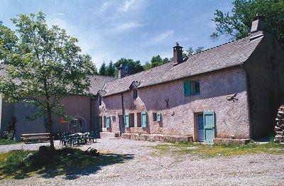
Guy.Grégoire A Resistance refuge
In early 1943, the first Resistance group of the Cévennes was formed. The refuge of the Aire-de-côte group was one of the wooden shacks used for forestry works, whose roof was camouflaged using branches. On 10 July 1943, a message warned the post office in Rousses that a German attack was imminent. The Resistance was informed – but a storm delayed the group’s departure. The Germans arrived… The forester was arrested as an accomplice, accused of being in radio contact with London. Indeed, the Aire-de-côte Resistance listened to a crystal radio set built by the two Jews who were hiding there.
Vue depuis les 4000 marches - Olivier.Prohin Le Coulet
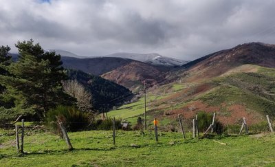
At Le Coulet (meaning little pass), views open up onto the Mediterranean side, towards Valleraugue. The viewpoint lies on the watershed. Up to this point, the route followed the valley of the Bédil, a brook with a gentle, non-torrential gradient, whose waters flow into the Atlantic. Here, you discover the valley of the Clarou (a tributary of the Hérault), with its typically Mediterranean, i.e. more abrupt, profile. To the south, schist outcrops break through the slopes; to the north, the slopes are entirely wooded.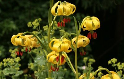
Lis des Pyrénées - © J.-P. Grandmont Alpine garden
Marker 5
This panel shows the legacy of Charles Flahault's experimental work.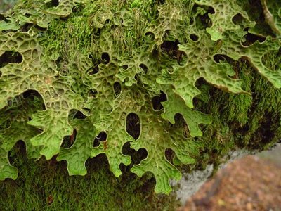
Lobaria pulmonaria - © Mario Klesczewski Did you say “chourradou”?
Marker 4
This remarkable beech is over 200 years old and called chourradou in Occitan, after the sheep that would chourrer (ruminate) and rest under its shady canopy. This kind of tree (large cavity, detached bark and dead wood) is home above all to saproxylic or dead-wood-eating insects and fungi. On another of these old beeches, below the path, you can see a large lichen called lobaria pulmonaria, which needs a lot of water and is highly sensible to atmospheric pollution. It grows very slowly and thus testifies to the ripe old age of this part of the forest.
Chalet laboratoire en 2023 - © B. Algoët The Chalet, Charles Flahault's laboratory
Marker 6
“And who knows whether some generous benefactor will not decide one day that our students should have a hospitable roof at L'Hort de Dieu itself? I can see the little house as if it were already built, receiving much sunlight on the Mediterranean side, with its study room on the ground floor and its large fireplace around which scientific problems are discussed late into the night..” (Charles Flahault, 1904)
The Chalet, which was built the following year, made it possible to establish a botanical garden, a high-altitude vegetable plot and a plant nursery nearby. Despite the forest reconquering the surroundings, some of the plants introduced at the time have survived until today: Pyrenean lily, great masterwort, and others.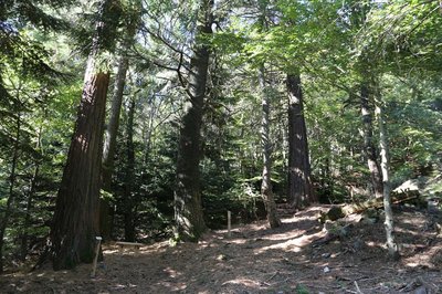
Collection de l'Hort de Dieu - © B. Algoët Acclimatising a plant species
Marker 7
Fabre and Flahault pursued two objectives: studying the way certain forest species adapt to the Cevenol climate and studying plants in their relationship with environmental conditions. Some plant species are better adapted than others to the Cevenol climate. Thus, Mediterranean and Douglas firs do very well, as do almost all the species native to Europe, Asia Minor and the western United States. Species from East Asia and the eastern United States, however, whither away. Through his work, Flahault laid the foundations of phytosociology, the study of how plants arrange themselves into communities as a function of the environmental conditions.
Description
Day 1: Florac, Barre-des-Cévennes, 16 km, 780 m of climbs, 390 m of descents. GR®43, GR®7.
From Florac, go to Barre-des-Cévennes on the GR®43 to the Col des Faïsses pass via Le Pont de Barre, La Rouvière, Tardonenche, Col du Rey. At Col de Faïsses, leave the GR®43 to take the GR®7 to Barre-des-Cévennes via the Can Noire plateau.
Day 2 : Barre-des-Cévennes, summit of Mont Aigoual, 30 km, 680 m of climbs, 1280 m of descents, GR®7.
From Barre-des-Cévennes, take the GR®7 back to Col des Faïsses. At the pass, continue on the GR®7 uphill to the summit of Mont Aigoual via L'Hospitalet, Col de Salidès, Aire de Côte, Cap Brion, Mont Aigoual.
Day 3 : Summit of Mont Aigoual, Le Vigan, 26 km, 440 m of climbs, 1770 m of descents, GR®7
From the summit of Mont Aigoual, go downhill to Prat Peyrot, Col de la Serreyrède, L'Espérou, Col de Montals, Col de la Broue, Aulas, Le Vigan.
- Departure : Florac
- Arrival : Le Vigan
- Towns crossed : Florac Trois Rivières, Cans et Cévennes, Barre-des-Cévennes, Vebron, Le Pompidou, Rousses, Bassurels, Saint-André-de-Valborgne, Val-d'Aigoual, Meyrueis, Saint-Sauveur-Camprieu, Dourbies, Bréau-Mars, Arphy, Aulas, Le Vigan, and Avèze
Forecast
Altimetric profile
Recommandations
Before committing yourself to a circuit, ensure that it is suitable for your activity level and ability. Remember that the weather changes quickly in the mountains. Take enough water.
Information desks
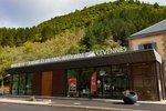
Tourism'house and national Parc at Florac
Place de l'ancienne gare, N106, 48400 Florac-trois-rivières
This office is part of the National Park's associated tourist-information network, whose mission is to provide information on, and raise awareness of, the sites and events as well as the rules that must be observed in the National Park's central zone.
On site: exhibitions, video projections, events and shop Open year-round
Transport
Bus line, lio.laregion.fr
Le Vigan-Alès : line D42, Monday to Friday 6.50 am, arrival 8.45 am
Bus line Florac-Alès : line 252, Monday to Friday.
Passenger and luggage transport : www.lamallepostale.com/fr
Access and parking
From Mende or Alès to Florac
Parking :
Source



Report a problem or an error
If you have found an error on this page or if you have noticed any problems during your hike, please report them to us here: