
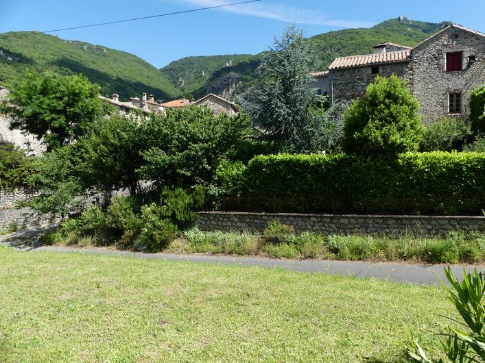
The hamlets, the Col de Mouzoules pass and the river Bavezon
An uphill section in a wild valley with waterfalls, a beautiful panorama around Les Vernèdes, and then a descent through hamlets showcasing traditional architecture as well as Aumessas, a designated “lovely village”.
8 points of interest

Aumessas - N Thomas 
Aumessas village
Aumessas was called Ulmensacium in 1248, from Latin ulmus meaning elm.
In 1769 1,300 inhabitants lived here (240 at the most recent census), the majority of them on the lower lands, below 600m. Their income was derived partly from chestnut growing but mostly from silk farming. On the eve of the French Revolution, 54 silk manufacturers made Aumessas their home. The other inhabitants were shepherds. They lived up in the mountains. The land belonged to the landed gentry, the middle classes or merchants.
Rocher de Saint-Peyre - © Nathalie Thomas St-Peyre rock
To evoke the site of St Peyre, here is a text by C. Chante, taken from his work Un coin des Cévennes. Le Vigan et ses environs (1933). “All of a sudden, an oak grove appears that surrounds a small clearing where some leftover rocks, laid out in an elongated oval, seem to indicate a cromlech. At one end stands the antique structure, which the centuries have respected and which the Christians never thought to come and destroy on this almost inaccessible escarpment. There can be no doubt about its purpose: it is clearly a Druidic altar, made from granite blocks set out in a semicircle with a gradient, whence the priest must have harangued the faithful before or after the sacrifice (…).”
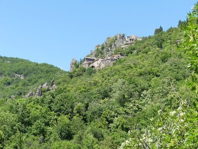
Le Caladon - N Thomas 
Le Caladon hamlet
The path passes pleasantly through treeless areas that let you admire Le Caladon, a village perched on a rocky spur. Caladon was called Calador in 1167, the final “n” being a recent addition that makes the name mean “flagstone for paving” in Occitan. The village stands on a dark and unusual rock: very hard schist (slate) with quartz inclusions, called quartzite. In the 11th century, the hamlet was overlooked by a castle belonging to the House of Roquefeuil. The Roquefeuil family had much power in the region and owned many castles. It is said that a tunnel linked the castle with the Col de Mouzoules pass...
La fauvette à tête noire - Bruno Descaves  Fauna
FaunaEurasian blackcap
Oak forest predominates on this slope but as you get closer to the pass, the trees become rarer. With a bit of luck, you may see a Eurasian blackcap. Its feathers are inconspicuous but the male can easily be identified by its shiny black cap, which stops abruptly just above the eyes. The blackcap particularly likes shrubs and dense thickets, where it builds its nest out of grasses. It sings vigorously in spring, but stops in mid-July.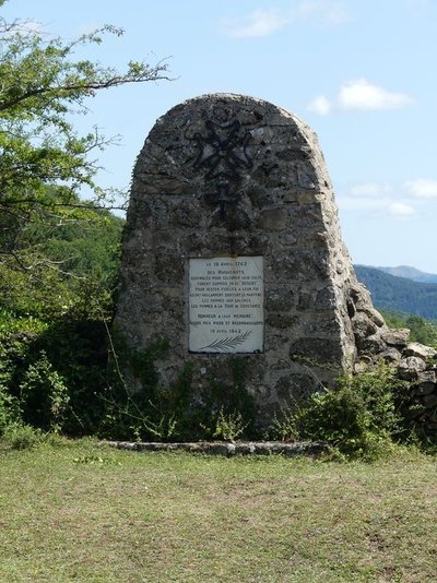
Stèle au col de Mouzoules - N. Thomas Memorial stone for the Camisards and the Gathering in the Wilderness
The stone commemorates the arrest of a gathering of Camisards on 17 April 1742. After Luther’s Reformation in 1521, the Cévenols had converted en masse. By 1560, there were already numerous Protestant communities in the region. The 1598 Edict of Nantes accorded Protestants the freedom of conscience and the freedom to worship. And yet, from 1660 onwards, harassment began with the prohibition of certain positions for Huguenots. The King’s soldiers (the Dragoons) were billeted in locals’ houses and given the right to do anything short of killing them. Brutality, bullying, pillaging of food, destruction of possessions and forced baptisms incited locals to convert to Catholicism. This regime of terror was so effective that just the threat of such a dragonnade sufficed to convert entire villages. (...) A gathering in the Wilderness [secret Protestant service in an isolated outdoors location] was held at Mouzoules. It was denounced by a traitor who, after the tragedy, was forced by the Huguenots to dig his own tomb at the bottom of the Mouzoules meadow. Eleven people were arrested. The men were sent to the galleys, the women locked up in the Tour de Constance tower in Aigues-Mortes. Not one of the women recanted; most died there.
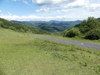
Col de Mouzoulès - N Thomas The mule tracks (Col de Mouzoules pass)
Before roads were built, this track saw much traffic between Le Vigan and the Causses (limestone plateaux). Mule tracks were used by merchants going to fairs. They took wheat and products from livestock farms down into the valleys. When they returned, they brought chestnuts onto the plateau.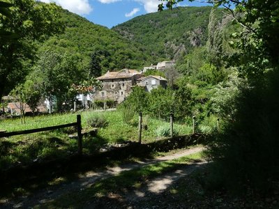
Le Cambon - N Thomas Fruit growing
In the early 20th century, as silk farming declined, the mulberry trees were no longer needed, and were replaced by plum trees around Aumessas. The golden age of fruit growing was from 1930 to 1965. On the train, the fruit was rapidly transported into town. M.M. remembers that “We grew lots of plums around Aumessas. In ‘30, we ripped up the mulberries and planted plum trees on the crop terraces. The men took care of the growing and harvesting, the women packed the fruit, that’s delicate work because plums are fragile. They have to be handled with care so you don’t damage the fine white wax that covers them. The women put them in rows in small baskets that nested within one another. The market eventually collapsed because bigger, more competitive farms and the entry of the country into the European Community meant that small family farms could no longer survive.”
Cloche de l'église d'Aumessas - N Thomas The Catholic church and its bell-gable
The church is remarkable for its bell-gable and has been a listed building since 15 February 1995. The bell bears the date of its casting: 1539. Like other bells, it used to ring the hour and summon the faithful to worship. But in the days of steam trains, it also warned locals of any fires started by escarbilles (small bits of coal). At the time, there were no firemen; the inhabitants were responsible for fighting fires. (bell visible in church).
Description
Signposts will guide you all along this route. In the description below, the signposted place names and/or directions are given in bold italics between quotation marks:
Starting from "AUMESSAS", walk towards to "Roques Longues".
- Continue on “LES VERNEDES”
- Then direction “COL DE MOUZOULES” via “Le Travers”.
- At the "COL DE MOUZOULES" return to "AUMESSAS" along the river Bavezon, via "Aumessas-La Gare".
This walk is taken from the guidebook Les Vallées Cévenoles - En Pays Viganais, published by the Communauté de communes Pays Viganais-Cévennes as part of the collection Espaces Naturels Gardois and the label Gard Pleine Nature.
- Departure : Aumessas
- Arrival : Aumessas
- Towns crossed : Aumessas and Mars
Forecast
Altimetric profile
Recommandations
Make sure your equipment is appropriate for the day’s weather conditions. Take enough water, wear sturdy shoes and put on a hat. Please close all gates and barriers behind you.
Information desks
Tourism office Cévennes and Navacelles, Le Vigan
Maison de pays, place du Marché, BP 21, 30120 Le Vigan
This office is part of the National Park's associated tourist-information network, whose mission is to provide information on, and raise awareness of, the sites and events as well as the rules that must be observed in the National Park's central zone.
Open year-round
Transport
LiO is the regional public transport service of the Occitanie/ Pyrénées – Méditerranée region. It facilitates everyone’s movements by prioritising public transport. For more information, go to the lio Occitanie app or visit : https://www.mestrajets.lio.laregion.fr
Access and parking
From Le Vigan, take the D999 towards Alzon. After Pont d'Arre, turn right onto the D232 to Aumessas.
Parking :
Source


Report a problem or an error
If you have found an error on this page or if you have noticed any problems during your hike, please report them to us here: