
Les Pins
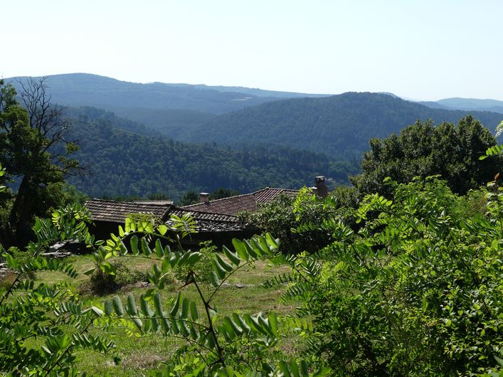
Despite the duality of chestnut trees and maritime pines, on this walk you will find everything that makes the charm of the Cévenol lanscape: low walls, well-maintained chestnut groves, typical Cévenol mas (isolated farms), panoramic views onto the valleys… and a shady path too.
Description
From the car park behind the church, walk uphill on the road, take the road on the left and then immediately the path on the right that climbs the hillside.
- Take the wider path on the right. This goes back down through a chestnut grove to a small road (please respect this private property)
- Turn right onto the road for 300m to the hamlet of La Blichère.
- As you enter the hamlet, take the path that goes uphill on the right (please respect this chestnut grove, which is farmed). Cross the Valat des Clots ravine and continue on the path which leads to a road. (Optional viewpoint : turn left and then right on the road, then retrace your steps)
- Take the track on the right that goes steadily uphill and continue straight ahead, ignoring a track on your right.
- When you arrive at the road, turn right onto it and walk for 180m.
- Take the path on the right and, at the crossroads, continue downhill on the left (careful: beehives on the right). Continue downhill, ignoring the tracks on your right.
- At the road, turn right to return to your starting-point (500m).
- Departure : St-Julien des Points (church)
- Arrival : St-Julien des Points (church)
- Towns crossed : Saint-Julien-des-Points, Le Collet-de-Dèze, and Sainte-Cécile-d'Andorge
Forecast
Altimetric profile
Recommandations
This hike is accessible to all.
It can be done on mountain-bike, but be careful between the start and point 1: damaged path ! Take the road instead.
Make sure your equipment is appropriate for the day’s weather conditions. Remember that the weather changes quickly in the mountains. Take enough water, wear sturdy shoes and put on a hat. Please close any gates and barriers behind you.
Information desks

Tourism office Des Cévennes au mont-Lozère, Le Collet-de-Dèze
RN 106, 48160 Le Collet-de-Dèze
This office is part of the National Park's associated tourist-information network, whose mission is to provide information on, and raise awareness of, the sites and events as well as the rules that must be observed in the National Park's central zone.
Open year-round

Tourism office Des Cévennes au mont-Lozère, Vialas
1 place de l'ancienne gendarmerie, 48220 Vialas
This office is part of the National Park's associated tourist-information network, whose mission is to provide information on, and raise awareness of, the sites and events as well as the rules that must be observed in the National Park's central zone. Open July and August
Transport
LiO is the regional public transport service of the Occitanie/ Pyrénées – Méditerranée region. It facilitates everyone’s movements by prioritising public transport. For more information, go to the lio Occitanie app or visit : https://www.mestrajets.lio.laregion.fr
Access and parking
From Le Collet de Dèze, drive downhill on the N106 for 5km, then, just before Le Pont, take a small road on the left to Église (à La Combe) via Le Champ Neuf.
Parking :
Source


Report a problem or an error
If you have found an error on this page or if you have noticed any problems during your hike, please report them to us here: