From Meyrueis to the summit of Mont Aigoual.
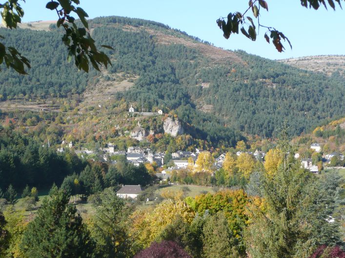
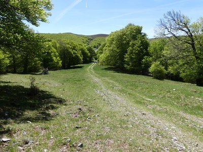
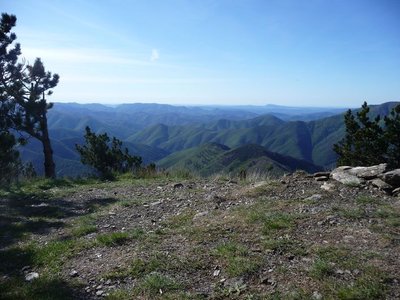
You leave Meyrueis, a market town built at the confluence of three rivers, to immerse yourself in a beech forest with some rather crooked trees that alternates with upland grasslands. As well as the vista from the summit, this hike also offers panoramic views onto the Causses plateaux and the Brèze and Béthuzon valleys.
40 points of interest
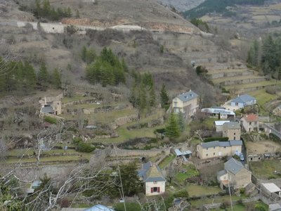
Terrasses sur Meyrueis - © Nathalie Thomas Terrace
Throughout the climb, you will see abandoned former crop terraces. A few grapevines have persisted since local wine-growing came to an end. They bear witness to the fact that the slopes around these hamlets and villages were once cultivated and planted with fruit trees and vines. Terraces like these were the only way for the valley's inhabitants to have flat areas with deep soil suitable for growing.
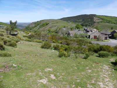
Cabrillac - nathalie.thomas 
Cabrillac
Cabrillac was located at the crossroads of the grande draille d'Aubrac (Aubrac drovers’ road) and the road from Meyrueis to Florac and St Jean du Gard. The village had about a hundred inhabitants in the 20th century and was an important and inevitable place of transit. Two fairs were held every year: one during the migration to the summer pastures in May; the other in September, during the return. For some shepherds, this was the occasion to sell the lambs that had spent the summer on the Aubrac plateau.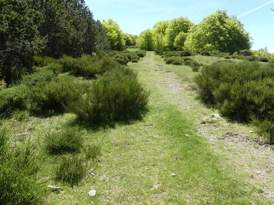
Draille de Cabrillac - nathalie.thomas The Aubrac drovers’ road
From Cabrillac, we follow the Aubrac drovers’ road, which started near Ganges (Hérault) to lead flocks onto the Aubrac pastures, a distance of 110 km. If you climb to the top of Mont Aigoual (2 hrs), you can visit the meteorological observatory and meet transhumant flocks. Be careful of the patous (livestock guardians).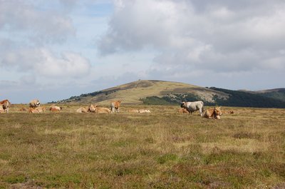
Troupeau au sommet de l'Aigoual - © Nathalie Thomas  Flora
FloraSummit of Mont Aigoual
At an altitude of 1,565 m, the climate is harsh: weather conditions are the same as they would be at 2,000 m elsewhere, with only four “frost-free” months a year. Winds of above 60 kph blow on 265 days a year, and the average annual temperature is 4.8°C. Trees do not have enough time to complete their life cycle. Local plant formations are those of the montane zone: subalpine short-grass prairies.
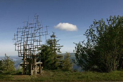
Assise (Marie-Hélène Richard) - © Filature du Mazel 
Seated (Marie-Hélène Richard)
Far from town, paths open the door to new rhythms. Another vision of life and time lets us breathe in the ever-present contemplation, stones, trees and skies. A physical experience of coming face-to-face with nature. A bench made of wood and branches, whose back becomes thinner as it rises towards the sky, as if to turn back into a tree.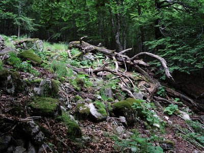
Forêt de l'Aigoual - © Gaël Karczewski A site for botanical experiments
Marker 1
L’Hort de Dieu is located at an altitude of 1,300 m and shaped by an extreme climate. This site with its exceptional assets is a favoured study and experimentation zone for botanists. The tree collection is just over 100 years old, and some of the specimens are declining because of old age or else because they are not well-adapted to this mountain range. Today, there are 75 species left of the 140 that have been tested over the past century. To safeguard the interest of this heritage site, the Office National des Forêts and the Cévennes National Park are currently reflecting on renewing the collection.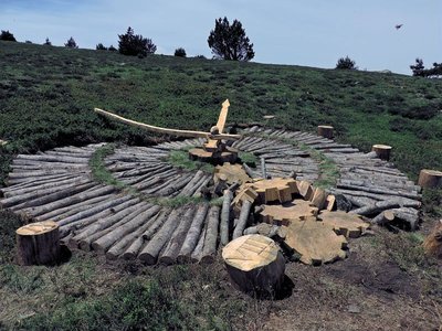
Tempus fugit (Fiona Paterson, Donald Buglass) - © Natacha Maltaverne Tempus Fugit (Fiona Paterson, Donald Buglass)
Time flies, conscience cries, death threatens, heaven invites, hell scolds, and man sleeps. Here, the effects of time and natural elements transform the wood used in the artwork; everything is an endless renewal at the same rate as the passing hours. How much time have we got left before everything is lost and it is too late to repair the damage? Nature will continue on its trajectory and efface the traces of Humanity on Earth.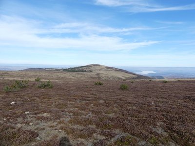
Le Portalet - nathalie.thomas FloraShort-grass prairies and heath on the summit of Mont Aigoual
Here, only species with a short reproductive cycle can settle due to the frequently glacial climate. The heath has been invaded by heather and mountain pine. This zone is barely wooded due to the violent winds and is comparable to subalpine vegetation, consisting of short-grass prairies and heather and blueberry moor. It is sometimes called pseudo-alpine.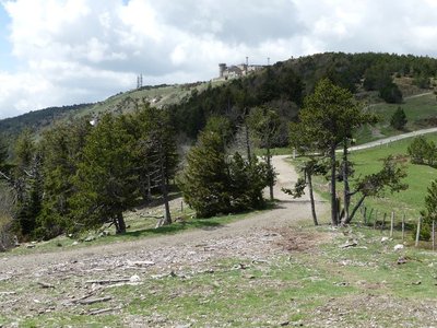
Observatoire de l'Aigoual - nathalie.thomas The meteorological observatory
Inaugurated in 1824, the meteorological observatory was built on the initiative of Georges Fabre, one of the pioneers of the reforestation of Mont Aigoual. His work with the botanist Charles Flahault enabled the creation of the arboretum of L’Hort de Dieu. The first meteorological data were gathered by agents from the French National Water and Forestry Commission. Since 1943, the observatory has been managed by the National Meteorological Office. It is France’s last mountain weather station that is inhabited year-round.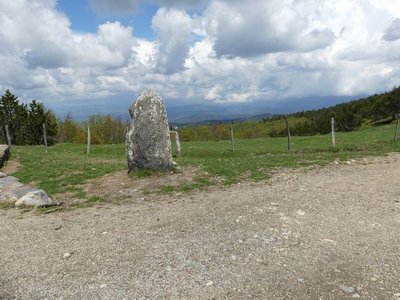
Vue depuis Font de Trépaloup - nathalie.thomas FloraThe evolution of plant life
At the pass stands a schist menhir (standing stone). To the north, in Trépaloup ravine, hewn flint implements bear witness to a human presence in the region since prehistoric times. Palynological analyses (studies of pollen fossilised in peatbogs) have allowed scientists to piece together the plant life on Mont Aigoual from 8,000 to 5,000 BC. Pine predominated, accompanied by birch and hazelnut. Then pine populations gradually diminished. The damp climate warmed up, favouring the spread of oak and hazelnut. Finally, the increased damp and cloud cover at altitude allowed fir and beech to develop. From the end of the first century BC, the substantial percentage of grasses shows that forest had receded in favour of pasture and prairies. This was the start of the great deforestation.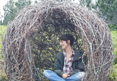
Cellule (Marie Gueydon de Dives) - © Filature du Mazel Cell (Marie Gueydon de Dives)
This artwork, natural in architecture but artificial in execution, represents a passage between the interior and exterior worlds. Posing or opposing while questioning the notions of limit, porousness and opening.
This work encourages you to come inside but feel outside. To be the contemplative eye, the receiving ear, the conscience that objectifies reality.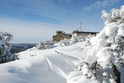
L'Aigoual sous la neige - © Météosite du Mont Aigoual Mont Aigoual weather station
Inaugurated in 1894, this infrastructure is France’s last mountain weather station to be inhabited. Its history is closely linked to the reforestation of Mont Aigoual. It has become a high-performance weather station with an array of modern test instruments, measuring devices for extreme conditions, and a museum/exhibition on meteorology. The 800 sq m exhibition will tell you more about climatology on Mont Aigoual and about meteorology in general.
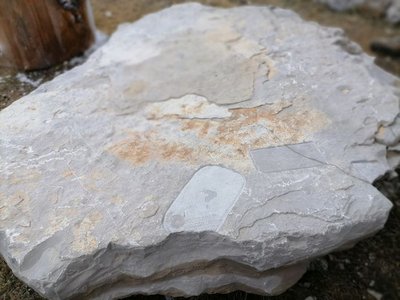
Archéosmart (Marc Limousin) - © Filature du Mazel 
Archeosmart (Marc Limousin)
Smartphone imprints appear on the rocks: fossils of the present that will become mysterious in the future. This carved stone, like the cup-shaped marks and other rock art of the region, discloses history revealed in matter and resonates with Malraux’s phrase: “The future is a present given to us by the past”.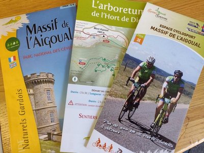
le Pole Nature de l'Aigoual - Béatrice Galzin 
Pôle Nature 4 Saisons
The Pôle Nature 4 Saisons of the Aigoual massif offers outdoor activities in all seasons in the central zone of the Cévennes National Park, overlooked by the legendary summit of Mont Aigoual (1,570 m). Discover our network of trails on foot, on horseback, by bike, or else by mountain-bike or with a donkey, as the fancy takes you!
Children can explore the orienteering circuit or geocaching.
For the sportier among you we have laid out trail running circuits!
Prefer road biking? We have created circuits of varying difficulty levels so you can discover our villages and valleys.
Try not to make any noise! Wildlife enthusiasts can spot mouflons and other animals.
And if you would just like a gentle walk on the massif, the discovery trail “The cliffs of Mont Aigoual” is for you. There are various rest stops over its 4.5 km, with only 150 m in height difference.
We look forward to seeing you on our paths.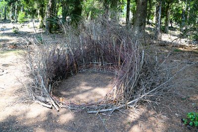
Nids (Céline Pialot) - © E. Fréget  Fauna
FaunaThe Nests (Céline Pialot)
Little by little, the bird makes its nest, its cosy nest, baby cocoon, wasps’ nest…
Like a bird, the artist has gathered materials offered by nature and has arranged them to build three nests, three refuges, three circles that reference perfection and invite meditation.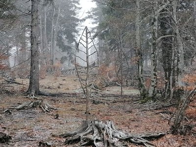
Arbre feuille (Alain Bernegger) - © Filature du Mazel FloraLeaf-Tree (Alain Bernegger)
Leaf-Trees use a veined structure to create a visual resonance between the tree and the leaf. The change of scale works like an inverted echo of this fractal structure. And as winter comes, the eternal summer of the Leaf-Trees confronts the winter of the bare branches.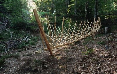
Bassin versant (Xavier Réche) - © Filature du Mazel 
Catchment Area (Xavier Rèche)
By its location and name, this installation evokes the nearby watershed between the Atlantic and Mediterranean. A vessel reduced to a suspended wooden framework, without strakes or gunwale, tilts in the direction of the runoff. It emphasises the first branches of a gigantic drainage system.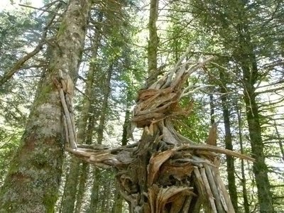
Gardien des bois (Raphaël Daynié) - © Filature du Mazel FloraGuardian of the Woods (Raphaël Daynié)
The Guardian evokes a possible connection, a dream connection, in which humans consider themselves a part of nature, developing in close union with their environment. This Guardian of the Woods overlooking the Aigoual valley was built with natural materials found on site, and gently touches a tree that is still alive.
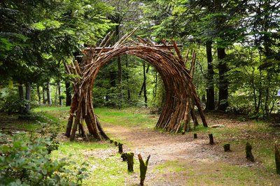
L'Orée (Yoann Crépin) - © Filature du Mazel 
On the Verge (Yoann Crépin)
A doorway to a circuit of art within the natural environment.
To fuse and interact with the environment and play with the seasons, time, light and weightlessness. To let humanity express itself through nature and nature express itself through humanity – a necessary interaction, a symbiotic interaction that inspires us to discover another world.
Vue plongeante sur la vallée de l'Hérault - Arnaud.Bouissou River capture
Violent precipitation and the steep gradient of Mediterranean torrents cause regressive (i.e. upstream) erosion of the valleys through which they flow. This erosion can invert the sense of flow and thus “capture” for the Mediterranean a waterway that had, until then, flowed into the Atlantic. One example is the Hérault with its waterfalls, the capture being located at the falls. The Hérault and the Dauphine brook used to flow via L'Espérou into the Dourbie... River pebbles found around the village by geologists attest to the existence of a waterway in the past.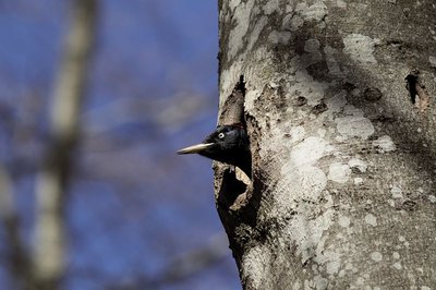
Le pic noir - Jean-Pierre.Malafosse FaunaThe black woodpecker
The black woodpecker is the largest of our woodpeckers and reappeared in the massif in 1936. Gripping wood with its claw, supported by its very stiff tail, it hammers a large hole (diameter over 30 cm) into the trunk of a beech: its nesting chamber, in which it will reproduce. The hole must be located over 6 m above ground, and its oval entrance must open onto a clear space to facilitate take-off. Abundant food must be available: ant hills; diseased or dead conifers that the black woodpecker will riddle with holes to extract larvae; pine or spruce cones that it will wedge into those holes to pick out the seeds. You may hear its call, a powerful “kree-kree”!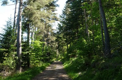
Chemin dans la forêt - Michel Monnot Beech trees and the Mont Aigoual forest
Beech is the main species of the Mont Aigoual forest, which consists of a large variety of trees adapted to the diverse soil types and exposure. Like most deciduous trees, beech stumps put out many shoots after a tree has been felled. Foresters select the best of these for timber. Old beeches can attain remarkable sizes, such as the beech in Le Suquet forest in the municipality of Camprieu, a vestige of the original forest that has come down to us through the centuries and has a circumference of six metres and a height of 25!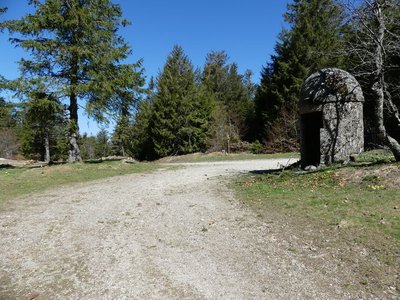
Col de la Caumette - nathalie.thomas The salt road
La Caumette pass is on a former salt road. From Antiquity to modern times, salt has been a precious merchandise used for preserving food and tanning leather. Salt has always been traded and taxed during its transport inland from the Mediterranean coast. The sentry box at the pass was built in the 16th or 17th century at a strategic point at the crossroads of several roads, both to levy the salt tax and for surveillance against smuggling.
Route Royale - Béatrice Galzin From canons to the King’s Road
Have you noticed that you are on an ancient path?
Let’s plunge into history… Around the year 1000, this track was called Camin Ferrat and was used by transhumant shepherds and their flocks, pilgrims and merchants between Meyrueis and Le Vigan. From the latter, it passed through Mandagout, L'Espérou and the Col de la Serreyrède pass before descending to Bonheur Abbey and going back up to La Croix de Fer and reaching Meyrueis. This important mule track enabled trade between the Mediterranean and Meyruies. The Baron de Roquefueil, the region’s lord, had an abbey built below it, in the Bonheur valley, to aid travellers lost in the mountains. In the late 11th century, he founded a religious community of six canons who performed religious services and, in bad weather, rang the “bell for the lost” at regular times to guide passers-by in danger. The Abbey was abandoned in 1790. In the 18th century, the Camin Ferrat was disused in favour of the King’s Road, which you follow from the Col de la Caumette pass to Meyrueis. This new route went via the Col de la Serreyrède and the Col de la Caumette, after which it followed the ridge. The wall that you walk alongside from La Caumette and La Croix de Fer might be a vestige of the King’s Road or else the limit of the Bonheur Abbey estate. The secret remains, only our ancestors knew…
Zone humide - Béatrice Galzin Wetlands
Above the path, the soft sound of trickling water… These are wetlands, a fragile zone that must be protected. The peatbog is made up of rushes, sedge and many types of moss, such as sphagnum. Numerous insects live here, such as the large marsh grasshopper and dragonflies, as well as the common frog. If you make little noise, you may see deer here, or other animals that have come to cool down.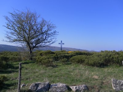
Col de la croix de fer - nelly Carel Col de la Croix de Fer pass
At the col de la Croix de Fer pass, which is a strategic crossroads of several tracks, there used to be an inn for travellers. The magnificent ruin with its two impressive vaults was also a sizeable farm, owned by the Baron de Roquedols. It was located at the limit of the municipalities of Meyrueis and St-Sauveur-Camprieu on the route of the Camin Ferrat and the King’s Road. In the days of religious persecution, the preacher François Vivens* organised secret Protestant gatherings in the small valley just below the buildings. (*Vivens was killed in 1692, 10 years before the Camisard War)
La Pierre Plantée - Béatrice Galzin Pierre plantée (Pierre plantée)
Since ancient times, stones have stood along the Camin Ferrat: directional markers indicating a crossroads. Above all, they marked the boundaries of two parishes. Since the creation of Departments in 1790, they have outlined the border between Gard and Lozère.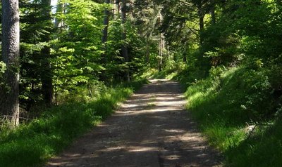
La piste en forêt - Michel Monnot The Commanders
You are on a ridge path on the so-called “Commanders’ crests”. It is the last trace of the fact that this area belonged, from 1312 onwards, to the Knights Hospitaller and then to the Knights of Malta, who were based at the nearby hamlet of Servillières, at their “Commandery of Meyrueis and Servillières”. You are here on the border between the Gard and Lozère, marked by a standing stone. This ridge path is called the “wolf pen drovers’ road”, a variant thousands of years old of the main drovers’ road of La Lusette between L'Espérou and Meyrueis. Transhumant livestock would overnight here, in a closed-off space safe from wolves.
L'arbre et la vie - Gaël Karczewski Forest management
The Mont Aigoual forest.
The wood harvested here comes from a forest that was reforested from the late 19th century onwards, after a period of overgrazing. This forest begins, grows and dies like all living beings. The job of foresters is to manage and support its development while respecting the laws of nature. They harvest trees before they die to make room for young trees. These tree trunks supply an entire economic sector, from the lumberjack to the skidder operator, the saw operator and the carpenter or cabinetmaker. Wood also accompanies you throughout your lives, from your cradle, furniture, woodwork and the wooden frame of your house to your coffin.
L'ancien béal - © A. BOUISSOU / TERRA Ministère de l'Environnement Between labour and idleness
Marker 3
Men and women have fashioned the Estate according to their needs and wishes. At Roquedols, crops used to be irrigated with water from the Pauchètes stream. In fact, the path you have just been walking on may have struck you as narrow and stony. It follows a former béal, or small irrigation channel. Much later, ornamental landscaping was laid out, including this beautiful archway – which is built on the vestiges of the wall of the former Protestant cemetery!
Forêt de l'Aigoual entre le col des Ubertes et Roquedols - eddie.balaye Produce and protect
Marker 4
Felled trees and branches left on the ground in a protected space? That might seem surprising, but at Roquedols Estate, the forest has always been intended to be productive. In the 19th century, Messrs. Breuil, Dayre and Jouve already exploited the woods of Roquedols intensively. Today, tree fellings are planned with the greatest respect for biodiversity. You are in a living forest, whose appearance evolves by human intervention.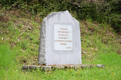
Stèle du chantier n°19, « les jeunes forestiers de Roquedols » - © Dominique Meuret Indoctrinated youth
On the Ferrussac road, the association Anciens des Chantiers de Jeunesse has erected a memorial stone.
The chantiers de jeunesse (youth work sites) were established by the Vichy regime in July 1940 in the French Free Zone to ensure that youths exempted from military service for various reasons received physical and doctrinal training for eight months. About 6,000 youths from Work Site 19, “Roquedols’s Young Foresters”, were spread out in the surroundings of Meyrueis. They carried out forestry work and made charcoal. The work sites were operational from 1940 to 1944.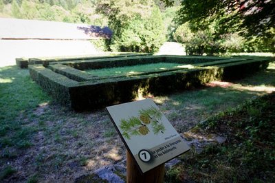
Jardins à la française - © A. BOUISSOU / TERRA Ministère de l'Environnement The formal garden and the buildings
Marker 7
Life was good at Roquedols in the late 19th century! Madame Dol transformed the Estate, embellishing the promenade with a chestnut avenue and formal garden. They might almost make you forget the Estate’s history of agriculture and forestry, except that its buildings – the former farm outbuildings later turned into a sawmill – are such visible reminders of it.
Séquoïa - © Elodie Mazel Forest giants
Marker 5
To contemplate these giants, you need to crane your neck and lift your eyes to the skies! The most remarkable is a giant sequoia originally from California. It was introduced at Roquedols for aesthetic reasons and out of a taste for the exotic. The many silver firs growing around it reveal ambitions of a different kind. In about 1840, the Estate’s owners created a tree nursery so as to be able to grow a large variety of species. The nursery was maintained until the 1980s.
Coll. Ph. Chambon The Château de Roquedols
Marker 6
A former agricultural estate building, the traditional 14th century farm evolved into a castle in the 16th century. Looking at its quadrilateral shape, you will see that the tower on the left looks different from the one on the right. The shape of the porch before the entrance seems unlike the other parts of this monument. Up until the 20th century, the Château underwent several transformations, but Roquedols Estate has always retained its agricultural purpose. Its successive owners have taken possession of the space in different ways: the Dupont de Bossuges family hosted clandestine Protestant gatherings (18th c.); Madame Dol turned the Estate into a charming residence (late 19th to early 20th c.). During the Second World War, the castle was a refuge for the forestry services and a storage place for artworks. Today, it brings happiness to walkers looking for fresh air!
© A. BOUISSOU / TERRA Ministère de l'Environnement Roquedols or literary genius
Marker 2
“It is not a palace. It is a simple castel, a Cévenol castel: the château of a harsh and austere country. Backing onto wooded slopes, it stands in a hollow from where the view extends over the valley downstream.” (Jeannin, 1961). Standing at the top of the dovecote will easily give you a poetical outlook. Roquedols Estate and the forest on Mont Aigoual have inspired many authors. In the 19th century, Fabre d’Olivet invented a troubadour’s chant: in order to recover his castle and marry his betrothed, Ponce de Meyrueis must capture a sword held by terrible brigands. After many incidents, Ponce and Rose are reunited and can live together in love.
Le Pigeonier - © A. BOUISSOU / TERRA Ministère de l'Environnement Dovecote
Marker 2
The interior layout of the dovecote with its nesting-boxes has been lost. The set-back roof made it possible for the birds to sun themselves in the winter whilst remaining sheltered from the north wind. At Roquedols, as elsewhere, only the nobility had the right to breed pigeons, which were sought-after not only for their flesh but also for their droppings, used as a powerful fertiliser.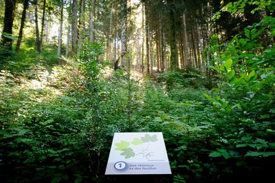
Forêt de Roquedols - © A. BOUISSOU / TERRA Ministère de l'Environnement Of conifers and deciduous trees
Marker 1
In Roquedols forest, firs and beeches grow side by side magnificently. Softwood and hardwood, together? Yes, but the combination is not entirely due to chance. This forest is not a wilderness, but a space cultivated to maintain the diversity of species. At Roquedols, you can see conifers such as fir, larch and spruce as well as deciduous trees: beech, maple and ash. Gaps are made in the forest canopy to give the trees all the light that they need to develop.Attachment
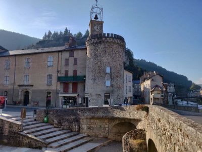
Le centre de Meyrueis et sa tour - Béatrice Galzin 
The village of Meyrueis
The geographical location of Meyrueis is remarkable, nestled between the Aigoual massif, the causse Noir and the causse Méjean. Here the Camin Ferrat crosses the Jonte river. Pilgrims and transhumant flocks of sheep stopped in the village before continuing their journey. Many merchants came to its large fairs. Stroll through the lanes and relive the flourishing past of the belle époque. From the prosperous bourgeois residences to the marketplaces, everything still speaks of the past! Sheep’s wool from the plateaux was woven here, silk was spun. There was intense economic activity. In the 17th century, Meyrueis became a centre for hat-making. By 1860, 17 milliners were busy making hats for Languedoc and Provence, beautiful and exceptionally high-quality hats made from felted wool and silk bourette. Discontinued as of about 1920, this activity left room for tourism, which today animates the village.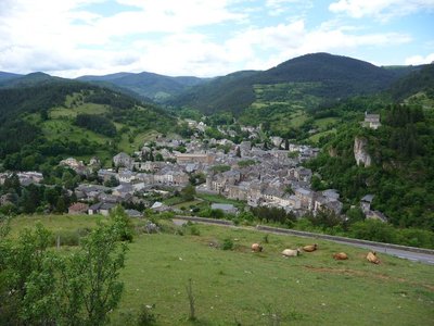
Meyrueis - ©Nathalie Thomas Castle rock
According to a non-verifiable claim from the 17th century, the Roman general Caius Marius had a castrum built on the rock overlooking the village, in 101 BC. However, the first written sources to mention the village date from the 11th c. and refer to the castle, home to the Bermont family. The castle then passed successively into the hands of the Anduze, Roquefeuil and Armagnac families, before falling to Jeanne d’Albret, Queen of Navarre.
Description
- Day 1: 19 km. Starting from Meyrueis, follow the GR®66 long-distance hiking trail to Cabrillac. At that hamlet, leave the GR®66 for the GR®60, which climbs to the top of Mont Aigoual via Le Plo du Four.
- Day 2: 20 km. From Mont Aigoual, head back down on the GR®6 to the Prat Peyrot resort, then continue always along the GR®6 towards Meyrueis via La croix de fer and Bout de Côte.
- Departure : Meyrueis
- Arrival : Meyrueis
- Towns crossed : Meyrueis, Gatuzières, Rousses, Bassurels, Val-d'Aigoual, Saint-Sauveur-Camprieu, and Lanuéjols
Forecast
Altimetric profile
Recommandations
Make sure your equipment is appropriate for the day’s weather conditions. Remember that the weather changes quickly in the mountains. Take enough water, wear sturdy shoes and put on a hat. Please close all gates and barriers behind you.
Caution: patous (livestock guard dogs)! Seek advice on how to behave near these dogs from tourist offices and National Park information centres.
Information desks
Tourism'house and national Parc at Florac
Place de l'ancienne gare, N106, 48400 Florac-trois-rivières
This office is part of the National Park's associated tourist-information network, whose mission is to provide information on, and raise awareness of, the sites and events as well as the rules that must be observed in the National Park's central zone.
On site: exhibitions, video projections, events and shop Open year-round
Transport
Place Sully
Bus line "Meyrueis-Millau" July and August
https://lio.laregion.fr/IMG/pdf/oc-1903-fhbus-48-257-3v_bd_04_.pdf
Daily year-round. Different timetables for term time or school holidays:
Line 215 Autocars Causse + 33 (0)6 65 61 24 16
Access and parking
Meyrueis, via the Jonte gorge on the RD 996.
Parking :
Source

Report a problem or an error
If you have found an error on this page or if you have noticed any problems during your hike, please report them to us here: