
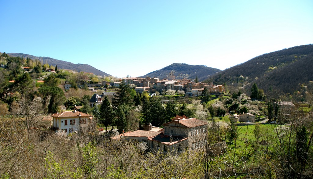
Le Montlouvier
3 points of interest

Cloche de l'église d'Aumessas - N Thomas 
The Catholic church and its bell-gable
The church is remarkable for its bell-gable and has been a listed building since 15 February 1995. The bell bears the date of its casting: 1539. Like other bells, it used to ring the hour and summon the faithful to worship. But in the days of steam trains, it also warned locals of any fires started by escarbilles (small bits of coal). At the time, there were no firemen; the inhabitants were responsible for fighting fires. (bell visible in church).
Rocher de Saint-Peyre - © Nathalie Thomas 
St-Peyre rock
To evoke the site of St Peyre, here is a text by C. Chante, taken from his work Un coin des Cévennes. Le Vigan et ses environs (1933). “All of a sudden, an oak grove appears that surrounds a small clearing where some leftover rocks, laid out in an elongated oval, seem to indicate a cromlech. At one end stands the antique structure, which the centuries have respected and which the Christians never thought to come and destroy on this almost inaccessible escarpment. There can be no doubt about its purpose: it is clearly a Druidic altar, made from granite blocks set out in a semicircle with a gradient, whence the priest must have harangued the faithful before or after the sacrifice (…).”

Aumessas - N Thomas Aumessas village
Aumessas was called Ulmensacium in 1248, from Latin ulmus meaning elm.
In 1769 1,300 inhabitants lived here (240 at the most recent census), the majority of them on the lower lands, below 600m. Their income was derived partly from chestnut growing but mostly from silk farming. On the eve of the French Revolution, 54 silk manufacturers made Aumessas their home. The other inhabitants were shepherds. They lived up in the mountains. The land belonged to the landed gentry, the middle classes or merchants.
Description
Signposts will guide you all along this route. In the description below, the signposted place names and/or directions are given in bold italics between quotation marks :
Starting at “ AUMESSAS ”, walk to “ ST GEORGES ” via :
- « Vernes »,
- « ST GEORGES »
A detour (there-and-back) to the former hamlet is
highly recommended. - « Roques Longues »,
- « LES VERNÈDES »,
- « Sous la Luzette »,
- « Sous le col des Portes »,
- « PANORAMA DES MOLIERES ».
- « Les Molières »,
- « LES VERNÈDES », then return directly to "AUMESSAS" via :
- " Roques Longues " along the Rau d'Albagne river.
This walk is taken from the guidebook Les Vallées Cévenoles - En Pays Viganais, published by the Communauté de communes Pays Viganais-Cévennes as part of the collection Espaces Naturels Gardois and the label Gard Pleine Nature.
- Departure : Aumessas
- Arrival : Aumessas
- Towns crossed : Aumessas and Arrigas
Forecast
Altimetric profile
Recommandations
Make sure your equipment is appropriate for the day’s weather conditions. Take enough water, wear sturdy shoes and put on a hat. Please close any gates and barriers behind you.
Information desks
Tourism office Cévennes and Navacelles, Le Vigan
Maison de pays, place du Marché, BP 21, 30120 Le Vigan
This office is part of the National Park's associated tourist-information network, whose mission is to provide information on, and raise awareness of, the sites and events as well as the rules that must be observed in the National Park's central zone.
Open year-round
Transport
Alés bus line 142
Nîmes line 140
Montpellier line 608
LIO Région Occitanie - https://lio.laregion.fr/
Access and parking
From Alès or Nîmes take the D999 to Le Vigan then Arre. Take the D232 to Aumessas
Parking :
Source


Report a problem or an error
If you have found an error on this page or if you have noticed any problems during your hike, please report them to us here: