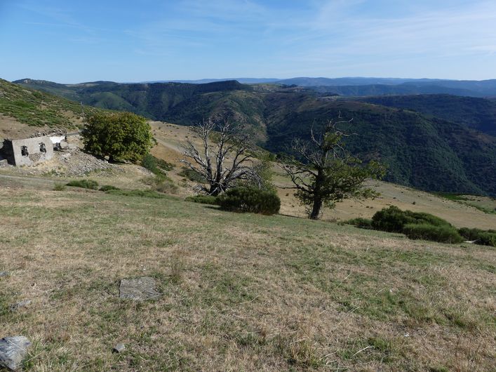
Col Salidès
You are cycling around Mont Aigoual, “the belly button of France”!
There are 360° views throughout, and substantial elevation gains, but also rewards in every bend and at every pass. And you will be able to say: I’ve done it !
50 points of interest
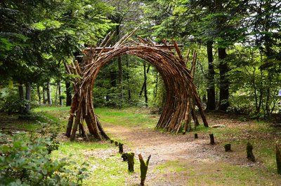
L'Orée (Yoann Crépin) - © Filature du Mazel 
On the Verge (Yoann Crépin)
A doorway to a circuit of art within the natural environment.
To fuse and interact with the environment and play with the seasons, time, light and weightlessness. To let humanity express itself through nature and nature express itself through humanity – a necessary interaction, a symbiotic interaction that inspires us to discover another world.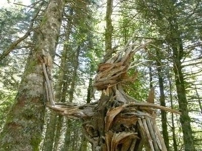
Gardien des bois (Raphaël Daynié) - © Filature du Mazel  Flora
FloraGuardian of the Woods (Raphaël Daynié)
The Guardian evokes a possible connection, a dream connection, in which humans consider themselves a part of nature, developing in close union with their environment. This Guardian of the Woods overlooking the Aigoual valley was built with natural materials found on site, and gently touches a tree that is still alive.
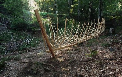
Bassin versant (Xavier Réche) - © Filature du Mazel 
Catchment Area (Xavier Rèche)
By its location and name, this installation evokes the nearby watershed between the Atlantic and Mediterranean. A vessel reduced to a suspended wooden framework, without strakes or gunwale, tilts in the direction of the runoff. It emphasises the first branches of a gigantic drainage system.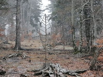
Arbre feuille (Alain Bernegger) - © Filature du Mazel FloraLeaf-Tree (Alain Bernegger)
Leaf-Trees use a veined structure to create a visual resonance between the tree and the leaf. The change of scale works like an inverted echo of this fractal structure. And as winter comes, the eternal summer of the Leaf-Trees confronts the winter of the bare branches.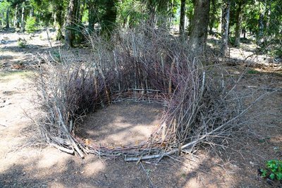
Nids (Céline Pialot) - © E. Fréget  Fauna
FaunaThe Nests (Céline Pialot)
Little by little, the bird makes its nest, its cosy nest, baby cocoon, wasps’ nest…
Like a bird, the artist has gathered materials offered by nature and has arranged them to build three nests, three refuges, three circles that reference perfection and invite meditation.
le Pole Nature de l'Aigoual - Béatrice Galzin 
Pôle Nature 4 Saisons
The Pôle Nature 4 Saisons of the Aigoual massif offers outdoor activities in all seasons in the central zone of the Cévennes National Park, overlooked by the legendary summit of Mont Aigoual (1,570 m). Discover our network of trails on foot, on horseback, by bike, or else by mountain-bike or with a donkey, as the fancy takes you!
Children can explore the orienteering circuit or geocaching.
For the sportier among you we have laid out trail running circuits!
Prefer road biking? We have created circuits of varying difficulty levels so you can discover our villages and valleys.
Try not to make any noise! Wildlife enthusiasts can spot mouflons and other animals.
And if you would just like a gentle walk on the massif, the discovery trail “The cliffs of Mont Aigoual” is for you. There are various rest stops over its 4.5 km, with only 150 m in height difference.
We look forward to seeing you on our paths.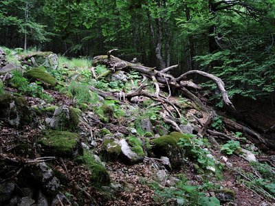
Forêt de l'Aigoual - © Gaël Karczewski 
A site for botanical experiments
Marker 1
L’Hort de Dieu is located at an altitude of 1,300 m and shaped by an extreme climate. This site with its exceptional assets is a favoured study and experimentation zone for botanists. The tree collection is just over 100 years old, and some of the specimens are declining because of old age or else because they are not well-adapted to this mountain range. Today, there are 75 species left of the 140 that have been tested over the past century. To safeguard the interest of this heritage site, the Office National des Forêts and the Cévennes National Park are currently reflecting on renewing the collection.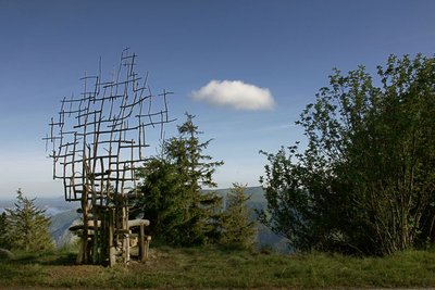
Assise (Marie-Hélène Richard) - © Filature du Mazel 
Seated (Marie-Hélène Richard)
Far from town, paths open the door to new rhythms. Another vision of life and time lets us breathe in the ever-present contemplation, stones, trees and skies. A physical experience of coming face-to-face with nature. A bench made of wood and branches, whose back becomes thinner as it rises towards the sky, as if to turn back into a tree.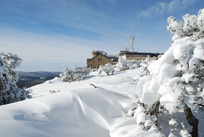
L'Aigoual sous la neige - © Météosite du Mont Aigoual Mont Aigoual weather station
Inaugurated in 1894, this infrastructure is France’s last mountain weather station to be inhabited. Its history is closely linked to the reforestation of Mont Aigoual. It has become a high-performance weather station with an array of modern test instruments, measuring devices for extreme conditions, and a museum/exhibition on meteorology. The 800 sq m exhibition will tell you more about climatology on Mont Aigoual and about meteorology in general.

Stèle homage aux botanistes et forestiers - © B. Algoët Botanists' history
Marker 9
The particular nature of this site earned it the name of “God's garden” (Hortus Dei). Since the 16th century, Mont Aigoual has provided botanists with rare species for herbariums and botanical surveys. Some species were also gathered for their medicinal qualities, called “vertus des simples”, a term to be found on a handwritten map of the Cévennes dating from the early 18th century. In 1936, a stele was inaugurated that is dedicated to the memory of the many botanists who contributed to the advancement of the sciences on the L'Hort de Dieu site.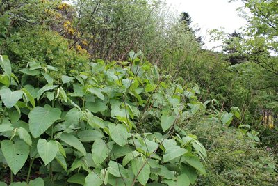
Renouée - © Valère Marsaudon FloraAn invasive species: knotweed (fallopia japonica)
Marker 8
Sakhalin knotweed, just like Japanese knotweed, is an invasive species. That means it is not in its environment of origin and grows at the expense of other species, alongside roads and on the banks of many rivers. A “test zone” project aiming to limit the species is being studied at L'Hort de Dieu, thus continuing the experimental mission of the arboretum. To stop knotweed from proliferating, ripping-up, rhizome destruction and covering- up with tarpaulins are all being tried.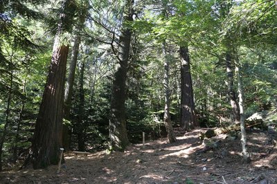
Collection de l'Hort de Dieu - © B. Algoët Acclimatising a plant species
Marker 7
Fabre and Flahault pursued two objectives: studying the way certain forest species adapt to the Cevenol climate and studying plants in their relationship with environmental conditions. Some plant species are better adapted than others to the Cevenol climate. Thus, Mediterranean and Douglas firs do very well, as do almost all the species native to Europe, Asia Minor and the western United States. Species from East Asia and the eastern United States, however, whither away. Through his work, Flahault laid the foundations of phytosociology, the study of how plants arrange themselves into communities as a function of the environmental conditions.
Chalet laboratoire en 2023 - © B. Algoët The Chalet, Charles Flahault's laboratory
Marker 6
“And who knows whether some generous benefactor will not decide one day that our students should have a hospitable roof at L'Hort de Dieu itself? I can see the little house as if it were already built, receiving much sunlight on the Mediterranean side, with its study room on the ground floor and its large fireplace around which scientific problems are discussed late into the night..” (Charles Flahault, 1904)
The Chalet, which was built the following year, made it possible to establish a botanical garden, a high-altitude vegetable plot and a plant nursery nearby. Despite the forest reconquering the surroundings, some of the plants introduced at the time have survived until today: Pyrenean lily, great masterwort, and others.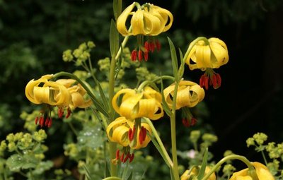
Lis des Pyrénées - © J.-P. Grandmont Alpine garden
Marker 5
This panel shows the legacy of Charles Flahault's experimental work.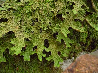
Lobaria pulmonaria - © Mario Klesczewski Did you say “chourradou”?
Marker 4
This remarkable beech is over 200 years old and called chourradou in Occitan, after the sheep that would chourrer (ruminate) and rest under its shady canopy. This kind of tree (large cavity, detached bark and dead wood) is home above all to saproxylic or dead-wood-eating insects and fungi. On another of these old beeches, below the path, you can see a large lichen called lobaria pulmonaria, which needs a lot of water and is highly sensible to atmospheric pollution. It grows very slowly and thus testifies to the ripe old age of this part of the forest.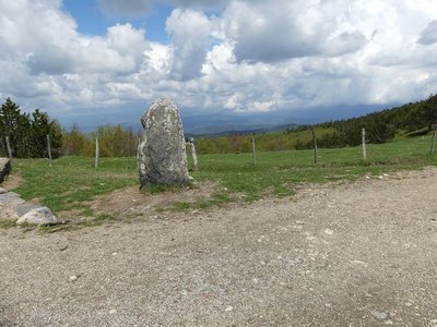
Vue depuis Font de Trépaloup - nathalie.thomas FloraThe evolution of plant life
At the pass stands a schist menhir (standing stone). To the north, in Trépaloup ravine, hewn flint implements bear witness to a human presence in the region since prehistoric times. Palynological analyses (studies of pollen fossilised in peatbogs) have allowed scientists to piece together the plant life on Mont Aigoual from 8,000 to 5,000 BC. Pine predominated, accompanied by birch and hazelnut. Then pine populations gradually diminished. The damp climate warmed up, favouring the spread of oak and hazelnut. Finally, the increased damp and cloud cover at altitude allowed fir and beech to develop. From the end of the first century BC, the substantial percentage of grasses shows that forest had receded in favour of pasture and prairies. This was the start of the great deforestation.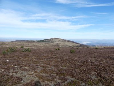
Le Portalet - nathalie.thomas FloraShort-grass prairies and heath on the summit of Mont Aigoual
Here, only species with a short reproductive cycle can settle due to the frequently glacial climate. The heath has been invaded by heather and mountain pine. This zone is barely wooded due to the violent winds and is comparable to subalpine vegetation, consisting of short-grass prairies and heather and blueberry moor. It is sometimes called pseudo-alpine.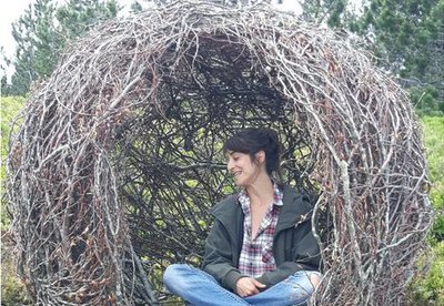
Cellule (Marie Gueydon de Dives) - © Filature du Mazel Cell (Marie Gueydon de Dives)
This artwork, natural in architecture but artificial in execution, represents a passage between the interior and exterior worlds. Posing or opposing while questioning the notions of limit, porousness and opening.
This work encourages you to come inside but feel outside. To be the contemplative eye, the receiving ear, the conscience that objectifies reality.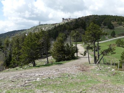
Observatoire de l'Aigoual - nathalie.thomas The meteorological observatory
Inaugurated in 1824, the meteorological observatory was built on the initiative of Georges Fabre, one of the pioneers of the reforestation of Mont Aigoual. His work with the botanist Charles Flahault enabled the creation of the arboretum of L’Hort de Dieu. The first meteorological data were gathered by agents from the French National Water and Forestry Commission. Since 1943, the observatory has been managed by the National Meteorological Office. It is France’s last mountain weather station that is inhabited year-round.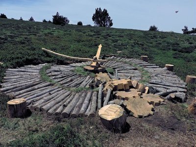
Tempus fugit (Fiona Paterson, Donald Buglass) - © Natacha Maltaverne Tempus Fugit (Fiona Paterson, Donald Buglass)
Time flies, conscience cries, death threatens, heaven invites, hell scolds, and man sleeps. Here, the effects of time and natural elements transform the wood used in the artwork; everything is an endless renewal at the same rate as the passing hours. How much time have we got left before everything is lost and it is too late to repair the damage? Nature will continue on its trajectory and efface the traces of Humanity on Earth.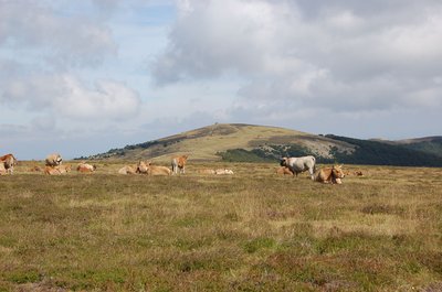
Troupeau au sommet de l'Aigoual - © Nathalie Thomas FloraSummit of Mont Aigoual
At an altitude of 1,565 m, the climate is harsh: weather conditions are the same as they would be at 2,000 m elsewhere, with only four “frost-free” months a year. Winds of above 60 kph blow on 265 days a year, and the average annual temperature is 4.8°C. Trees do not have enough time to complete their life cycle. Local plant formations are those of the montane zone: subalpine short-grass prairies.
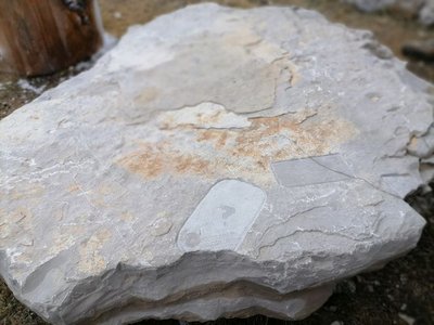
Archéosmart (Marc Limousin) - © Filature du Mazel 
Archeosmart (Marc Limousin)
Smartphone imprints appear on the rocks: fossils of the present that will become mysterious in the future. This carved stone, like the cup-shaped marks and other rock art of the region, discloses history revealed in matter and resonates with Malraux’s phrase: “The future is a present given to us by the past”.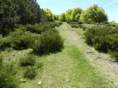
Draille de Cabrillac - nathalie.thomas The Aubrac drovers’ road
From Cabrillac, we follow the Aubrac drovers’ road, which started near Ganges (Hérault) to lead flocks onto the Aubrac pastures, a distance of 110 km. If you climb to the top of Mont Aigoual (2 hrs), you can visit the meteorological observatory and meet transhumant flocks. Be careful of the patous (livestock guardians).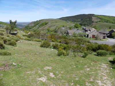
Cabrillac - nathalie.thomas Cabrillac
Cabrillac was located at the crossroads of the grande draille d'Aubrac (Aubrac drovers’ road) and the road from Meyrueis to Florac and St Jean du Gard. The village had about a hundred inhabitants in the 20th century and was an important and inevitable place of transit. Two fairs were held every year: one during the migration to the summer pastures in May; the other in September, during the return. For some shepherds, this was the occasion to sell the lambs that had spent the summer on the Aubrac plateau.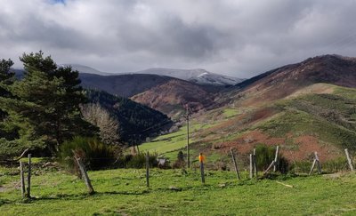
La Vallée de Sexte et son manteau blanc - Béatrice Galzin Col Salidès
The bare ridge that rises opposite is the watershed between the Mediterranean and the Atlantic. Rain that falls on the Sexte valley flows into the Tarnon below (on the left) and ends up in the ocean. On your right, the Mediterranean side offers extraordinary views onto the foothills of the can de l’Hospitalet plateau and the entirety of the Cévenol mountains. On some days, the Alps and Mont Ventoux can be seen in the distance …
Maison du berger - Michel Monnot 
Summer pastures
Since time immemorial, animals have naturally migrated from the plains into the mountains in summer. The Salidès pass has summer pastures for sheep. The shepherd’s house is just below you on the Mediterranean side. The shepherd stays several months with about 800 sheep and a few dogs. Careful: patous, the big and handsome white dogs, are there to supervise and defend the herd!
It is important for the herd to graze here. The animals fertilise the soil and maintain the open spaces.
Le Col Salidès - Office de tourisme OTMACC The transhumant shepherd of the Col de Salidès
From the end of spring onwards, the Col de Salidès livens up. The transhumant shepherd moves up for the three months of summer grazing in this magical spot with almost 1,000 sheep. In all weather, the shepherd takes the animals outside so they can graze new grass. He has to both manage his pasture land and look after the sheep.
At the end of summer, each livestock farmer comes to recover his animals. Be careful around the dogs that watch over the flock!
Le château de l'Hom - Béatrice Galzin 
The castles of the upper Vallée Borgne
The Château du Poujol is the last castle of the Vallée Borgne. It is located under the rocky ridge of the Can de l’Hospitalet to the north and the Col Salidès to the south. It was built in the 13th century on a rocky spur to watch over the valley. Locals laid out many terraces around the site, which gives you an idea of agricultural life in the Cévennes.
The Château de l’Hom sits in lush greenery. It is first mentioned in 1401. Many lords have left their trace in the architecture, but not only there. In 1826, an assassination took place on this spot, in connection to a goat’s ear cut off in punishment for eating the lady’s flowers…
Hameau du château du Folhaquier - Béatrice Galzin Château du Folhaquier
The Château du Folhaquier is outlined on this small ridge, which was a strategic site in the Middle Ages, overlooking the Gardon de Saint-Jean river and the Château de La Fare opposite.
It is separated from the hamlet by a ditch cut into the schist bedrock, and a square tower can still be seen that was built in the 16th century on 12th century ramparts, as well as the vestiges of a round tower at the other end. The foundations of the castle chapel are easy to distinguish, and the Romanesque church of Notre-Dame du Folhaquier, which remains in an excellent state, has withstood the elements for almost a millennium.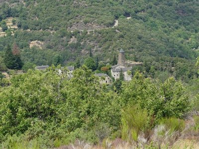
Le château du Folhaquier - Nathalie Thomas The mediaeval castles
Very close to the village of St-André de Valborgne, on the edge of a cliff, stand the remains of the castrum of La Fare, a defensive castle believed to date from the 12th century. Only a wall face of the tower survives. The ruins above bear witness to the site’s importance. The archives mention a well, cistern and drawbridge – but on site nothing remains. On the next spur is the majestic and dominating castle of Le Folhaquier. Transformations throughout the centuries by various owners have shaped the hamlet as we see it today. The era of silk farming strongly influenced the landscape by welcoming the “tree of gold”, the mulberry tree.
Les ruines du château de la Fare - capri’ces des Cévennes Château de la Fare
Following on from many battles against the Château du Folhaquier, today all that is left of the large mediaeval castle of the Lord de la Fare is this expanse of wall. Built at the summit of a schist hill, the castle is surrounded by sheer drops on all sides. The former village was fortified and located just below the expanse of wall. Sources indicate that the castle had a drawbridge and a chapel.
le château de Nogaret - Sabine Keller The Château de Nogaret
Built in the 11th century, the Château de Nogaret stood on the only road linking Saint-André de Valborgne with Le Pompidou. It is believed to have been constructed to serve as a stronghold and to defend the Vallée Borgne. It was set alight in 1628 during the war between the Duke of Rohan and Louis XIII, and again in 1704 by the Camisards, before being rebuilt in the 18th century. This private property still belongs to the Manoel de Nogaret family.
“This small château is one of the finest examples of the fortified manor houses built towards the end of the Middle Ages by minor local lords wanting to free themselves, at least symbolically, from domination by their feudal overlords.” (Isabelle Darnas - Les châteaux médiévaux en Cévennes).
© Béatrice Galzin 
Traces of giants?
“Giant’s cauldrons” have formed in the rock at the base of the waterfall. These regular, rounded cavities are only created in rapidly flowing waters. They are caused by the repeated friction of stones caught in a depression and moved by swirling currents.
© Béatrice Galzin The tanners’ district
La Calquière district gets its name from that of the ditches in which the tanners soaked their animal skins with limestone, which is called cauç or calç in Occitan. All along the Gardon there were tanneries because its acidic water was good for rinsing the skins, which was indispensable for obtaining high quality products.
© Béatrice Galzin The age of silk
From the 19th century onwards, the silk industry developed in the Cévennes: tanneries gave way to spinning mills. The mills used water not only to treat the silkworm cocoons (which were boiled to prepare the silk) but also for the steam-driven spinning machines. In the second half of the 19th century, diseases strongly reduced silk production, which was also subject to competition from foreign silks and then from artificial silk. The silk industry went under in 1965.
© Béatrice Galzin One spring, five fountains
This fountain is one of Saint-André’s five public fountains, all of which are supplied by the same spring (its water is thus the same as in the Fontaine du Griffon). Before houses were connected to mains water, there were many more fountains on this side of the quay.
Le village de St André de Valborgne - Béatrice Galzin The village of St André de Valborgne
As you stroll along the quay above the river, you can still see the handsome bourgeois houses dating from the silk boom. If you look around, former spinning mills and industrial buildings dedicated to silk farming can still be seen in the landscape. A little lower down, opposite the 16th century château, you can listen to
Bernadette Lafont on the Camisard saga in and after 1702. As you reach the square again, quench your thirst at the fountain and have a look inside the Romanesque church (12th century).
© Béatrice Galzin The gardonnades
The village benefits from the water that the Gardon brings – but it also has to put up with the river’s sporadic bad moods. Abundant rain can rapidly raise river levels. It is often in autumn that the torrent overflows its banks. The worst floods can have dramatic consequences in both material and human terms. Many can still remember the floods of September 1958 and 2002, which caused much damage.
Fontaine du Griffon - © Béatrice Galzin Water!
The Griffon fountain is known for its pure water, which will quench any walker’s thirst. In the old days, the whole neighbourhood used it not only for drinking but also for cooking, washing, washing clothes, watering plants, etc. The fountain was not only a supply point but also an important meeting-point in village life.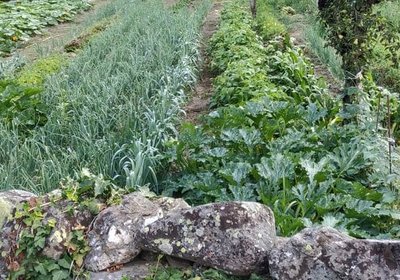
© Béatrice Galzin Well-supplied
Cévenol gardens are supplied by béals (little canals), which bring water from rivers or springs to cultivated land. The latter is usually laid out in bancels (terraces). By retaining the soil, the low walls make it possible to have level plots and deeper soils. Water can seep into the ground slowly and remain there for longer.
Calade - © Béatrice Galzin Two in one
This cobbled path going uphill is a calade. It is not only a path but also a brook, allowing rainwater to be evacuated. Caution: slippery when wet!
Bergeronnette des ruisseaux - © Régis Descamps FaunaFish and other animals...
On the river banks, a pretty white, grey and black bird paces up and down looking for insects, bopping its long tail up and down: the white wagtail. The more colourful grey wagtail is often seen alongside it. The white-throated dipper resembles a blackbird with a big white stain on its breast. It often disappears underwater to hunt insect larvae. Trout, which like the same prey, also live in the Gardon, where they keep anglers happy.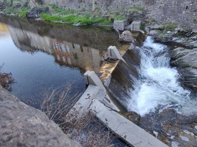
© Béatrice Galzin Electrified…
The village’s inhabitants had access to electricity as early as 1919. The inconspicuous little hut on the opposite bank sheltered a little turbine supplied with water by a béal (irrigation channel). It was built by a villager, Mr Teston, and produced enough electricity for one lightbulb per household.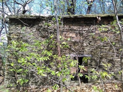
Les ruines d'Aygue Bernesse - Nathalie Thomas Cévenol housing
Houses normally occupied the centre of the cultivated area. Built from schist, they were tall and narrow to save the level ground for crops. When houses needed expanding, people either added another storey to existing buildings or built a new wing parallel to the contour lines. Hamlets were always constructed near water sources and often at mid-slope because the valley floors are susceptible to brutal flooding as well as difficult to access. Good exposure to sunlight was not a decisive factor in choosing sites.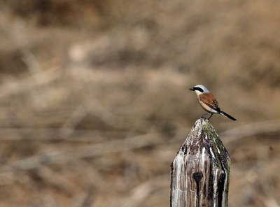
Pie-grièche écorcheur - Descamps Régis FaunaLook up!
In the forest, Dartford warblers (black, burgundy belly) accompany your efforts by chirping from the top of broom bushes. You might also come across their cousin, the much more colourful Eastern subalpine warbler (orange belly), or else a Northern wheatear.
The ridges are home to two rare bird species, protected in both France and the European Union: the red-backed shrike and the Eurasian eagle-owl. Other interesting protected species, such as the Eleonora’s falcon and the common rock thrush, may also be observed here.
Montée au dessus de Valleraugue - © Michel Monnot FloraMediterranean level
To begin with, the path is in the holm-oak altitudinal zone. Holm oaks tend to grow on the Mediterranean side of the watershed, where they are plentiful up to an altitude of about 500 m. Here, they have been eradicated to create crop terraces. On the either side of the path, which runs between high walls and has steps that give access to gardens, you can still see these terraces, now invaded by or planted with conifers. Like the holm oak, the tree heath and strawberry trees that are also present are typically Mediterranean species. Plants in this zone are xerophile, meaning that they thrive in dry environments. They are well-adapted because their small and glazed leaves limit water evaporation.
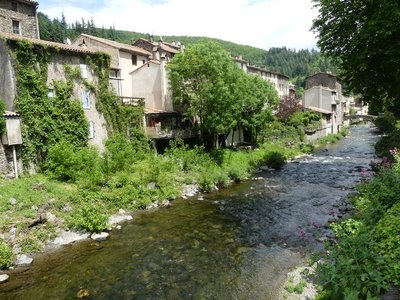
Valleraugue - nathalie.thomas 1703
In Valleraugue, exporting chestnuts in times of famine or trouble was forbidden by law. In 1703, however, during the Camisard War, an official decree ordered the inhabitants to transport their chestnuts and cereals to other villages. This was to deprive the insurgents, who were supported by the locals, of provisions. The goods were guarded, and the inhabitants only kept two weeks’ worth in reserve.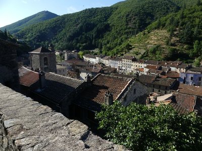
Valleraugue - nathalie.thomas Valleraugue
Valleraugue is believed to derive from "vallis eraugia", the Hérault valley. With its 7,834 hectares, the town extends from the Hérault valley to the summit of Mont Aigoual. Valleraugue is located on an important transportation route between the garrigues and the uplands, and once had up to 4,192 inhabitants (1851). Just over a century ago, in 1907, Abbot Fesquet wrote in his monograph on the village: "The population has been reduced to 2,500 souls. There was a time when it was difficult to find lodgings, says a 1773 town council deliberation. Nowadays, accommodation is plentiful...". In the 2007 census, the population was 1,081.

Village de l'Espérou - Béatrice Galzin The village of L’Espérou
The village of L’Espérou lies on the border of Dourbies and Valleraugue local councils. A draille (track for livestock to migrate to summer pastures with their shepherds) crosses the village. As in many villages in the Gard, the two places of worship – one Catholic, the other Protestant – are opposite each other. The village is located in a varied environment that is suitable for outdoor activities and sports.

Georges Fabre
A graduate of the Ecole polytechnique, and top of his year at the Nancy forestry school, the forester Georges Fabre devoted 30 years of his energy to reforesting the mountains of the Lozère and Gard. His goal was to stabilise mountain soils, but also to provide work for a local population that would otherwise have been condemned, in its entirety, to leave the countryside. In 1894, he initiated the construction of the Mont Aigoual weather observatory. In association with the Club Cévenol and Club Alpin Français, he also laid the foundations of the local “heritage tourism” (creating the Grand Hotel de l'Aigoual, building a shelter and viewpoint indicator at the summit, etc.) that continues to this day.
Description
From Prat Peyrot, take the D269 greenway to climb to the summit of Mont Aigoual. Then continue on the D18 to Cabrillac.
- At Cabrillac turn right onto the D19 to the Col Salidès pass. After the pass, take the D907 to St-André de Valborgne.
- Cycle through the village of St-André de Valborgne and turn right onto the D10, towards Valleraugue, via the Col de l’Espinas and Col du Pas passes.
- At Valleraugue, return to the Col de La Serreyrède on the D986, via L’Espérou, then take the D269 to Prat Peyrot.
- Departure : Prat-Peyrot
- Arrival : Prat-Peyrot
- Towns crossed : Val-d'Aigoual, Meyrueis, Bassurels, Gatuzières, Rousses, Saint-André-de-Valborgne, and Les Plantiers
Forecast
Altimetric profile
Recommandations
Before committing yourself to a circuit, ensure that it is suitable for your activity level and ability. Respect traffic laws and other road users; stay in control of your speed and trajectory. Make sure to be seen and travel in single file when in a group. Remember that the weather changes quickly in the mountains. Take enough water. Safe trip !
Information desks
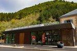
Tourism'house and national Parc at Florac
Place de l'ancienne gare, N106, 48400 Florac-trois-rivières
This office is part of the National Park's associated tourist-information network, whose mission is to provide information on, and raise awareness of, the sites and events as well as the rules that must be observed in the National Park's central zone.
On site: exhibitions, video projections, events and shop Open year-round

Tourism office Mont Aigoual Causses Cévennes, Saint-André-de-Valborgne
les quais, 30940 Saint-André-de-Valborgne
This office is part of the National Park's associated tourist-information network, whose mission is to provide information on, and raise awareness of, the sites and events as well as the rules that must be observed in the National Park's central zone.

Tourism office Mont Aigoual Causses Cévennes, Valleraugue
7 quartier des Horts, 30570 Valleraugue
This office is part of the National Park's associated tourist-information network, whose mission is to provide information on, and raise awareness of, the sites and events as well as the rules that must be observed in the National Park's central zone. : Open year-round
Access and parking
From Meyrueis or Valleraugue, take the D986 to the Col de La Serreyrède pass, then the D269 to Prat Peyrot.
Parking :
Source

Report a problem or an error
If you have found an error on this page or if you have noticed any problems during your hike, please report them to us here: