
The Serre du Bois de la ville walk
6 points of interest
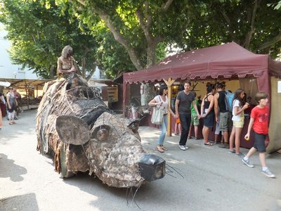
La fête médiévale - © O.Pagès 
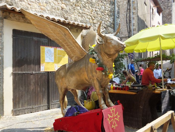
The legend of Volo biou
In the old days vineyards surrounded St-Ambroix. One year during the Middle Ages, the harvest was so abundant that locals did not know what to do with all the wine. To avoid it going to waste, a consul arranged for proclamations in the neighbouring villages that an ox was going to fly in the sky over St Ambroix on a certain evening. The whole day was festive and very hot, with only one refreshment allowed: the sour wine that the town needed rid of! (…) The drunk and cheerful populace was convinced that an ox really had taken off from the cliff. Today, the ox still goes for a flight one evening every summer, after a day of festivities. Be reassured: the winged ox is only an imitation, but a handsome one that is well worth the detour!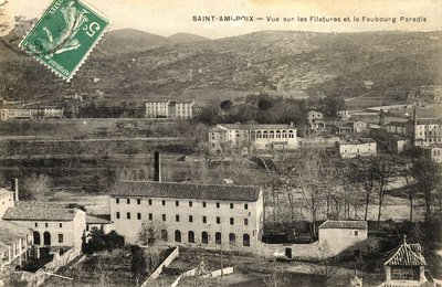
Filature de Saint-Ambroix - ©Com com Cèze Cévennes The spinners
More than 1,500 women worked in the town’s 21 spinning mills in the 19th century. During a spinners’ congress in 1908, the work was categorised as "female slave labour" because the women (or girls) worked 14 hours a day for miserable pay. One strike followed another all over the region, the first of them taking place in Saint-Ambroix in 1879. The thankless work was among the worst paid in the textile industry, and yet spinners spoke of it nostalgically once they had left the labourers’ life.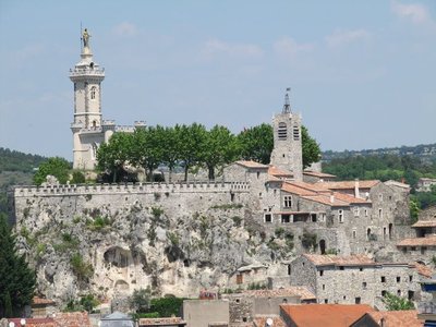
Plateau de Dugas - © O.Pagès Le Dugas
Narrow cobblestoned lanes, arched passageways, staircases, and lanes as narrow as paths: this perched area is inaccessible by car and shelters vestiges of the dawn of time. Prehistory, Antiquity, the Middle Ages, the religious crisis of the 16th century Reformation and all centuries since then have left their mark on this slope. A Pagan sacrificial altar, a grandly crenelated 19th century chapel, three 12th century gates, a castle and its ramparts razed in 1629 on the order of Louis XIII...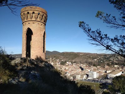
Tour Guisquet - © JF.Raulet Guisquet Tower
The tower stands proudly on the rock at the end of the path. Each of its windows gives you panoramic views. It was built here in 1850 by a Mr Guisquet to celebrate his victory in a lawsuit against another “pretender to the rock”.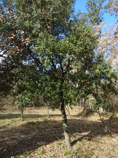
chêne kermès - JF.RAULET  Flora
FloraShrub oak
The word "Kirmiz", Persian in origin, designates both a very small thorny oak and the insect which lays its eggs on its branches: a cochineal. You may already have spotted small, pea-sized balls on the oak branches. Female cochineals lay eggs, then envelop both themselves and their eggs in a horned film for protection. The cochineal was and still is harvested to make red dye. The food additive E120 is nothing other than a colouring made from crushed cochineal larvae, which turn your dried sausages and strawberry yoghurts pink.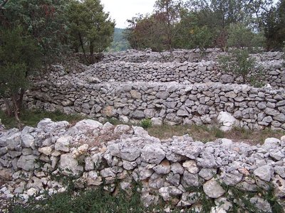
Site du Cap Barré - © O.Pagès Site of Le Cap Barré
This astonishing grid pattern of low drystone walls extends over a hectare and a half under the holm oaks. According to archaeologists who have studied the site, this layout seems to be an agricultural system built at two distinct times. One dates from the 18th century and has been maintained since. The other part, which has deteriorated more, is older. This parched plateau could only have hosted drought-resistant crops. Given the narrow parcels, it was most likely a tree plantation, perhaps olive trees. This site is made accessible to you because of its nostalgic peasant architecture. Please respect it by not moving the stones!
Description
Starting from "SAINT-AMBROIX", follow "CLOS DU BOUC" via "Le Pont de la Gare", "Fabiargues", "La Montagnette" and "Chemin de la Tour". Continue to "La Tour Guisquet" for the view onto the town, then to "Serre du Bois de la Ville". For views onto the Cèze valley and to return, follow "Chemin de la Tour","La Montagnette", "Fabiargues" and "Le Pont de la Gare".
This hike is taken from the guidebook Cévennes Haute Vallée de la Cèze, published by the Communauté de communes Cèze Cévennes as part of the collection Espaces Naturels Gardois and the label Gard Pleine Nature.
- Departure : Saint Ambroix: on the esplanade
- Arrival : Saint Ambroix: on the esplanade
- Towns crossed : Saint-Ambroix
Forecast
Altimetric profile
Recommandations
Information desks
Tourism office CezeCévennes, Bessèges
14 rue de la République, 30160 Bessèges
This office is part of the National Park's associated tourist-information network, whose mission is to provide information on, and raise awareness of, the sites and events as well as the rules that must be observed in the National Park's central zone.
Open year-round
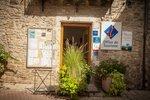
Tourism office Cèze-Cévennes Saint-Ambroix
Place de l'ancien Temple, 30500 Saint-Ambroix
This office is part of the National Park's associated tourist-information network, whose mission is to provide information on, and raise awareness of, the sites and events as well as the rules that must be observed in the National Park's central zone.
Open year-round
Transport
liO is the regional public transport service of the Occitanie/ Pyrénées – Méditerranée region. It facilitates everyone’s movements by prioritising public transport. For more information, call 08 10 33 42 73 or go to www.laregion.fr
Access and parking
Parking :
Source

Report a problem or an error
If you have found an error on this page or if you have noticed any problems during your hike, please report them to us here: