Station Prat-Peyrot - Road bike circuit #10
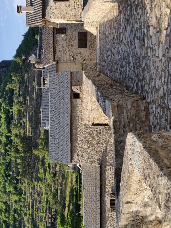
This circuit is the most handsome and westernmost in the Gard department. It promises a pleasant surprise at every turn : the charming village of Dourbies in its preserved valley, Trèves and its stone lanes at the foot of the limestone cliffs overlooking Le Trévezel, the village of Lanuéjols at the edge of the Causse Noir plateau, the small town of Meyrueis and its centre that sparkles in the sunlight…
50 points of interest
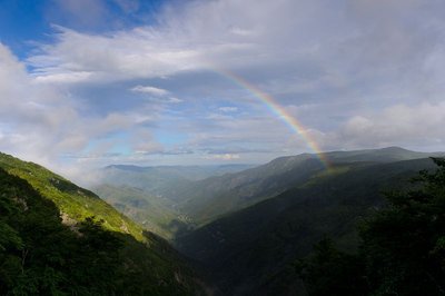
Vue plongeante sur la vallée de l'Hérault - Arnaud.Bouissou 
River capture
Violent precipitation and the steep gradient of Mediterranean torrents cause regressive (i.e. upstream) erosion of the valleys through which they flow. This erosion can invert the sense of flow and thus “capture” for the Mediterranean a waterway that had, until then, flowed into the Atlantic. One example is the Hérault with its waterfalls, the capture being located at the falls. The Hérault and the Dauphine brook used to flow via L'Espérou into the Dourbie... River pebbles found around the village by geologists attest to the existence of a waterway in the past.
© R. Descamps Two waterfalls... Find the Hérault!
Faced with these two threads of rivers, geographers hesitated between flow rate and length, and finally designated the waterway below you the Hérault while the waterfall opposite you was named the Dauphine. Two remarkable plants can be seen here: orpine (Hylotelephium telephium) with its succulent leaves, a food source for the larvae of a butterfly that is in strong decline all over the Massif central: the Apollo (which may be seen from mid-July to mid-August); and Prost saxifrage, which forms regular cushions that are easy to recognise. They enable it better to store what little water is available. It is a plant endemic to the Cévennes.
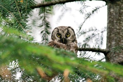
La chouette de tengmalm - Gaël.Karczewski  Fauna
FaunaBoreal owl
Abandoned woodpecker chambers are a boon for small mammals and other birds, such as the boreal owl, which has come from Nordic countries to settle here at altitudes of 800 m. Very discreet, it confines itself to the depths of our forested mountain ranges. It can be identified in March by its sonorous and gentle call. To maintain the species, the Cévennes National Park and the French forestry office protect trees with nesting chambers and old-growth forests from being logged.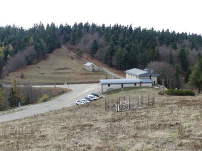
La Serreyrède - nathalie.thomas Climate frontier
The pass is also a climate frontier. The Atlantic side is predominantly exposed to the west wind and receives rainfall that is fairly regularly spread over the year. The Mediterranean side, however, is drier and hotter and constitutes a massive barrier to the occasional southeast wind (the marin), thus forcing its humid air to rise suddenly. This makes the clouds’ water content condense, which can give rise to so-called Cevenol episodes: heavy rainfall (600 mm in 24 hrs) causing catastrophic floods. The Aigoual, Mount Aigualis the rainy (A. Bernard), is well-named! After Savoie, it is the rainiest place in France.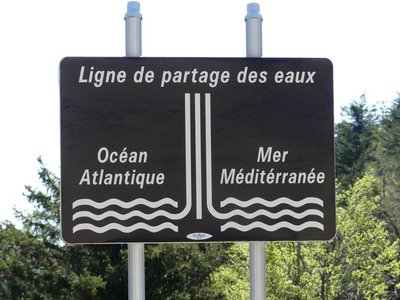
Ligne de partage des eaux - nathalie.thomas 
The watershed
The current relief creates a frontier between the Atlantic and the Mediterranean: depending on the slope, water runs towards either the Ocean or the Sea. This is due to the uplift of the Cevenol sill, brought about by geological activity along the Cévennes fault, which borders draw the northern limit of the Languedoc region. This natural sill marks the geographical border between the northwest slope – verdant, not too steep – and the southeast slope, which falls away abruptly in the Languedoc and continues to be subject to powerful erosion.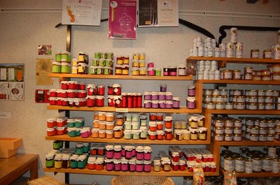
Boutique des producteurs - © Nathalie Thomas The association "Terres d'Aigoual"
The Cévennes National Park rents out part of the building to the association, enabling local farmers to sell their products directly to the public. The association brings together farmers who wish to promote what they produce and share their know-how. They also enjoy sharing their vision of farming- high quality produce and products,
- human-sized farms,
- mutual aid.
Come and discover their products!


Irregular forest
This tree population consists of trees of very different diameters, ages and heights. Species are mixed: mainly pine, but also beech, rowan and whitebeam. This is an irregular mature forest, a forestry dynamic that is interesting for several reasons: it creates permanent forest cover; resistance to soil erosion; better resilience against storms or parasite attacks; regular production, etc. In the small clearing to the left of the path, the sunlight now penetrating to the forest floor has made natural regeneration of beech and fir possible, ensuring the renewal of the forest.

From beech copse to mature plantation
Marker 1
Around 1850, before reforestation began, the inhabitants of the Cevennes were using local wood resources on a massive scale for heating and in industry, especially spinning-mills. Gradually, only a few beech copses remained, which were cut every 25 to 40 years. Grazing by tens of thousands of sheep further reduced the herbaceous plant cover. Much weakened, the plant cover was then also subjected to heavy precipitation, the so-called Cevenol episodes. It is against this backdrop that the lengthy work of the foresters began. To reduce risks and establish a lasting forest cover, the first technique was to make use of what was already present by converting the disused copses into mature plantations.
Productive forest
Marker 2
Another method of creating a durable forest cover is to plant or sow. This work is carried out either on bare soil or among existing tree stands. The Aigoual reforestation programme was a gigantic effort, requiring 900,000 days of work, the planting of 60 million conifers and 7 million deciduous trees, and sowing of 38 tonnes of seeds. Spruces and pines, which can be planted in full sunlight and grow quite quickly, were widely used. Under the forest canopy, preference was given to firs.
Maison forestière de la Serreyrède - © Jacques de Joly La Serreyrède
Before 1861, the house at the Col de la Serreyrède was inhabited by two families of farmers. They owned some livestock and had a vegetable garden, whose terraces you can still see above the La Caumette track. From 1861 on, the farm was inhabited by a forest ranger. It was only bought by the state body Eaux et Forêts in 1883, to be turned into a forester's house. It became one of Georges Fabre's headquarters during the reforestation of the Aigoual massif. The Cévennes National Park, tourism office and Terres d'Aigoual growers have now joined forces to revive La Serreyrède with the help of the Communauté de Communes Causses Aigoual Cévennes – Terres solidaires.

Drosera rotundifolia - © Bruno Descaves Le Trévezel molière (peat bog)
Marker 3
A peat bog is a thick layer of plant cover that has decayed little or not at all because of accumulated water, acid soils and the cold climate. This wetland has hardly changed for centuries. Once called molières, soulages, sagnes or fanga, these environments were long denigrated and “cleaned up”. Today, they are known to be well worth preserving. Peat bogs are home to a great variety of more or less specific species, such as the sundew, a little carnivorous plant.Georges Fabre
A graduate of the Ecole polytechnique, and top of his year at the Nancy forestry school, the forester Georges Fabre devoted 30 years of his energy to reforesting the mountains of the Lozère and Gard. His goal was to stabilise mountain soils, but also to provide work for a local population that would otherwise have been condemned, in its entirety, to leave the countryside. In 1894, he initiated the construction of the Mont Aigoual weather observatory. In association with the Club Cévenol and Club Alpin Français, he also laid the foundations of the local “heritage tourism” (creating the Grand Hotel de l'Aigoual, building a shelter and viewpoint indicator at the summit, etc.) that continues to this day.

Village de l'Espérou - Béatrice Galzin The village of L’Espérou
The village of L’Espérou lies on the border of Dourbies and Valleraugue local councils. A draille (track for livestock to migrate to summer pastures with their shepherds) crosses the village. As in many villages in the Gard, the two places of worship – one Catholic, the other Protestant – are opposite each other. The village is located in a varied environment that is suitable for outdoor activities and sports.
Dourbies - nathalie.thomas FaunaThe Dourbie
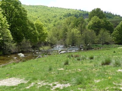
In the upper reaches of the river, a diverse and fascinating wildlife has developed despite the strong current. The clear running waters condition the presence and future of the brown trout. It cohabits with minnows, otters… You may see a white-throated dipper on a rock, or else a grey heron or wagtail on the bank. But it is in the clear waters and under rocks that a whole little aquatic world exists: molluscs, crustaceans, insect larvae, etc. They pile up quite harmoniously, dozens per square metre. Some stick to the rocks; others drift, lurk or float. It all depends on the equipment nature has provided them with: bristles, suckers, hooks, sheaths weighted with gravel...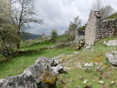
Malpertus - nathalie.thomas 
Malpertus
The ruined hamlet of Malpertus is a splendid and moving site, with its feel of a paradise lost which one would like to restore to its former glory. The views onto the Dourbie valley are stunning. The short grass makes it easy to see far, and spot friends or enemies early. Weapons were hidden here in World War Two, stored in a rock shelter at the Roc du Salidou, just behind the buildings. The hamlet’s last inhabitant left this site, inaccessible except on muleback, in the 1960s. Today it is home to diverse small fauna: birds, insects, lizards, common frogs, etc.
Aulne glutineux - nathalie.thomas  Flora
FloraThe common alder
A wise tree lives in the sunshine with its feet in the waters of the Dourbie: the common alder. You can identify it even in winter by looking for its strobili on the ground or on its branches - female inflorescences shaped like small pinecones. The alder’s tangled roots are solidly anchored in low riverbanks, thus ensuring their protection. By symbiosis between alders and a bacteria called frankia living in their root, nitrogen is fixed in the ground at about 60 to 200 kg per hectare per year! This is a bonanza for poor soils, which are quickly enriched.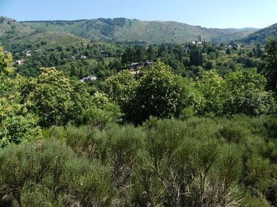
Vue sur Dourbies - nathalie.thomas Dourbies
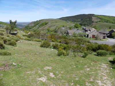
The village of Dourbies was built on a ridge to maximise the flatter soils for cultivation. Farming having declined in the valley, fields that were once cultivated have now been urbanised, and broom heath is invading more and more land.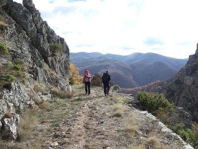
Vue sur le Lingas - nathalie.thomas 
The Dourbies gorge
The path comes out on the Dourbie gorge. Opposite you, the western part of the high granite plateau of the Lingas joins up on its right with the limestone plateau called Causse de Larzac. On your right, you can see the granite dome of Saint-Guiral. Closer to you, in the vales that converge on the Dourbie, are the former crop terraces, pastureland, the village built on the riverbank at the valley’s widest point and finally the chestnut orchard. You are seeing the upper limit of its range, which corresponds to it maximum altitude in this zone (800 m).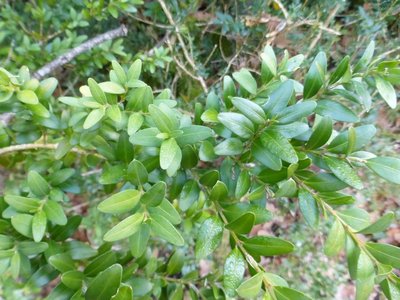
Buis - © Nathalie Thomas Box (Buxus)
Boxwood and humans: a long relationship! When livestock farming increased, the primeval oak forest opened up and box – which is too hard for sheep's teeth – took hold everywhere. Humans discovered one of its major qualities: broken up and scattered over the ground as a litter, it protects vegetable seedlings from drought and frost. Its leaves can make up for a lack of straw for fertilising arable land. In 1818, a decree issued by the prefect of the Gard department worried about the excessive clearing of box groves and the messy manner in which they were being uprooted, without adequate tools. Until about 1910, you might see mules laden with enormous bundles of box; then chemistry took over. (B. Mathieu)
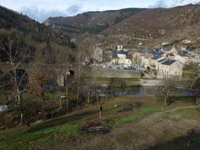
Trèves - nathalie.thomas Treves
In Antiquity, the village square was a cemetery. The name Trèves is believed to derive from the Gaulish trebo – meaning 'village' according to some sources or the Celtic water goddess according to others – or perhaps from trivium, crossroads... The track going over the Roman bridge at Le Trévezel, restored in the 18th century, was in fact an important road in Antiquity. There is another hypothesis if you consult Boissier de Sauvages' 1820 dictionary, in whose opinion Treva or Trebo are Occitan words referring to phantoms or spirits. You might well be tempted by this version once you know the history of the Pas de Joulié cave described below! (B. Mathieu)
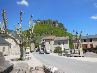
La place du village - Béatrice Galzin Trèves
From Tabrî, meaning “village close to the water” in the Chasséen culture (Baume Lairoux, La Verrière, etc.), which lay on the trade route between the Gabali tribe, the coast and the Arecomici tribe. It was given a wooden bridge by the Romans, occupied first by Arian Visigoths and then by Nicene Christian Franks, and destroyed by Muslims around 730. It was revived in the Carolingian period with its Romanesque bridge, and was loyal to the Kings of France, who granted it a consuls’ charter in the 14th century and the bell on top of the church, which had remained Catholic. In the 17th century, Trèves had hemp fields, whose hempen cloth was used in the draperies in Lodève. Its blue sheep’s cheese, its galena mine and its terraces of almond trees and lentils belong to the past. Only the Pétassou (local pagan character and festival) remains (M.MOULINIER, historian).
Montjardin, le hameau - Béatrice Galzin The hamlet of Montjardin
The ground here is full of ores of all kinds, which have been mined at various times but without ever being abundant enough to make exploitation permanent.
Periodically, life in the village of Montjardin and its surroundings was dominated by lead, zinc, chalcopyrite and silver mining. In 1778 a shepherd discovered a silver vein at Montjardin. It was exploited for some time and then abandoned. In 1908 the Villemagne mining and metalworking company re-opened the mine, as well as others in the sector. The mine gallery at Montjardin was 450 m long. During this boom period, over 400 miners were employed across the concession. It definitively closed in 1932, and the former miners’ village near Montjardin is today a holiday centre.
L'arbre et la vie - Gaël Karczewski Forest management
The Mont Aigoual forest.
The wood harvested here comes from a forest that was reforested from the late 19th century onwards, after a period of overgrazing. This forest begins, grows and dies like all living beings. The job of foresters is to manage and support its development while respecting the laws of nature. They harvest trees before they die to make room for young trees. These tree trunks supply an entire economic sector, from the lumberjack to the skidder operator, the saw operator and the carpenter or cabinetmaker. Wood also accompanies you throughout your lives, from your cradle, furniture, woodwork and the wooden frame of your house to your coffin.
L'ancien béal - © A. BOUISSOU / TERRA Ministère de l'Environnement Between labour and idleness
Marker 3
Men and women have fashioned the Estate according to their needs and wishes. At Roquedols, crops used to be irrigated with water from the Pauchètes stream. In fact, the path you have just been walking on may have struck you as narrow and stony. It follows a former béal, or small irrigation channel. Much later, ornamental landscaping was laid out, including this beautiful archway – which is built on the vestiges of the wall of the former Protestant cemetery!
Forêt de l'Aigoual entre le col des Ubertes et Roquedols - eddie.balaye Produce and protect
Marker 4
Felled trees and branches left on the ground in a protected space? That might seem surprising, but at Roquedols Estate, the forest has always been intended to be productive. In the 19th century, Messrs. Breuil, Dayre and Jouve already exploited the woods of Roquedols intensively. Today, tree fellings are planned with the greatest respect for biodiversity. You are in a living forest, whose appearance evolves by human intervention.
Séquoïa - © Elodie Mazel Forest giants
Marker 5
To contemplate these giants, you need to crane your neck and lift your eyes to the skies! The most remarkable is a giant sequoia originally from California. It was introduced at Roquedols for aesthetic reasons and out of a taste for the exotic. The many silver firs growing around it reveal ambitions of a different kind. In about 1840, the Estate’s owners created a tree nursery so as to be able to grow a large variety of species. The nursery was maintained until the 1980s.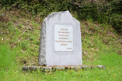
Stèle du chantier n°19, « les jeunes forestiers de Roquedols » - © Dominique Meuret Indoctrinated youth
On the Ferrussac road, the association Anciens des Chantiers de Jeunesse has erected a memorial stone.
The chantiers de jeunesse (youth work sites) were established by the Vichy regime in July 1940 in the French Free Zone to ensure that youths exempted from military service for various reasons received physical and doctrinal training for eight months. About 6,000 youths from Work Site 19, “Roquedols’s Young Foresters”, were spread out in the surroundings of Meyrueis. They carried out forestry work and made charcoal. The work sites were operational from 1940 to 1944.
Le Pigeonier - © A. BOUISSOU / TERRA Ministère de l'Environnement Dovecote
Marker 2
The interior layout of the dovecote with its nesting-boxes has been lost. The set-back roof made it possible for the birds to sun themselves in the winter whilst remaining sheltered from the north wind. At Roquedols, as elsewhere, only the nobility had the right to breed pigeons, which were sought-after not only for their flesh but also for their droppings, used as a powerful fertiliser.
Coll. Ph. Chambon The Château de Roquedols
Marker 6
A former agricultural estate building, the traditional 14th century farm evolved into a castle in the 16th century. Looking at its quadrilateral shape, you will see that the tower on the left looks different from the one on the right. The shape of the porch before the entrance seems unlike the other parts of this monument. Up until the 20th century, the Château underwent several transformations, but Roquedols Estate has always retained its agricultural purpose. Its successive owners have taken possession of the space in different ways: the Dupont de Bossuges family hosted clandestine Protestant gatherings (18th c.); Madame Dol turned the Estate into a charming residence (late 19th to early 20th c.). During the Second World War, the castle was a refuge for the forestry services and a storage place for artworks. Today, it brings happiness to walkers looking for fresh air!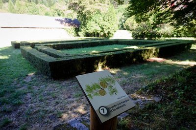
Jardins à la française - © A. BOUISSOU / TERRA Ministère de l'Environnement The formal garden and the buildings
Marker 7
Life was good at Roquedols in the late 19th century! Madame Dol transformed the Estate, embellishing the promenade with a chestnut avenue and formal garden. They might almost make you forget the Estate’s history of agriculture and forestry, except that its buildings – the former farm outbuildings later turned into a sawmill – are such visible reminders of it.
© A. BOUISSOU / TERRA Ministère de l'Environnement Roquedols or literary genius
Marker 2
“It is not a palace. It is a simple castel, a Cévenol castel: the château of a harsh and austere country. Backing onto wooded slopes, it stands in a hollow from where the view extends over the valley downstream.” (Jeannin, 1961). Standing at the top of the dovecote will easily give you a poetical outlook. Roquedols Estate and the forest on Mont Aigoual have inspired many authors. In the 19th century, Fabre d’Olivet invented a troubadour’s chant: in order to recover his castle and marry his betrothed, Ponce de Meyrueis must capture a sword held by terrible brigands. After many incidents, Ponce and Rose are reunited and can live together in love.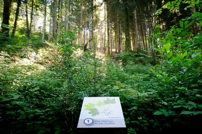
Forêt de Roquedols - © A. BOUISSOU / TERRA Ministère de l'Environnement Of conifers and deciduous trees
Marker 1
In Roquedols forest, firs and beeches grow side by side magnificently. Softwood and hardwood, together? Yes, but the combination is not entirely due to chance. This forest is not a wilderness, but a space cultivated to maintain the diversity of species. At Roquedols, you can see conifers such as fir, larch and spruce as well as deciduous trees: beech, maple and ash. Gaps are made in the forest canopy to give the trees all the light that they need to develop.Attachment
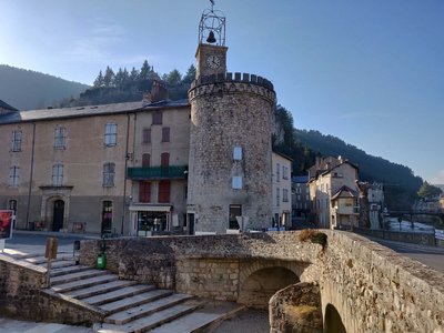
Le centre de Meyrueis et sa tour - Béatrice Galzin The village of Meyrueis
The geographical location of Meyrueis is remarkable, nestled between the Aigoual massif, the causse Noir and the causse Méjean. Here the Camin Ferrat crosses the Jonte river. Pilgrims and transhumant flocks of sheep stopped in the village before continuing their journey. Many merchants came to its large fairs. Stroll through the lanes and relive the flourishing past of the belle époque. From the prosperous bourgeois residences to the marketplaces, everything still speaks of the past! Sheep’s wool from the plateaux was woven here, silk was spun. There was intense economic activity. In the 17th century, Meyrueis became a centre for hat-making. By 1860, 17 milliners were busy making hats for Languedoc and Provence, beautiful and exceptionally high-quality hats made from felted wool and silk bourette. Discontinued as of about 1920, this activity left room for tourism, which today animates the village.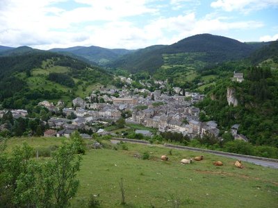
Meyrueis - ©Nathalie Thomas Castle rock
According to a non-verifiable claim from the 17th century, the Roman general Caius Marius had a castrum built on the rock overlooking the village, in 101 BC. However, the first written sources to mention the village date from the 11th c. and refer to the castle, home to the Bermont family. The castle then passed successively into the hands of the Anduze, Roquefeuil and Armagnac families, before falling to Jeanne d’Albret, Queen of Navarre.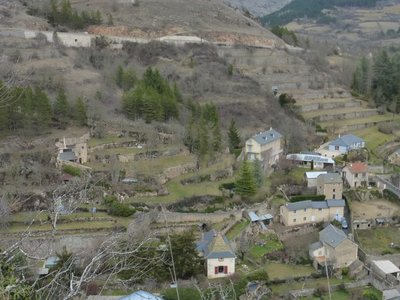
Terrasses sur Meyrueis - © Nathalie Thomas Terrace
Throughout the climb, you will see abandoned former crop terraces. A few grapevines have persisted since local wine-growing came to an end. They bear witness to the fact that the slopes around these hamlets and villages were once cultivated and planted with fruit trees and vines. Terraces like these were the only way for the valley's inhabitants to have flat areas with deep soil suitable for growing.
Cabrillac - nathalie.thomas Cabrillac
Cabrillac was located at the crossroads of the grande draille d'Aubrac (Aubrac drovers’ road) and the road from Meyrueis to Florac and St Jean du Gard. The village had about a hundred inhabitants in the 20th century and was an important and inevitable place of transit. Two fairs were held every year: one during the migration to the summer pastures in May; the other in September, during the return. For some shepherds, this was the occasion to sell the lambs that had spent the summer on the Aubrac plateau.
Draille de Cabrillac - nathalie.thomas The Aubrac drovers’ road
From Cabrillac, we follow the Aubrac drovers’ road, which started near Ganges (Hérault) to lead flocks onto the Aubrac pastures, a distance of 110 km. If you climb to the top of Mont Aigoual (2 hrs), you can visit the meteorological observatory and meet transhumant flocks. Be careful of the patous (livestock guardians).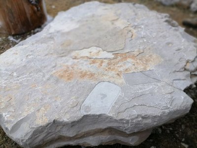
Archéosmart (Marc Limousin) - © Filature du Mazel 
Archeosmart (Marc Limousin)
Smartphone imprints appear on the rocks: fossils of the present that will become mysterious in the future. This carved stone, like the cup-shaped marks and other rock art of the region, discloses history revealed in matter and resonates with Malraux’s phrase: “The future is a present given to us by the past”.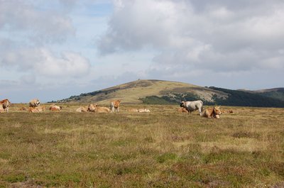
Troupeau au sommet de l'Aigoual - © Nathalie Thomas FloraSummit of Mont Aigoual
At an altitude of 1,565 m, the climate is harsh: weather conditions are the same as they would be at 2,000 m elsewhere, with only four “frost-free” months a year. Winds of above 60 kph blow on 265 days a year, and the average annual temperature is 4.8°C. Trees do not have enough time to complete their life cycle. Local plant formations are those of the montane zone: subalpine short-grass prairies.
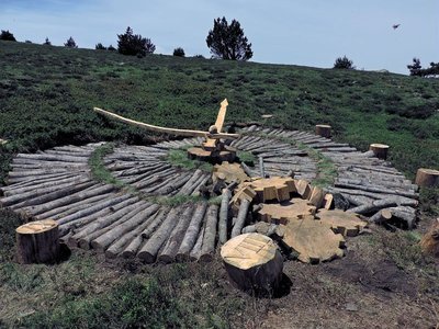
Tempus fugit (Fiona Paterson, Donald Buglass) - © Natacha Maltaverne Tempus Fugit (Fiona Paterson, Donald Buglass)
Time flies, conscience cries, death threatens, heaven invites, hell scolds, and man sleeps. Here, the effects of time and natural elements transform the wood used in the artwork; everything is an endless renewal at the same rate as the passing hours. How much time have we got left before everything is lost and it is too late to repair the damage? Nature will continue on its trajectory and efface the traces of Humanity on Earth.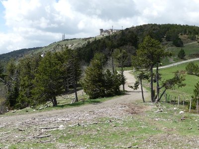
Observatoire de l'Aigoual - nathalie.thomas The meteorological observatory
Inaugurated in 1824, the meteorological observatory was built on the initiative of Georges Fabre, one of the pioneers of the reforestation of Mont Aigoual. His work with the botanist Charles Flahault enabled the creation of the arboretum of L’Hort de Dieu. The first meteorological data were gathered by agents from the French National Water and Forestry Commission. Since 1943, the observatory has been managed by the National Meteorological Office. It is France’s last mountain weather station that is inhabited year-round.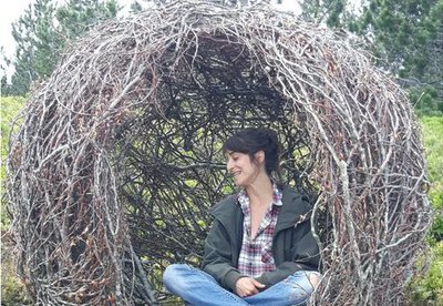
Cellule (Marie Gueydon de Dives) - © Filature du Mazel Cell (Marie Gueydon de Dives)
This artwork, natural in architecture but artificial in execution, represents a passage between the interior and exterior worlds. Posing or opposing while questioning the notions of limit, porousness and opening.
This work encourages you to come inside but feel outside. To be the contemplative eye, the receiving ear, the conscience that objectifies reality.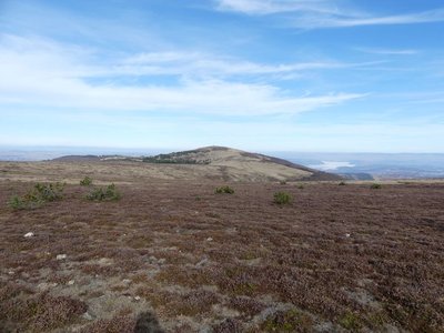
Le Portalet - nathalie.thomas FloraShort-grass prairies and heath on the summit of Mont Aigoual
Here, only species with a short reproductive cycle can settle due to the frequently glacial climate. The heath has been invaded by heather and mountain pine. This zone is barely wooded due to the violent winds and is comparable to subalpine vegetation, consisting of short-grass prairies and heather and blueberry moor. It is sometimes called pseudo-alpine.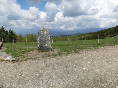
Vue depuis Font de Trépaloup - nathalie.thomas FloraThe evolution of plant life
At the pass stands a schist menhir (standing stone). To the north, in Trépaloup ravine, hewn flint implements bear witness to a human presence in the region since prehistoric times. Palynological analyses (studies of pollen fossilised in peatbogs) have allowed scientists to piece together the plant life on Mont Aigoual from 8,000 to 5,000 BC. Pine predominated, accompanied by birch and hazelnut. Then pine populations gradually diminished. The damp climate warmed up, favouring the spread of oak and hazelnut. Finally, the increased damp and cloud cover at altitude allowed fir and beech to develop. From the end of the first century BC, the substantial percentage of grasses shows that forest had receded in favour of pasture and prairies. This was the start of the great deforestation.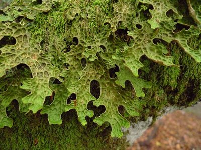
Lobaria pulmonaria - © Mario Klesczewski Did you say “chourradou”?
Marker 4
This remarkable beech is over 200 years old and called chourradou in Occitan, after the sheep that would chourrer (ruminate) and rest under its shady canopy. This kind of tree (large cavity, detached bark and dead wood) is home above all to saproxylic or dead-wood-eating insects and fungi. On another of these old beeches, below the path, you can see a large lichen called lobaria pulmonaria, which needs a lot of water and is highly sensible to atmospheric pollution. It grows very slowly and thus testifies to the ripe old age of this part of the forest.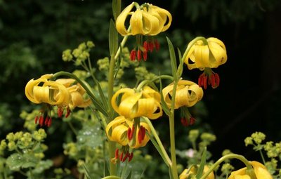
Lis des Pyrénées - © J.-P. Grandmont Alpine garden
Marker 5
This panel shows the legacy of Charles Flahault's experimental work.
Chalet laboratoire en 2023 - © B. Algoët The Chalet, Charles Flahault's laboratory
Marker 6
“And who knows whether some generous benefactor will not decide one day that our students should have a hospitable roof at L'Hort de Dieu itself? I can see the little house as if it were already built, receiving much sunlight on the Mediterranean side, with its study room on the ground floor and its large fireplace around which scientific problems are discussed late into the night..” (Charles Flahault, 1904)
The Chalet, which was built the following year, made it possible to establish a botanical garden, a high-altitude vegetable plot and a plant nursery nearby. Despite the forest reconquering the surroundings, some of the plants introduced at the time have survived until today: Pyrenean lily, great masterwort, and others.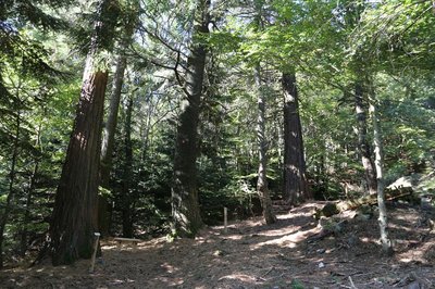
Collection de l'Hort de Dieu - © B. Algoët Acclimatising a plant species
Marker 7
Fabre and Flahault pursued two objectives: studying the way certain forest species adapt to the Cevenol climate and studying plants in their relationship with environmental conditions. Some plant species are better adapted than others to the Cevenol climate. Thus, Mediterranean and Douglas firs do very well, as do almost all the species native to Europe, Asia Minor and the western United States. Species from East Asia and the eastern United States, however, whither away. Through his work, Flahault laid the foundations of phytosociology, the study of how plants arrange themselves into communities as a function of the environmental conditions.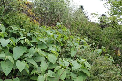
Renouée - © Valère Marsaudon FloraAn invasive species: knotweed (fallopia japonica)
Marker 8
Sakhalin knotweed, just like Japanese knotweed, is an invasive species. That means it is not in its environment of origin and grows at the expense of other species, alongside roads and on the banks of many rivers. A “test zone” project aiming to limit the species is being studied at L'Hort de Dieu, thus continuing the experimental mission of the arboretum. To stop knotweed from proliferating, ripping-up, rhizome destruction and covering- up with tarpaulins are all being tried.
Stèle homage aux botanistes et forestiers - © B. Algoët Botanists' history
Marker 9
The particular nature of this site earned it the name of “God's garden” (Hortus Dei). Since the 16th century, Mont Aigoual has provided botanists with rare species for herbariums and botanical surveys. Some species were also gathered for their medicinal qualities, called “vertus des simples”, a term to be found on a handwritten map of the Cévennes dating from the early 18th century. In 1936, a stele was inaugurated that is dedicated to the memory of the many botanists who contributed to the advancement of the sciences on the L'Hort de Dieu site.
Description
From Prat Peyrot outdoor activity centre, take the D269 to the Col de La Serreyrède pass, then the D986 to L’Espérou.
- At the roundabout, head to Dourbies on the D151.
- After the village of Dourbies, continue on the D151 towards Trèves/Nant.
- At the Col de la Pierre Plantée pass, take the D47 to Lanuéjols via Trèves.
- At Lanuéjols, take the D263 and then the D986 to Meyrueis.
- As you leave Meyrueis, head towards Florac on the D996 to the Col de Perjuret pass.
- At the Perjuret pass, take the D18 via Cabrillac.
- Continue on the D18 to Mont Aigoual.
- At the entrance to the parking lot, take the "greenway"
- On your right, back to the Prat-Peyrot resort.
- Departure : Prat-Peyrot
- Arrival : Prat-Peyrot
- Towns crossed : Meyrueis, Val-d'Aigoual, Dourbies, Trèves, Lanuéjols, Gatuzières, Fraissinet-de-Fourques, Rousses, and Bassurels
Forecast
Altimetric profile
Recommandations
Before committing yourself to a circuit, ensure that it is suitable for your activity level and ability. Respect traffic laws and other road users; stay in control of your speed and trajectory. Make sure to be seen and travel in single file when in a group. Remember that the weather changes quickly in the mountains. Take enough water. Safe trip !
Information desks

Tourism & national parc'house
Col de la Serreyrède, 30570 Val d'Aigoual
The Maison de l'Aigoual houses the tourism office Mont Aigoual Causses Cévennes and the Maison du Parc national. This visitor centre provides information on and raises awareness of the Cévennes National Park, its sites and events as well as the rules that must be observed in the National Park's central zone.
On site: changing exhibitions, video projections, Festival Nature events and shop Open year-round

Tourism office Mont Aigoual Causses Cévennes, Saint-André-de-Valborgne
les quais, 30940 Saint-André-de-Valborgne
This office is part of the National Park's associated tourist-information network, whose mission is to provide information on, and raise awareness of, the sites and events as well as the rules that must be observed in the National Park's central zone.
Access and parking
From Meyrueis or Valleraugue, take the D986 towards the Col de La Serreyrède pass, then take the D269 to Prat Peyrot.
Parking :
Report a problem or an error
If you have found an error on this page or if you have noticed any problems during your hike, please report them to us here: