
Taleyrac
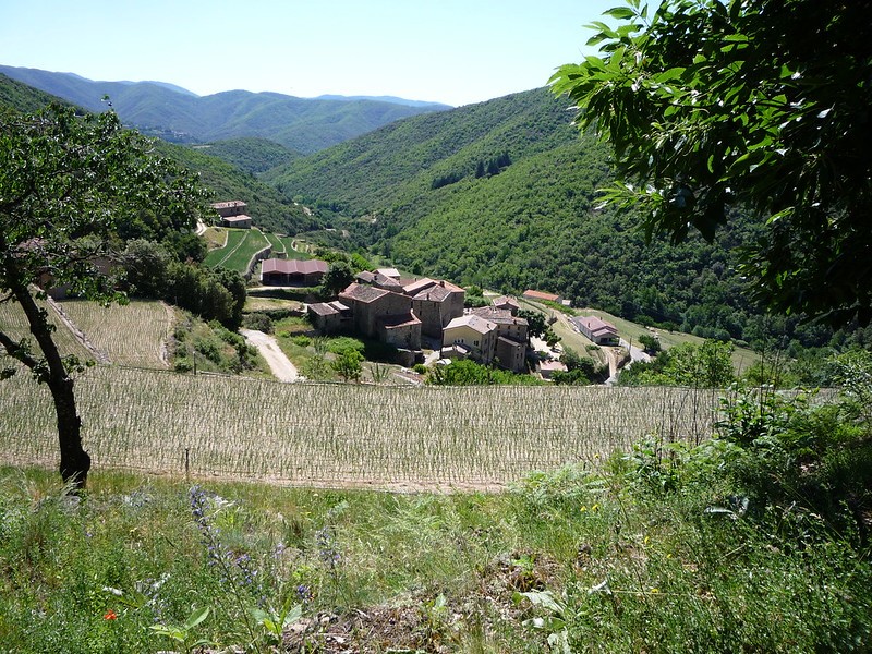
The path winds between the Hérault and Taleyrac valleys, in a contact zone of schist and granite, and uses an ancient track linking Saint-André de Majencoules and Valleraugue. Explore the Taleyrac valley and its surroundings, which were once planted with mulberry and peach trees but today concentrate on mild-onion farming.
5 points of interest
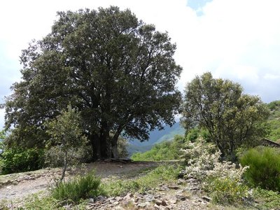
Chêne vert au col de l'Elze - nathalie.thomas  Flora
FloraThe Col de l''Elze
The Col de l'Elze pass is a large open space that still has several handsome holm oaks (elze in Occitan). They are rather squat, probably due to the wind. This was once an area where cereals – rye and wheat – were grown. It is now pastureland, with associated flora and insect life. Sheep have prevented shrubs from invading. There are magnificent views to the north onto Mont Aigoual and its foothills, and to the southeast onto the Taleyrac valley and the hills of Sumènes. If you get to the top of the hillock, 300 m to the east, very early in the morning or in the late afternoon, you may see mouflon on Le Montet, to the southwest.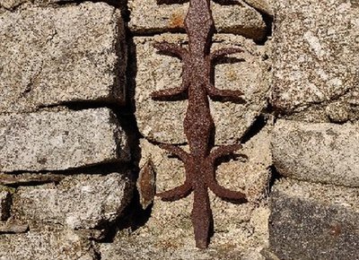
Construction d’une habitation en granite - Béatrice Galzin 
Granite
Granite is a massive rock made of translucent quartz crystals, shiny silver/black crystals, and white or pinkish mica or feldspar. On some blocks you find large feldspar crystals: this is called “horsetooth granite” owing to the shape of its crystals. Granite, which is very sensitive to erosion, breaks down into coarse sand, making a light and well-draining soil suitable for onion farming.
On the Taleyrac hillside, the walls of the traversiers (crop terraces) and houses are built out of granite – a round rock not easy to handle for building.
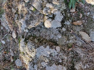
Trace de la chaussure cloutée - Béatrice Galzin 
Cobblestoned track
From the Col de la Croix pass in Taleyrac, you take a cobblestoned track that is of exceptionally high quality. The track used to link Valleraugue with St-André de Majencoules where it is said to date from well before the Protestant revolts (1702).
It is also said that the postman used it to reach Taleyrac and its neighbouring hamlets from Valleraugue and that he left the traces of his hobnailed boots in the granite!
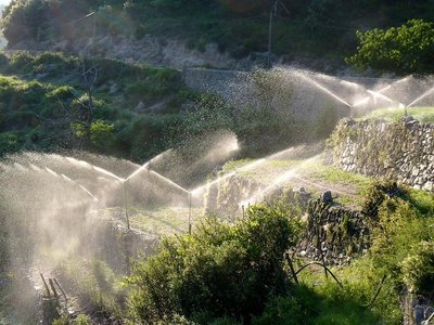
Culture de l'oignon doux des Cévennes - Michel Monnot Mild onions
Cévennes mild onions (a Protected Designation of Origin since 2008) are transplanted in May and harvested 90 days later. During these 3 months, the onions have to be watered every other day. In old times, watering had to be by hand using an azagadouïro (a sort of wooden shovel). Since the arrival of hoses and especially of pumps, watering has been carried out using sprinklers and ramps for more regular spraying. This is mostly done in the morning, a good occasion to admire the cascading jets of water.
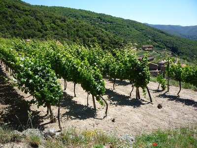
Les vignes - Michel Monnot The Taleyrac valley
This valley consists of several hamlets that are part of the municipality of Val d’Aigoual. On the valley floor, springs are abundant; the cultivated crop terraces face south. This is good luck for diversified farming: fruit trees, grapes, mulberry trees and mild onions. Everything grows – but the onion is king!
Built on the rocks, the hamlets overlook the river with their enormous and very tall houses: any soil had to be reserved for crops!
Some flocks of sheep maintain the land behind the hamlets but most of it is done by humans, even today. The crop terraces, built out of granite, are remarkably beautiful. All of them are maintained!
Description
From the car park, at "Vallée de Taleyrac-Campredon", go up in the village and take the direction of:
- "La Molière", (NB: on the left are waymarks for a discovery trail). Continue on
- " La Bessède". As you leave La Bessède, follow the road on your left for 800 m, then take the track on the right to return to the "Col de l’Elze".
- At "Col de l'Elze", turn left and follow the ridge path to get back onto the road coming from La Bessède. Immediately take the path on the right going downhill to Taleyrac.
- At "Mas Frejon", turn left onto it and walk for 1.5 km to return to "Vallée de Taleyrac-Campredon".
- Departure : Campredon - Vallée de Taleyrac
- Arrival : Campredon - Vallée de Taleyrac
- Towns crossed : Val-d'Aigoual
Forecast
Altimetric profile
Recommandations
Before committing yourself to a circuit, ensure that it is suitable for your activity level and ability. Remember that the weather changes quickly in the mountains. Take enough water. Please close any gates and barriers behind you. Keep your dog on a leash – flocks of goats and sheep graze the area.
Information desks

Tourism & national parc'house
Col de la Serreyrède, 30570 Val d'Aigoual
The Maison de l'Aigoual houses the tourism office Mont Aigoual Causses Cévennes and the Maison du Parc national. This visitor centre provides information on and raises awareness of the Cévennes National Park, its sites and events as well as the rules that must be observed in the National Park's central zone.
On site: changing exhibitions, video projections, Festival Nature events and shop Open year-round

Tourism office Mont Aigoual Causses Cévennes, Valleraugue
7 quartier des Horts, 30570 Valleraugue
This office is part of the National Park's associated tourist-information network, whose mission is to provide information on, and raise awareness of, the sites and events as well as the rules that must be observed in the National Park's central zone. : Open year-round
Transport
LiO is the Occitanie Transport public service for the Occitanie/Pyrénées-Méditerranée region. It allows everyone to move easily by favoring public transport.
Access and parking
From Valleraugue, take the D 986 towards Le Vigan for 9 km. At Le Mazel, turn right onto the D 323 towards Taleyrac. Park 3.5 km further on in the hamlet of Campredon.
Parking :
Source


Report a problem or an error
If you have found an error on this page or if you have noticed any problems during your hike, please report them to us here: