
1. From Le Vigan to Mont Aigoual – Day 1
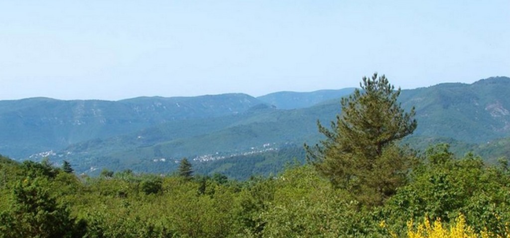
The sheep bells ring in the valleys of the Cévennes every year from June onwards – a living heritage. You can explore the Col de la Lusette pass, altitude 1351m and not to be missed by the region’s cyclists who appreciate this challenge for its difficulty. The famous writer and member of the French Academy, André Chamson, who was born in the Cévennes as well as his wife are buried here. You have breath-taking views over the mountains and valleys of the Cévennes.
1 point of interest

Le Faucon Pélerin - Descamps Régis  Fauna
FaunaThe peregrine falcon
Given that it nests nearby, you might be lucky enough to observe a peregrine falcon. This is the most powerful and, above all, the fastest of the falcons in the Cévennes National Park. Grey in colour, the adult has a wingspan of about one metre for females, more than that for males. Its wings are angular, wide and pointed, and a black mask covers its cheeks.
Description
Signposts will guide you all along this route. In the description below, the signposted place names and/or directions are given in bold italics between quotation marks :
- Starting at "LE VIGAN" on the Mairie car park, walk to "LE COL DES MOUREZES" via "Mas de Régis", “Station de pompage”.
- At “LE COL DES MOUREZES” continue to “CAP DE COTE” via “LE BALQUINET”, “Le Salet”, “Le Crestat” and “Serre de Naves”.
- Departure : Le Vigan
- Arrival : Cap de Côte
- Towns crossed : Le Vigan, Aulas, Mandagout, and Arphy
Forecast
Altimetric profile
Recommandations
Make sure your equipment is appropriate for the day’s weather conditions. Remember that the weather changes quickly in the mountains. Take enough water, wear sturdy shoes and put on a hat.
Information desks
Tourism office Cévennes and Navacelles, Le Vigan
Maison de pays, place du Marché, BP 21, 30120 Le Vigan
This office is part of the National Park's associated tourist-information network, whose mission is to provide information on, and raise awareness of, the sites and events as well as the rules that must be observed in the National Park's central zone.
Open year-round
Transport
This hike is accessible by public transport.
To consult an up-to-date timetable and plan your journey, use the journey calculator below for your destination bus stop : LE VIGAN – Communauté de Communes.
Access and parking
From Alés or Nîmes take the D999 to Le Vigan
Parking :
Source

Report a problem or an error
If you have found an error on this page or if you have noticed any problems during your hike, please report them to us here:
