
5. From Le Vigan to Mont Aigoual – Day 5
8 points of interest

Pépinière en 1903 - ONF 
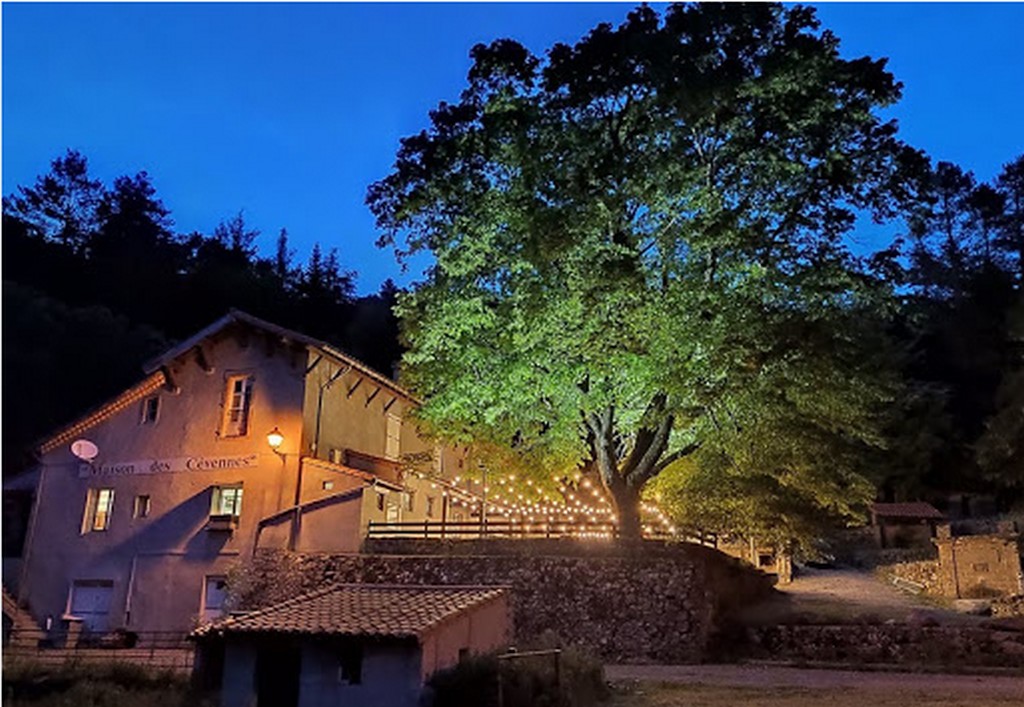
Immersion in Puéchagut
Puéchagut gets its name from the local relief: puech means peak or summit, and agut means pointed, hence the translation of “pointed mountain”.
In the old days, the Maison des Cévennes was a farming estate producing livestock and crops grown on terraces. In the late 19th century, it became an arboretum including a forester’s house as part of the vast reforestation programme on the Aigoual massif. What is now the car park used to be one of the 37 tree nurseries.

Reconnaître par l'écorce - Antoine Philippe ONF  Flora
FloraIdentifying trees by their bark
My bark is fissured and comes away in layers; my straight trunks used to be made into ship’s masts – who am I?
Atlas cedar, Douglas fir, Corsican pine, beech: would you be able to tell them by their bark ?

Belvédère - Antoine Philippe ONF 
Viewpoint
The forest of the senses opens up for a scenic view. Enjoy!

Reconnaître par les feuilles - Antoine Philippe ONF FloraIdentifying trees by their leaves
Puechagut path has a diversity of deciduous trees. This is due to the arboretum and the sunny exposure. Simple or compound leaves, the layout of the leaf veins: learn how to identify eight different varieties of deciduous tree, all of them visible by the edge of the path.

Les résineux et leurs cônes - Antoine Philippe ONF FloraConifers and their cones
Cones are the structures which contain a conifer’s reproductive organs. Most softwood trees have both female cones and male cones. The ones you see on the ground are female. It often takes several years for them to grow on the tree; they open in the heat to liberate the seeds that they contain. Austrian pine, Douglas fir, Atlas cedar: would you be able to tell them by their cones ?

Le village d'Aulas - Nathalie Thomas The village of Aulas
In the old days, the Place de l’Airette was where the wheat was thrashed. The village’s two fountains – on the Place de l'Airette and on the church square – were created on the initiative of the village council in 1887. They were almost removed when the houses were connected to mains water but were preserved by the support of certain councillors. Aulas was called Aulacio in 1001, from the Latin man’s name Aulas. In the 14th century, the village was fortified due to the many groups of brigands in the area. The ramparts were bordered by ditches and had gates. One of them, La Poterne, can still be seen. The village has remained picturesque thanks to its narrow lanes, its covered passage and its old buildings.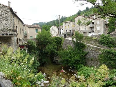
Le ruisseau de Coudoulous - Nathalie Thomas Coudoulous river
From the road, you overlook Coudoulous river. On its banks were the mills and spinning-mills of Aulas. In around 1870, a carding factory was established near the bridge. During a visit of the workshops by the owner, his wife’s hoop skirt caught in the gears of a waterwheel. It was impossible to bring the machine to an immediate stop and the poor woman died the following day, her bones crushed.
In the feudal era, the village was well-known for its mills. The numerous fulling mills were used to make sheets. Other mills dotted the banks too: flour mills and oil mills (olive and walnut). According to Adrienne Durand Tullou, in 1550 there were 17 mills (nine flour, six fulling and two oil mills) in Aulas.
River management
Lords were responsible for managing non-navigable rivers. Since building a mill was expensive, funding was provided by lords or religious orders. Mills were a substantial source of income. Sometimes, a lord sold his rights. In 1275, “the baron of Hierle, Guillaume d'Anduze, who had a pressing need for money, granted the inhabitants [of Aulas] significant tax exemptions in exchange for 6 000 livres tournois”.
Description
Signposts will guide you all along this route. In the description below, the signposted place names and/or directions are given in bold italics between quotation marks :
- Starting at Maison des Cévennes "PUECHAGUT", walk towards "Les Perriers" to reach "PRATCOUSTALS" (GR7 long-distance hiking path).
- At “PRATCOUSTAL”, continue on the GR®7 towards “Carnieu”.
- Continue to “Aulas-Temple”, “Quartier du Pont” and “AULAS”,
- At “AULAS” walk to “Les quatre chemins”, “Les Calquières”, “Château d’Assas”, “LE VIGAN”.
- Departure : Puechagut
- Arrival : Le Vigan
- Towns crossed : Bréau-Mars, Arphy, Aulas, Le Vigan, and Avèze
Forecast
Altimetric profile
Recommandations
Make sure your equipment is appropriate for the day’s weather conditions. Remember that the weather changes quickly in the mountains. Take enough water, wear sturdy shoes and put on a hat.
Information desks
Tourism office Cévennes and Navacelles, Le Vigan
Maison de pays, place du Marché, BP 21, 30120 Le Vigan
This office is part of the National Park's associated tourist-information network, whose mission is to provide information on, and raise awareness of, the sites and events as well as the rules that must be observed in the National Park's central zone.
Open year-round
Source
Report a problem or an error
If you have found an error on this page or if you have noticed any problems during your hike, please report them to us here:
